Safety Score: 2,7 of 5.0 based on data from 9 authorites. Meaning we advice caution when travelling to United States.
Travel warnings are updated daily. Source: Travel Warning United States. Last Update: 2024-08-13 08:21:03
Discover Mission Springs
Mission Springs in Santa Cruz County (California) is a place in United States about 2,429 mi (or 3,909 km) west of Washington DC, the country's capital city.
Current time in Mission Springs is now 02:34 AM (Monday). The local timezone is named America / Los Angeles with an UTC offset of -8 hours. We know of 8 airports near Mission Springs, of which 3 are larger airports. The closest airport in United States is Norman Y. Mineta San Jose International Airport in a distance of 21 mi (or 34 km), North. Besides the airports, there are other travel options available (check left side).
Also, if you like playing golf, there are a few options in driving distance. We encountered 1 points of interest in the vicinity of this place. If you need a hotel, we compiled a list of available hotels close to the map centre further down the page.
While being here, you might want to pay a visit to some of the following locations: Santa Cruz, San Jose, Redwood City, Salinas and Hollister. To further explore this place, just scroll down and browse the available info.
Local weather forecast
Todays Local Weather Conditions & Forecast: 13°C / 55 °F
| Morning Temperature | 7°C / 45 °F |
| Evening Temperature | 10°C / 50 °F |
| Night Temperature | 7°C / 45 °F |
| Chance of rainfall | 0% |
| Air Humidity | 44% |
| Air Pressure | 1022 hPa |
| Wind Speed | Moderate breeze with 10 km/h (6 mph) from South-East |
| Cloud Conditions | Broken clouds, covering 79% of sky |
| General Conditions | Broken clouds |
Monday, 18th of November 2024
12°C (54 °F)
10°C (49 °F)
Overcast clouds, light breeze.
Tuesday, 19th of November 2024
12°C (54 °F)
11°C (52 °F)
Overcast clouds, moderate breeze.
Wednesday, 20th of November 2024
13°C (55 °F)
11°C (52 °F)
Overcast clouds, light breeze.
Hotels and Places to Stay
Hilton Santa Cruz-Scotts Valley
CHAMINADE RESORT AND SPA
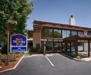
BW PLUS INN SCOTTS VALLEY
Hampton Inn Santa Cruz CA
Holiday Inn Express & Suites SANTA CRUZ
Quality Inn & Suites Santa Cruz Mountains
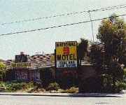
National 9 Santa Cruz
BEST WESTERN INN
Comfort Inn Santa Cruz
Quality Inn Santa Cruz
Videos from this area
These are videos related to the place based on their proximity to this place.
Minimalist Running - Scotts Valley Lockewood Loop Run | RWU
shammasandals.com Run With Us on the Scotts Valley Lockwood Loop Run with Shamma Sandals.
Bean Creek Run in Scotts Valley - Shamma Sandals
site: http://shammasandals.com/ sandals: http://shammasandals.com/buy-barefoot-running-sandals Run With Us vid up around Bean Creek Road in Scotts Valley with Josh from Shamma Sandals. Go...
Scotts Valley Pump Track Opening Oct 4, 2014
Mountain Bikers of Santa Cruz and the City of Scotts Valley wishes to thank FOX, Bell and other local businesses to make this community pump track a reality. Video shot and produced by Patrick Rosso.
Thank You Scotts Valley
Thank you to the My Scotts Valley commUNITY for giving me the honor of being "Man of the Year" for our town. Without all of your support, none of this would be possible. Looking forward to...
Courage Scotts Valley High School
This video was meant to be a pump up video during a sports rally at Scotts Valley High School to encourage students to participate in sports and was compiled using several different videos...
Just Listed! 15 Jolley Way - Scotts Valley
Yes, you can own a single-family home at a condo-townhouse price in Scotts Valley with a spacious yard with trees, grass, decking, and an endless pool and hot-tub! Located in the middle of...
CampgroundViews.com - Henry Cowell Redwoods State Park Campground Scotts Valley CA California
http://www.CampgroundViews.com takes user submitted videos combined with professional editing to provide tent and RV campers with a first person view of a campground or RV park. Henry Cowell...
Scotts Valley High School Graduation 2014
Scotts Valley High School Graduation 2014 Preview Video. Held Thursday June 12, 2014 at Scotts Valley High School Football Field at 4:00pm.
CampgroundViews.com - Santa Cruz Ranch RV Park Scotts Valley California CA
http://www.CampgroundViews.com takes user submitted videos combined with professional editing to provide tent and RV campers with a first person view of a campground or RV park. Santa Cruz...
Scotts Valley Police Motor Competition Practice 20 July 2012
Ian Martinez practicing at the Scotts Valley Police Motors Competition - Practice Day 20 July 2012 Scotts Valley, California.
Videos provided by Youtube are under the copyright of their owners.
Attractions and noteworthy things
Distances are based on the centre of the city/town and sightseeing location. This list contains brief abstracts about monuments, holiday activities, national parcs, museums, organisations and more from the area as well as interesting facts about the region itself. Where available, you'll find the corresponding homepage. Otherwise the related wikipedia article.
Scotts Valley, California
Scotts Valley is a small city in Santa Cruz County, California, United States, about thirty miles (48 km) south of downtown San Jose and six miles (10 km) north of Monterey Bay, in the upland slope of the Santa Cruz Mountains. As of the 2010 census, the city population was 11,580. Principal access to the city is supplied by State Route 17 that connects San Jose and Santa Cruz. The city was incorporated in 1966.
Santa Cruz Sky Park
Santa Cruz Sky Park was an airport located in Scotts Valley, California, within Santa Cruz County.
Bethany University
Bethany University was a four-year private Christian university located in Scotts Valley, California in Santa Cruz County. It operated from 1919 until closing in 2011 and was endorsed by the Assemblies of God USA, a Pentecostal denomination, and was the denomination's oldest college at the time of its closure. It was formerly called Glad Tidings Bible Institute, Bethany Bible College and Bethany College.
Carbonera Creek
Carbonera Creek is a 10.2-mile-long watercourse in Santa Cruz County, California, that eventually flows to the San Lorenzo River. The stream rises in the rugged Santa Cruz Mountains and flows in a generally southwesterly direction. The city of Scotts Valley is situated within the watershed of Carbonera Creek and its main tributary to the north, Bean Creek. Carbonera Creek joins Branciforte Creek near the 500 block of Market Street in Santa Cruz.
Bean Creek
Bean Creek is a 9.1-mile-long stream that rises on the western slopes of the Santa Cruz Mountains and discharges to Zayante Creek. This stream traverses relatively rugged, forested lands and is the locus of an important fossil bearing formation. These fossils are embedded in the Lower Santa Margarita Formation and include Astrodapsis spatiosus;also rare species of gastropod Thais cf. lapillis, and shark teeth (e.g.
Eccles, California
Eccles, California is a ghost town in Santa Cruz County, near Felton, east of Ben Lomond. It was near where Lompico Creek flows into Zayante Creek. Located between Zayante and Felton, Eccles was a stop on the narrow gauge South Pacific Coast Railroad that ran from Santa Cruz to Oakland from 1880 to 1940. The railroad carried lumber and local produce.
Rancho San Agustin
Rancho San Agustin was a 4,437-acre Mexican land grant in present day Santa Cruz County, California given in 1833 by Governor José Figueroa to José Antonio Bolcoff. The grant was bounded by the San Lorenzo River on the west and Rancho Carbonera on the south, and encompassed present day Scotts Valley.
Rancho Zayante
Rancho Zayante was a 2,658-acre Mexican land grant in present day Santa Cruz County, California. The grant, measuring one league by one-half league (2,658 acres), straddled Zayante Creek and the San Lorenzo River. It included most of the present day communities of Felton, Mount Hermon and Olympia, along with parts of Ben Lomond, Quail Hollow and Brackney, but not Zayante.


