Safety Score: 2,7 of 5.0 based on data from 9 authorites. Meaning we advice caution when travelling to United States.
Travel warnings are updated daily. Source: Travel Warning United States. Last Update: 2024-08-13 08:21:03
Discover La Selva Beach
La Selva Beach in Santa Cruz County (California) with it's 2,843 citizens is a place in United States about 2,422 mi (or 3,899 km) west of Washington DC, the country's capital city.
Current time in La Selva Beach is now 04:14 AM (Monday). The local timezone is named America / Los Angeles with an UTC offset of -8 hours. We know of 8 airports near La Selva Beach, of which 3 are larger airports. The closest airport in United States is Marina Municipal Airport in a distance of 18 mi (or 30 km), South. Besides the airports, there are other travel options available (check left side).
Also, if you like playing golf, there are a few options in driving distance. We encountered 4 points of interest in the vicinity of this place. If you need a hotel, we compiled a list of available hotels close to the map centre further down the page.
While being here, you might want to pay a visit to some of the following locations: Santa Cruz, Salinas, San Jose, Hollister and Redwood City. To further explore this place, just scroll down and browse the available info.
Local weather forecast
Todays Local Weather Conditions & Forecast: 14°C / 57 °F
| Morning Temperature | 6°C / 43 °F |
| Evening Temperature | 10°C / 50 °F |
| Night Temperature | 7°C / 44 °F |
| Chance of rainfall | 0% |
| Air Humidity | 40% |
| Air Pressure | 1022 hPa |
| Wind Speed | Moderate breeze with 9 km/h (6 mph) from South-East |
| Cloud Conditions | Clear sky, covering 8% of sky |
| General Conditions | Sky is clear |
Monday, 18th of November 2024
13°C (55 °F)
8°C (47 °F)
Overcast clouds, light breeze.
Tuesday, 19th of November 2024
12°C (54 °F)
11°C (51 °F)
Overcast clouds, gentle breeze.
Wednesday, 20th of November 2024
15°C (58 °F)
11°C (51 °F)
Sky is clear, light breeze, few clouds.
Hotels and Places to Stay
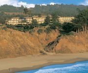
Seascape Beach Resort Monterey
Inn at Depot Hill
BEST WESTERN SEACLIFF INN
Holiday Inn Express & Suites WATSONVILLE
Monarch Cove Inn
RIO SANDS HOTEL
MOTEL 6 WATSONVILLE MONTEREY AREA
Comfort Inn Watsonville
Videos from this area
These are videos related to the place based on their proximity to this place.
Raymond Ellis #51 Highlights from the Branham vs. Aptos Game 2014
Raymond Ellis #51 play highlights from the Branham High vs. Aptos High Game November 21, 2014. (Please note: This video has no audio.)
Aptos California, The world's shortest parade
Every year on the Fourth of July, the beachside community of Aptos California gathers along Soquel drive to celebrate our nation's birthday and participate in the world's shortest parade....
Matthew Manfre - Pitcher - Aptos High 2010 - California
Matthew is attending Sonoma State University. Matt Manfre is a tall lanky pitcher with a hard fastball, nasty change up and a big breaking curve ball. Matt is looking for a place to play in...
Santa Cruz Warriors team introduced at Season Ticket Holder event at Aptos High
Check out the entire Santa Cruz Warriors team introduced at the season ticket holder event at Aptos High.
Hidden Beach Park, Aptos CA - 360 Degree View
This video shows a 360 view of Hidden Beach Park located in Aptos California. For more information on this beach, check out: http://www.californiabeaches.com/beach/hidden-beach-park/
819 Vista Del Mar Aptos CA 95003 - Judy Brose - Century 21 M M Associates
http://homesite.obeo.com/viewer/default.aspx?tourid=904544&refURL=youtube Contact: Judy Brose Century 21 M and M and Associates (831)234-9908 jbrose@c21mm.com http://www.judybrose.com.
Wedding Coordination, Wedding Venue Selection in Aptos CA 95003
Thank you for your interest in the Wedding Connection. With 28 years of planning and coordinating experience, we have organized events and have worked all over the Bay area, Santa Cruz County,...
Beer Can Beach, Aptos CA - 360 Degree View
This video shows a 360 view of Beer Can Beach located in Aptos California. For more information on this beach, check out: http://www.californiabeaches.com/beach/beer-can-beach/
Videos provided by Youtube are under the copyright of their owners.
Attractions and noteworthy things
Distances are based on the centre of the city/town and sightseeing location. This list contains brief abstracts about monuments, holiday activities, national parcs, museums, organisations and more from the area as well as interesting facts about the region itself. Where available, you'll find the corresponding homepage. Otherwise the related wikipedia article.
Aptos Hills-Larkin Valley, California
Aptos Hills-Larkin Valley is a census-designated place (CDP) in Santa Cruz County, California, United States. The population was 2,381 at the 2010 census.
Rio del Mar, California
Rio del Mar is a census-designated place (CDP) in Santa Cruz County, California, United States. The name "Rio Del Mar" was chosen as a "catchy" name to promote real estate in the area during the 1920s. There is no body of water by that name in Santa Cruz County. But there is a large creek, Aptos Creek, that goes through Rio del Mar and empties into the Monterey Bay at Rio del Mar. Aptos Creek is the "Rio" in Rio del Mar. The population was 9,216 at the 2010 census.
Monterey Bay Academy Airport
Monterey Bay Academy Airport is located near the city of Watsonville in Santa Cruz County, California, USA. This private use airport is owned by the Seventh-day Adventist Church and located on the campus of the Monterey Bay Academy, site of the former Camp McQuaide.
Manresa State Beach
Manresa State Beach is a beach near Watsonville, California in Santa Cruz County. It is operated by the California Department of Parks and Recreation. South of Manresa State Beach is Sunset State Beach. Manresa beach hosts the junior lifeguards program which runs two sessions each summer, teaching lifesaving, fitness and water safety to children in Santa Cruz County. Many local surfers were once junior lifeguards in the program.
Monterey Bay Academy
Monterey Bay Academy (MBA) is a private school in Santa Cruz County, California.
Aptos High School
Aptos High School is a comprehensive secondary school in Aptos, California, USA in the Pajaro Valley Unified School District. Aptos High serves the communities of Rio Del Mar, Corralitos, Seacliff, Seascape, La Selva Beach, Buena Vista and Watsonville. Historically, Aptos has been one of the largest high schools in the county, but recently other district schools Watsonville High School and Pajaro Valley High School have surpassed its enrollment.
Rancho San Andrés
Rancho San Andrés was a 8,911-acre Mexican land grant in present day Santa Cruz County, California given in 1833 by Governor José Figueroa to José Joaquín Castro. The grant on Monterey Bay extended from La Selva Beach on the north to Watsonville Slough on the south. Rancho Aptos of his son Rafael Castro formed the north boundary of the grant.


