Safety Score: 2,7 of 5.0 based on data from 9 authorites. Meaning we advice caution when travelling to United States.
Travel warnings are updated daily. Source: Travel Warning United States. Last Update: 2024-08-13 08:21:03
Explore Forest Springs
Forest Springs in Santa Cruz County (California) is a city in United States about 2,433 mi (or 3,916 km) west of Washington DC, the country's capital.
Local time in Forest Springs is now 04:19 AM (Monday). The local timezone is named America / Los Angeles with an UTC offset of -8 hours. We know of 8 airports in the vicinity of Forest Springs, of which 3 are larger airports. The closest airport in United States is Norman Y. Mineta San Jose International Airport in a distance of 20 mi (or 32 km), North-East. Besides the airports, there are other travel options available (check left side).
Also, if you like golfing, there are multiple options in driving distance. We found 1 points of interest in the vicinity of this place. If you need a place to sleep, we compiled a list of available hotels close to the map centre further down the page.
Depending on your travel schedule, you might want to pay a visit to some of the following locations: Santa Cruz, San Jose, Redwood City, Salinas and Oakland. To further explore this place, just scroll down and browse the available info.
Local weather forecast
Todays Local Weather Conditions & Forecast: 12°C / 54 °F
| Morning Temperature | 7°C / 45 °F |
| Evening Temperature | 9°C / 48 °F |
| Night Temperature | 6°C / 43 °F |
| Chance of rainfall | 0% |
| Air Humidity | 48% |
| Air Pressure | 1022 hPa |
| Wind Speed | Moderate breeze with 10 km/h (6 mph) from South-East |
| Cloud Conditions | Scattered clouds, covering 41% of sky |
| General Conditions | Scattered clouds |
Monday, 18th of November 2024
13°C (55 °F)
8°C (47 °F)
Overcast clouds, light breeze.
Tuesday, 19th of November 2024
12°C (54 °F)
11°C (51 °F)
Overcast clouds, moderate breeze.
Wednesday, 20th of November 2024
13°C (56 °F)
11°C (51 °F)
Overcast clouds, gentle breeze.
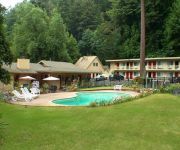
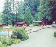
Hotels and Places to Stay
Quality Inn & Suites Santa Cruz Mountains
JAYES TIMBERLANE RE
Videos from this area
These are videos related to the place based on their proximity to this place.
Scottish Red Deer Hind Ben Lomond Loch Lomond Scotland
Tour Scotland December video of a Red Deer hind below Ben Lomond mountain on ancestry visit to Loch Lomond It is not a Red Deer, but what is it ?
Endeavor Space Shuttle Fly Over of Ben Lomond, CA, Santa Cruz Mts
Caught her just above my studio ~ such an awesome sight!
Baby Please Don't Go - The Bob Gonzalez Band
The Bob Gonzalez Band perform 'Baby Please Don't Go' at Henfling's Firehouse Tavern in Ben Lomond, California, on April 15th, 2012. Featuring Bob Gonzalez on bass, T.J. Politzer on guitar,...
San Lorenzo River north of Boulder Creek
San Lorenzo River north of Boulder Creek, CA, approaching flood stage on March 24, 2011.
Highway 9 near Boulder Creek - KTM Duke 690
Riding northbound on Highway 9 from Boulder Creek towards San Jose. South from one lane portion of Big Basin Way (Hwy 236) to the park's parking lot. Riding on KTM Duke 690 Filmed with Polaroid.
90 Seconds in Boulder Creek and Ben Lomond via Dashboard Camera
Driving southbound on California Highway 9 through the towns of Boulder Creek and Ben Lomond in the San Lorenzo Valley of the Santa Cruz Mountains. One of the benefits of this area is that...
Fire in boulder creek 9/13
House fire off hiway 9 Friday night stops traffic for hours , forces many to turn around and go 236 to get home.
Boulder Creek Redwoods
Here are The PItcarin Kids over in Boulder Creek exploring the Redwoods. A special little shout out to the folks back in Rochester, NY.
Camp Harmon - Easter Seals Camp
Easter Seals Central California's CAMP HARMON is on Highway 9 above Boulder Creek, California. Just minutes from Santa Cruz and San Jose, this camp is called home by thousands each year. ...
Videos provided by Youtube are under the copyright of their owners.
Attractions and noteworthy things
Distances are based on the centre of the city/town and sightseeing location. This list contains brief abstracts about monuments, holiday activities, national parcs, museums, organisations and more from the area as well as interesting facts about the region itself. Where available, you'll find the corresponding homepage. Otherwise the related wikipedia article.
Boulder Creek, California
Boulder Creek is a census-designated place (CDP) in Santa Cruz County, California, with a population of 4,923 as of the 2010 census. Boulder Creek served as the upper terminus of the San Lorenzo Valley Logging Flume terminating in Felton, which began construction in 1874 and when formally opened in October 1875 was augmented by a new rail line to transport logs to the wharf in Santa Cruz.
Boulder Creek (California)
Boulder Creek is a small river in Santa Cruz County, California, United States, in the southern San Francisco Bay Area. The creek is the namesake of Boulder Creek, California, a small mountain community. The town is located north of the more widely known Santa Cruz, and is the town nearest the San Lorenzo River. {{#invoke:Coordinates|coord}}{{#coordinates:37.1268911|N|122.1210757|W||||| |primary |name= }}
Forest Springs, Santa Cruz County, California
Forest Springs is a community in Boulder Creek, California.


