Safety Score: 2,7 of 5.0 based on data from 9 authorites. Meaning we advice caution when travelling to United States.
Travel warnings are updated daily. Source: Travel Warning United States. Last Update: 2024-08-13 08:21:03
Touring Day Valley
Day Valley in Santa Cruz County (California) with it's 3,409 residents is a town located in United States about 2,420 mi (or 3,895 km) west of Washington DC, the country's capital place.
Time in Day Valley is now 04:40 AM (Monday). The local timezone is named America / Los Angeles with an UTC offset of -8 hours. We know of 8 airports nearby Day Valley, of which 3 are larger airports. The closest airport in United States is Norman Y. Mineta San Jose International Airport in a distance of 23 mi (or 37 km), North. Besides the airports, there are other travel options available (check left side).
Also, if you like the game of golf, there are several options within driving distance. We collected 1 points of interest near this location. Need some hints on where to stay? We compiled a list of available hotels close to the map centre further down the page.
Being here already, you might want to pay a visit to some of the following locations: Santa Cruz, San Jose, Salinas, Hollister and Redwood City. To further explore this place, just scroll down and browse the available info.
Local weather forecast
Todays Local Weather Conditions & Forecast: 14°C / 57 °F
| Morning Temperature | 7°C / 45 °F |
| Evening Temperature | 11°C / 51 °F |
| Night Temperature | 7°C / 45 °F |
| Chance of rainfall | 0% |
| Air Humidity | 41% |
| Air Pressure | 1021 hPa |
| Wind Speed | Moderate breeze with 9 km/h (6 mph) from South-East |
| Cloud Conditions | Overcast clouds, covering 100% of sky |
| General Conditions | Overcast clouds |
Monday, 18th of November 2024
13°C (55 °F)
10°C (50 °F)
Overcast clouds, light breeze.
Tuesday, 19th of November 2024
13°C (55 °F)
11°C (52 °F)
Overcast clouds, gentle breeze.
Wednesday, 20th of November 2024
14°C (56 °F)
12°C (53 °F)
Overcast clouds, light breeze.
Hotels and Places to Stay
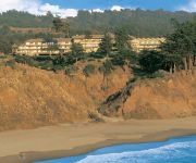
Seascape Beach Resort Monterey
BEST WESTERN SEACLIFF INN
Monarch Cove Inn
RIO SANDS HOTEL
Videos from this area
These are videos related to the place based on their proximity to this place.
CampgroundViews.com - Seacliff State Beach Aptos California CA
http://www.CampgroundViews.com takes user submitted videos combined with professional editing to provide tent and RV campers with a first person view of a campground or RV park. Seacliff State...
Union Pacific's Santa Cruz Local in Rio Del Mar 2-18-09
Union Pacific's Santa Cruz Local continues westbound on the Santa Cruz Branch, passing through Rio Del Mar. The train has just passed through Seascape, and is about to enter the heart of Aptos,...
Greg Watts at the Aptos Jumps via DJI Phantom and GoPro 3+
World Class dirt jumper, Greg Watts, hammers the Post Office Jumps in Aptos California. POV guru, Ian Boyd, captures the action with his DJI Phantom mounted Hero 3+ drone in addition to some...
Aptos world shortest parade 4th July 2012.wmv
Aptos Parade 2012, Aptos California, the worlds shortest parade.
Raymond Ellis #51 Highlights from the Branham vs. Aptos Game 2014
Raymond Ellis #51 play highlights from the Branham High vs. Aptos High Game November 21, 2014. (Please note: This video has no audio.)
Aptos California, The world's shortest parade
Every year on the Fourth of July, the beachside community of Aptos California gathers along Soquel drive to celebrate our nation's birthday and participate in the world's shortest parade....
Matthew Manfre - Pitcher - Aptos High 2010 - California
Matthew is attending Sonoma State University. Matt Manfre is a tall lanky pitcher with a hard fastball, nasty change up and a big breaking curve ball. Matt is looking for a place to play in...
CampgroundViews.com - Seacliff Center Trailer Park Aptos California CA
http://www.CampgroundViews.com takes user submitted videos combined with professional editing to provide tent and RV campers with a first person view of a campground or RV park. Seacliff Center...
Videos provided by Youtube are under the copyright of their owners.
Attractions and noteworthy things
Distances are based on the centre of the city/town and sightseeing location. This list contains brief abstracts about monuments, holiday activities, national parcs, museums, organisations and more from the area as well as interesting facts about the region itself. Where available, you'll find the corresponding homepage. Otherwise the related wikipedia article.
Day Valley, California
Day Valley is a census-designated place (CDP) in Santa Cruz County, California, United States. The population was 3,409 at the 2010 census.
1989 Loma Prieta earthquake
The Loma Prieta earthquake, also known as the Quake of '89 and the World Series Earthquake, was a major earthquake that struck the San Francisco Bay Area of California on October 17, 1989, at 5:04 pm local time. Caused by a slip along the San Andreas Fault, the quake lasted 10–15 seconds and measured 6.9 on both the moment magnitude scale (surface-wave magnitude 7.1) and on the open-ended Richter Scale.
The Forest of Nisene Marks State Park
The Forest of Nisene Marks State Park is a state park of California, USA, protecting a tract of secondary forest in the Santa Cruz Mountains. It is located outside Aptos, California and contains over 40 miles of hiking trails and fire roads through 10,223 acres of variable terrain. The park was named for Nisene Marks, a passionate nature lover and the mother of a Salinas farming family that purchased the land from lumber companies (and others) in the hopes of finding oil.


