Safety Score: 2,7 of 5.0 based on data from 9 authorites. Meaning we advice caution when travelling to United States.
Travel warnings are updated daily. Source: Travel Warning United States. Last Update: 2024-08-13 08:21:03
Discover Bonny Doon
Bonny Doon in Santa Cruz County (California) with it's 2,678 citizens is a town in United States about 2,435 mi (or 3,919 km) west of Washington DC, the country's capital city.
Current time in Bonny Doon is now 04:18 AM (Monday). The local timezone is named America / Los Angeles with an UTC offset of -8 hours. We know of 8 airports near Bonny Doon, of which 3 are larger airports. The closest airport in United States is Norman Y. Mineta San Jose International Airport in a distance of 25 mi (or 41 km), North-East. Besides the airports, there are other travel options available (check left side).
Also, if you like playing golf, there are a few options in driving distance. We discovered 1 points of interest in the vicinity of this place. Looking for a place to stay? we compiled a list of available hotels close to the map centre further down the page.
When in this area, you might want to pay a visit to some of the following locations: Santa Cruz, San Jose, Redwood City, Salinas and Oakland. To further explore this place, just scroll down and browse the available info.
Local weather forecast
Todays Local Weather Conditions & Forecast: 11°C / 52 °F
| Morning Temperature | 6°C / 44 °F |
| Evening Temperature | 9°C / 47 °F |
| Night Temperature | 6°C / 43 °F |
| Chance of rainfall | 0% |
| Air Humidity | 49% |
| Air Pressure | 1022 hPa |
| Wind Speed | Moderate breeze with 11 km/h (7 mph) from South-East |
| Cloud Conditions | Broken clouds, covering 55% of sky |
| General Conditions | Broken clouds |
Monday, 18th of November 2024
10°C (51 °F)
8°C (47 °F)
Overcast clouds, light breeze.
Tuesday, 19th of November 2024
11°C (51 °F)
10°C (50 °F)
Overcast clouds, moderate breeze.
Wednesday, 20th of November 2024
11°C (52 °F)
10°C (50 °F)
Overcast clouds, gentle breeze.
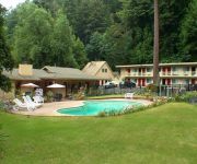
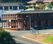
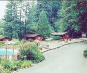
Hotels and Places to Stay
Quality Inn & Suites Santa Cruz Mountains
THE DAVENPORT ROADH
JAYES TIMBERLANE RE
Videos from this area
These are videos related to the place based on their proximity to this place.
2-18-09 Santa Cruz Local near old Coast Road south of Davenport
Union Pacific's Santa Cruz Local rolls westbound through a farming community on the old Coast Road between Santa Cruz and Davenport, CA.
SILLY VIDEO - Suicidal squirrel attacks sportbike
Silly video from a spin through the local canyons with a fellow European. Since my bike was in the shop, I drove the P-car. In the midst of it, this is what my security dash-cam picked up...
LDR 2012 - Load-out Timelapse
Loading out the labor day retreat. Recorded with a GoPro camera, 1 frame every 10 seconds.
Felton Empire Grade
Connector road descending from Empire Road to Route 9 in Felton, CA in Santa Cruz County.
Adventurous Habits & Shamma Sandals in Fall Creek, Felton | Run With Us
the sandals: http://shammasandals.com/buy-running-sandals learn more: http://shammasandals.com/barefoot-running-sandals This episode of Run With Us features guest runner Marshall Moore from...
Swanton Berry Farm Strawberry Field Davenport California
Strawberry field at Swanton Berry Farm in Davenport, California.
Davenport, California The Davenport Mill Premier Wood shop Doors Windows Custom Wood Work
Davenport California, Commercial Property For Sale Davenport CA, The Davenport Mill is known for high end wood work, for door and windows. Also creating special projects for your home. This...
Surf Death Doors Davenport California
Lifeguards retrieve dead body from surf off park cliffs in Davenport, California, November 27, 2006.
Davenport Landing Beach
A video showing a 360 degree view of the Davenport Landing beach. For more information on this beach, check out: http://www.californiabeaches.com/beach/davenport-landing-beach/
Davenport Beach Video
This video shows a 360 view of Davenport Beach located in Davenport California. For more information on this beach, check out: http://www.californiabeaches.com/beach/davenport-beach/
Videos provided by Youtube are under the copyright of their owners.
Attractions and noteworthy things
Distances are based on the centre of the city/town and sightseeing location. This list contains brief abstracts about monuments, holiday activities, national parcs, museums, organisations and more from the area as well as interesting facts about the region itself. Where available, you'll find the corresponding homepage. Otherwise the related wikipedia article.
Robert A. Heinlein
Robert Anson Heinlein was an American science fiction writer. Often called the "dean of science fiction writers", he was one of the most influential and controversial authors of the genre in his time. He set a standard for scientific and engineering plausibility, and helped to raise the genre's standards of literary quality. He was one of the first science fiction writers to break into mainstream magazines such as The Saturday Evening Post in the late 1940s.
Davenport, California
Davenport is a census-designated place (CDP) in Santa Cruz County, California. Davenport sits at an elevation of 259 feet . The 2010 United States census reported Davenport's population was 408.
Rancho Arroyo de la Laguna
Rancho Arroyo de la Laguna was a 4,418-acre Mexican land grant in present day Santa Cruz County, California given in 1840 by Governor Juan B. Alvarado to Gil Sanchez. The grant extended along the Pacific coast south-east from Rancho San Vicente and San Vicente Creek (which runs through present day Davenport) to Laguna Creek and Rancho Refugio.
Rancho San Vicente (Escamilla)
Rancho San Vicente was a 10,803-acre Mexican land grant in present day Santa Cruz County, California given in 1846 by Governor Pío Pico to Blas A. Escamilla. The grant extended along the Pacific coast from Molino Creek and Rancho Agua Puerca y las Trancas south past Davenport Landing to San Vicente Creek and Rancho Arroyo de la Laguna. The grant stretched from the coast back into the Santa Cruz Mountains between the two neighboring ranchos.


