Safety Score: 2,7 of 5.0 based on data from 9 authorites. Meaning we advice caution when travelling to United States.
Travel warnings are updated daily. Source: Travel Warning United States. Last Update: 2024-08-13 08:21:03
Delve into Ventura
Ventura in Santa Clara County (California) is a town located in United States about 2,427 mi (or 3,906 km) west of Washington DC, the country's capital town.
Time in Ventura is now 02:35 AM (Monday). The local timezone is named America / Los Angeles with an UTC offset of -8 hours. We know of 8 airports closer to Ventura, of which 4 are larger airports. The closest airport in United States is Norman Y. Mineta San Jose International Airport in a distance of 12 mi (or 19 km), East. Besides the airports, there are other travel options available (check left side).
Also, if you like the game of golf, there are some options within driving distance. We saw 10 points of interest near this location. In need of a room? We compiled a list of available hotels close to the map centre further down the page.
Since you are here already, you might want to pay a visit to some of the following locations: Redwood City, San Jose, Oakland, San Francisco and Santa Cruz. To further explore this place, just scroll down and browse the available info.
Local weather forecast
Todays Local Weather Conditions & Forecast: 13°C / 55 °F
| Morning Temperature | 10°C / 50 °F |
| Evening Temperature | 11°C / 52 °F |
| Night Temperature | 9°C / 48 °F |
| Chance of rainfall | 0% |
| Air Humidity | 46% |
| Air Pressure | 1022 hPa |
| Wind Speed | Moderate breeze with 11 km/h (7 mph) from South-East |
| Cloud Conditions | Few clouds, covering 13% of sky |
| General Conditions | Few clouds |
Monday, 18th of November 2024
14°C (57 °F)
10°C (50 °F)
Overcast clouds, light breeze.
Tuesday, 19th of November 2024
15°C (58 °F)
13°C (55 °F)
Overcast clouds, moderate breeze.
Wednesday, 20th of November 2024
16°C (61 °F)
13°C (55 °F)
Overcast clouds, light breeze.
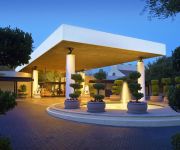
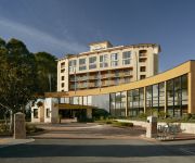
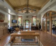
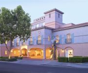
Hotels and Places to Stay
Sheraton Palo Alto Hotel
ABODA at the Marc
Crowne Plaza PALO ALTO
Dinahs Garden Hotel
The Westin Palo Alto
OAKWOOD AT PARKER PALO ALTO
OAKWOOD AT DOMUS ON THE BLVD
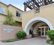
Residence Inn Palo Alto Los Altos
Homewood Suites by Hilton Palo Alto
Courtyard Palo Alto Los Altos
Videos from this area
These are videos related to the place based on their proximity to this place.
Palo Alto SAT Prep - Mr. Test Prep
An uncommon passion for SAT tutoring. Serving Palo Alto, Menlo Park, Los Altos, San Jose and Cupertino; Mr. Test Prep provides highly reviewed SAT, SAT2, PSAT and ACT prep tutoring classes....
Palo Alto Skating
Kristyna and Grandma Jana skating at Winter Lodge, Palo Alto, March 5, 2011. Kristýna a babička Jana bruslí ve Winter Lodge, Palo Alto, 5, března 2011.
Southwood Apartments - Palo Alto - University - 2 Bedroom
Southwood apartments in Palo Alto, CA offers nearby golf courses, tennis courts, and bike paths. Our newly-renovated homes feature energy-efficient appliances, upgraded cabinetry and brand-new...
Stanford Doctors on Latest Advances in Lung Cancer Screening and Treatment
Lung cancer is the leading cause of cancer death in both men and women. This talk will address new lung cancer screening guidelines for former heavy smokers as well as the newest approaches...
Stanford Radiation Oncologist Explains Radiation Therapy Treatment for Prostate Cancer
CONTENT DESCRIPTION 0:01 Introduction 3:00 Shared decision-making 3:45 Risk assessment 7:40 General treatment options 8:47 Survival and prostate cancer 9:29 Radiation treatment options ...
Stanford's Dr. Oliver Dorigo on Ovarian Cancer -- Current & Novel Treatment Strategies
Ovarian Cancer: Current and Novel Treatment Strategies New understanding of the basic biology of ovarian cancer has led to more accurate diagnosis and specialized treatments that are based...
Securing More Sustainable Solutions to Urban Water Challenges - Prof. Richard Luthy
Dick Luthy is the Silas H. Palmer Professor in the Department of Civil and Environmental Engineering at Stanford University and a Senior Fellow at the Woods Institute for the Environment. His...
City of Palo Alto's CIO Embraces Apps
The CIO of Palo Alto discusses how they are using technology to solve problems. This video was recorded at the Silicon Valley iOS Developers Meetup on May 21, 2012.
Stanford Digestive Health Center: Sensible Seasonal Eating
The holiday season is a time for celebration, reflection, and spending time with loved ones. But often it is also a time when many of us overindulge and overeat. Stanford registered dietitian,...
Videos provided by Youtube are under the copyright of their owners.
Attractions and noteworthy things
Distances are based on the centre of the city/town and sightseeing location. This list contains brief abstracts about monuments, holiday activities, national parcs, museums, organisations and more from the area as well as interesting facts about the region itself. Where available, you'll find the corresponding homepage. Otherwise the related wikipedia article.
Gunn High School
Henry M. Gunn High School is one of two public high schools in Palo Alto, California. Gunn High School is a four-year high school with a current enrollment of just over 1,900 students. The academic year has two semesters with 240 minutes of weekly instruction for every class. The school's schedule operates on a rotating bell schedule with classes assigned to lettered "periods" from A through G. In the spring of 2010, Gunn High School was picketed by the Westboro Baptist Church.
College Terrace, Palo Alto, California
College Terrace is a neighborhood in the city of Palo Alto, California, adjacent to Stanford University.
Palo Alto Chinese School
Founded in 1963, Palo Alto Chinese School (PACS) is located in Palo Alto, California and is the oldest Chinese school in the San Francisco Bay Area. The school was formed with a merger between a Cantonese school and a Mandarin school. The history of the Cantonese school could be traced back to 1960, when the Santa Clara Overseas Chinese School was founded. School hours are 7:00PM - 9:00PM on Friday night at Jane Lathrop Stanford Middle School, 480 E.
California Avenue (Caltrain station)
California Avenue station is a Caltrain station at milepost 31.7 in Palo Alto, California. It stops at the historical town center of Mayfield, which was annexed by the town of Palo Alto in 1925. The current structure was built in 1983 at the same time as the nearby Palo Alto Central condominium complex, replacing a shelter a few hundred feet to the south.
Palo Alto Unified School District
The Palo Alto Unified School District is a public school district located in Palo Alto, California. It consists of twelve elementary schools, three middle schools, and two high schools.
Hewlett-Packard
Hewlett-Packard Company or HP is an American multinational information technology corporation headquartered in Palo Alto, California, United States. It provides products, technologies, software, solutions and services to consumers, small- and medium-sized businesses and large enterprises, including customers in the government, health and education sectors. The company was founded in a one-car garage in Palo Alto by William "Bill" Redington Hewlett and Dave Packard.
Rancho Rincon de San Francisquito
Rancho Rincon de San Francisquito was a 8,418-acre Mexican land grant in present day Santa Clara County, California given in 1841 by Governor Juan Alvarado to José Peña. The name means "corner or bend of the San Francisquito" referring to San Francisquito Creek. The grant extended along Matadero Creek to the hills and included the southern part of present day Palo Alto and the southern part of the Stanford University campus.
Baumé Restaurant
Baumé Restaurant is a French restaurant in Palo Alto, California specialising in molecular gastronomy. It was listed among the 10 best molecular gastronomy restaurants in the US in the Gayot Guide, and received its second Michelin star in 2011 and again in 2012. The owner chef is Bruno Chemel.


