Safety Score: 2,7 of 5.0 based on data from 9 authorites. Meaning we advice caution when travelling to United States.
Travel warnings are updated daily. Source: Travel Warning United States. Last Update: 2024-08-13 08:21:03
Delve into Parkmoor
Parkmoor in Santa Clara County (California) is a town located in United States about 2,418 mi (or 3,892 km) west of Washington DC, the country's capital town.
Time in Parkmoor is now 02:34 AM (Monday). The local timezone is named America / Los Angeles with an UTC offset of -8 hours. We know of 8 airports closer to Parkmoor, of which 4 are larger airports. The closest airport in United States is Norman Y. Mineta San Jose International Airport in a distance of 3 mi (or 5 km), North. Besides the airports, there are other travel options available (check left side).
Also, if you like the game of golf, there are some options within driving distance. We saw 3 points of interest near this location. In need of a room? We compiled a list of available hotels close to the map centre further down the page.
Since you are here already, you might want to pay a visit to some of the following locations: San Jose, Redwood City, Santa Cruz, Oakland and San Francisco. To further explore this place, just scroll down and browse the available info.
Local weather forecast
Todays Local Weather Conditions & Forecast: 13°C / 55 °F
| Morning Temperature | 9°C / 48 °F |
| Evening Temperature | 11°C / 51 °F |
| Night Temperature | 8°C / 46 °F |
| Chance of rainfall | 0% |
| Air Humidity | 41% |
| Air Pressure | 1022 hPa |
| Wind Speed | Moderate breeze with 10 km/h (6 mph) from South-East |
| Cloud Conditions | Scattered clouds, covering 31% of sky |
| General Conditions | Scattered clouds |
Monday, 18th of November 2024
14°C (58 °F)
10°C (51 °F)
Overcast clouds, light breeze.
Tuesday, 19th of November 2024
14°C (58 °F)
11°C (51 °F)
Overcast clouds, moderate breeze.
Wednesday, 20th of November 2024
16°C (60 °F)
12°C (54 °F)
Overcast clouds, gentle breeze.
Hotels and Places to Stay
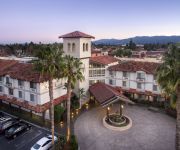
DoubleTree by Hilton Campbell - Pruneyard Plaza
San Jose Marriott
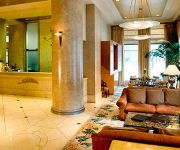
Hilton San Jose
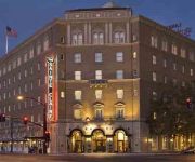
Hotel De Anza
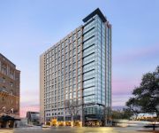
AC Hotel San Jose Downtown
The Westin San Jose
TownePlace Suites San Jose Cupertino
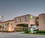
Holiday Inn Express & Suites SANTA CLARA
TownePlace Suites San Jose Campbell
CAMPBELL INN
Videos from this area
These are videos related to the place based on their proximity to this place.
Options Education Course Review - David - San Jose Options
San Jose Options is reviewed by an attendee at our live workshop and seminar. Listen to David speak candidly about the SJ Options seminar and options trading course in general. SJ Options...
Quit Smoking Timeline Is A Journey On How To Quit Smoking Successfully
http://quitsmokingtimelinerx.blogspot.com offers tips and educating smokers about establishing a quit smoking timeline, and how it helps a smoker quits with confidence. Discovering and knowing...
New House Hunters is it Safe? Review newhousehunters
Read ▻"newhousehunters.com": http://tinyurl.com/newhousehunters ▻▻▻ Reviews, Comments and Testimonial by user and press report about new house hunters. See "newhousehunterscom": ...
2011 Dodge Journey Sport Utility R/T San Jose San Francisco Palo Alto Pleasanton Oakland
2011 Dodge Journey Sport Utility R/T Stock Number: 4659 Vin:3D4PG7FG6BT532076. Audi Stevens Creek: servicing San Jose, San Francisco, Palo Alto, Pleasanton, and Oakland Give us a call...
VTA Light Rail Crossing Signal - VTA Light Rail Train Crossing
VTA Light Rail train crossing at Fruitdale and Bascom. This is a short video showing the crossing arms down, the VTA Light Rail train going from Winchester to Mountain View pulling out of...
Caltrain College
College Park is a village within the city limits of San Jose, California. It's the least busy station on the Caltrain line to San Francisco, served by only four trains Monday-Friday: even stations...
I LIVE AT TARGET - Life After College Vlog: Ep 36
Life After College Vlog Ep. 35 - Here is my Daily Vlog focusing on my life after graduating from college. I am a big fan of CTFxC and BFvsGF/PVP SAAAN! Features of this Episode: - Workout...
Videos provided by Youtube are under the copyright of their owners.
Attractions and noteworthy things
Distances are based on the centre of the city/town and sightseeing location. This list contains brief abstracts about monuments, holiday activities, national parcs, museums, organisations and more from the area as well as interesting facts about the region itself. Where available, you'll find the corresponding homepage. Otherwise the related wikipedia article.
Buena Vista, Santa Clara County, California
Buena Vista is a former census-designated place (CDP) in Santa Clara County, California, United States. The population was 1,704 at the 2000 census. The area is now part of the city of San Jose.
Fruitdale, California
Fruitdale is an unincorporated Census Designated Place in Santa Clara County, California, United States. The population was 935 at the 2010 census.
Burbank, Santa Clara County, California
Burbank is a census-designated place in Santa Clara County, California. Part of the neighborhood has been annexed to San Jose, while the rest consists of unincorporated areas of Santa Clara County. The population was 4,926 at the 2010 census. The neighborhood was named after Luther Burbank.
Rosicrucian Egyptian Museum
The Rosicrucian Egyptian Museum (REM), founded by the Ancient Mystical Order Rosae Crucis, is a museum about Ancient Egypt located at AMORC's Rosicrucian Park in the Rose Garden neighborhood of San Jose, California, United States. The Rosicrucian Order continues to support and expand the museum and its educational and scientific activities.
San Jose City College
San Jose City College, founded in 1921, is a community college located in the city of San Jose, Santa Clara County, California. San Jose City College was originally called San Jose Junior College and operated in downtown San Jose, California. San Jose Unified School District took over the College’s operation in 1953 from San Jose State College, moving it to its present 2100 Moorpark Avenue location, overlooking Interstate 280. The name changed to San Jose City College in 1958.
Del Mar High School
Del Mar High School (DMHS) is a four-year, public secondary school established in 1959 in San Jose, California. It is part of the Campbell Union High School District, (CUHSD), the other schools in which are Branham, Leigh, Prospect, and Westmont. Most of Del Mar’s students come from the Campbell Union School District’s middle schools: Monroe, Campbell, and Rolling Hills. The school serves both San Jose and Campbell, in addition to some unincorporated pockets of Santa Clara County.
Santana Row
Santana Row is an upscale shopping, residential, dining and entertainment complex in San Jose, California. Westfield Valley Fair is located just to its north, on the other side of Stevens Creek Boulevard, and the Winchester Mystery House just to the west, across Winchester Boulevard.
Rosicrucian Park
Rosicrucian Park is the headquarters of the English Grand Lodge for the Americas of AMORC, located in San Jose, California. The park takes up nearly an entire city block and includes the Rosicrucian Egyptian Museum, the administration building for the Order, the Rosicrucian Planetarium, the Rosicrucian Peace Garden, the Rosicrucian Research Library, the Grand Temple, and a central fountain plaza and gardens.
San Jose Municipal Rose Garden
The San Jose Municipal Rose Garden is a rose garden located at the intersection of Naglee and Dana Avenues, San Jose, California, in the Rose Garden neighborhood. The garden, 5.5 acres in size, was once a prune orchard, but was bought by San Jose in 1927 and is now exclusively devoted to roses. It features more than 3,500 shrubs representing 189 rose varieties.
Abraham Lincoln High School (San Jose, California)
Abraham Lincoln High School is a high school in the San Jose Unified School District. It is a magnet school for "Academic, Visual, and Performing Arts". The current principal is Matt Hewitson. The school mascot is a Lion. The school colors are blue and gold. Lincoln High offers cross country, water polo, tennis, volleyball, basketball, wrestling, football, baseball, softball, soccer, golf, badminton, track and field, and swimming. Football receives special attention during the Big Bone Game.
Westfield Valley Fair
Westfield Valley Fair, formerly named and known as Valley Fair, is an upscale indoor shopping mall in Silicon Valley, in the U.S. state of California, owned by the Westfield Group. It is located at the corner of Winchester and Stevens Creek Boulevards, straddling the border of San Jose and Santa Clara. The eastern portion of the mall is located in San Jose, and the western portion is located in Santa Clara.
Fruitdale (VTA)
Fruitdale is a light rail station operated by Santa Clara Valley Transportation Authority (VTA). The station has a center platform situated between two trackways. Fruitdale is served by the Mountain View–Winchester light rail line.


