Safety Score: 2,7 of 5.0 based on data from 9 authorites. Meaning we advice caution when travelling to United States.
Travel warnings are updated daily. Source: Travel Warning United States. Last Update: 2024-08-13 08:21:03
Delve into Monta Loma
Monta Loma in Santa Clara County (California) is a town located in United States about 2,425 mi (or 3,903 km) west of Washington DC, the country's capital town.
Time in Monta Loma is now 03:47 AM (Monday). The local timezone is named America / Los Angeles with an UTC offset of -8 hours. We know of 8 airports closer to Monta Loma, of which 4 are larger airports. The closest airport in United States is Norman Y. Mineta San Jose International Airport in a distance of 10 mi (or 16 km), East. Besides the airports, there are other travel options available (check left side).
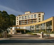
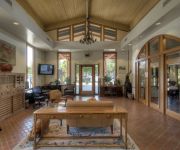
Also, if you like the game of golf, there are some options within driving distance. We saw 9 points of interest near this location. In need of a room? We compiled a list of available hotels close to the map centre further down the page.
Since you are here already, you might want to pay a visit to some of the following locations: Redwood City, San Jose, Oakland, Santa Cruz and San Francisco. To further explore this place, just scroll down and browse the available info.
Local weather forecast
Todays Local Weather Conditions & Forecast: 13°C / 55 °F
| Morning Temperature | 8°C / 47 °F |
| Evening Temperature | 10°C / 50 °F |
| Night Temperature | 8°C / 46 °F |
| Chance of rainfall | 0% |
| Air Humidity | 45% |
| Air Pressure | 1022 hPa |
| Wind Speed | Moderate breeze with 9 km/h (6 mph) from South-East |
| Cloud Conditions | Few clouds, covering 14% of sky |
| General Conditions | Few clouds |
Monday, 18th of November 2024
14°C (57 °F)
9°C (48 °F)
Broken clouds, light breeze.
Tuesday, 19th of November 2024
14°C (57 °F)
12°C (54 °F)
Overcast clouds, moderate breeze.
Wednesday, 20th of November 2024
17°C (62 °F)
12°C (53 °F)
Overcast clouds, gentle breeze.
Hotels and Places to Stay
Crowne Plaza PALO ALTO
Dinahs Garden Hotel
Oakwood At Eaves Mtn View
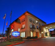
Hampton Inn - Suites Mountain View
THE ZEN HOTEL
Hilton Garden Inn Palo Alto
Courtyard Palo Alto Los Altos
OAKWOOD AT MADRONE
Homewood Suites by Hilton Palo Alto
OAKWOOD AT DOMUS ON THE BLVD
Videos from this area
These are videos related to the place based on their proximity to this place.
broken rail-crossing gate Mountain View, CA (Caltrain)
broken rail-crossing gate at Rengstorff and Central Express Way Mountain View, California Caltrain train passing.
Happy Frankie 100 from Wednesday Night Hop in Mountain View, California
In honor of the Frankie Manning Centennial and World Lindy Hop Day, dancers all over the world are performing Frankie's choreography of the "Lindy Chorus" for what would have been his 100th...
Dan green Brandon Lilly Boss Barbell club Seminar Recap mountain view California
The seminar was full, but i got in anyway. VLOG here :) http://youtu.be/V2wVSUWfAS0 #powerlifting I literally just made this video right after the event, reviewing my notes while it's still...
ANG BELEN EXHIBIT HELD AT ZSMIT
MY OWN COLLECTION PHOTOS OF ANG BELEN EXHIBIT HELD AT ZSMIT PAGADIAN CITY..........VIA MOBILE CAM ONLY.
Diwali 2014 at GARF: Garba
Diwali Mela 2014 was held on Friday 24th October 2014 at Google's GARF field. It was an amazing event attended by over 2000 people. It was organized by the Indus Googler Network (IGN). This...
Journey To the Center of the Earth recreation on RCT3
This is a log flume version of Journey to the Center of the Earth movies. It is in night-time version, so it looks like you are in the deep, dark, center of the Earth. and thanks for the 1000...
Clayface Gets a Girlfriend & Eats The Joker - imaginext batman toys
Batman vs Catwoman https://www.youtube.com/watch?v=_CgdrqQ0UQs&list=UUxMI2kSn5ZWg7OJOu0HLXaw Joker and Harley Quinn Steal Gotham City Ruby ...
Chinese New Year Harlem Shake vBox
The Box team got inspired by the holiday to deliver this to you. Shake yourself to free cloud storage for your shaky self at box.com. And lions dancers. And keg stands. Actually this is a...
Videos provided by Youtube are under the copyright of their owners.
Attractions and noteworthy things
Distances are based on the centre of the city/town and sightseeing location. This list contains brief abstracts about monuments, holiday activities, national parcs, museums, organisations and more from the area as well as interesting facts about the region itself. Where available, you'll find the corresponding homepage. Otherwise the related wikipedia article.
Shockley Semiconductor Laboratory
Shockley Semiconductor Laboratory, a division of Beckman Instruments, Inc. , was the first establishment working on silicon semiconductor devices in what came to be known as Silicon Valley. In 1957, its 8 leading scientists left and formed Fairchild Semiconductor, a loss from which it never recovered. It was purchased by Clevite in 1960, and officially closed shortly after being sold to ITT in 1968.
Midpeninsula Regional Open Space District
Formed in 1972 by voter initiative, the Midpeninsula Regional Open Space District (MROSD) is a non-enterprise special district in the San Francisco Bay Area committed to the following mission: To acquire and preserve a regional greenbelt of open space land in perpetuity; protect and restore the natural environment; and provide opportunities for ecologically sensitive public enjoyment and education.
San Antonio Shopping Center
San Antonio Shopping Center is an outdoor shopping mall located on El Camino Real at San Antonio Road in Mountain View, California. It is one of the biggest shopping malls in Mountain View, and its proximity to Los Altos and Palo Alto also attracts shoppers from the nearby towns. The mall's anchor stores include 24 Hour Fitness, Ross Dress For Less, Trader Joe's, and Wal-Mart. Sears was an anchor until July 2011. The building that housed Sears has been demolished to make way for Safeway.
Bullis Charter School
Bullis Charter School (BCS) is a public charter school located in Los Altos, California, USA, for grades kindergarten through eighth. As the Santa Clara County Office of Education charters the school, BCS operates independently of the Los Altos School District (LASD). BCS differentiates itself from the LASD schools by providing "Focused Learning Goals", full-time teaching specialists in the arts and sciences, a Mandarin language program, and optional after-school activities.
Egan Junior High School
Ardis G. Egan Junior High School is a middle school for seventh graders and eighth graders in Los Altos, California. It is part of the Los Altos School District. Most of Egan's over five hundred students live in Los Altos and Los Altos Hills, and a few students live in Mountain View. Egan is named after Ardis G. Egan, the founder and former Superintendent of the Los Altos School District.
Kehillah Jewish High School
Kehillah Jewish High School is an independent college preparatory high school located in Palo Alto, California. "Kehillah" is a Hebrew word meaning "community. " The school is one of a series of pluralistic (community) Jewish day schools in the United States at the high school level founded within the past 10 years. In the fall of 2005, the school moved from its original location in San Jose to its new campus at 3900 Fabian Way, Palo Alto, California.
Saint Athanasius Parish
Saint Athanasius Parish is a territorial parish of the Roman Catholic Diocese of San Jose in California. The parish was established June 19, 1959, by John J. Mitty, D.D. , Archbishop of San Francisco, to serve Catholics of Mountain View and Palo Alto. The parish is named for Athanasius, Patriarch of Alexandria.
Castro (Caltrain station)
Castro Station was a Caltrain station located in Mountain View, California. It was replaced by the newer San Antonio station 0.8 mi (1 km) to the north in 1999. The last Castro boardings were in 2000.
San Antonio (Caltrain station)
San Antonio Station is a Caltrain station in Mountain View, California. It opened in 1999, replacing the Castro station at Rengstorff Ave 0.8 miles (1.3 km) to the south, which closed in 2000. A pedestrian tunnel at the south end of the platform area connects the two platforms. An apartment complex near the station has a Valley Transit Authority underground Park and Ride lot.
Community School of Music and Arts at Finn Center
Ellwood P. Cubberley High School
Cubberley High School was one of three public high schools in Palo Alto, California. Opened in 1956, Cubberley High was located at 4000 Middlefield Road. It was finally closed in 1979 as a reaction to declining enrollment and decreased revenues following Proposition 13.
Android lawn statues
The Android lawn statues are a series of large plastic statues located in front of building 44 at the Googleplex in Mountain View, California. They are based on the code names for versions of Google's Android mobile operating system, which are named after desserts.


