Safety Score: 2,7 of 5.0 based on data from 9 authorites. Meaning we advice caution when travelling to United States.
Travel warnings are updated daily. Source: Travel Warning United States. Last Update: 2024-08-13 08:21:03
Delve into Santa Ynez
Santa Ynez in Santa Barbara County (California) with it's 4,418 habitants is a town located in United States about 2,379 mi (or 3,828 km) west of Washington DC, the country's capital town.
Time in Santa Ynez is now 11:08 PM (Monday). The local timezone is named America / Los Angeles with an UTC offset of -8 hours. We know of 11 airports closer to Santa Ynez, of which 3 are larger airports. The closest airport in United States is Santa Barbara Municipal Airport in a distance of 19 mi (or 30 km), South-East. Besides the airports, there are other travel options available (check left side).
Also, if you like the game of golf, there are some options within driving distance. In need of a room? We compiled a list of available hotels close to the map centre further down the page.
Since you are here already, you might want to pay a visit to some of the following locations: Santa Barbara, Ventura, San Luis Obispo, Bakersfield and Hanford. To further explore this place, just scroll down and browse the available info.
Local weather forecast
Todays Local Weather Conditions & Forecast: 15°C / 60 °F
| Morning Temperature | 13°C / 56 °F |
| Evening Temperature | 14°C / 58 °F |
| Night Temperature | 15°C / 58 °F |
| Chance of rainfall | 6% |
| Air Humidity | 88% |
| Air Pressure | 1019 hPa |
| Wind Speed | Gentle Breeze with 5 km/h (3 mph) from North-West |
| Cloud Conditions | Overcast clouds, covering 100% of sky |
| General Conditions | Light rain |
Tuesday, 26th of November 2024
19°C (65 °F)
12°C (53 °F)
Moderate rain, light breeze, broken clouds.
Wednesday, 27th of November 2024
18°C (64 °F)
14°C (57 °F)
Overcast clouds, light breeze.
Thursday, 28th of November 2024
19°C (66 °F)
13°C (56 °F)
Light rain, light breeze, overcast clouds.
Hotels and Places to Stay
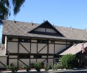
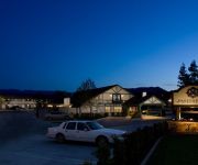
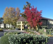
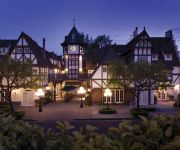
Chumash Casino Resort
Ballard Inn & Gathering Table
Fess Parker Wine Country Inn
Hotel Corque
KING FREDERIK INN
The Landsby
KRONBORG INN
Hadsten House Inn and Spa
Holiday Inn Express SOLVANG - SANTA YNEZ VALLEY
WINE VALLEY INN & COTTAGES-SOLVANG
Videos from this area
These are videos related to the place based on their proximity to this place.
Milyone's First Green Hunter Competition 8/24/2014 Santa Ynez, CA
Milyone's first competition after only 1 week jumping. Trained and ridden by Erika Cooper, owned by Linda Moss and George Bedar.
No Se Va A Poder - Espinoza Paz - SANTA YNEZ, CA
NO SE VA A PODER - ESPINOZA PAZ EN CHUMASH CASINO - SANTA YNEZ, CA ABRIL 12, 2012.
2014 Viera's Hot Rod Roundup | Santa Ynez, California
The 2014 Viera's Hot Rod Roundup took place in Santa Ynez, California.
Riding into Santa Ynez
Heading west on Hwy 246 we enter Santa Ynez. I am on my Electra Glide and Daniel is on his Fat Boy. Filmed with Contour HD helmet cam. See more at http://www.GotBadDog.com.
Chumash Life - Winter 2014/15
In this edition of Chumash Life: The journey of creating the Chumash Museum and Cultural Center begins with the vision of renowned architect Johnpaul Jones. A recent economic impact study...
Chumash Life - Spring 2015
In this edition of Chumash Life: Sovereignty: what it is, what it means and how it is applied to Native American tribes today. This year marks the 50th anniversary of the Santa Ynez Band...
CLIP - Home on the Rez (Summer 2014)
Housing has been a long-time concern for the Santa Ynez Band of Chumash Indians. From a lack of housing to overcrowding on the reservation, the tribe has grappled with the issue for decades.
CLIP - A Traveling Training Trailer (Spring 2015)
A recent matching grant from the Santa Ynez Chumash Indians Foundation is helping the community learn valuable lessons about emergency preparedness and safety.
1966 Lincoln Continental Low Rider
Les Clark presents the 1966 Lincoln Continental Low Rider at the 2014 Viera's Hot Rod Roundup, Santa Ynez CA.
Videos provided by Youtube are under the copyright of their owners.
Attractions and noteworthy things
Distances are based on the centre of the city/town and sightseeing location. This list contains brief abstracts about monuments, holiday activities, national parcs, museums, organisations and more from the area as well as interesting facts about the region itself. Where available, you'll find the corresponding homepage. Otherwise the related wikipedia article.
Santa Ynez, California
Santa Ynez is a census-designated place (CDP) in Santa Barbara County, California, United States. The town of Santa Ynez is one of the communities that make up the Santa Ynez Valley, and features the Santa Ynez Airport for general aviation with a paved 2804 x 75 foot runway. The population was 4,418 at the 2010 census, down from 4,584 at the 2000 census. It is named after Saint Agnes, Ynez being the former Spanish language spelling.
Santa Ynez Airport
Santa Ynez Airport is a public airport located one mile (2 km) southeast of the central business district of Santa Ynez, in the Santa Ynez Valley of Santa Barbara County, California, United States. The airport covers 125 acres and has one runway. Although most U.S. airports use the same three-letter location identifier for the FAA and IATA, Santa Ynez is assigned IZA by the FAA and SQA by the IATA. The airport's ICAO identifier is KIZA.
Rancho Cañada de los Pinos
Rancho Cañada de los Pinos or College Rancho was a 35,499-acre Mexican land grant in present day Santa Barbara County, California. The grant extended along the north bank of the Santa Ynez River opposite Rancho Lomas de la Purificacion and encompassed Mission Santa Inés and present day Santa Ynez, in the Santa Ynez Valley.


