Safety Score: 2,7 of 5.0 based on data from 9 authorites. Meaning we advice caution when travelling to United States.
Travel warnings are updated daily. Source: Travel Warning United States. Last Update: 2024-08-13 08:21:03
Discover Mission Canyon
Mission Canyon in Santa Barbara County (California) with it's 2,381 citizens is a place in United States about 2,363 mi (or 3,803 km) west of Washington DC, the country's capital city.
Current time in Mission Canyon is now 01:35 AM (Friday). The local timezone is named America / Los Angeles with an UTC offset of -8 hours. We know of 11 airports near Mission Canyon, of which 4 are larger airports. The closest airport in United States is Santa Barbara Municipal Airport in a distance of 7 mi (or 12 km), West. Besides the airports, there are other travel options available (check left side).
Also, if you like playing golf, there are a few options in driving distance. If you need a hotel, we compiled a list of available hotels close to the map centre further down the page.
While being here, you might want to pay a visit to some of the following locations: Santa Barbara, Ventura, Bakersfield, San Luis Obispo and Los Angeles. To further explore this place, just scroll down and browse the available info.
Local weather forecast
Todays Local Weather Conditions & Forecast: 21°C / 69 °F
| Morning Temperature | 15°C / 59 °F |
| Evening Temperature | 15°C / 58 °F |
| Night Temperature | 15°C / 58 °F |
| Chance of rainfall | 0% |
| Air Humidity | 44% |
| Air Pressure | 1018 hPa |
| Wind Speed | Gentle Breeze with 6 km/h (4 mph) from North-East |
| Cloud Conditions | Clear sky, covering 3% of sky |
| General Conditions | Sky is clear |
Friday, 22nd of November 2024
16°C (61 °F)
13°C (55 °F)
Moderate rain, light breeze, overcast clouds.
Saturday, 23rd of November 2024
16°C (61 °F)
13°C (56 °F)
Light rain, gentle breeze, overcast clouds.
Sunday, 24th of November 2024
14°C (57 °F)
14°C (58 °F)
Moderate rain, moderate breeze, overcast clouds.
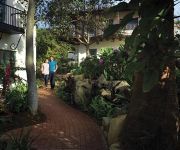
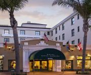
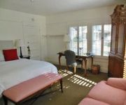
Hotels and Places to Stay
Belmond El Encanto
Kimpton Canary Hotel
HOTEL SANTA BARBARA
The Upham Hotel & Country House
Cheshire Cat Inn
THE UPHAM HOTEL
Secret Garden Inn and Cottages
LEMON TREE INN
La Quinta Inn and Suites Santa Barbara Downtown
La Quinta Inn & Suites Santa Barbara Downtown
Videos from this area
These are videos related to the place based on their proximity to this place.
Butterfly Beach, Santa Barbara California, Montecito Beach
Butterfly Beach in Santa Barbara California is the famous beach in Montecito in front of the Biltmore Hotel, and next to the Coral Casino, a celebrity hangout. One of the most picturesque...
New america Kaplan Santa Barbara
Hey everyone ! I just wanted to share with you my year In America. Enjoy and Be Cool ! Ride on ! Hey tout le monde , cette vidéo relate mon année aux Etats-Unis avec L'école Kaplan Internationa...
Tour the Canary Hotel in Santa Barbara, CA
Jetset Extra takes you on a tour of Santa Barbara's only full service luxury boutique hotel in downtown. The Canary Hotel wants their guests to feel like they have been swept away to a relaxing...
DJI Phantom and GoPo Hero 3+ Over Santa Barbara
POV videographer and GoPro guru, Ian Boyd, flies a DJI Phantom with a GoPro Hero+ aboard. Check out Santa Barbara's beaches, mission, and city scape from above.
Santa Barbara Train Station Amtrack
The public train station in Santa Barbara California is located in downtown Santa Barbara adjacent to State Street near Stearns Wharf - the Santa Barbara pier, and Cabrillo Boulevard, Rebecca...
The Hotel Milo Santa Barbara, California - Classic Hotel on the Beach
SUN, SURF, AND SOPHISTICATION IN A CHIC SANTA BARBARA BEACH HOTEL Built in the traditional Spanish-style architecture that reflects this city's rich colonial history, this classic Santa...
U.S. National Pro - Highlights - Santa Barbara, CA
U.S. National Pro - Best moments - Santa Barbara, CA Jan. 11th, 2015.
Harlem Shake EF Santa Barbara
COPYRIGHT© Shout out to Baauer - Harlem Shake. EF is an international language school located in Santa Barbara, CA for students from over 45 different nationalities. This video is of our...
Videos provided by Youtube are under the copyright of their owners.
Attractions and noteworthy things
Distances are based on the centre of the city/town and sightseeing location. This list contains brief abstracts about monuments, holiday activities, national parcs, museums, organisations and more from the area as well as interesting facts about the region itself. Where available, you'll find the corresponding homepage. Otherwise the related wikipedia article.
Mission Canyon, California
Mission Canyon is a census-designated place and an unincorporated suburb of Santa Barbara, California, in Santa Barbara County, United States. The population was 2,381 at the 2010 census, down from 2,610 at the 2000 census. Mission Canyon is directly north — on the mountain side — of the city of Santa Barbara, and derives its name from the Mission Santa Barbara which is built between Mission Canyon and the center of the city.
Santa Barbara Botanic Garden
The Santa Barbara Botanic Garden is a 78 acre botanical garden, containing over 1,000 species of rare and indigenous plants. It is located in Mission Canyon, Santa Barbara, California, USA. The purpose of the Garden is to display California native plants in natural settings. There are approximately 9.2 km of hiking trails within the garden.
Fielding Graduate University
Fielding Graduate University, previously Fielding Graduate Institute, and The Fielding Institute, is an accredited, nonprofit post-graduate institution of higher learning based in Santa Barbara, California, USA. Fielding Graduate University was founded in March, 1974, in Santa Barbara, California, the realization of the vision of three founders: Frederic M. Hudson, Hallock Hoffman, and Renata Tesch.
Rattlesnake Canyon (Santa Barbara)
Rattlesnake Canyon stretches from Skofield Park into the Santa Ynez mountains. Its name comes from its serpentine shape and curves, not rattlesnake occupation.
Santa Barbara Cottage Hospital
Santa Barbara Cottage Hospital is a hospital in the city of Santa Barbara, California. It is owned and operated by Cottage Health System. It is the only Level II trauma center between Los Angeles (south) and the Bay Area (north) on coastal California. Santa Barbara Cottage's location is approximately 90 miles northwest of Los Angeles and approximately 300 miles south of the Bay Area.
Skofield Park
Skofield Park, of Santa Barbara, California, was originally private property, owned by Ray Skofield. The 35 acres were originally used as a camp for Los Rancheros Vistadores, a men's riding group which Skofield was a founder of, in 1930.
Jesusita Fire
The Jesusita Fire was a wildfire that began at approximately 1:45 PM on May 5, 2009 in the hills of Santa Barbara, California. The fire burned 8,733 acres, destroyed 80 homes and damaged 15 more before being 100% contained.
Garden Street Academy
Garden Street Academy is a K-12 independent school located in Santa Barbara, California, United States. Garden Street was founded as a K-6 school in 2002 and was created under the paradigm that a focus on Social-Emotional Learning (SEL) is critical to academic achievement. Within two years, the Middle School program was added, followed by the Upper School in 2005. The campus offers classes on a historic site on the Upper Eastside of Santa Barbara, encompassing eleven acres.


