Safety Score: 2,7 of 5.0 based on data from 9 authorites. Meaning we advice caution when travelling to United States.
Travel warnings are updated daily. Source: Travel Warning United States. Last Update: 2024-08-13 08:21:03
Delve into Vista de Santa Barbara Mobile Homes
The district Vista de Santa Barbara Mobile Homes of Carpinteria in Santa Barbara County (California) is a district located in United States about 2,353 mi west of Washington DC, the country's capital town.
In need of a room? We compiled a list of available hotels close to the map centre further down the page.
Since you are here already, you might want to pay a visit to some of the following locations: Santa Barbara, Ventura, Bakersfield, Los Angeles and San Luis Obispo. To further explore this place, just scroll down and browse the available info.
Local weather forecast
Todays Local Weather Conditions & Forecast: 17°C / 63 °F
| Morning Temperature | 12°C / 54 °F |
| Evening Temperature | 13°C / 56 °F |
| Night Temperature | 13°C / 56 °F |
| Chance of rainfall | 0% |
| Air Humidity | 50% |
| Air Pressure | 1018 hPa |
| Wind Speed | Gentle Breeze with 8 km/h (5 mph) from East |
| Cloud Conditions | Overcast clouds, covering 97% of sky |
| General Conditions | Overcast clouds |
Monday, 25th of November 2024
14°C (56 °F)
15°C (59 °F)
Moderate rain, light breeze, overcast clouds.
Tuesday, 26th of November 2024
16°C (60 °F)
16°C (60 °F)
Moderate rain, light breeze, overcast clouds.
Wednesday, 27th of November 2024
18°C (64 °F)
15°C (59 °F)
Broken clouds, light breeze.
Hotels and Places to Stay
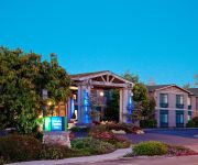
Holiday Inn Express & Suites CARPINTERIA
BW PLUS CARPINTERIA INN
Sandyland Reef Inn
MOTEL SANTA BARBARA - CARPINTERIA S
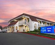
MOTEL 6 SANTA BARBARA - CARPINTERIA
CLIFF HOUSE INN
Videos from this area
These are videos related to the place based on their proximity to this place.
California Ventura Beach, Santa Maria area road trip
Some scenery between Ventura beach and Santa Maria California.
CampgroundViews.com - Carpinteria State Beach Campground Carpinteria California CA
http://www.CampgroundViews.com takes user submitted videos combined with professional editing to provide tent and RV campers with a first person view of a campground or RV park. Carpinteria...
California Harbor Seals in surf at Carpinteria Bluffs..
Carpinteria Bluffs is one of only a few sites on the mainland in southern California where harbor seals give birth. At the Bluffs there is a small protected beach near an oil service dock...
Carpinteria Bluffs Trail & Beach
Hello again family, friends, foes and strangers! small hike and beach trip we took after football scrimmage plus footage from the ride back.
6180 Via Real, #8, Carpinteria, CA Presented by Sheila Siegel.
Click to see more: http://www.searchallproperties.com/virtualtour/2031022/6180-Via-Real,-#8-Carpinteria-CA 6180 Via Real, #8 Carpinteria, CA 93013 Contact Sheila Siegel for more information....
Yelp Carpinteria Home Remodeling Room Additions Shafran Construction 805-421-4333
Web site: www.shafranconstruction.com Email: info@shafranconstruction.com Phone: 805-421-4333 Choose the #1 Company in Los Angeles and Ventura County for your next construction or ...
2014-10-05 Vlog - Day 16,456 - Avocado Festival
Robert Jones dailyish vlog. Robert Jones, Jim Sirianni and J hit up the Carpinteria, CA Avocado Festival, try out the new GoPro camera and basically eat a lot of crap food....or something...
Train Stops at Railroad Crossing
Caught these Amtrak Surfliner trains stopping at the station in Carpinteria California. The first pulls a nice looking Santa Fe Acoma car. Great train and crossing guard sounds!
Videos provided by Youtube are under the copyright of their owners.
Attractions and noteworthy things
Distances are based on the centre of the city/town and sightseeing location. This list contains brief abstracts about monuments, holiday activities, national parcs, museums, organisations and more from the area as well as interesting facts about the region itself. Where available, you'll find the corresponding homepage. Otherwise the related wikipedia article.
Summerland, California
Summerland is a census-designated place (CDP) in Santa Barbara County, California, United States. The population was 1,448 at the 2010 census, down from 1,545 at the 2000 census. The town includes a school and a Presbyterian Church. There are many small businesses.
Rincon (surfspot)
Rincon (Spanish, "angle" or "corner") is a surf spot located at the Ventura and Santa Barbara County line in Southern California, USA. Also known as the "Queen of the Coast", Rincon is one of the most famous surf spots in California, known around the world for its well-formed waves and long rides. The book 100 Best Surf Spots in the World rates Rincon at 24. It is best at low tide during the winter months when swells are coming mostly from the west and northwest.
Santa Barbara Biltmore
The Santa Barbara Biltmore opened in 1927 as part of the legendary Biltmore Hotels chain. Now known as the Four Seasons Resort—The Biltmore Santa Barbara or just the Biltmore, it is a luxury hotel located in Montecito, California. Its landmark Spanish Colonial Revival architecture and gardens are on the Pacific Coast just east of Santa Barbara in Southern California, in the U.S..
Casitas Dam
Casitas Dam is an earthfill dam across Coyote Creek that forms Lake Casitas in the Los Padres National Forest of Ventura County, California near Ojai, California. The dam is located two miles (3 km) above the junction of Coyote Creek and the Ventura River. Water from the Ventura River is diverted to Lake Casitas as well. The 334 ft structure was built by the U.S. Bureau of Reclamation. It is a key part of the Ventura River Project. Construction was completed in 1959.
Lake Casitas
Lake Casitas is an man-made lake in the Los Padres National Forest of Ventura County, California, created by the construction of Casitas Dam on Coyote Creek, two miles (3 km) before it joins the Ventura River. Santa Ana Creek and North Fork Coyote Creek also flow into the lake. The dam was constructed of earth-fill and was completed in 1959. It is 279 ft and was built by the United States Bureau of Reclamation. The lake has a capacity of 254,000 acre·ft .
KHAY
KHAY is a commercial radio station located in Ventura, California, broadcasting to the Oxnard-Ventura, California area on 100.7 FM. KHAY airs a country music format branded as "K-HAY". The station originally signed on in 1962 as KVEN-FM and simulcasted the AM station of the same call letters for most of the next eleven years before becoming automated country KHAY in 1973. KHAY and KVEN remain as sister stations.
KDAR
KDAR is a Christian radio station based in Oxnard, California, USA. It is owned by Salem Communications. As with other stations of the format, KDAR plays condensed church services, Biblical teaching programs, and some Contemporary Christian music, or CCM. KDAR also operates a broadcast booster to cover the Santa Barbara area. Currently, the booster only broadcasts in mono.
Carpinteria (Amtrak station)
The Carpinteria Amtrak Station is an Amtrak rail station in the city of Carpinteria, California. It is served by Amtrak's Pacific Surfliner from San Luis Obispo to San Diego. Ten Pacific Surfliner trains serve the station daily. The station consists only of a concrete platform and an open-air shelter. Of the 73 California stations served by Amtrak, Carpinteria was the 48th-busiest in FY2010, boarding or detraining an average of approximately 55 passengers daily.
KFYV
KFYV (105.5 FM, "Live 105.5") is a commercial radio station located in Ojai, California, broadcasting to the Oxnard-Ventura, California, area. KFYV airs a Top 40 music format. It is owned by Gold Coast Broadcasting LLC.
KOCP
KOCP (95.9 FM, "Rewind 95.9") is a commercial radio station located in Camarillo, California, broadcasting to the Oxnard-Ventura, California, area. KOCP plays a 70s-80s classic hits music format. It is owned by Gold Coast Broadcasting LLC.
Rincon Island, California
Rincon Island is an artificial island located off Rincon Beach in Ventura County, California on public land leased from the California State Lands Commission (CSLC). The island is situated approximately 1,000 feet offshore in 55 feet of water. The island was constructed in 1958 for the specific purpose of well drilling and oil and gas production. It is near the seaside communities of Mussel Shoals and La Conchita. The island is connected to the mainland by the Richfield Pier.
1969 Santa Barbara oil spill
The Santa Barbara oil spill occurred in January and February 1969 in the Santa Barbara Channel, near the city of Santa Barbara in Southern California. It was the largest oil spill in United States waters at the time, and now ranks third after the 2010 Deepwater Horizon and 1989 Exxon Valdez spills. It remains the largest oil spill to have occurred in the waters off California.
Crane Country Day School
Crane Country Day School, established in 1928 by William D. Crane, is a highly-regarded kindergarten through eighth grade, coeducational private school in Santa Barbara, California, United States. William D. Crane shared a remarkable vision with founding headmaster F. Arnold Lejeune. Crane has remained true to their vision for the past eight decades, offering rigorous academic programs with hands-on experiences that challenge both the intellect and the imagination.
Shalawa Meadow, California
Shalawa Meadow (now most often called Hammond's Meadow) is a 3-acre seaside meadow used in ancient times as a burial site by the Chumash people, adjoining a once large Chumash community about 5 miles east of Santa Barbara, California in the community of Montecito.
Rancho El Rincon (Arellanes)
Rancho El Rincon was a 4,460-acre Mexican land grant in present day Santa Barbara County and Ventura County, California given in 1835 by Governor José Figueroa to Teodoro Arellanes. "Rincon" means "corner" in Spanish. The grant extended along the Pacific coast at the Santa Barbara and Ventura County line and encompassed Rincon Point, Rincon State Beach and present day La Conchita.
Summerland Oil Field
The Summerland Oil Field (and Summerland Offshore Oil Field) is an inactive oil field in Santa Barbara County, California, about four miles (6 km) east of the city of Santa Barbara, within and next to the unincorporated community of Summerland. First developed in the 1890s, and richly productive in the early 20th century, the Summerland Oil Field was the location of the world's first offshore oil wells, drilled from piers in 1896.
Rincon Oil Field
The Rincon Oil Field is a large oil field on the coast of southern California, about ten miles northwest of the city of Ventura, and about 20 miles east-southeast of the city of Santa Barbara. It is the westernmost onshore field in a series of three fields which follow the Ventura Anticline, an east-west trending feature paralleling the Transverse Ranges.
Dos Cuadras Offshore Oil Field
The Dos Cuadras Offshore Oil Field is a large oil and gas field underneath the Santa Barbara Channel about eight miles southeast of Santa Barbara, California. Discovered in 1968, and with a cumulative production of over 260 million barrels of oil, it is the 24th-largest oil field within California and the adjacent waters. As it is in the Pacific Ocean outside of the 3-mile tidelands limit, it is a federally leased field, regulated by the U.S.
San Miguelito Oil Field
The San Miguelito Oil Field is a large and currently productive oil field in the hills northwest of the city of Ventura in southern California in the United States. The field is close to the coastline, with U.S. Highway 101 running past at the base of the hills, and is sandwiched between the larger Ventura Oil Field to the east and the Rincon Oil Field, which is partially offshore, to the north and northwest.
Muscle Shoals, California
Muscle Shoals is an unincorporated community in Ventura County, California. The name was collected in 1987 by the California Coastal Commission, and entered into the Geographic Names Information System on December 2, 1996.
Rancho Santa Ana
Rancho Santa Ana was a 21,522-acre Mexican land grant in present day Ventura County, California given in 1837 by Governor Juan Alvarado to Crisogono Ayala and Cosme Vanegas. Rancho Santa Ana was located inland in the Ventura River Valley on the west side of the Ventura River across from Rancho Ojai which was granted in the same year. Rancho Santa Ana encompassed present day Lake Casitas and Oak View.
Carpinteria Offshore Oil Field
The Carpinteria Offshore Oil Field is an oil and gas field in Santa Barbara Channel, south of the city of Carpinteria in southern California in the United States. Discovered in 1964, and reaching peak production in 1969, it has produced over 106 million barrels of oil in its lifetime, and retains approximately 2 million barrels in reserve recoverable with present technology, according to the California State Department of Natural Resources.
Carpinteria Tar Pits
The Carpinteria Tar Pits (also Carpinteria Oil Seeps) are a series of natural asphalt lakes situated in the southern part of Santa Barbara County in southern California. The Carpinteria Tar Pits are one of the five natural asphalt lake areas in the world, the others being Tierra de Brea in Trinidad and Tobago, Lake Guanoco in Venezuela and the Rancho La Brea Tar Pits (Los Angeles) and McKittrick Tar Pits both also located in the US state of California.
2005 La Conchita landslide
On January 10, 2005, a major landslide occurred in the town of La Conchita, California. The landslide killed 10 people, and destroyed or damaged dozens of houses. The landslide occurred on part of a previous landslide that occurred in 1995.
KUHD-LP
KUHD-LP, (channel 6), is a low power television station in Ventura, California, owned by Obidia Porras. Because the station broadcasts an analog signal on channel 6, its audio can be received at 87.75 MHz FM. The station has a construction permit to move its city of license to Camarillo, California, with a new transmitter in the UHF band on channel 44. The station would also carry a digital signal, as opposed to the current analog broadcast.


