Safety Score: 2,7 of 5.0 based on data from 9 authorites. Meaning we advice caution when travelling to United States.
Travel warnings are updated daily. Source: Travel Warning United States. Last Update: 2024-08-13 08:21:03
Delve into Red Arrow Mobile Home Park
The district Red Arrow Mobile Home Park of South San Francisco in San Mateo County (California) is a district located in United States about 2,438 mi west of Washington DC, the country's capital town.
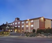
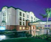
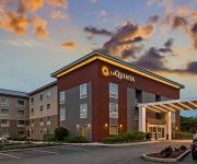
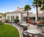
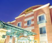
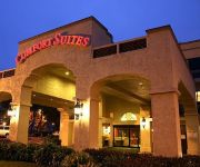
In need of a room? We compiled a list of available hotels close to the map centre further down the page.
Since you are here already, you might want to pay a visit to some of the following locations: San Francisco, Oakland, Redwood City, San Rafael and Martinez. To further explore this place, just scroll down and browse the available info.
Local weather forecast
Todays Local Weather Conditions & Forecast: 12°C / 54 °F
| Morning Temperature | 10°C / 50 °F |
| Evening Temperature | 11°C / 52 °F |
| Night Temperature | 10°C / 50 °F |
| Chance of rainfall | 0% |
| Air Humidity | 55% |
| Air Pressure | 1023 hPa |
| Wind Speed | Fresh Breeze with 16 km/h (10 mph) from South-East |
| Cloud Conditions | Clear sky, covering 5% of sky |
| General Conditions | Sky is clear |
Tuesday, 19th of November 2024
12°C (54 °F)
12°C (53 °F)
Overcast clouds, gentle breeze.
Wednesday, 20th of November 2024
14°C (57 °F)
14°C (57 °F)
Overcast clouds, fresh breeze.
Thursday, 21st of November 2024
14°C (57 °F)
14°C (57 °F)
Overcast clouds, moderate breeze.
Hotels and Places to Stay
Embassy Suites by Hilton San Francisco Airport
Hotel Focus SFO
Holiday Inn SAN FRANCISCO AIRPORT
Staybridge Suites SAN FRANCISCO AIRPORT
La Quinta Inn and Suites San Francisco Airport North
Hilton Garden Inn San Francisco Arpt North
Quality Inn & Suites
Comfort Inn & Suites San Francisco Airport North
Courtyard San Francisco Airport
BEST WESTERN PLUS GROSVENOR
Videos from this area
These are videos related to the place based on their proximity to this place.
South City Station Apartments - 1 Bedroom A - South San Francisco
http://www.equityapartments.com/california/san-francisco-bay-apartments/south-san-francisco/south-city-station-apartments.aspx Click the link to see the most up to date prices & availability....
South City Station Apartments - 2 Bedrooms D - South San Francisco
http://www.equityapartments.com/california/san-francisco-bay-apartments/south-san-francisco/south-city-station-apartments.aspx Click the link to see the most up to date prices & availability....
VanGo Rooter San Francisco, CA | Plumbing and Drain Cleaning
http://vangorooter.com/ VanGo Rooter 170 S Spruce Ave Suite E South San Francisco, CA 94080 415-755-7405.
VanGo Rooter | Plumbing Installation, Repair San Francisco, CA
http://vangorooter.com/ VanGo Rooter 170 S Spruce Ave Suite E South San Francisco, CA 94080 415-755-7405.
San Bruno Mountain Fire - 9/7/2013
Fire on San Bruno Mountain in South San Francisco, California on 9/7/2013. Driving up to see how bad it was and capture video of it.
SSFHS Football vs Woodside 10-10-14
Watch the entire game: http://www.nfhsnetwork.com/events/south-san-francisco-high-school-south-san-francisco-ca/56b281cb65.
Descent from San Bruno Mountain to Brisbane CA (MTB)
Relaxing Sunday afternoon down the hill ride (I do not want to call this downhill) after climbing to the top and running into another mountain biker from Brisbane. Sadly you are not allowed...
Videos provided by Youtube are under the copyright of their owners.
Attractions and noteworthy things
Distances are based on the centre of the city/town and sightseeing location. This list contains brief abstracts about monuments, holiday activities, national parcs, museums, organisations and more from the area as well as interesting facts about the region itself. Where available, you'll find the corresponding homepage. Otherwise the related wikipedia article.
South San Francisco, California
South San Francisco is a city in San Mateo County, California, United States, located on the San Francisco Peninsula in the San Francisco Bay Area. The population was 63,632 at the 2010 census. South San Francisco lies north of San Bruno and San Francisco International Airport in a small valley south of Daly City, Colma, Brisbane, and San Bruno Mountain, east of Pacifica and the hills of the Coast Range, and west of the waters of San Francisco Bay.
Cypress Lawn Memorial Park
Cypress Lawn Memorial Park, established by Hamden Holmes Noble in 1892, is a cemetery located in Colma, California, a place known as the "City of the Silent". It is the final resting site for several members of the celebrated Hearst family plus other prominent citizens from the greater San Francisco area. The cemetery was among those profiled in the 2005 PBS documentary A Cemetery Special.
KQED-FM
KQED-FM is an NPR-member radio station owned by Northern California Public Broadcasting in San Francisco, California. Its parent organization is KQED, Inc.. KQED-FM was founded by James Day in 1969 as the radio arm of KQED Television. The founding manager was Bernard Mayes who later went on to be Executive Vice-President of KQED TV and also co-founder and chairman of NPR (National Public Radio).
Golden Gate National Cemetery
Golden Gate National Cemetery is a U.S. National Cemetery, located in the city of San Bruno, San Mateo County, 12 miles (19 km) south of San Francisco. Because of the name and location, it is frequently confused with San Francisco National Cemetery, which dates to the 19th century and is in the Presidio of San Francisco, in view of the Golden Gate.
KITS
KITS ("Live 105") is a San Francisco, California, USA-based radio station broadcasting at 105.3 MHz. The station is owned by CBS Radio and programs a modern rock format. The station also broadcasts on HD channel L2, locally on Comcast cable channel 986, and is streaming online.
KNTV
KNTV, channel 11, is an NBC owned-and-operated television station licensed to San Jose, California and serving the San Francisco Bay Area. Also known on-air by the branding NBC Bay Area, KNTV has its studios and main office in San Jose, which it shares with co-owned Telemundo station KSTS and CNBC's Silicon Valley bureau. The station's transmitter is located on San Bruno Mountain, just south of San Francisco. KNTV is one of five Bay Area market television stations that is licensed to San Jose.
KSAN (FM)
For the former KSAN see KYLD or KSOL KSAN Image:KSANFM.
Colma (BART station)
Colma Station is a Bay Area Rapid Transit station located in unincorporated Colma, California, in northern San Mateo County, adjacent to incorporated Colma and Daly City. Situated in a small valley immediately adjacent to a BART rail yard, the station consists of three main tracks with a shared island platform and one side platform. Currently, only the island platform and two of the main tracks are in service.
South San Francisco (BART station)
South San Francisco Station is a Bay Area Rapid Transit station located in suburban South San Francisco, California in northern San Mateo County. It consists of two main tracks and a shared underground island platform.
KRZZ
KRZZ is a commercial radio station located in San Francisco, California, broadcasting to the San Francisco Bay Area on 93.3 FM. KRZZ airs a regional Mexican music format branded as "La Raza".
KIOI
KIOI (101.3 FM, "Star 101.3") is a radio station licensed to San Francisco, California. The Clear Channel Communications-owned station programs a Hot Adult Contemporary format.
KKPX-TV
KKPX-TV, San Jose, California broadcasts on digital channel 41, serving the San Francisco Bay Area. It is an owned and operated affiliate of the Ion Television network.
KOSF
KOSF, known as "The Bay's 103.7 FM", is a classic hits radio station in San Francisco, California. The station is owned and operated by Clear Channel Communications.
San Bruno Mountain State Park
San Bruno Mountain State Park is a state park located in northern San Mateo County, California. It is adjacent to the southern boundary of San Francisco and borders the cities of Brisbane, South San Francisco, Colma and Daly City. San Bruno Mountain Park is a landmark of local and regional significance, standing as a unique open-space island in the midst of the peninsula's urbanization at the northern end of the Santa Cruz Mountain Range.
KTSF
KTSF is an independent television station serving the San Francisco Bay Area. Although licensed to San Francisco, the station's studio building is located in south suburban Brisbane, California. It is owned by Lincoln Broadcasting Company, and broadcasts its digital signal on UHF channel 27 from a transmitter located on San Bruno Mountain. Through the use of PSIP, KTSF's virtual channel is displayed as 26 on digital television receivers.
South San Francisco High School
South San Francisco High School, known colloquially as "South City High", is an American public high school located in South San Francisco, California which serves grades 9-12 as part of the South San Francisco Unified School District (SSFUSD).
El Camino High School (South San Francisco)
El Camino High School is a four-year American public high school in South San Francisco, California. It is located directly adjacent to the South San Francisco BART Station. It is part of the South San Francisco Unified School District (SSFUSD). El Camino High School has received accreditation from KYLD 94.9 as the San Francisco Bay Area "Most Spirited School In The Bay" in 2009 and 2011. El Camino ranks consistently at the top of its many athletic leagues except football.
Holy Cross Cemetery, Colma
Holy Cross Catholic Cemetery in Colma, California is an American Roman Catholic cemetery operated by the Archdiocese of San Francisco. Established in 1887 on 300 acres of a former potato farm, it is the oldest and largest cemetery established in Colma to serve the needs of San Francisco. Several notable historical figures are interred at Holy Cross. One of the cemetery sequences in the film Harold and Maude was filmed here.
Serramonte
Serramonte is a large 1960s residential neighborhood on the border of Daly City and Colma in the suburbs south of San Francisco, California, that is also home to numerous shopping malls, strip malls, and big box retailers. The nexus of Serramonte is Serramonte Center, originally opened in 1968, near the intersection of State Route 1 and Interstate 280, in the triangle formed by Callan Boulevard, Serramonte Boulevard, and Junipero Serra Boulevard which originally opened in 1968.
Serramonte Center
Serramonte Center is a 865,000 sq ft . super-regional shopping mall located in Daly City, California. The mall is anchored by Macy's, J. C. Penney, and Target Greatland. The world's largest New York & Company is located at this mall. The mall is owned by Capital & Counties and is managed by Jones Lang LaSalle.
Ponderosa Elementary School (South San Francisco)
Ponderosa Elementary School is a K–5 elementary school located in South San Francisco, California. It is part of the South San Francisco Unified School District.
KMVQ-FM
KMVQ-FM (99.7 FM, "99-7 Now") is a broadcast radio station in San Francisco, California in the United States. The station, known as "99-7 Now", broadcasts a Top 40 (CHR) format with a Rhythmic lean. KMVQ's HD2 channel features a Dance format, billing themselves as "Pulse Radio. " The move came about after KNGY dropped their Dance format for Top 40/CHR in September 2009.
Saint Veronica Catholic School
Saint Veronica Catholic School is a private parochial school located in South San Francisco, California. (Saint Veronica, 2006) The school enrollment is 306 students spanning the grade levels K through 8. The school is located at 434 Alida Way, South San Francisco.
KYLD
KYLD (94.9 FM, "WiLD 94.9") is a commercial radio station in San Francisco, California, serving the San Francisco Bay Area. The station airs a Rhythmic Contemporary format on its analog primary signal. In January 2006, KYLD added a HD Radio subcarrier, "WiLD en Espanol", which had targeted a Hispanic audience with a commercial-free, jockless Rhythmic Dance format, but in 2007 it was replaced by "FuZiC", which offers a format focusing on future hit music.
KMEL
KMEL (106.1 FM) is an Urban Contemporary-formatted radio station located in San Francisco, California. Owned by Clear Channel Communications, it has been one of the most well-programmed urban radio stations in the United States, owing to its unusual roots from carrying a Top 40 Pop-turned-Rhythmic format originally.


