Safety Score: 2,7 of 5.0 based on data from 9 authorites. Meaning we advice caution when travelling to United States.
Travel warnings are updated daily. Source: Travel Warning United States. Last Update: 2024-08-13 08:21:03
Delve into Farm Hills
The district Farm Hills of Redwood City in San Mateo County (California) is a subburb in United States about 2,433 mi west of Washington DC, the country's capital town.
If you need a hotel, we compiled a list of available hotels close to the map centre further down the page.
While being here, you might want to pay a visit to some of the following locations: Oakland, San Francisco, San Jose, Santa Cruz and Martinez. To further explore this place, just scroll down and browse the available info.
Local weather forecast
Todays Local Weather Conditions & Forecast: 12°C / 53 °F
| Morning Temperature | 8°C / 47 °F |
| Evening Temperature | 9°C / 49 °F |
| Night Temperature | 7°C / 45 °F |
| Chance of rainfall | 0% |
| Air Humidity | 52% |
| Air Pressure | 1023 hPa |
| Wind Speed | Moderate breeze with 11 km/h (7 mph) from South-East |
| Cloud Conditions | Few clouds, covering 21% of sky |
| General Conditions | Few clouds |
Tuesday, 19th of November 2024
13°C (55 °F)
9°C (48 °F)
Overcast clouds, light breeze.
Wednesday, 20th of November 2024
13°C (56 °F)
12°C (53 °F)
Overcast clouds, moderate breeze.
Thursday, 21st of November 2024
15°C (59 °F)
12°C (53 °F)
Overcast clouds, gentle breeze.
Hotels and Places to Stay
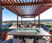
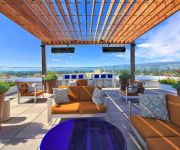
ABODA at Franklin 299 Apartments
Franklin 754 by RedAwning
DAYS INN REDWOOD CITY
BW INN
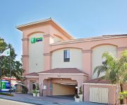
Holiday Inn Express REDWOOD CITY-CENTRAL
Fairfield Inn & Suites San Francisco San Carlos
OAKWOOD AT 201 MARSHALL
CA San Carlos Country Inn and Suites by Radisson
Courtyard Redwood City
Oakwood Redwood City
Videos from this area
These are videos related to the place based on their proximity to this place.
San Mateo/Redwood City BLS CPR Demo on a Child
http://www.redwoodcitycprclasses.com/course-catalog/bls-for-hcp-classroom/ The American Heart Association BLS for the Healthcare Providers CPR Class is taught in San Mateo County. View our...
Redwood City Sewer Repair | Trenchless Sewer Replacement in Redwood City CA
Redwood City sewer repair http://www.gobackflow.com/redwood-city-sewer-repair and Redwood City trenchless sewer replacement provided by Caccia of Redwood City is performed by Redwood City ...
Redwood City BLS Renewal Classes - bls renewal pocket mask infant
http://www.redwoodcitycprclasses.com teaches American Heart Association BLS for the Healthcare Provider CPR classes in San Mateo County. This advanced CPR course is for nurses, medical ...
Best Personal Injury Attorney Redwood City 650-206-8700 Attorney - Lawyer
Personal Injury Attorney Redwood City Norman Newhouse Get a respected, knowledgeable and experienced personal injury lawyer who can help you win your case Mr. Newhouse is big enough to win ...
Redwood City Real Estate Overview by Realtor and Resident Sally Lau
Brief description of neighborhoods west of the El Camino Real including pricing, schools, parks and downtown entertainment and offerings.
Redwood City BLS Renewal - infant CPR practice course
http:///www.redwoodcitycprclasses.com teaches American Heart Association bls for the healthcare provider CPR classes throughout San Mateo county.
Redwood City Trail - Northbound
A proposed 2-mile recreation trail along the Hetch Hetchy right-of-way in Redwood City. The trail would go all the way from the Emerald Market shopping center to Massachusetts Ave. See http://www...
Woodside Country Estate
http://www.tourfactory.com/s863585/r_www.youtube.com ----- For more information, contact: Jim McCahon, (650)851-7226, Coldwell Banker Previews ----- Presiding on more than 4 acres off a private...
Shredwood Contest
Contest held at Phil Shao Memorial Skate Park in Redwood City on May 24th, 2008 sponsored by Skate Works and Red Bull. Skaters include Josh Mattson, Andrew Langi, Frank Faria, Jerry Gurney....
Jeanine Allred and Annabell helmet camera beginner novice Woodside Oct.2014
Annabell first event. She was very good. She hadn't had the opportunity to school x-country. She was very brave, a stop to look at the first fence, after that she got better and better.
Videos provided by Youtube are under the copyright of their owners.
Attractions and noteworthy things
Distances are based on the centre of the city/town and sightseeing location. This list contains brief abstracts about monuments, holiday activities, national parcs, museums, organisations and more from the area as well as interesting facts about the region itself. Where available, you'll find the corresponding homepage. Otherwise the related wikipedia article.
SLAC National Accelerator Laboratory
The SLAC National Accelerator Laboratory, originally named Stanford Linear Accelerator Center, is a United States Department of Energy National Laboratory operated by Stanford University under the programmatic direction of the U.S. Department of Energy Office of Science.
Atherton, California
Atherton is an incorporated town in San Mateo County, California, United States. Its population was 6,914 at the 2010 census. In September 2010, Forbes magazine placed Atherton's zip code of 94027 at #2 on its annual list of America's most expensive zip codes, with a median home price of $4,010,200. Atherton is one of the wealthiest cities in the United States.
Emerald Lake Hills, California
Emerald Lake Hills is a census-designated place and neighborhood in unincorporated San Mateo County, in the state of California, USA. Situated among oak-studded hills between Woodside, Redwood City, and San Carlos roughly bounded by Edgewood Road, Alameda de las Pulgas, Farm Hill Boulevard, and Interstate 280.
North Fair Oaks, California
North Fair Oaks is a census-designated place and district for the purposes of the United States census in an unincorporated area of San Mateo County adjacent to Redwood City, Atherton, and Menlo Park. As of the 2010 census the area had a total population of 14,687. Because of the large number of residents from one Mexican state the area is also known as Little Michoacán.
San Carlos, California
San Carlos is a city in San Mateo County, California, USA on the San Francisco Peninsula, about halfway between San Francisco and San Jose. It is an affluent small residential suburb located between Belmont to the north and Redwood City to the south. San Carlos' ZIP code is 94070, and it is within the 650 area code. The population was 28,406 at the 2010 census.
Woodside, California
Woodside is a small incorporated town in San Mateo County, California, United States, on the San Francisco Peninsula. It uses a council-manager system of government. The population of the town was 5,287 at the 2010 census. Woodside is among the wealthiest communities in the United States.
Larry Ellison
Lawrence Joseph "Larry" Ellison (born August 17, 1944) is an American business magnate, co-founder and chief executive of Oracle Corporation, one of the world's leading enterprise software companies. As of 2012, he was the third-wealthiest American with an estimated worth of $41 billion including his ownership of Oracle company stock.
Hiller Aviation Museum
The Hiller Aviation Museum, located in San Carlos, California, USA at the San Carlos Airport, is an aircraft history museum. The museum was founded by Stanley Hiller, Jr. , in June 1998. and is endowed by members of the Hiller Family (owners of the Hiller Aircraft Corporation, an early helicopter pioneer). It specializes in Northern California aircraft history and helicopter history. The museum is also an affiliate within the Smithsonian Affiliations program.
San Carlos Airport
San Carlos Airport is a county-owned public use airport in San Mateo County, California, United States. It is located two nautical miles (3.7 km) northeast of the central business district of San Carlos, California. The FAA's National Plan of Integrated Airport Systems (NPIAS) classifies San Carlos as a reliever airport for San Francisco International Airport. The airport is off U.S. Route 101. The airport is home to Civil Air Patrol West Bay Composite Squadron 192.
Kleiner Perkins Caufield & Byers
Kleiner Perkins Caufield & Byers (KPCB) is a venture capital firm located on Sand Hill Road in Menlo Park in Silicon Valley. The Wall Street Journal and other media have called it one of the "largest and most established" venture capital firms and by Dealbook as "one of Silicon Valley’s top venture capital providers". KPCB specializes in investments in incubation and early stage companies.
Jasper Ridge Biological Preserve
The Jasper Ridge Biological Preserve is a 1,200 acre (5 km²) is a nature preserve and biological field station owned by Stanford University, located at {{#invoke:Coordinates|coord}}{{#coordinates:37.408|-122.2275|region:US-CA_type:landmark|||||| |primary |name= }} south of Sand Hill Road and west of Interstate 280 in Portola Valley, California. It is used by students, researchers, and docents to conduct biology research, and teach the community about the importance of that research.
Summit Preparatory Charter High School
Summit Preparatory Charter High School, part of the Sequoia Union High School District is a college preparatory and charter high school. Everest Public High School is a sister school to Summit, also in Redwood City.
Jackling House
The Jackling House was a mansion in Woodside, California, designed and built for copper mining magnate Daniel Cowan Jackling and his family by the noted California architect George Washington Smith in 1925. Although considered a historic home, its final owner Steve Jobs demolished it in 2011, after a protracted court battle, in order to build a smaller home.
Circle Star Theater
The Circle Star Theatre was a performing arts venue in San Carlos, San Mateo County, California). Its name is based on it being a theater in the round, featuring a rotating circular stage with none of its 3,743 seats further than 50 feet from the stage. Unlike similar venues across the US, the Circle Star Theatre Stage had the unique ability to rotate in either direction without limit thanks to the collector ring & brush system for infinite rotation.
KCEA
KCEA is a high school radio station in Atherton, California, USA. The station features big band and swing music, mostly from the 1930s and 1940s. The station is housed on the campus of Menlo-Atherton High School.
Redwood City (Caltrain station)
Redwood City Station is a Caltrain train station at milepost 25.4 in Redwood City, California. It is the weekday timed transfer station for limited-stop trains.
Sequoia High School (Redwood City, California)
Sequoia High School is a high school in downtown Redwood City, California, United States. Established in 1895, it is the oldest high school in San Mateo County. It was founded as a preparatory school for Stanford University. Today, it is one of the few schools to offer the International Baccalaureate (IB) Diploma Programme within the Bay Area. The present-day campus is located on the grounds of the former estate of Horace Hawes, author of the legislative bill that created San Mateo County.
Pulgas Ridge Open Space Preserve
Pulgas Ridge Open Space Preserve is a public recreation area in the Santa Cruz Mountains, San Mateo County in northern California. It is managed by the Midpeninsula Regional Open Space District (MROSD). The nature reserve covers 366 acres with 6 miles of trails with elevation changes of around 500 feet . Trails provide views of San Francisco Bay and undeveloped hillsides. The reserve hosts the source of Cordilleras Creek.
Sequoia Hospital
Sequoia Hospital is a hospital in Redwood City, California, USA. It is operated by Dignity Health.
North Star Academy (Redwood City, California)
North Star Academy is a magnet school in Redwood City, California, serving students from grades 3–8. The school is part of the Redwood City School District. North Star Academy received a Blue Ribbon School award for 2012.
Everest Public High School
Everest Public High School is a college preparatory and charter high school, within the Sequoia Union High School District, in Redwood City, California, USA. The school, which was modeled after Summit Preparatory Charter High School in Redwood City, opened in August 2009 following State approval of the Everest charter, after having been denied by the Sequoia Union High School district and the San Mateo County Office of Education the previous year.
Rancho Cañada de Raymundo
Rancho Cañada de Raymundo was a 12,545-acre Mexican land grant in present-day San Mateo County, California given August 4, 1840 to Raimundo (also known as Raymundo), a native of Baja California, who was sent out by the padres of Mission Santa Clara to capture runaway Mission Indians in 1797. On the 1856 Rancho de las Pulgas and 1868 Easton maps, the valley of Laguna Creek was referred to as the Cañada de Raymundo. Laguna Creek was also alternatively known as Cañada Raimundo Creek.
Episcopal Church of the Epiphany of San Carlos, California
The Episcopal Church of the Epiphany of San Carlos, California, is a parish in the Episcopal Diocese of California, and part of the Episcopal Church in the United States of America (ECUSA). Within its community the parish is normally referred to as simply The Church of the Epiphany.
The Guardian (sculpture)
The Guardian, is a public artwork by artist Ante Buljan, located at the front of the Redwood City Police Station, in Redwood City, CA, USA. The Guardian is a 12-foot bronze and granite sculpture which was commissioned by Redwood City for the entrance to its police department complex.
Bear Gulch Reservoir
Bear Gulch Reservoir is a reservoir in the town of Atherton, California. It is the main storage for the Bear Gulch District of the California Water Service, holds 215 million US gallons of water, and serves 55,501 people. It is not open to the public. Mountain lions are occasionally sighted in the area.


