Safety Score: 2,7 of 5.0 based on data from 9 authorites. Meaning we advice caution when travelling to United States.
Travel warnings are updated daily. Source: Travel Warning United States. Last Update: 2024-08-13 08:21:03
Touring Linda Mar
Linda Mar in San Mateo County (California) is a town located in United States about 2,442 mi (or 3,931 km) west of Washington DC, the country's capital place.
Time in Linda Mar is now 02:37 AM (Monday). The local timezone is named America / Los Angeles with an UTC offset of -8 hours. We know of 8 airports nearby Linda Mar, of which 4 are larger airports. The closest airport in United States is San Francisco International Airport in a distance of 7 mi (or 11 km), East. Besides the airports, there are other travel options available (check left side).
Also, if you like the game of golf, there are several options within driving distance. We collected 10 points of interest near this location. Need some hints on where to stay? We compiled a list of available hotels close to the map centre further down the page.
Being here already, you might want to pay a visit to some of the following locations: San Francisco, Redwood City, Oakland, San Rafael and Martinez. To further explore this place, just scroll down and browse the available info.
Local weather forecast
Todays Local Weather Conditions & Forecast: 12°C / 53 °F
| Morning Temperature | 10°C / 51 °F |
| Evening Temperature | 11°C / 52 °F |
| Night Temperature | 11°C / 51 °F |
| Chance of rainfall | 0% |
| Air Humidity | 60% |
| Air Pressure | 1023 hPa |
| Wind Speed | Fresh Breeze with 17 km/h (11 mph) from South-East |
| Cloud Conditions | Clear sky, covering 9% of sky |
| General Conditions | Sky is clear |
Monday, 18th of November 2024
12°C (54 °F)
12°C (53 °F)
Overcast clouds, moderate breeze.
Tuesday, 19th of November 2024
13°C (56 °F)
14°C (57 °F)
Overcast clouds, strong breeze.
Wednesday, 20th of November 2024
14°C (57 °F)
14°C (57 °F)
Overcast clouds, fresh breeze.
Hotels and Places to Stay
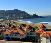
PACIFICA BEACH HOTEL
Courtyard San Francisco Airport
Holiday Inn Express & Suites PACIFICA
BEST WESTERN PLUS LIGHTHOUSE
Staybridge Suites SAN FRANCISCO AIRPORT
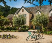
Seal Cove Inn
GATEWAY INN AND SUI
Travelers Inn
Pacifica Motor Inn
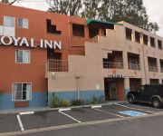
Royal Inn
Videos from this area
These are videos related to the place based on their proximity to this place.
Pacifica Fire Pacifica Ca Rockaway Area Grass Fire Monday Jan 26,2015
At 5;30 a.m. police and fire crews evacuated local residents in the City of Pacifica this morning due to a 6 alarm brush fire located in the Rockaway hills area of this coast side community.No...
2014 King Tide Slams Pacifica Boat Docks
On Dec 21st, 2014 a "King Tide" slams into the Pacifica docks. A "King Tide" is when the sun, moon, and earth are all lined up causing extra high tides. More Info on King Tides: http://en.wikiped...
The Boat Builder film set near Pacifica State Beach
Derek Stefan shows off his excellent acting ability in take 20 of a fairly boring scene. In my 30 minutes of observing this set over 3 hours, I can confirm that Hollywood movie-making looks...
2010 Randy and Ari Sea Kayak in Pacifica
A 30 second video of Randy and Ari sea kayaking in Pacifica near the docks. The kayak is a Pelican Apex 130T tandem. For more pictures and explanation visit http://www.ski-epic.com/2010_echt_wils.
2014 May 1 Time Lapse Linda Mar Beach Pacifica
A 90 second timelapse (covering 15 hours) beach video. This was taken on May 1st, 2014 on Linda Mar Beach in Pacifica, California.
Pacifica State Beach, Linda Mar, Pacifica, California, USA 01/20/2015
Pacifica State Beach at Linda Mar. Pacifica, California, USA 2015-01-20 00121.MTS.
2012 Tiny Surfer in Pacifica
This tiny little surfer impressed the heck out of me. This video doesn't really do justice, the tiny surfer caught many waves (with a little push from Dad). I only caught one on video. This...
Surf's Up At Rockaway Beach
Surf's Up At Rockaway Beach in Pacifica, California, a popular place for Bay Area surfers. Subscribe: http://www.youtube.com/subscription_center?add_user=GottaBme4me2bFree.
Videos provided by Youtube are under the copyright of their owners.
Attractions and noteworthy things
Distances are based on the centre of the city/town and sightseeing location. This list contains brief abstracts about monuments, holiday activities, national parcs, museums, organisations and more from the area as well as interesting facts about the region itself. Where available, you'll find the corresponding homepage. Otherwise the related wikipedia article.
Alma Heights Christian Schools
Alma Heights Christian Schools (AHC), formerly Alma Heights Christian Academy, is a private elementary, middle and high school in Pacifica, California.
Rockaway Beach, Pacifica, California
Rockaway Beach is a shoreline area of the Pacific Ocean in the southern portion of Pacifica, California, United States, approximately 7 miles miles south of the city of San Francisco. It is located within a gently curving embayment with direct access via Rockaway Beach Avenue and providing easy access to Highway 1. The beach itself is a popular place to visit with many restaurant and shopping venues although erosion has decreased its size over the years.
Terra Nova High School (California)
Terra Nova High School is an American public high school in Pacifica in San Mateo County, California serving grades 9 through 12 as part of the Jefferson Union High School District.
San Pedro y San Pablo Asistencia
The San Pedro y San Pablo Asistencia was established in 1786, as a "sub-mission" to Mission San Francisco de Asís in the San Pedro Valley at the Ohlone village of Pruristac. The site is located within the bounds of the Rancho San Pedro (home to the Sánchez Adobe) in what today is the town of Pacifica.
North Fork, San Pedro Creek
North Fork is the largest tributary of San Pedro Creek in Pacifica, San Mateo County, California in the San Francisco Bay Area. North fork enters San Pedro Creek from the northeast less than 0.5 mile downstream from the junction of South Fork and Middle Fork. {{#invoke:Coordinates|coord}}{{#coordinates:37.5796598|N|122.4733087|W|region:US-CA_type:river_source:gnis|||| |primary |name= }}
Rockaway Creek (California)
Rockaway Creek is a small creek, in the Rockaway Beach neighborhood of Pacifica, California. Located just south of Calera Creek.
Mori Point
Mori Point is a 110-acre park located in Pacifica, California that is part of the Golden Gate National Recreation Area. Mori Point itself is a bluff next to the Pacific Ocean that provides scenic views of the peninsula coastline. In addition to the bluff and ridge, Mori Point contains a few small ponds and wetlands. Trails, many newly built, connect the ridgeline to the entrances to the park and to Sharp Park beach.
Tom Lantos Tunnels
The Tom Lantos Tunnels are two tunnels located within the coastal promontory of Devil's Slide in California, United States, allowing State Route 1 to bypass the treacherous Devil's Slide stretch. They are named after late Congressman Tom Lantos, who was instrumental in securing funding for the project.


