Safety Score: 2,7 of 5.0 based on data from 9 authorites. Meaning we advice caution when travelling to United States.
Travel warnings are updated daily. Source: Travel Warning United States. Last Update: 2024-08-13 08:21:03
Delve into El Granada
El Granada in San Mateo County (California) with it's 5,467 habitants is located in United States about 2,443 mi (or 3,931 km) west of Washington DC, the country's capital town.
Current time in El Granada is now 04:19 AM (Monday). The local timezone is named America / Los Angeles with an UTC offset of -8 hours. We know of 8 airports close to El Granada, of which 4 are larger airports. The closest airport in United States is San Francisco International Airport in a distance of 10 mi (or 15 km), North-East. Besides the airports, there are other travel options available (check left side).
Also, if you like playing golf, there are some options within driving distance. We encountered 10 points of interest near this location. If you need a hotel, we compiled a list of available hotels close to the map centre further down the page.
While being here, you might want to pay a visit to some of the following locations: Redwood City, San Francisco, Oakland, San Rafael and San Jose. To further explore this place, just scroll down and browse the available info.
Local weather forecast
Todays Local Weather Conditions & Forecast: 12°C / 53 °F
| Morning Temperature | 10°C / 50 °F |
| Evening Temperature | 11°C / 51 °F |
| Night Temperature | 10°C / 50 °F |
| Chance of rainfall | 0% |
| Air Humidity | 62% |
| Air Pressure | 1023 hPa |
| Wind Speed | Fresh Breeze with 16 km/h (10 mph) from South-East |
| Cloud Conditions | Few clouds, covering 10% of sky |
| General Conditions | Sky is clear |
Monday, 18th of November 2024
12°C (54 °F)
11°C (51 °F)
Overcast clouds, gentle breeze.
Tuesday, 19th of November 2024
13°C (56 °F)
13°C (55 °F)
Overcast clouds, fresh breeze.
Wednesday, 20th of November 2024
14°C (57 °F)
13°C (55 °F)
Overcast clouds, fresh breeze.
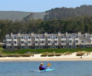
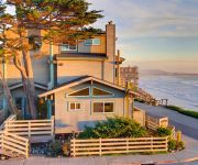
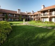
Hotels and Places to Stay
The Ritz-Carlton Half Moon Bay
Mill Rose Inn
BEACH HOUSE HOTEL HALF MOON BAY.
Cypress Inn On Miramar Beach
Seal Cove Inn
Nantucket Whale Inn
Half Moon Bay Lodge
Landis Shores Oceanfront Inn
HARBOR VIEW INN
Harbor View Inn
Videos from this area
These are videos related to the place based on their proximity to this place.
Unsafe Playground at Quarry Park in El Granada, CA
The San Mateo County Board of Supervisors plan to pave Quarry Park playground with 60 tons of asphalt. Shame on Supervisors Don Horsley, Carole Groom, Adrienne Tissier and Rose Jacobs Gibson ...
Quarry Park: El Granada, CA - San Mateo County
San Mateo County issued themselves a Coastal Development Permit Exemption one month after this video was published. The Coastal Development Permit Exemption checkbox for grading was ...
Pillar Point Harbor Area Shops & Restaurants
VisitHalfMoonBay.org presents Pillar Point Harbor at Princeton by the Sea near El Granada. We left off previously looking out at Maverics beyond the breakwater and back to the inner breakwater...
Videos provided by Youtube are under the copyright of their owners.
Attractions and noteworthy things
Distances are based on the centre of the city/town and sightseeing location. This list contains brief abstracts about monuments, holiday activities, national parcs, museums, organisations and more from the area as well as interesting facts about the region itself. Where available, you'll find the corresponding homepage. Otherwise the related wikipedia article.
El Granada, California
El Granada is a census-designated place (CDP) in the coastal area of northern San Mateo County, California, United States. The population was 5,467 at the 2010 census.
Miramar, Half Moon Bay, California
Miramar is a district located within the city limits of Half Moon Bay in San Mateo County, California. Miramar Beach is located at Miramar. {{#invoke:Coordinates|coord}}{{#coordinates:37|29|35|N|122|27|24|W|region:US-CA_type:landmark_source:gnis |primary |name= }}
Princeton-by-the-Sea, California
Princeton-by-the-Sea (sometimes, especially locally, called Princeton) is an unincorporated community on the coast of San Mateo County, California. The ZIP Code is 94019 and the community is inside area code 650.
Arroyo de en Medio
Arroyo de en Medio (Spanish for "in the middle creek") is a 2.5-mile-long coastal stream in western San Mateo County, California. Arroyo de en Medio rises on the western slopes of Montara Mountain and discharges to the Pacific Ocean at Half Moon Bay at the location of the unincorporated community of Miramar at Miramar Beach.
Denniston Creek
Denniston Creek is a 4.4-mile-long coastal stream in western San Mateo County, California. Denniston Creek rises on the western slopes of Montara Mountain and discharges to the Pacific Ocean at Pillar Point Harbor somewhat north of El Granada Beach. The watershed of Denniston Creek is made up of relatively permeable sandy soils capable of significant recharge to its aquifers, which supply a moderate amount of potable water to the local area.
Miramar Beach, California
Miramar Beach is a sandy beach in western San Mateo County, California. Miramar Beach is one of the numerous beaches on Half Moon Bay, a Pacific Ocean embayment noted for its surfing and extensive visitation.
Naples Creek
Naples Creek is a stream in San Mateo County, California, USA that rises on the western slopes of the Santa Cruz Mountains and discharges to the Pacific Ocean. The specific point of discharge is onto Naples Beach, a unit of the Half Moon Bay State Beach. This watercourse runs through the city of Half Moon Bay, which municipality has planning jurisdiction over the creekside area within its city boundaries.
Half Moon Bay (California)
Half Moon Bay is a bay of the Pacific Ocean on the coast of San Mateo County, California. The bay is approximately semi-circular, hence the name half moon, with sea access to the south. Coastal towns located there are Princeton-by-the-Sea, Miramar, El Granada, and the city of Half Moon Bay. The surfing location Mavericks is located on the outer edge of the peninsula which forms the bay. Miramar Beach is located along the shore of the bay opposite the peninsula.


