Safety Score: 2,7 of 5.0 based on data from 9 authorites. Meaning we advice caution when travelling to United States.
Travel warnings are updated daily. Source: Travel Warning United States. Last Update: 2024-08-13 08:21:03
Delve into Edgemar
Edgemar in San Mateo County (California) is located in United States about 2,441 mi (or 3,929 km) west of Washington DC, the country's capital town.
Current time in Edgemar is now 02:32 AM (Monday). The local timezone is named America / Los Angeles with an UTC offset of -8 hours. We know of 8 airports close to Edgemar, of which 4 are larger airports. The closest airport in United States is San Francisco International Airport in a distance of 7 mi (or 11 km), East. Besides the airports, there are other travel options available (check left side).
Also, if you like playing golf, there are some options within driving distance. We encountered 10 points of interest near this location. If you need a hotel, we compiled a list of available hotels close to the map centre further down the page.
While being here, you might want to pay a visit to some of the following locations: San Francisco, Oakland, Redwood City, San Rafael and Martinez. To further explore this place, just scroll down and browse the available info.
Local weather forecast
Todays Local Weather Conditions & Forecast: 12°C / 53 °F
| Morning Temperature | 10°C / 51 °F |
| Evening Temperature | 11°C / 52 °F |
| Night Temperature | 11°C / 51 °F |
| Chance of rainfall | 0% |
| Air Humidity | 58% |
| Air Pressure | 1023 hPa |
| Wind Speed | Fresh Breeze with 16 km/h (10 mph) from South-East |
| Cloud Conditions | Clear sky, covering 9% of sky |
| General Conditions | Sky is clear |
Monday, 18th of November 2024
12°C (53 °F)
12°C (54 °F)
Overcast clouds, moderate breeze.
Tuesday, 19th of November 2024
14°C (57 °F)
14°C (57 °F)
Light rain, strong breeze, overcast clouds.
Wednesday, 20th of November 2024
14°C (58 °F)
14°C (57 °F)
Light rain, fresh breeze, overcast clouds.
Hotels and Places to Stay
Courtyard San Francisco Airport
La Quinta Inn and Suites San Francisco Airport North
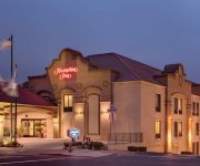
Hampton Inn San Francisco - Daly City CA
BEST WESTERN PLUS LIGHTHOUSE
Holiday Inn Express & Suites PACIFICA
PACIFICA BEACH HOTEL
Staybridge Suites SAN FRANCISCO AIRPORT
Four Points by Sheraton Hotel & Suites San Francisco Airport
THE ALPINE INN
Regency Inn SFO Airport
Videos from this area
These are videos related to the place based on their proximity to this place.
Kalua Pork @ Hawaiian King BBQ Serramonte Center Food Court Daly City California
Kalua pork and white rice with macaroni salad and vegetables mini plate lunch from Hawaiian King BBQ at the Serramonte Center Food Court in Daly City, California.
Striper from Pacifica Pier, CA (5-28-09)
Guy catches a nice striped bass off the Pacifica Pier. Live shiner perch or live smelt for bait.
Drone flight over Pacifica, CA on perfect, late winter day
The weather is always a gamble when it comes to Pacifica. It can be sunny and warm 10 miles away, but completely fogged in and cold in Pacifica. But on this Sunday in late February, I hit the...
Sea Lion attacking crab trap at Pacifica
Crabbing at the Pacifica Pier. GoPro caught the sea lion trying to get to the bait.
Itchy O Marching Band @ Winters Pacifica
32 piece electric marching band takes over the tavern in a wild performance.
Fish Fights at Rice N Roll in Pacifica CA
Tank Match Fish Fight! Place your bets at Rice N Roll restaurant! I bet five fish flakes on Goldie! "Everybody was fish-y fighting. Those carps were fast as lightning! In fact it was a...
Videos provided by Youtube are under the copyright of their owners.
Attractions and noteworthy things
Distances are based on the centre of the city/town and sightseeing location. This list contains brief abstracts about monuments, holiday activities, national parcs, museums, organisations and more from the area as well as interesting facts about the region itself. Where available, you'll find the corresponding homepage. Otherwise the related wikipedia article.
Cypress Lawn Memorial Park
Cypress Lawn Memorial Park, established by Hamden Holmes Noble in 1892, is a cemetery located in Colma, California, a place known as the "City of the Silent". It is the final resting site for several members of the celebrated Hearst family plus other prominent citizens from the greater San Francisco area. The cemetery was among those profiled in the 2005 PBS documentary A Cemetery Special.
Westmoor High School
Westmoor High School is an American public high school in Daly City, California that serves grades 9 through 12 as part of the Jefferson Union High School District (JUHSD). It generally serves the residents of Daly City, Pacifica, and Colma. Westmoor High School was recently selected as a California Distinguished School.
Milagra Ridge
Milagra Ridge is a 240 acre (.97 km²) parcel of land that is an isolated island ecosystem, located about 7 miles (11 km) south of San Francisco, near the city of Pacifica. It was first inhabited by the Ohlone indigenous people, and was later claimed by Spanish settlers and Mexican ranchers.
Mussel Rock
Mussel Rock is a rock formation on the coast of San Mateo County, California, offshore from Daly City. It consists of one large and numerous smaller rocks of a type known as a stack, where a headland is eroded unevenly, leaving small islands. It is best known for being the closest point to the epicenter of the 1906 San Francisco Earthquake, and where the San Andreas Fault enters the San Francisco Peninsula from the northwest.
Serramonte
Serramonte is a large 1960s residential neighborhood on the border of Daly City and Colma in the suburbs south of San Francisco, California, that is also home to numerous shopping malls, strip malls, and big box retailers. The nexus of Serramonte is Serramonte Center, originally opened in 1968, near the intersection of State Route 1 and Interstate 280, in the triangle formed by Callan Boulevard, Serramonte Boulevard, and Junipero Serra Boulevard which originally opened in 1968.
Serramonte Center
Serramonte Center is a 865,000 sq ft . super-regional shopping mall located in Daly City, California. The mall is anchored by Macy's, J. C. Penney, and Target Greatland. The world's largest New York & Company is located at this mall. The mall is owned by Capital & Counties and is managed by Jones Lang LaSalle.
Mori Point
Mori Point is a 110-acre park located in Pacifica, California that is part of the Golden Gate National Recreation Area. Mori Point itself is a bluff next to the Pacific Ocean that provides scenic views of the peninsula coastline. In addition to the bluff and ridge, Mori Point contains a few small ponds and wetlands. Trails, many newly built, connect the ridgeline to the entrances to the park and to Sharp Park beach.
Rancho San Pedro (Sanchez)
Rancho San Pedro was a 8,926-acre Mexican land grant in present day San Mateo County, California given in 1839 by Governor Juan Alvarado to Francisco Sanchez. The grant encompasses present day Pacifica.


