Safety Score: 2,7 of 5.0 based on data from 9 authorites. Meaning we advice caution when travelling to United States.
Travel warnings are updated daily. Source: Travel Warning United States. Last Update: 2024-08-13 08:21:03
Discover Westlake
The district Westlake of Daly City in San Mateo County (California) is a subburb in United States about 2,440 mi west of Washington DC, the country's capital city.
If you need a hotel, we compiled a list of available hotels close to the map centre further down the page.
While being here, you might want to pay a visit to some of the following locations: San Francisco, Oakland, San Rafael, Redwood City and Martinez. To further explore this place, just scroll down and browse the available info.
Local weather forecast
Todays Local Weather Conditions & Forecast: 12°C / 53 °F
| Morning Temperature | 10°C / 51 °F |
| Evening Temperature | 11°C / 52 °F |
| Night Temperature | 11°C / 51 °F |
| Chance of rainfall | 0% |
| Air Humidity | 58% |
| Air Pressure | 1023 hPa |
| Wind Speed | Fresh Breeze with 16 km/h (10 mph) from South-East |
| Cloud Conditions | Clear sky, covering 9% of sky |
| General Conditions | Sky is clear |
Tuesday, 19th of November 2024
12°C (53 °F)
12°C (54 °F)
Overcast clouds, moderate breeze.
Wednesday, 20th of November 2024
14°C (57 °F)
14°C (57 °F)
Light rain, strong breeze, overcast clouds.
Thursday, 21st of November 2024
14°C (58 °F)
14°C (57 °F)
Light rain, fresh breeze, overcast clouds.
Hotels and Places to Stay
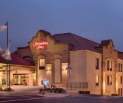
Hampton Inn San Francisco - Daly City CA
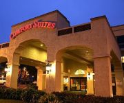
Comfort Inn & Suites San Francisco Airport North
THE ALPINE INN
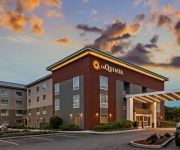
La Quinta Inn and Suites San Francisco Airport North
Staybridge Suites SAN FRANCISCO AIRPORT
Travelers Inn
El Capitan Hotel
DAYS INN SAN FRANCISCO SOUTH
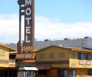
GEARY PARKWAY MOTEL
Beck's Motor Lodge
Videos from this area
These are videos related to the place based on their proximity to this place.
Daly City/San Francisco BLS Renewal Classes: Adult pocket CPR mask
http://safetytrainingseminars.com/schedule/bls-hcp-classroom/ BLS Renewal classes are offered in our American Heart Association training classroom located in San Francisco. this location is...
Daly City labor lawyer; Daly City employment attorney
http://californialaborlawattorney.org. Call me! I'll talk with you personally about your case. Jeff Holmes, Attorney At Law. (800) 379-0719. I'm one of the leading labor and employment...
Taco Bell Doritos Locos Tacos Nacho Cheese & Cool Ranch @ Daly City California
Nacho Cheese and Cool Ranch Doritos Locos Tacos at Taco Bell on Mission Street in Daly City, California.
Lion Dancers @ Banana Island Westlake Shopping Center Daly City California
Lion dancers at Banana Island restaurant at Westlake Shopping Center in Daly City, California.
Daly City Chiropractic - Short | Daly City, CA
Call us today at (650) 757-7777. At Daly City Chiropractic Center we specialize in dalycitychiropractic.com - Chiropractic, Physical Therapy, Reflexology, and Massage Therapy. In addition our...
Jollibee Chickenjoy Fried Chicken Corn Rice Gravy @ Daly City California
Jollibee Chickenjoy fried chicken with corn, rice, and gravy on Mission Street in Daly City, California.
Westlake Shopping Center, Daly City, CA in 2000
Westlake Shopping Center before it was renovated. Shot with DV camcorder. Used DVDate to extract timecode and Textsub filter in Virtualdub to display timecode and SimpleSlugUpscale to upscale...
BART Train Daly City California Bay Area Rapid Transit
Northbound BART Train approaches the Daly City BART Station in Daly City.
Videos provided by Youtube are under the copyright of their owners.
Attractions and noteworthy things
Distances are based on the centre of the city/town and sightseeing location. This list contains brief abstracts about monuments, holiday activities, national parcs, museums, organisations and more from the area as well as interesting facts about the region itself. Where available, you'll find the corresponding homepage. Otherwise the related wikipedia article.
Broadmoor, California
Broadmoor is a census-designated place (CDP) in an unincorporated area of San Mateo County, California, United States. The enclave is entirely surrounded by Daly City. The population was 4,176 at the 2010 census.
San Francisco State University
San Francisco State University (commonly referred to as San Francisco State, SF State and SFSU) is a public university located in San Francisco, California. As part of the 23-campus California State University system, the university offers 118 different Bachelor's degrees, 94 Master's degrees, 5 Doctoral degrees including two Doctor of Education, a Doctor of Physical Therapy, a Ph.
Congregation B’nai Israel (Daly City, California)
Congregation B'nai Israel is the only Karaite synagogue in the United States. It is located in Daly City, California.
Westmoor High School
Westmoor High School is an American public high school in Daly City, California that serves grades 9 through 12 as part of the Jefferson Union High School District (JUHSD). It generally serves the residents of Daly City, Pacifica, and Colma. Westmoor High School was recently selected as a California Distinguished School.
Daly City (BART station)
Daly City Station is a Bay Area Rapid Transit station located in extreme northern San Mateo County, California, in suburban Daly City, less than one block outside the San Francisco city and county limits. Interstate 280 and California Route 1 run along the immediate west side of the station.
Colma (BART station)
Colma Station is a Bay Area Rapid Transit station located in unincorporated Colma, California, in northern San Mateo County, adjacent to incorporated Colma and Daly City. Situated in a small valley immediately adjacent to a BART rail yard, the station consists of three main tracks with a shared island platform and one side platform. Currently, only the island platform and two of the main tracks are in service.
Olympic Club
The Olympic Club is an athletic club and private social club in San Francisco, California. Its main "City Clubhouse" is located in downtown San Francisco, and its three golf courses are in the southwestern corner of the city, at the border with Daly City. The "Lakeside Clubhouse" is located just north of the Daly City border; the two clubhouses are separated by about 10 miles . The three golf courses are named Lake, Ocean, and Cliffs.
Parkmerced, San Francisco
Parkmerced is the second-largest single-owner neighborhood of apartment blocks west of the Mississippi River after Park La Brea in Los Angeles. It was a planned neighborhood of high-rise apartment towers and low-rise garden apartments in southwestern San Francisco, California, for middle-income tenants.
Jefferson High School (Daly City, California)
For schools with a similar name, see Jefferson High School (disambiguation).
Krouzian-Zekarian-Vasbouragan Armenian School
Krouzian-Zakarian-Vasbouragan Armenian School is a bi-lingual Elementary school in San Francisco, California. The school is the only Armenian school in Northern California.
Westlake Shopping Center
Westlake Shopping Center is an outdoor shopping mall in Daly City, California, USA. It is anchored by Burlington Coat Factory, Home Depot, Ross, Safeway, T.J. Maxx, and Walgreens.
San Francisco State University Station
San Francisco State University Station is a major Muni Metro aboveground station located on the median of 19th Avenue at Holloway Avenue, near the station's namesake university. It is served by the M Ocean View line, which runs between Embarcadero Station and Balboa Park Station. Several Muni and SF State Shuttle bus lines also have stops near the station. The next station is Stonestown Galleria Station.
1998 U.S. Open (golf)
The 1998 United States Open Championship was the 98th U.S. Open, held June 18–21 at the Olympic Club in San Francisco, California. Lee Janzen won his second U.S. Open, one stroke ahead of runner-up Payne Stewart. Janzen became the second golfer at a U.S. Open at the Olympic Club's Lake Course to come back from seven strokes behind in the final round and win; Billy Casper also did it in 1966. Four-time champion Jack Nicklaus, age 58, made the 36-hole cut at the U.S. Open for the final time.
1987 U.S. Open (golf)
The 1987 U.S. Open was the 87th U.S. Open, held June 18–21 at the Olympic Club in San Francisco, California. Scott Simpson passed and held off former champion Tom Watson on the Lake Course to win his only major title by one stroke. Watson held a share of the lead after 36 holes, then took an one-shot lead over Simpson and Keith Clearwater into the final round. Clearwater, 27, shot a six-under 64 on Saturday to get into the final pair with Watson.
1966 U.S. Open (golf)
The 1966 U.S. Open was the 66th U.S. Open. The golf tournament was held June 16–20, 1966, at Olympic Club in San Francisco, California. Billy Casper staged one of the greatest comebacks in history by erasing a seven-stroke deficit on the final nine holes to tie Arnold Palmer, then prevailed in an 18-hole playoff for his second U.S. Open title.
1955 U.S. Open (golf)
The 1955 U.S. Open was the 55th U.S. Open. The golf tournament was held June 16–19, 1955, at Olympic Club in San Francisco, California. In arguably the greatest upset in golf history, Jack Fleck, a municipal-course pro from Iowa, denied Ben Hogan his record fifth U.S. Open title by prevailing in an 18-hole playoff.
Westlake, Daly City, California
The Westlake District of Daly City, California, is one of the first post-World War II suburbs in the United States. Located just south of San Francisco, Westlake has frequently been compared to Levittown, New York, the first major large-scale postwar middle-class housing development in the U.S. Developed by Henry Doelger, Westlake is notable for its monostylistic architecture, created by a core team of designers to encompass nearly every building in the development.
19th Avenue and Junipero Serra
19th Avenue and Junipero Serra is a station on the San Francisco Municipal Railway light rail network's M Ocean View line. It is located in the Merced Heights neighborhood.
Randolph and 19th Avenue
Randolph and 19th Avenue is a station on the San Francisco Municipal Railway light rail network's M Ocean View line. It is located in the Merced Heights neighborhood.
Randolph and Arch
Randolph and Arch is a station on the San Francisco Municipal Railway light rail network's M Ocean View line. It is located in the Merced Heights neighborhood.
Randolph and Bright
Randolph and Bright is a station on the San Francisco Municipal Railway light rail network's M Ocean View line. It is located in the Ingleside neighborhood.
Broad and Orizaba
Broad and Orizaba is a station on the San Francisco Municipal Railway light rail network's M Ocean View line. It is located in the Ingleside neighborhood.
Rancho Laguna de la Merced
Rancho Laguna de la Merced (also known as the Galindo ranch) was a 2,219-acre Mexican land grant, in present day San Francisco County and San Mateo County, California, given in 1835 by Governor José Castro to José Antonio Galindo. The grant encompassed the area around Lake Merced and the present day Daly City neighborhoods of Westlake, and Serramonte.
Broderick–Terry duel
The Broderick–Terry duel (subsequently called "the last notable American duel") was fought between United States Senator David C. Broderick, of California, and ex-Chief Justice David S. Terry, of the Supreme Court of California, on September 13, 1859. The two men had been friends and political allies within the Democratic Party. However, Broderick was an abolitionist, whereas Terry was pro-slavery.
2012 U.S. Open (golf)
The 2012 United States Open Championship was the 112th U.S. Open, played June 14–17 at the Olympic Club in San Francisco, California. Webb Simpson won his first major title, one stroke ahead of runners-up Graeme McDowell and Michael Thompson.


