Safety Score: 2,7 of 5.0 based on data from 9 authorites. Meaning we advice caution when travelling to United States.
Travel warnings are updated daily. Source: Travel Warning United States. Last Update: 2024-08-13 08:21:03
Delve into Bayshore
The district Bayshore of Daly City in San Mateo County (California) is a subburb in United States about 2,436 mi west of Washington DC, the country's capital town.
If you need a hotel, we compiled a list of available hotels close to the map centre further down the page.
While being here, you might want to pay a visit to some of the following locations: San Francisco, Oakland, Redwood City, San Rafael and Martinez. To further explore this place, just scroll down and browse the available info.
Local weather forecast
Todays Local Weather Conditions & Forecast: 12°C / 53 °F
| Morning Temperature | 10°C / 50 °F |
| Evening Temperature | 11°C / 51 °F |
| Night Temperature | 9°C / 49 °F |
| Chance of rainfall | 0% |
| Air Humidity | 52% |
| Air Pressure | 1022 hPa |
| Wind Speed | Fresh Breeze with 16 km/h (10 mph) from South-East |
| Cloud Conditions | Clear sky, covering 5% of sky |
| General Conditions | Sky is clear |
Tuesday, 19th of November 2024
11°C (53 °F)
11°C (52 °F)
Overcast clouds, gentle breeze.
Wednesday, 20th of November 2024
14°C (56 °F)
13°C (56 °F)
Overcast clouds, fresh breeze.
Thursday, 21st of November 2024
13°C (56 °F)
13°C (56 °F)
Overcast clouds, moderate breeze.
Hotels and Places to Stay
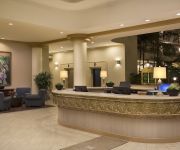
Embassy Suites by Hilton San Francisco Airport
DoubleTree by Hilton San Francisco Airport North
AC Hotel San Francisco Airport/Oyster Point Waterfront
Hotel Focus SFO
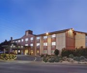
THE ALPINE INN
Homewood Suites by Hilton San Francisco Arpt North CA
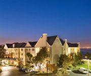
Residence Inn San Francisco Airport/Oyster Point Waterfront
Courtyard San Francisco Airport/Oyster Point Waterfront
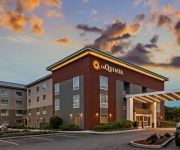
La Quinta Inn and Suites San Francisco Airport North
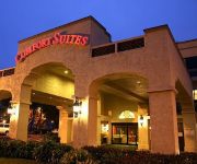
Comfort Inn & Suites San Francisco Airport North
Videos from this area
These are videos related to the place based on their proximity to this place.
BART Train to Daly City at Powell Street Station
BART train to Daly City at Powell Street Station. Video was taken on November 30th, 2013.
353 Humboldt Road Brisbane
Built in 2009! 4bed/3.5 bath. Views of San Francisco Bay, spacious rear yard, maple floors, granite counter tops, custom tile, 3 decks, 4 car parking, sound system, ipod dock, smart wire throughout...
285 San Bruno Ave Brisbane $559,000
Charming detached 2bedroom/1bath corner home. Renovated bath with glass tiles. New wall heater. Updated kitchen with newer appliances. Hardwood floors. Double paned windows. W/D in ...
Integrated Resources Group Brisbane, CA
Integrated Resources Group Brisbane, CA http://local.sfgate.com/b18915252/Integrated+Resources+Group?type= slate, wholesale stone, marble countertops, quartzite countertops, natural stone,marble...
Brisbane Drug Crime Defense Lawyers | Drug Offense Lawyers in Brisbane
Brisbane drug crime defense lawyers http://www.beleslaw.com/Oakland-Criminal-Lawyers/ at the Law Offices of Robert J. Beles have over 30 years of experience defending people accused of drug...
Bobbie Webb at The Seven Mile House, Brisbane
You'll find Bobbie Webb at The Seven Mile House every 2nd Thursday evening of the month.
Descent from San Bruno Mountain to Brisbane CA (MTB)
Relaxing Sunday afternoon down the hill ride (I do not want to call this downhill) after climbing to the top and running into another mountain biker from Brisbane. Sadly you are not allowed...
Videos provided by Youtube are under the copyright of their owners.
Attractions and noteworthy things
Distances are based on the centre of the city/town and sightseeing location. This list contains brief abstracts about monuments, holiday activities, national parcs, museums, organisations and more from the area as well as interesting facts about the region itself. Where available, you'll find the corresponding homepage. Otherwise the related wikipedia article.
Cow Palace
The Cow Palace (originally the California State Livestock Pavilion) is an indoor arena, in Daly City, California, situated on the city's border with neighboring San Francisco.
KQED-FM
KQED-FM is an NPR-member radio station owned by Northern California Public Broadcasting in San Francisco, California. Its parent organization is KQED, Inc.. KQED-FM was founded by James Day in 1969 as the radio arm of KQED Television. The founding manager was Bernard Mayes who later went on to be Executive Vice-President of KQED TV and also co-founder and chairman of NPR (National Public Radio).
Bernal Heights, San Francisco
Bernal Heights is a neighborhood in San Francisco, California.
McLaren Park
McLaren Park is a park in south-eastern San Francisco. McLaren Park is the second largest park in San Francisco after Golden Gate Park. The park is surrounded mostly by the Excelsior, Crocker-Amazon, Visitacion Valley, Portola and University Mound neighborhoods.
Excelsior District, San Francisco
The Excelsior District is a neighborhood in San Francisco, California.
KITS
KITS ("Live 105") is a San Francisco, California, USA-based radio station broadcasting at 105.3 MHz. The station is owned by CBS Radio and programs a modern rock format. The station also broadcasts on HD channel L2, locally on Comcast cable channel 986, and is streaming online.
KNTV
KNTV, channel 11, is an NBC owned-and-operated television station licensed to San Jose, California and serving the San Francisco Bay Area. Also known on-air by the branding NBC Bay Area, KNTV has its studios and main office in San Jose, which it shares with co-owned Telemundo station KSTS and CNBC's Silicon Valley bureau. The station's transmitter is located on San Bruno Mountain, just south of San Francisco. KNTV is one of five Bay Area market television stations that is licensed to San Jose.
KSAN (FM)
For the former KSAN see KYLD or KSOL KSAN Image:KSANFM.
KRZZ
KRZZ is a commercial radio station located in San Francisco, California, broadcasting to the San Francisco Bay Area on 93.3 FM. KRZZ airs a regional Mexican music format branded as "La Raza".
KKPX-TV
KKPX-TV, San Jose, California broadcasts on digital channel 41, serving the San Francisco Bay Area. It is an owned and operated affiliate of the Ion Television network.
KOSF
KOSF, known as "The Bay's 103.7 FM", is a classic hits radio station in San Francisco, California. The station is owned and operated by Clear Channel Communications.
KTSF
KTSF is an independent television station serving the San Francisco Bay Area. Although licensed to San Francisco, the station's studio building is located in south suburban Brisbane, California. It is owned by Lincoln Broadcasting Company, and broadcasts its digital signal on UHF channel 27 from a transmitter located on San Bruno Mountain. Through the use of PSIP, KTSF's virtual channel is displayed as 26 on digital television receivers.
School of the Epiphany
School of the Epiphany, colloquially called Epiphany or Epiphany School, is a Catholic school in San Francisco, California. The school opened in 1938 and is named for the Feast of the Epiphany.
Phillip & Sala Burton High School
Phillip and Sala Burton Academic High School is an American secondary school in San Francisco, California. The founding of the school is a result of a consent decree ruling in 1984 between the City of San Francisco and the National Association for the Advancement of Colored People. First established in the Silver Terrace neighborhood, the current campus is located in Visitacion Valley at 400 Mansell Avenue, on the former site of Woodrow Wilson High School. The school is named after former U.S.
Bayshore (Caltrain station)
Bayshore Station is a Caltrain commuter rail station located in the Visitacion Valley District of San Francisco, California. Like most other Caltrain stations, it is not staffed with ticket personnel. Tickets are available from Caltrain ticket machines.
Paul Avenue (Caltrain station)
Paul Avenue Station was a lightly used Caltrain station located in Bayview, San Francisco, California. Before its closure in 2005, the station was served by only two trains Monday through Friday (one morning northbound Local and one afternoon southbound Local), and had no service on weekends. The station was located between 22nd Street station and Bayshore station, it was two blocks west of Gilman/Paul Station on the T Third Street muni line.
KSFB
KSFB is an AM broadcasting station licensed on 1260 kHz at San Francisco, California. It broadcasts Immaculate Heart Radio, a Roman Catholic radio format, to the San Francisco Bay Area of the United States. It was previously known as KYA (AM) until 1983, and KOIT (AM) and KXLR after that.
Brisbane School District
Brisbane School District is a school district in California. It consists of Lipman Middle School, Brisbane Elementary School, and Panorama Elementary School.
Carroll Station
Carroll Station is a light rail station of the San Francisco Municipal Railway's Muni Metro system located in the median of Third Street at Carroll Avenue in the historic Bayview district of San Francisco, California.
Gilman/Paul Station
Gilman/Paul Station is a light rail station of the San Francisco Municipal Railway's Muni Metro system located in the median of Third Street at Gilman and Paul Avenues in Bayview, San Francisco, California.
Le Conte Station
Le Conte Station is an island platform light rail station of the San Francisco Municipal Railway's Muni Metro system located in the median of Third Street at Le Conte Avenue in Bayview, San Francisco, California, United States.
Arleta Station
Arleta Station is an island platform light rail station of the San Francisco Municipal Railway's Muni Metro system located in the median of Third Street at Arleta Avenue in Visitacion Valley, San Francisco, California.
Sunnydale Station
Sunnydale Station is an island platform light rail station of the San Francisco Municipal Railway's Muni Metro system located in the median of Bayshore Boulevard at Sunnydale Avenue in Visitacion Valley, San Francisco, California. This is the terminal for the T Third Street Muni Metro line.
Rancho Rincon de las Salinas y Potrero Viejo
Rancho Rincon de las Salinas y Potrero Viejo was a 4,446-acre Mexican land grant, largely in present day San Francisco County, California and extending to San Mateo County, California, given in 1839 by Governor Protem Manual Jimeno to José Cornelio Bernal. The grant consisted of two grants - Rincon de las Salinas ("corner of a salty marsh" - around Islais Creek) and Potrero Viejo ("old pasture" - part of Mission Dolores).
Church of the Epiphany in San Francisco
Church of the Epiphany is a Catholic Church under the Archdiocese of San Francisco. It is located in the Excelsior District near Crocker Amazon Park.


