Safety Score: 2,7 of 5.0 based on data from 9 authorites. Meaning we advice caution when travelling to United States.
Travel warnings are updated daily. Source: Travel Warning United States. Last Update: 2024-08-13 08:21:03
Discover Adobe Corner
Adobe Corner in San Mateo County (California) is a city in United States about 2,434 mi (or 3,917 km) west of Washington DC, the country's capital city.
Local time in Adobe Corner is now 03:49 AM (Monday). The local timezone is named America / Los Angeles with an UTC offset of -8 hours. We know of 8 airports in the vicinity of Adobe Corner, of which 4 are larger airports. The closest airport in United States is San Francisco International Airport in a distance of 15 mi (or 24 km), North-West. Besides the airports, there are other travel options available (check left side).
Also, if you like golfing, there are a few options in driving distance. We discovered 10 points of interest in the vicinity of this place. Looking for a place to stay? we compiled a list of available hotels close to the map centre further down the page.
When in this area, you might want to pay a visit to some of the following locations: Redwood City, Oakland, San Jose, San Francisco and Santa Cruz. To further explore this place, just scroll down and browse the available info.
Local weather forecast
Todays Local Weather Conditions & Forecast: 12°C / 53 °F
| Morning Temperature | 8°C / 47 °F |
| Evening Temperature | 9°C / 49 °F |
| Night Temperature | 7°C / 45 °F |
| Chance of rainfall | 0% |
| Air Humidity | 52% |
| Air Pressure | 1023 hPa |
| Wind Speed | Moderate breeze with 11 km/h (7 mph) from South-East |
| Cloud Conditions | Few clouds, covering 21% of sky |
| General Conditions | Few clouds |
Monday, 18th of November 2024
13°C (55 °F)
9°C (48 °F)
Overcast clouds, light breeze.
Tuesday, 19th of November 2024
13°C (56 °F)
12°C (53 °F)
Overcast clouds, moderate breeze.
Wednesday, 20th of November 2024
15°C (59 °F)
12°C (53 °F)
Overcast clouds, gentle breeze.
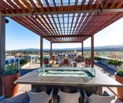
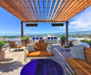
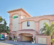
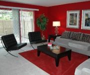
Hotels and Places to Stay
ABODA at Franklin 299 Apartments
Franklin 754 by RedAwning
OAKWOOD AT OAK CREEK
Oakwood at Oak Creek
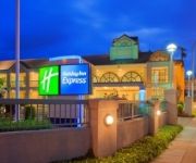
Holiday Inn Express REDWOOD CITY-CENTRAL
Oakwood Redwood City
OAKWOOD AT SHARON GREEN
DAYS INN REDWOOD CITY
ATHERTON PARK INN AND SUITES
Oakwood at Sharon Grove
Videos from this area
These are videos related to the place based on their proximity to this place.
Redwood City Real Estate Overview by Realtor and Resident Sally Lau
Brief description of neighborhoods west of the El Camino Real including pricing, schools, parks and downtown entertainment and offerings.
Searsville Dam removed with a blast at celebration!
On December 1st, 2011 the grass-roots coalition Beyond Searsville Dam held it's end of the year fundraising celebration "Give a Dam!" in Palo Alto, California. Over 250 people attended the...
30 Miles in 90 Seconds Bicycle Ride Woodside & Portola Valley California
30 miles in 90 seconds! A bicycle ride in Woodside and Portola Valley California December 26th 2014. The route includes Manzanita Way, Mountain Home Road, Cañada Road, (Upper Crystal Springs.
Woodside Country Estate
http://www.tourfactory.com/s863585/r_www.youtube.com ----- For more information, contact: Jim McCahon, (650)851-7226, Coldwell Banker Previews ----- Presiding on more than 4 acres off a private...
Jeanine Allred and Annabell helmet camera beginner novice Woodside Oct.2014
Annabell first event. She was very good. She hadn't had the opportunity to school x-country. She was very brave, a stop to look at the first fence, after that she got better and better.
Helmet cam Goldquest and Jeanine Allred Preliminary horse challenge woodside may 2014
Woodside Preliminary challenge horse division May 2014. Tigger learned a lot this weekend.
Fortune Most Powerful Women Mentee Julia Kibore, Kenya
Julia Kibore speaks on what women really need! Access to finances, access to markets, access to information and to overcome social/cultural barriers! Hear her story... Julia is being mentored...
Phantom Flight 2 - California Poppy Field
A short film of some fly overs with my new drone.. at the end I go high and then get attacked by a swarm of bees -- they start buzzing my quadcopter.
10 Years of the Woodside Day of the Horse
This piece is in celebration of 10 years of the Woodside Day of the Horse. Generations in the Woodside area have worked to preserve its heritage of horses, trails and rural landscape. WHOA!...
2008 WOODSIDE RODEO GIRLS BREAKAWAY ROPING
Girls breakaway roping at the 2008 Mounted Patrol 4th of July Junior (NorCal) Rodeo at Woodside California.
Videos provided by Youtube are under the copyright of their owners.
Attractions and noteworthy things
Distances are based on the centre of the city/town and sightseeing location. This list contains brief abstracts about monuments, holiday activities, national parcs, museums, organisations and more from the area as well as interesting facts about the region itself. Where available, you'll find the corresponding homepage. Otherwise the related wikipedia article.
Emerald Lake Hills, California
Emerald Lake Hills is a census-designated place and neighborhood in unincorporated San Mateo County, in the state of California, USA. Situated among oak-studded hills between Woodside, Redwood City, and San Carlos roughly bounded by Edgewood Road, Alameda de las Pulgas, Farm Hill Boulevard, and Interstate 280.
Woodside, California
Woodside is a small incorporated town in San Mateo County, California, United States, on the San Francisco Peninsula. It uses a council-manager system of government. The population of the town was 5,287 at the 2010 census. Woodside is among the wealthiest communities in the United States.
Larry Ellison
Lawrence Joseph "Larry" Ellison (born August 17, 1944) is an American business magnate, co-founder and chief executive of Oracle Corporation, one of the world's leading enterprise software companies. As of 2012, he was the third-wealthiest American with an estimated worth of $41 billion including his ownership of Oracle company stock.
Skeggs Point, California
Skeggs Point is a scenic turnout in San Mateo County along State Route 35 between Kings Mountain and State Route 84. The feature is marked with a guide sign along the road and is listed on the USGS 7.5 minute quadrangle, "Woodside, California" as well as in the National Geographic Names Database. The area is about three miles (five kilometers) west, and 2,000 feet (600 m) above the town of Woodside.
Jackling House
The Jackling House was a mansion in Woodside, California, designed and built for copper mining magnate Daniel Cowan Jackling and his family by the noted California architect George Washington Smith in 1925. Although considered a historic home, its final owner Steve Jobs demolished it in 2011, after a protracted court battle, in order to build a smaller home.
La Honda Creek
La Honda Creek is a small river in San Mateo County, California and is a tributary of San Gregorio Creek. It flows about 7 miles, from its source near Bear Gulch Road and Skyline Boulevard (CA 35), to its confluence with Alpine Creek to form San Gregorio Creek in La Honda. California State Route 84 (CA 84) follows the valley of the creek from Sky Londa to San Gregorio. A large part of the creek's upper watershed is in La Honda Creek Open Space Preserve.
Rancho Cañada de Raymundo
Rancho Cañada de Raymundo was a 12,545-acre Mexican land grant in present-day San Mateo County, California given August 4, 1840 to Raimundo (also known as Raymundo), a native of Baja California, who was sent out by the padres of Mission Santa Clara to capture runaway Mission Indians in 1797. On the 1856 Rancho de las Pulgas and 1868 Easton maps, the valley of Laguna Creek was referred to as the Cañada de Raymundo. Laguna Creek was also alternatively known as Cañada Raimundo Creek.
Bear Gulch Reservoir
Bear Gulch Reservoir is a reservoir in the town of Atherton, California. It is the main storage for the Bear Gulch District of the California Water Service, holds 215 million US gallons of water, and serves 55,501 people. It is not open to the public. Mountain lions are occasionally sighted in the area.


