Safety Score: 2,7 of 5.0 based on data from 9 authorites. Meaning we advice caution when travelling to United States.
Travel warnings are updated daily. Source: Travel Warning United States. Last Update: 2024-08-13 08:21:03
Discover McKay
McKay in San Luis Obispo County (California) is a town in United States about 2,387 mi (or 3,841 km) west of Washington DC, the country's capital city.
Current time in McKay is now 04:41 AM (Monday). The local timezone is named America / Los Angeles with an UTC offset of -8 hours. We know of 12 airports near McKay, of which 4 are larger airports. The closest airport in United States is New Coalinga Municipal Airport in a distance of 36 mi (or 57 km), North-East. Besides the airports, there are other travel options available (check left side).
Also, if you like playing golf, there are a few options in driving distance. We discovered 3 points of interest in the vicinity of this place. Looking for a place to stay? we compiled a list of available hotels close to the map centre further down the page.
When in this area, you might want to pay a visit to some of the following locations: San Luis Obispo, Hanford, Hollister, Salinas and Madera. To further explore this place, just scroll down and browse the available info.
Local weather forecast
Todays Local Weather Conditions & Forecast: 12°C / 54 °F
| Morning Temperature | 7°C / 45 °F |
| Evening Temperature | 11°C / 51 °F |
| Night Temperature | 5°C / 41 °F |
| Chance of rainfall | 0% |
| Air Humidity | 40% |
| Air Pressure | 1020 hPa |
| Wind Speed | Moderate breeze with 13 km/h (8 mph) from South-East |
| Cloud Conditions | Clear sky, covering 4% of sky |
| General Conditions | Sky is clear |
Monday, 18th of November 2024
11°C (52 °F)
9°C (47 °F)
Overcast clouds, light breeze.
Tuesday, 19th of November 2024
13°C (55 °F)
6°C (42 °F)
Overcast clouds, gentle breeze.
Wednesday, 20th of November 2024
15°C (59 °F)
7°C (45 °F)
Sky is clear, light breeze, clear sky.
Hotels and Places to Stay
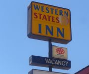
WESTERN STATES INN SAN MIGUEL
Videos from this area
These are videos related to the place based on their proximity to this place.
A UP ES44AC Leads A MWCRV Through San Miguel
Locomotives: 1) ES44AC #5435 2) SD70M #4786 3) ES44AC #5369 4) ES44AC #5446 This manifest was one of a few detours that went on the Coast Line due to UP replacing the Stockton Diamonds.
High-Altitude Balloon Launch
The Mission College Preparatory Catholic High School Physics Club launched a high altitude balloon on February 14th, 2015 from Lillian Larsen Elementary School in San Miguel, California. The...
UP 2438 light engine move north [HD]
On Sat 21 Feb 2015, the two San Kuis Obispo helper units (UP 2438, 2413) come north through San Miguel CA at 6:20 PM on their way to Wunpost to pick up a string of 13 empty oil cans.
Amtrak #11 and #14 of Tue 7 Aug 2007
Amtrak Coast Starlights: (1) Sb. #11 (a) through San Miguel CA at 3:26 PM; (b) grab shot into Paso Robles at 3:38; (c) leaves at 3:40; (d) grab shot through north Atascadero at 3:52; (2) Nb....
Amtrak #14 of Fri 5 Sep 2014 [HD]
After leaving Paso Robles, the nb. Coast Starlight comes into San Miguel CA at 6:25 PM/
John Chapter 1 - ASK ELIJAH - OMEGACUBE
http://ask-elijah.org - https://www.facebook.com/groups/askelijah/ - 1st Draft - Live Teaching - 4 to 5 parts ----- Book of John Chapter 1 Part-1-of-4... Teaching at Archangel San Miguel (Michael)...
Santa Margarita Turn of Thu 17 Jan 2008
I had to chase the northbound Turn out of Paso Robles CA; caught it coming into San Miguel at 4:21 PM.
UP 4174 quality manifest south
A QRVPX comes through San Miguel CA at 7:47 PM as the sun sets on Tue 17 Jul 2007.
UP 8351 loaded oil cans south (6 in 1) [XQ]
The OWPDO (UP 8351, 8311, 9905, 8336, 8335, 78 cans) On Fri 21 Sep 2012: (a. b) meeting Amtrak #14 at Bradley CA at 6:00 PM and continuing at 6:03; (c, d) through East Garrison at 6:13; (e)...
Videos provided by Youtube are under the copyright of their owners.
Attractions and noteworthy things
Distances are based on the centre of the city/town and sightseeing location. This list contains brief abstracts about monuments, holiday activities, national parcs, museums, organisations and more from the area as well as interesting facts about the region itself. Where available, you'll find the corresponding homepage. Otherwise the related wikipedia article.
Estrella River
The Estrella River is a 28.5-mile-long river in eastern San Luis Obispo County, California. The river forms at the confluence of Cholame Creek, from the north, and San Juan Creek, from the south, near the town of Shandon. From there it flows west-northwest to the Salinas River, of which it is a tributary. Cholame Creek has its headwaters on the southwest side of Middle Mountain and its tributary, Little Cholame Creek, begins on the northeast side.
Roberts Army Heliport
Roberts Army Heliport is a U.S. Army heliport at Camp Roberts in extreme southern Monterey County, California, United States. It is located just off U.S. Route 101, four nautical miles (7 km) northwest of the central business district of San Miguel, about halfway between it and the tiny community of Bradley in southern Monterey County. Roberts AHP has one helipad designated H1 with a 2,740 x 100 ft (835 x 30 m) asphalt surface.


!['UP 2438 light engine move north [HD]' preview picture of video 'UP 2438 light engine move north [HD]'](https://img.youtube.com/vi/LMEAGru7yQU/mqdefault.jpg)

!['Amtrak #14 of Fri 5 Sep 2014 [HD]' preview picture of video 'Amtrak #14 of Fri 5 Sep 2014 [HD]'](https://img.youtube.com/vi/IeNvpV6Hn_c/mqdefault.jpg)


!['UP 8351 loaded oil cans south (6 in 1) [XQ]' preview picture of video 'UP 8351 loaded oil cans south (6 in 1) [XQ]'](https://img.youtube.com/vi/-hWcdACKjio/mqdefault.jpg)