Safety Score: 2,7 of 5.0 based on data from 9 authorites. Meaning we advice caution when travelling to United States.
Travel warnings are updated daily. Source: Travel Warning United States. Last Update: 2024-08-13 08:21:03
Touring Westwood Highlands
The district Westwood Highlands of Sherwood Forest in San Francisco County (California) is a subburb located in United States about 2,438 mi west of Washington DC, the country's capital place.
Need some hints on where to stay? We compiled a list of available hotels close to the map centre further down the page.
Being here already, you might want to pay a visit to some of the following locations: San Francisco, Oakland, San Rafael, Redwood City and Martinez. To further explore this place, just scroll down and browse the available info.
Local weather forecast
Todays Local Weather Conditions & Forecast: 12°C / 53 °F
| Morning Temperature | 10°C / 50 °F |
| Evening Temperature | 11°C / 52 °F |
| Night Temperature | 10°C / 50 °F |
| Chance of rainfall | 0% |
| Air Humidity | 56% |
| Air Pressure | 1023 hPa |
| Wind Speed | Fresh Breeze with 16 km/h (10 mph) from South-East |
| Cloud Conditions | Clear sky, covering 8% of sky |
| General Conditions | Sky is clear |
Tuesday, 19th of November 2024
11°C (53 °F)
12°C (53 °F)
Overcast clouds, moderate breeze.
Wednesday, 20th of November 2024
13°C (56 °F)
14°C (56 °F)
Light rain, strong breeze, overcast clouds.
Thursday, 21st of November 2024
14°C (57 °F)
14°C (57 °F)
Light rain, fresh breeze, overcast clouds.
Hotels and Places to Stay
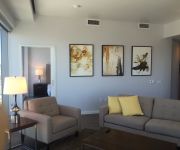
Aboda at 100 Van Ness
Hotel Kabuki
THE ALPINE INN
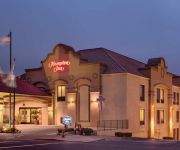
Hampton Inn San Francisco - Daly City CA
Laurel Inn
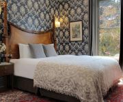
Monte Cristo Inn
EDWARDIAN SAN FRANCISCO HOTEL
Beach Motel
BRIDGEPOINT INN DALY CITY
MYLO HOTEL
Videos from this area
These are videos related to the place based on their proximity to this place.
DJI Phantom 2 at Daly City, CA
Flying my DJI this morning at BART Station in Daly City. After I updated RC Firmware it took me a while to make it functional. Finally it's back to work again since last night. So I just test...
Golden Gate Bridge
Фильм рассказывает о нескольких людях, разных возрастов, полов и разных судеб, которые решили покончить...
San Francisco Firefighters Funeral Procession @ south 280 PART1
SFFD ANTHONY & VINCENT FUNERAL PART1 San Francisco Firefighters Funeral Procession @ 280 south.
KCSF Promo (KCSF Radio @ BEMA in City College SF)
KCSF Promo -- Producer: Linda Dackman -- AP/Audio: Gilbert Francis -- Editor/Motion Graphics: Leland Yee -- Camera/Audio: Kevin Valencia Guest: Deez of da Maddhouze ...
KCSF teaser (KCSF Radio @ BEMA - City College SF)
KCSF teaser (17Sec) -- Producer: Linda Dackman -- AP/Audio: Gilbert Francis -- Editor/Motion Graphics: Leland Yee -- Camera/Audio: Kevin Valencia Guest: Deez of da Maddhouze ...
Flute Sonata in G minor, Op. 1 No. 2 HWV 360 IV. Presto - G. F. Handel
Forest Hill Concerts February 17, 2013.
Fantasy in F minor Op. Post. 103, D. 940 - Franz Schubert
Performers: Isabelle Jotterand & Colin Brady (piano 4 hands) Forest Hill Concerts August 18, 2013.
Flute Sonata in G minor, Op. 1 No. 2 HWV 360 II. Andante - G. F. Handel
Forest Hill Concerts February 17, 2013.
String Trio in Eb Major, K.563 II. Adagio - Wolfgang Amadeus Mozart
Forest Hill Concerts December 30, 2012.
Videos provided by Youtube are under the copyright of their owners.
Attractions and noteworthy things
Distances are based on the centre of the city/town and sightseeing location. This list contains brief abstracts about monuments, holiday activities, national parcs, museums, organisations and more from the area as well as interesting facts about the region itself. Where available, you'll find the corresponding homepage. Otherwise the related wikipedia article.
West Portal, San Francisco
West Portal is a small neighborhood in San Francisco, California. Similar to adjacent Forest Hill and St. Francis Wood, West Portal is an affluent, primarily residential area of the City. The neighborhood's main corridor, West Portal Avenue, serves as a principal shopping district of southwestern San Francisco.
West Portal Station
West Portal Station is a Muni Metro station in the West Portal neighborhood in San Francisco, California. It is built around the entrance to the Twin Peaks Tunnel, which connects with the Market Street Subway and runs through the city to the Embarcadero. The station consists of two side platforms with turnstiles at each end that connects to the street.
St. Francis Wood, San Francisco
St. Francis Wood is an affluent residential neighborhood located in southwestern San Francisco, California, south of the West Portal neighborhood and west of Mount Davidson. St. Francis Wood has a population of 1,354 and a median household income of $201,399. Characterized by family homes on spacious lots (by San Francisco standards), St.
Balboa Park, San Francisco
Balboa Park is a neighborhood and public park in San Francisco, California. It was created in 1909 and parts of it were built over time. The neighborhood is located between Mission Street and Interstate 280 north of Geneva Avenue and the park is located on San Jose Avenue, north of Ocean Avenue. Inside of the park there is a public swimming pool, a children's playground, a stadium, baseball diamonds, tennis courts and the Ingleside police station.
City College of San Francisco
City College of San Francisco, or CCSF, is a two-year community college in San Francisco, California. The Ocean Avenue campus, in the Ingleside neighborhood, is the college's primary location.
Lick-Wilmerding High School
Lick-Wilmerding High School is a college-preparatory high school located in San Francisco, California, United States.
Westwood Park, San Francisco
Westwood Park is an affluent residential neighborhood located in southwestern San Francisco, California, near St. Francis Wood and City College of San Francisco. Westwood Park was built as an upperclass neighborhood for downtown merchants. Most streets in this neighborhood have a suffix of "wood," such as Eastwood, Northwood, Rollingwood, and so forth. It is bordered by: Monterey Boulevard (to the north), Ocean Avenue (to the south), Faxon Avenue (to the west) and Phelan Avenue (to the east).
Archbishop Riordan High School
Archbishop Riordan High School is an Archdiocesan, all-boys Catholic high school established by the Society of Mary in San Francisco, California. It is located in the Roman Catholic Archdiocese of San Francisco. Originally called Riordan High School, the school was named after Archbishop Patrick William Riordan, the second Archbishop of San Francisco, and opened in the fall of 1949. In 1990, "Archbishop" was officially added to the school's name.
Westwood Highlands, San Francisco
Westwood Highlands is a small neighborhood located in south-central San Francisco, California, northeast of the intersection of Monterey Boulevard and Plymouth Avenue. It is bordered by Westwood Park to the south, Saint Francis Wood to the west, Sherwood Forest to the north, and Sunnyside to the east. Mt. Davidson, the highest point in San Francisco, lays just northeast. Westwood Highlands covers an area of 0.178 square miles, with a population of 1,782 as of 2009.
Boxer Stadium
Boxer Stadium (also known as Matthew J. Boxer Stadium) is a soccer stadium in San Francisco, California. It is owned and operated by the San Francisco Recreation and Parks Department and is the only soccer-specific public stadium in San Francisco. Located within the confines of Balboa Park, the stadium has a capacity of 3,500. Boxer Stadium is the primary home of the century-year old San Francisco Soccer Football League.
Rams Stadium
Rams Stadium is a multi-purpose football stadium in San Francisco, California. Located on the campus of City College of San Francisco the stadium has a capacity of 5,000.
HerChurch
Herchurch is another name used for the Ebenezer Lutheran Church in San Francisco. Ebenezer herchurch is part of the Evangelical Lutheran Church in America (ELCA), the Evangelical and Ecumenical Women's Caucus and the San Francisco Council of Lutheran Churches. Stacy Boorn, the minister for herchurch, uses feminist theology in the church's expression of faith, worship, learning, mutual care, and acts of justice. Megan Rohrer is the Associate Pastor and is openly gay.
West Portal and 14th Avenue
West Portal and 14th Avenue is a station on the San Francisco Municipal Railway light rail network's K Ingleside and M Ocean View lines. It is located in the West Portal neighborhood. It is the only street level stop in a string of stations that includes the Market Street Subway and several outdoor platforms just to its south.
St. Francis Circle
St. Francis Circle is a station on the San Francisco Municipal Railway light rail network's K Ingleside and M Ocean View lines. It is located in the St. Francis Wood neighborhood. Here, the two services split, although they will meet again at their Balboa Park Station termini.
Ocean and San Leandro
Ocean and San Leandro is a station on the San Francisco Municipal Railway light rail network's K Ingleside line. It is located in the Balboa Terrace neighborhood.
Ocean and Aptos
Junipero Serra and Ocean is a station on the San Francisco Municipal Railway light rail network's K Ingleside line. It is located in the Balboa Terrace neighborhood.
Ocean and Cerritos
Ocean and Cerritos is a station on the San Francisco Municipal Railway light rail network's K Ingleside line. It is located in the Mount Davidson neighborhood.
Ocean and Victoria
Ocean and Victoria is a station on the San Francisco Municipal Railway light rail network's K Ingleside line. It is located in the Mount Davidson neighborhood.
Ocean and Jules
Ocean and Jules is a station on the San Francisco Municipal Railway light rail network's K Ingleside line. It is located in the Westwood Park neighborhood.
Ocean and Miramar
Ocean and Miramar is a station on the San Francisco Municipal Railway light rail network's K Ingleside line. It is located in the Westwood Park neighborhood.
Ocean and Lee
Ocean and Lee is a station on the San Francisco Municipal Railway light rail network's K Ingleside line. It is located in the Westwood Park neighborhood.
Ocean and Phelan
Ocean and Phelan is a station on the San Francisco Municipal Railway light rail network's K Ingleside line. It is located on the campus of San Francisco City College and is connected to the pedestrian bridge that links the main portion of the school with satellite buildings.
Ulloa and Forest Side
Ulloa and Forest Side is a station on the San Francisco Municipal Railway light rail network's L Taraval line. It is located in the Parkside neighborhood.
Ingleside Terraces, San Francisco
Ingleside Terraces is an affluent neighborhood of approximately 750 homes built at the former location of the Ingleside Racetrack in the southwestern part of San Francisco. It is adjacent to the Ingleside neighborhood, and is bordered by Ocean Avenue to the north, Ashton Avenue to the east, Holloway Avenue to the south and Junipero Serra Boulevard to the west.
2012 Ingleside, San Francisco homicide
Five people were found dead at a home in San Francisco's Ingleside neighborhood, on the morning of Friday, March 23, 2012. Police initially believed the case to be a murder-suicide, but two days later arrested a man identified as 35-year-old San Francisco resident Binh Thai Luc, and charged him with five counts of murder. The deaths were initially thought to be caused by gunshot wounds, but police ruled that out and instead stated that the deaths were from blunt force.


