Safety Score: 2,7 of 5.0 based on data from 9 authorites. Meaning we advice caution when travelling to United States.
Travel warnings are updated daily. Source: Travel Warning United States. Last Update: 2024-08-13 08:21:03
Explore Portola
The district Portola of San Francisco in San Francisco County (California) is located in United States about 2,435 mi west of Washington DC, the country's capital.
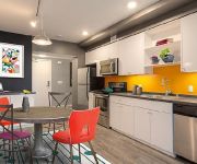
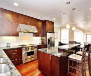
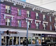
If you need a place to sleep, we compiled a list of available hotels close to the map centre further down the page.
Depending on your travel schedule, you might want to pay a visit to some of the following locations: Oakland, San Rafael, Redwood City, Martinez and Napa. To further explore this place, just scroll down and browse the available info.
Local weather forecast
Todays Local Weather Conditions & Forecast: 12°C / 54 °F
| Morning Temperature | 10°C / 51 °F |
| Evening Temperature | 11°C / 52 °F |
| Night Temperature | 10°C / 50 °F |
| Chance of rainfall | 0% |
| Air Humidity | 50% |
| Air Pressure | 1022 hPa |
| Wind Speed | Fresh Breeze with 14 km/h (9 mph) from South-East |
| Cloud Conditions | Clear sky, covering 6% of sky |
| General Conditions | Sky is clear |
Tuesday, 19th of November 2024
11°C (52 °F)
12°C (54 °F)
Overcast clouds, gentle breeze.
Wednesday, 20th of November 2024
14°C (57 °F)
14°C (57 °F)
Light rain, fresh breeze, overcast clouds.
Thursday, 21st of November 2024
14°C (56 °F)
14°C (57 °F)
Light rain, moderate breeze, overcast clouds.
Hotels and Places to Stay
OAKWOOD AT AVA 55 NINTH
SAN FRANCISCO
CITY CENTER INN AND SUITES
THE ALPINE INN
Sumner House SF
OAKWOOD AT EDGEWATER
Ram's Hotel
Inn on Folsom
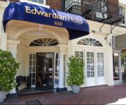
EDWARDIAN SAN FRANCISCO HOTEL
MYLO HOTEL
Videos from this area
These are videos related to the place based on their proximity to this place.
Bobbie Webb at The Seven Mile House, Brisbane
You'll find Bobbie Webb at The Seven Mile House every 2nd Thursday evening of the month.
Caltrain, China Basin area (2004)
View from front of CalTrain, northbound in the China Basin area of San Francisco. April 5, 2004, 5:11 pm. I made this video just for the heck of it, with a tiny non-HD camera, about a year...
VeloBrews Cafe & Cycling Community Center
VeloBrews Cafe is opening April, 2014 in the Bayview district of San Francisco.
myfarmsf.com + quesadagardens.org = Bridgeview Garden
myfarmsf.com joins with quesadagardens.org to create a brand new vegetable garden on NE slope of Bridgeview Hill in SF Bayview district. Effort was aided materially by Yahoo and also by City...
Inside a Home Re-Occupation #OccupySF 16 Mar 2012
On 16 March 2012, ACCE, Occupy SF and Occupy Bernal helped a man reoccupy his foreclosed home. As protesters dropped 2 banners from the roof, Dexter and his friends held a rally outside his...
San Francisco Apartment for Rent | 625 Guerrero St #6
Don't miss this large Mission District 1 bedroom apartment with amazing walk-in closet and big eat-in kitchen! Available now in this amazing location!!! Guerrero St between 18th & 19th. Walking...
Malia Cohen answers What's wrong with MUNI & how would I fix it as District 10's supervisor?
Malia Cohen answers "What's wrong with MUNI & how would I fix it as District 10's supervisor?"
THE GRIND - trailer (harsh language)
THE GRIND follows the parallel lives of Kilo and his estranged son Ricky, both navigating life in San Franciscos Bayview Hunters Point neighborhood. Kilo takes care of his infant son while...
San Francisco City College Soccer CCSF 2009
last season at sf city with a great team...these are just some of the goals i could get my hands on. Enjoy.
Videos provided by Youtube are under the copyright of their owners.
Attractions and noteworthy things
Distances are based on the centre of the city/town and sightseeing location. This list contains brief abstracts about monuments, holiday activities, national parcs, museums, organisations and more from the area as well as interesting facts about the region itself. Where available, you'll find the corresponding homepage. Otherwise the related wikipedia article.
Bayview-Hunters Point, San Francisco
Bayview-Hunters Point or The Bayview, is a neighborhood in the southeastern corner of San Francisco, California, United States. The decommissioned Hunters Point Naval Shipyard is located within its boundaries and Candlestick Park is on the southern edge. Originally dominated by grassland and tidal marshland, Bayview-Hunters Point has a unique history for its transformation into an urban industrial neighborhood while segregated from the metropolitan area.
McLaren Park
McLaren Park is a park in south-eastern San Francisco. McLaren Park is the second largest park in San Francisco after Golden Gate Park. The park is surrounded mostly by the Excelsior, Crocker-Amazon, Visitacion Valley, Portola and University Mound neighborhoods.
The Farm (San Francisco)
The Farm, located at the corner of Army Street (later renamed Cesar Chavez) and Potrero Avenue in San Francisco, California, was a community center from 1974-1987. Adults and children would gather at The Farm across a park from Buena Vista Elementary School. Children from Buena Vista would visit The Farm for field trips or go to The Farm after school. The Farm had a two-story building; the lower story contained an actual farm, with vegetable gardens, chickens, geese, rabbits, and goats.
Alemany Maze
Alemany Maze is the name given to the interchange between the James Lick Freeway and the John F. Foran Freeway in the city of San Francisco. An alternative name for this highway feature is the Alemany Interchange.
Phillip & Sala Burton High School
Phillip and Sala Burton Academic High School is an American secondary school in San Francisco, California. The founding of the school is a result of a consent decree ruling in 1984 between the City of San Francisco and the National Association for the Advancement of Colored People. First established in the Silver Terrace neighborhood, the current campus is located in Visitacion Valley at 400 Mansell Avenue, on the former site of Woodrow Wilson High School. The school is named after former U.S.
Paul Avenue (Caltrain station)
Paul Avenue Station was a lightly used Caltrain station located in Bayview, San Francisco, California. Before its closure in 2005, the station was served by only two trains Monday through Friday (one morning northbound Local and one afternoon southbound Local), and had no service on weekends. The station was located between 22nd Street station and Bayshore station, it was two blocks west of Gilman/Paul Station on the T Third Street muni line.
KSFB
KSFB is an AM broadcasting station licensed on 1260 kHz at San Francisco, California. It broadcasts Immaculate Heart Radio, a Roman Catholic radio format, to the San Francisco Bay Area of the United States. It was previously known as KYA (AM) until 1983, and KOIT (AM) and KXLR after that.
Garfield Square
Garfield Square, also known as Garfield Park, is a 3.46-acre city park located in the Mission District of San Francisco, California. It is bounded by 25th Street to the north, 26th Street to the south, Treat Avenue to the west, and Harrison Street to the east and was first opened in 1884. Previously the location of the Recreation Grounds baseball park which was the first professional baseball park in California, dating to 1868.
Recreation Park (San Francisco)
Recreation Park was the name applied to several former baseball parks in San Francisco, California in the late 19th Century and early 20th Century. Recreation Grounds, opening on November 26, 1868 and operated until May 1884, and was San Francisco's first professional enclosed ballpark. Located at the terminus of a railcar line in San Francisco's heavily Irish Mission District, at the present day Garfield Square.
Oakdale/Palou Station
Oakdale/Palou Station is an island platform light rail station of the San Francisco Municipal Railway's Muni Metro system located in the median of Third Street at Palou Avenue in Bayview, San Francisco, California.
Revere/Shafter Station
Revere/Shafter Station is an island platform light rail station of the San Francisco Municipal Railway's Muni Metro system located in the median of Third Street at Shafter Avenue in Bayview, San Francisco, California.
Williams Station
Williams Station is a light rail station of the San Francisco Municipal Railway's Muni Metro system located in the median of Third Street at Williams and Van Dyke Avenues in Bayview, San Francisco, California.
Carroll Station
Carroll Station is a light rail station of the San Francisco Municipal Railway's Muni Metro system located in the median of Third Street at Carroll Avenue in the historic Bayview district of San Francisco, California.
Gilman/Paul Station
Gilman/Paul Station is a light rail station of the San Francisco Municipal Railway's Muni Metro system located in the median of Third Street at Gilman and Paul Avenues in Bayview, San Francisco, California.
Le Conte Station
Le Conte Station is an island platform light rail station of the San Francisco Municipal Railway's Muni Metro system located in the median of Third Street at Le Conte Avenue in Bayview, San Francisco, California, United States.
Arleta Station
Arleta Station is an island platform light rail station of the San Francisco Municipal Railway's Muni Metro system located in the median of Third Street at Arleta Avenue in Visitacion Valley, San Francisco, California.
Sunnydale Station
Sunnydale Station is an island platform light rail station of the San Francisco Municipal Railway's Muni Metro system located in the median of Bayshore Boulevard at Sunnydale Avenue in Visitacion Valley, San Francisco, California. This is the terminal for the T Third Street Muni Metro line.
Bernal Heights Summit
Bernal Heights Summit or Bernal Heights Hill is a hill in San Francisco, California the neighborhood of Bernal Heights. Upper elevations are part of Bernal Hill Park, a component of San Francisco Recreation and Parks; a property at the highest elevation is privately owned and houses an equipment building and telecommunications tower, known among the local community as "Sutrito Tower. " The park and summit are largely surrounded by Bernal Heights Boulevard.
List of baseball parks in San Francisco
Early history of baseball in San Francisco, California.
Church and 27th Street
Church and 27th Street is a station on the San Francisco Municipal Railway light rail network's J Church line. It is located in the Mission District neighborhood.
Church and 29th Street
Church and 29th Street is a station on the San Francisco Municipal Railway light rail network's J Church line. It is located in the Mission District neighborhood.
Church and 30th Street
Church and 30th Street is a station on the San Francisco Municipal Railway light rail network's J Church line in the city of San Francisco, California. It is located in the Upper Noe Valley neighborhood.
30th Street and Dolores
30th Street and Dolores is a station on the San Francisco Municipal Railway light rail network's J Church line. It is located in the Bernal Heights neighborhood.
San Jose and Randall
San Jose and Randall is a station on the San Francisco Municipal Railway light rail network's J Church line. It is located in the Bernal Heights neighborhood.
Rancho Rincon de las Salinas y Potrero Viejo
Rancho Rincon de las Salinas y Potrero Viejo was a 4,446-acre Mexican land grant, largely in present day San Francisco County, California and extending to San Mateo County, California, given in 1839 by Governor Protem Manual Jimeno to José Cornelio Bernal. The grant consisted of two grants - Rincon de las Salinas ("corner of a salty marsh" - around Islais Creek) and Potrero Viejo ("old pasture" - part of Mission Dolores).


