Safety Score: 2,7 of 5.0 based on data from 9 authorites. Meaning we advice caution when travelling to United States.
Travel warnings are updated daily. Source: Travel Warning United States. Last Update: 2024-08-13 08:21:03
Delve into Park View Commons
The district Park View Commons of San Francisco in San Francisco County (California) is a subburb in United States about 2,437 mi west of Washington DC, the country's capital town.
If you need a hotel, we compiled a list of available hotels close to the map centre further down the page.
While being here, you might want to pay a visit to some of the following locations: Oakland, San Rafael, Redwood City, Martinez and Napa. To further explore this place, just scroll down and browse the available info.
Local weather forecast
Todays Local Weather Conditions & Forecast: 12°C / 54 °F
| Morning Temperature | 10°C / 51 °F |
| Evening Temperature | 11°C / 52 °F |
| Night Temperature | 10°C / 50 °F |
| Chance of rainfall | 0% |
| Air Humidity | 50% |
| Air Pressure | 1022 hPa |
| Wind Speed | Fresh Breeze with 14 km/h (9 mph) from South-East |
| Cloud Conditions | Clear sky, covering 6% of sky |
| General Conditions | Sky is clear |
Tuesday, 19th of November 2024
11°C (52 °F)
12°C (54 °F)
Overcast clouds, gentle breeze.
Wednesday, 20th of November 2024
14°C (57 °F)
14°C (57 °F)
Light rain, fresh breeze, overcast clouds.
Thursday, 21st of November 2024
14°C (56 °F)
14°C (57 °F)
Light rain, moderate breeze, overcast clouds.
Hotels and Places to Stay
Hotel Kabuki - a Joie de Vivre Boutique Hotel
Hotel Drisco
Hotel Kabuki
Monte Cristo Inn
Laurel Inn
QUEEN ANNE HOTEL
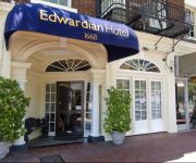
EDWARDIAN SAN FRANCISCO HOTEL
Beck's Motor Lodge
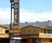
GEARY PARKWAY MOTEL
Casa Loma Hotel
Videos from this area
These are videos related to the place based on their proximity to this place.
STOCK SHOT CLIP NAT SOUND 1206 haight and ashbury clayton st
STOCK SHOT CLIP NAT SOUND 1206 walking down haight and ashbury clayton st area it is located in San Francisco feb 2010.
Haight & Ashbury
An attempt to make something coherent from three shots of Hi8 video footage, taken in the Haight-Ashbury District one day. It turned out to have some similarity to 1960's-era documentaries,...
Sophie and Savannah 8
Yorkie sisters Sophie and Savannah have a good time playing in their 8th video.
Shakedown Street by Hippie Hill April 20, 2011
A walk back in time as I approach Hippie Hill on April 20, 2011. For full coverage of the event, check out http://www.adventuresofagoodman.com/hanging-with-the-hippies-in-haight-ashbury/
52 Clarendon Ave - Stunning views from Clarendon Heights
52 Clarendon Avenue Clarendon Heights, San Francisco www.ClarendonGem.com Offered at $2499000 Bedrooms: 4 Bathrooms: 5 (3 full baths + 2 half baths) Parking: 2 SQFT: 3730 (per tax records)...
SAN FRANCISCO PARK COPS HIT BLACK ROCK WITH CAR
Golden Gate Park Police bottom out on a boulder and the hippie kids they were trying to intimidate let loose with the jokes non-stop for 8 minutes.
2014 SFUSD All-City Finals - 85 Girls 4x100m Relay
Rooftop School wins the 2014 San Francisco Unified School District Middle School All-City Finals in the Girls 85 4x100 Relay.
2014 SFUSD All-City Trials - 85 Girls 4x100m Relay
Qualifying heat for the 2014 San Francisco Unified School District All-City Middle School Track and Field Championships. Great job Abby, C. J. and M. and your top qualifying time!
Videos provided by Youtube are under the copyright of their owners.
Attractions and noteworthy things
Distances are based on the centre of the city/town and sightseeing location. This list contains brief abstracts about monuments, holiday activities, national parcs, museums, organisations and more from the area as well as interesting facts about the region itself. Where available, you'll find the corresponding homepage. Otherwise the related wikipedia article.
University of California, San Francisco
The University of California, San Francisco (UCSF) is a center of health sciences research, patient care, and education; located in San Francisco, California. Though one of the ten campuses of the University of California, it is unique for being the only University of California campus dedicated solely to graduate education, and in health and biomedical sciences.
Haight-Ashbury
Haight-Ashbury is a district of San Francisco, California, named for the intersection of Haight and Ashbury streets. It is also called The Haight and The Upper Haight.
Kezar Stadium
Kezar Stadium is a stadium located adjacent to Kezar Pavilion in the southeastern corner of Golden Gate Park in San Francisco, California. It is the former home of the San Francisco 49ers and the Oakland Raiders (their first season) of the NFL, and of the San Francisco Dragons of MLL. It also served as the home of the California Victory of the USL First Division before the club folded.
Panhandle (San Francisco)
The Panhandle is a park in San Francisco, California that forms a panhandle with Golden Gate Park. It is long and narrow, being three-quarters of a mile long and one block wide. Fell Street borders it to the north, Oak Street to the south, and Baker Street to the east. Only two streets run through it, Stanyan Street at the western end between it and Golden Gate Park, and Masonic Avenue through the middle.
Haight Street
Haight Street, in San Francisco, is perhaps best known as the principal street in San Francisco's Haight-Ashbury district, also known as Upper Haight. It stretches from Market Street to Stanyan Street, at Golden Gate Park. It is named after California pioneer and exchange banker Henry Haight (1820–1869).
The Red Victorian
The Red Victorian is a historic hotel located in San Francisco's Haight-Ashbury district, two blocks from Golden Gate Park and well served by public transit. The hotel was constructed in 1904 as the Jefferson Hotel. In 1967, during the Summer of Love, it was called the Jeffrey-Haight. In 1977, Dr. Sami Sunchild, environmental artist and social activist, acquired the building, painted the Victorian facade red plus nine other trim colors, and named it the "Red Victorian".
UCSF Medical Center
The University of California, San Francisco Medical Center is a world renowned hospital in research and a teaching hospital in San Francisco, California. It is one of the leading hospitals in the United States and with the UCSF School of Medicine has been the site of various breakthroughs in all specialities of medicine. Patients with complex diseases from around the world seek treatment at UCSF Medical Center.
Alvord Lake Bridge
The Alvord Lake Bridge was the first reinforced concrete bridge built in America. It was built in 1889 by Ernest L. Ransome, an innovator in reinforced concrete design, mixing equipment, and construction systems. The bridge was constructed as a single arch 64 feet wide with a 20-foot span . Ransome is believed to have used his patented cold-twisted square steel bar for reinforcement, placed longitudinally in the arch and curved in the same arc.
Clown Conservatory
The Clown Conservatory is a private performing arts school in San Francisco, CA. It is the only year-long professional circus and theatrical clown training program in America. Beginning in 2000 with a grant from the National Endowment for the Arts, to date 101 students have graduated from the program.
Kezar Pavilion
Kezar Pavilion, located adjacent to Kezar Stadium, is an indoor arena in the southeast corner of Golden Gate Park, San Francisco, California. The Pavilion, built in 1924, seats 4,000. Currently, The San Francisco Rumble of the American Basketball Association and the Academy of Art University Urban Knights of NCAA Division II call the venue home.
I-Beam (nightclub)
The I-Beam was a popular nightclub in San Francisco that was located in the Haight-Ashbury neighborhood at 1748 Haight Street. Before opening the club, Sanford Kellman had an impromptu party there and found that all the neighbors complained about the noise. Therefore, Sanford Kellman was required by the City government of San Francisco to soundproof the entire building at great expense, delaying the opening of the club for several months.
Haight Street Grounds
Haight Street Grounds was one of San Francisco's earliest baseball parks. It was built for use by the California League and was located on the east side of Golden Gate Park, bounded by Stanyan, Waller, Shrader, and Frederick streets. The opening game on April 3, 1887 between the Haverlys and the Pioneers was attended by 10,000 fans. In 1893, the California League folded, and, in 1895, plans were announced to use the ballpark land for residential development.
St. Mary's Medical Center (San Francisco)
St. Mary's Medical Center (SMMC) is a hospital in San Francisco, California, USA. It is currently operated by Dignity Health.
Circus Center
Circus Center is one of the foremost circus schools in the western United States. It was founded in 1984 by Wendy Parkman and Judy Finelli as the San Francisco School of Circus Arts.
Booksmith
Founded in October 1976, The Booksmith is an independent bookstore located in the Haight Ashbury neighborhood of San Francisco. When first opened, the store was located at 1746 Haight Street, below the former I-Beam nightclub. In 1985, the store moved to its current location at 1644 Haight Street at Belvedere, about a block and a half from the intersection of Haight and Ashbury.
San Francisco Police Department Park Station bombing
The San Francisco Police Department Park Station bombing occurred on February 16, 1970, when a pipe bomb filled with shrapnel detonated on the ledge of a window at the San Francisco Police Department's Golden Gate Park station. Brian V. McDonnell, a police sergeant, was fatally wounded in its blast. Robert Fogarty, another police officer, was severely wounded in his face and legs and was partially blinded. In addition, eight other police officers were wounded.
Langley Porter Psychiatric Institute
The Langley Porter Psychiatric Institute is a psychiatric teaching hospital, part of the Psychiatry Department at UCSF, one of the most highly regarded medical universities in the United States. Langley Porter is the oldest facility in the Psychiatry Department, and was the first psychiatric institute in California. The foundation stone of the hospital was laid in 1941. The hospital opened in 1942 with 100 beds and was completed in 1943.
Mount Olympus (San Francisco)
Mount Olympus is a 570 foot hill, located on Upper Terrace in the Ashbury Heights neighborhood of San Francisco. It was once considered to mark the geographical center of the city, and was topped off by a statue given by Adolph Sutro. Currently only the statue's pedestal remains, and the view from the top is obstructed by trees and condominiums.
University of California, San Francisco School of Dentistry
University of California, San Francisco School of Dentistry is a school of dentistry located in the United States city of San Francisco. The school is one of six dental schools in the state of California.
Carl and Cole
Carl and Cole is a station on the San Francisco Municipal Railway light rail network's N Judah line. It is located in the Haight-Ashbury neighborhood. It is the first stop west of the Sunset Tunnel under Buena Vista Park.
Carl and Stanyan
Carl and Stanyan is a station on the San Francisco Municipal Railway light rail network's N Judah line. It is located in the Haight-Ashbury neighborhood.
Carl and Willard
Carl and Willard is a station on the San Francisco Municipal Railway light rail network's N Judah line. It is located in the Haight-Ashbury neighborhood. The stop is directly behind Kezar Stadium.
Carl and Hillway
Carl and Hillway is a station on the San Francisco Municipal Railway light rail network's N Judah line. It is located in the Sunset District neighborhood.
Irving and 2nd Avenue
Irving and 2nd Avenue is a station on the San Francisco Municipal Railway light rail network's N Judah line. It is located in the Sunset District neighborhood. This is the primary stop for the University of California, San Francisco's Parnassus campus.
Irving and 4th Avenue
Irving and 4th Avenue is a station on the San Francisco Municipal Railway light rail network's N Judah line. It is located in the Sunset District neighborhood.


