Safety Score: 2,7 of 5.0 based on data from 9 authorites. Meaning we advice caution when travelling to United States.
Travel warnings are updated daily. Source: Travel Warning United States. Last Update: 2024-08-13 08:21:03
Discover Outer Sunset
The district Outer Sunset of San Francisco in San Francisco County (California) is a district in United States about 2,440 mi west of Washington DC, the country's capital city.
Looking for a place to stay? we compiled a list of available hotels close to the map centre further down the page.
When in this area, you might want to pay a visit to some of the following locations: San Rafael, Oakland, Redwood City, Martinez and Napa. To further explore this place, just scroll down and browse the available info.
Local weather forecast
Todays Local Weather Conditions & Forecast: 12°C / 53 °F
| Morning Temperature | 10°C / 50 °F |
| Evening Temperature | 11°C / 52 °F |
| Night Temperature | 10°C / 50 °F |
| Chance of rainfall | 0% |
| Air Humidity | 56% |
| Air Pressure | 1023 hPa |
| Wind Speed | Fresh Breeze with 16 km/h (10 mph) from South-East |
| Cloud Conditions | Clear sky, covering 8% of sky |
| General Conditions | Sky is clear |
Tuesday, 19th of November 2024
11°C (53 °F)
12°C (53 °F)
Overcast clouds, moderate breeze.
Wednesday, 20th of November 2024
13°C (56 °F)
14°C (56 °F)
Light rain, strong breeze, overcast clouds.
Thursday, 21st of November 2024
14°C (57 °F)
14°C (57 °F)
Light rain, fresh breeze, overcast clouds.
Hotels and Places to Stay
Hotel Drisco
Monte Cristo Inn
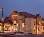
Hampton Inn San Francisco - Daly City CA
Laurel Inn
Beach Motel
Surf Motel
AMERICAS BEST VALUE INN
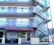
PRESIDIO INN
Marina Motel
Casa Loma Hotel
Videos from this area
These are videos related to the place based on their proximity to this place.
PA 2012 X C Champs Women
Pacific Assoc. USATF 2012 Women's X-C Champioship at Golden Gate Park 11/18/2012.
San Francisco, California - Drive through Golden Gate Park HD (2014)
Golden Gate Park, located in San Francisco, California, United States, is a large urban park consisting of 1017 acres (412 ha) of public grounds. Configured as a rectangle, it is similar in...
Discgolf USA Golden Gate Park
Discgolf 2014-06-09 at Golden Gate Park in San Francisco, California. Two brothers from Sweden making the journey of their dreams in USA. Template from AquuL. Free Intro Template from AquuL...
Golden Gate Park - San Francisco (1942)
Old colour film of San Francisco's Golden Gate Park. Specifically the 'Conservatory of flowers'. Includes scenes of San Francisco Zoo. Most likely taken by a WW2 cameraman on leave or waiting...
Brush fire in Golden Gate Park
I came across the beginning of a fire on my ride through Golden Gate Park this morning. I called 911 and reported it, then took this video.
Flyfishing Pools Golden Gate Park San Francisco California
Flyfishing pools in Golden Gate Park in San Francisco.
Kaiser Permanente San Francisco Half Marathon & 5K 2014 Golden Gate Park California
2014 Kaiser Permanente San Francisco Half Marathon and 5K run through Golden Gate Park in San Francisco.
Polar Bear Big Bears In San Francisco Zoo Wild Endangered Animal Videos Bay Area California Jazevox
Video of big Polar Bear (considered as largest bear / bears out there) in San Francisco Zoo. Polar Bear natural habitat is in the cold north pole but due the earth warm climate as the global...
San Francisco, California - Ocean Beach HD (2014)
Ocean Beach is a beach that runs along the west coast of San Francisco, California, United States, at the Pacific Ocean. It is adjacent to Golden Gate Park, the Richmond District, and the Sunset...
Videos provided by Youtube are under the copyright of their owners.
Attractions and noteworthy things
Distances are based on the centre of the city/town and sightseeing location. This list contains brief abstracts about monuments, holiday activities, national parcs, museums, organisations and more from the area as well as interesting facts about the region itself. Where available, you'll find the corresponding homepage. Otherwise the related wikipedia article.
Sunset District, San Francisco
The Sunset District is a large neighborhood in the west-central part of San Francisco, California, United States.
Ocean Beach, San Francisco
Ocean Beach is a beach that runs along the west coast of San Francisco, California, United States, at the Pacific Ocean. It is adjacent to Golden Gate Park, the Richmond District, and the Sunset District. The Great Highway runs alongside the beach, and the Cliff House and the site of the former Sutro Baths sit at the northern end. The beach is a part of the Golden Gate National Recreation Area, which is administered by the National Park Service.
San Francisco Zoo
The San Francisco Zoo is a 100-acre zoo located in the southwestern corner of San Francisco, California, between Lake Merced and the Pacific Ocean along the Great Highway. The zoo's main entrance, once located on the north side across Sloat Boulevard and one block south of the Muni Metro L Taraval line, is now to the west on the ocean side of the zoo off of the Great Highway.
Fleishhacker Pool
Fleishhacker Pool was a public saltwater swimming pool located in the southwest corner of San Francisco, California next to the zoo at Sloat Boulevard and the Great Highway. Upon its completion in 1925, it was one of the largest heated outdoor swimming pools in the world and remained open for more than four decades until its closure in 1971. It was eventually demolished in 2000.
Carville, San Francisco
Carville, also known Carville-by-the-Sea, was an impromptu neighborhood in what is now the Outer Sunset District of San Francisco, California. It was notable for its reuse of abandoned horsecars (horse-drawn trolleys) and, later, cable cars as or serving as parts of cottage, houses and public buildings.
Taraval and 30th Avenue
Taraval and 30th Avenue is a station on the San Francisco Municipal Railway light rail network's L Taraval line. It is located in the Parkside neighborhood.
Taraval and 32nd Avenue
Taraval and 32nd Avenue is a station on the San Francisco Municipal Railway light rail network's L Taraval line. It is located in the Parkside neighborhood.
Taraval and 35th Avenue
Taraval and 35th Avenue is a station on the San Francisco Municipal Railway light rail network's L Taraval line. It is located in the Parkside neighborhood.
Taraval and Sunset
Taraval and Sunset is a station on the San Francisco Municipal Railway light rail network's L Taraval line. It is located in the Parkside neighborhood.
Taraval and 40th Avenue
Taraval and 40th Avenue is a station on the San Francisco Municipal Railway light rail network's L Taraval line. It is located in the Sunset District neighborhood.
Taraval and 42nd Avenue
Taraval and 42nd Avenue is a station on the San Francisco Municipal Railway light rail network's L Taraval line. It is located in the Sunset District neighborhood.
Taraval and 44th Avenue
Taraval and 44th Avenue is a station on the San Francisco Municipal Railway light rail network's L Taraval line. It is located in the Sunset District neighborhood.
Taraval and 46th Avenue
Taraval and 46th Avenue is a station on the San Francisco Municipal Railway light rail network's L Taraval line. It is located in the Sunset District neighborhood. Here, the route curves to the south toward the San Francisco Zoo. Before conversion from a streetcar system to a light rail system, the L continued several blocks west and ended at the Great Highway along Pacific Ocean.
46th Avenue and Ulloa
46th Avenue and Ulloa is a station on the San Francisco Municipal Railway light rail network's L Taraval line. It is located in the Sunset District neighborhood.
46th Avenue and Vicente
46th Avenue and Vicente is a station on the San Francisco Municipal Railway light rail network's L Taraval line. It is located in the Sunset District neighborhood.
46th Avenue and Wawona
46th Avenue and Wawona is a station on the San Francisco Municipal Railway light rail network's L Taraval line. It is located in the Sunset District neighborhood. The terminus of the line, this stop is meant to serve the
Judah and 31st Avenue
Judah and 31st Avenue is a station on the San Francisco Municipal Railway light rail network's N Judah line. It is located in the Sunset District neighborhood.
Judah and 34th Avenue
Judah and 34th Avenue is a station on the San Francisco Municipal Railway light rail network's N Judah line. It is located in the Sunset District neighborhood.
Judah and 40th Avenue
Judah and 40th Avenue is a station on the San Francisco Municipal Railway light rail network's N Judah line. It is located in the Sunset District neighborhood.
Judah and 43rd Avenue
Judah and 43rd Avenue is a station on the San Francisco Municipal Railway light rail network's N Judah line. It is located in the Sunset District neighborhood.
Judah and 48th Avenue
Judah and 48th Avenue is a station on the San Francisco Municipal Railway light rail network's N Judah line. It is located in the Sunset District neighborhood.
Judah and Sunset
Judah and Sunset is a station on the San Francisco Municipal Railway light rail network's N Judah line. It is located in the Sunset District neighborhood at the interscetion with the parkway-like Sunset Boulevard.
Judah and 46th Avenue
Judah and 46th Avenue is a station on the San Francisco Municipal Railway light rail network's N Judah line. It is located in the Sunset District neighborhood. It is notable for being one of very few commercial corridors in the district, with a number of restaurants, stores, coffee shops and other businesses being located within a few blocks.
Judah and La Playa
Judah and La Playa is a station on the San Francisco Municipal Railway light rail network's N Judah line. It is located in the Sunset District neighborhood. It provides access to the surfing hotspot of Ocean Beach and the popular recreational trails along the
King Philip shipwreck
The King Philip shipwreck is the wreck of the King Philip, a 19th century clipper ship—a fast commercial three-masted sailing ship—which was named after an Indian chief. The wreck of this ship is only rarely visible; very infrequently the timbers can be seen protruding from the sands of Ocean Beach, on the Pacific Ocean coast of San Francisco, California. The wreck is the "most complete remains of an American medium clipper.


