Safety Score: 2,7 of 5.0 based on data from 9 authorites. Meaning we advice caution when travelling to United States.
Travel warnings are updated daily. Source: Travel Warning United States. Last Update: 2024-08-13 08:21:03
Discover Noe Valley
The district Noe Valley of San Francisco in San Francisco County (California) is a district in United States about 2,436 mi west of Washington DC, the country's capital city.
Looking for a place to stay? we compiled a list of available hotels close to the map centre further down the page.
When in this area, you might want to pay a visit to some of the following locations: Oakland, San Rafael, Redwood City, Martinez and Napa. To further explore this place, just scroll down and browse the available info.
Local weather forecast
Todays Local Weather Conditions & Forecast: 12°C / 54 °F
| Morning Temperature | 10°C / 51 °F |
| Evening Temperature | 11°C / 52 °F |
| Night Temperature | 10°C / 50 °F |
| Chance of rainfall | 0% |
| Air Humidity | 50% |
| Air Pressure | 1022 hPa |
| Wind Speed | Fresh Breeze with 14 km/h (9 mph) from South-East |
| Cloud Conditions | Clear sky, covering 6% of sky |
| General Conditions | Sky is clear |
Tuesday, 19th of November 2024
11°C (52 °F)
12°C (54 °F)
Overcast clouds, gentle breeze.
Wednesday, 20th of November 2024
14°C (57 °F)
14°C (57 °F)
Light rain, fresh breeze, overcast clouds.
Thursday, 21st of November 2024
14°C (56 °F)
14°C (57 °F)
Light rain, moderate breeze, overcast clouds.
Hotels and Places to Stay
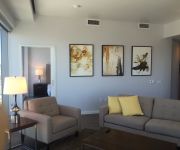
Aboda at 100 Van Ness
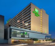
Holiday Inn SAN FRANCISCO-CIVIC CENTER
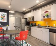
OAKWOOD AT AVA 55 NINTH
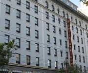
Whitcomb
SAN FRANCISCO
Inn on Folsom
El Capitan Hotel
Casa Loma Hotel
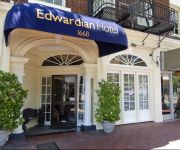
EDWARDIAN SAN FRANCISCO HOTEL
Beck's Motor Lodge
Videos from this area
These are videos related to the place based on their proximity to this place.
San Francisco Mortgage Agent
Ed Craine, San Francisco Mortgage Smith-Craine Real Estate Financing 5214F Diamond Heights Blvd, Ste 629 CA DRE #00781230 NMLS#288854 San Francisco, CA 94131...
2007 San Francisco Frameline31 Trip
http://www.calpernia.com/diary Calpernia and Andrea's trip to the 2007 Frameline31 San Francisco International GLBT Film Festival was amazing! Here's some cellphone cam of the Dykes on Bikes...
Summer Camp 2014 Session 1 Musical Showcase - Beatrice Stewart Journey to the Past
The Young Actors' Theatre Camp (YATC) is a multiple award-winning overnight theatre camp where kids of all ages and experience levels from across the country and around the world have the ...
California road trip 2009
A two-week driving tour of California taking in San Francisco, Napa Valley, Sacramento, Lake Tahoe, Mammoth Mountain, Yosemite, Monterey and the Pacific Coast Highway. This is a montage...
Yvette Travel Host
Yvette and her dog host a fun travel show. They travel the world--talking with people and animals! :) See a preview.
Ride Along: The Steep Streets of San Francisco
Ride along as we travel some of the steepest streets in San Francisco.
Summer 2014 Session 2 MS/ES Musical Showcase - Eleanor Koski Little Girls -Annie
The Young Actors' Theatre Camp (YATC) is a multiple award-winning overnight theatre camp where kids of all ages and experience levels from across the country and around the world have the ...
Videos provided by Youtube are under the copyright of their owners.
Attractions and noteworthy things
Distances are based on the centre of the city/town and sightseeing location. This list contains brief abstracts about monuments, holiday activities, national parcs, museums, organisations and more from the area as well as interesting facts about the region itself. Where available, you'll find the corresponding homepage. Otherwise the related wikipedia article.
Castro Theatre
The Castro Theatre is a popular San Francisco movie palace which became San Francisco Historic Landmark #100 in September 1976. Located at 429 Castro Street, in the Castro district, it was built in 1922 with a Spanish Colonial Baroque façade that pays homage—in its great arched central window surmounted by a scrolling pediment framing a niche—to the recently rebuilt basilica of Mission Dolores nearby. Its designer, Timothy L.
Dolores Park
Dolores Park (originally known as Mission Park) is a city park in San Francisco, California. It is located two blocks south of Mission Dolores at the western edge of the Mission District. South of the park is a hillside area known as "Dolores Heights," while The Castro neighborhood is located a short distance to the west. Dolores Park is bounded by 18th Street on the north, 20th Street on the south, Dolores Street on the east and Church Street on the west.
KALW
KALW is a public radio station based in San Francisco, California. Its HD FM radio signal is broadcast over the immediate San Francisco Bay Area at 91.7 MHz, and is webcast with live streaming audio.
Castro Street Station
Castro Street Station is a Muni Metro station at the intersection of Market Street, Castro Street, and 17th Street in The Castro district of San Francisco, California. The station consists of two side platforms next to the tracks on the second level down with the concourse mezzanine level overlooking it. At both Castro Street Station and Church Street Station, there is only one stairway on each side of Market Street leading into the station.
Twin Peaks Tunnel
The Twin Peaks Tunnel is a 2.27-mile -long light rail/streetcar tunnel in San Francisco, California. The tunnel runs under the Twin Peaks and is used by the K Ingleside, L Taraval, M Ocean View, and T Third Street Muni Metro lines. The S Castro Shuttle also use the tunnel for AT&T Park game day runs.
Glen Canyon Park
Glen Canyon Park is a city park in San Francisco, California. It occupies about 70 acres along a deep canyon adjacent to the Glen Park, Diamond Heights, and Miraloma Park neighborhoods. O’Shaughnessy Hollow is a rugged, undeveloped 3.6 acres tract of parkland that lies immediately to the west, and may be considered as an extension of Glen Canyon Park.
Mission High School (San Francisco, California)
Mission High School is a public high school in the San Francisco Unified School District (SFUSD) San Francisco, California. Serving grades 9-12, Mission is the oldest high school on its original site in San Francisco; it has been on 18th Street, between Dolores and Church, since 1896. The original campus burned in 1922, and the replacement was completed in two stages, the west wing in 1925 and the main building was dedicated by San Francisco mayor James Rolph on June 12, 1927.
Eureka Station
The Eureka Valley Station was an underground streetcar station in San Francisco, California, in use from 1918 until 1972. It was located inside the Twin Peaks Tunnel, very close to its eastern end, in the Eureka Valley neighborhood. Its location was chosen with the intent that it could serve as a transfer station to the Sunset Tunnel, whose east portal in early plans was to be located at the corner of Market and Eureka streets.
Diamond Heights, San Francisco
Diamond Heights is a neighborhood in central San Francisco, California, roughly bordered by Diamond Heights Boulevard and Noe Valley to the north and east and Glen Canyon Park to the south and west.
22nd Street (San Francisco)
22nd Street in San Francisco, California is one of the steepest streets in the world. In the block from Vicksburg to Church Streets in the Noe Valley neighborhood it descends 79 feet along the south side (78-1/2 feet along the north side) for an average grade of just over 31%, about the same as the steepest block of Filbert Street in San Francisco.
Immaculate Conception Academy (San Francisco, California)
Immaculate Conception Academy is a private, all-girls Roman Catholic high school in San Francisco, California. It is located in the Roman Catholic Archdiocese of San Francisco.
Alfred E. Clarke Mansion
The Alfred E. Clarke Mansion is a building in San Francisco, California, located at 250 Douglass Street in the Eureka Valley neighborhood.
St. Paul's Catholic Church (San Francisco)
St. Paul's Catholic Church, or Parroquia De San Pablo is a parish of the Roman Catholic Archdiocese of San Francisco. The parish is located in the city of San Francisco, California, at Church and Valley Street in the city's Noe Valley neighborhood.
Hartford Street Zen Center
The Hartford Street Zen Center, temple name Issan-ji (literally 'One Mountain Temple'), is a Soto Zen practice-center located in the Castro district of San Francisco.
Castro Camera
Castro Camera was a camera store in the Castro District of San Francisco, California, operated by Harvey Milk from 1972 until his assassination in 1978. During the 1970s the store became the center of the neighborhood's growing gay community, as well as campaign headquarters for Milk's various campaigns for elected office.
Church and 18th Street
Church and 18th Street is a station on the San Francisco Municipal Railway light rail network's J Church line. It is located in the Castro neighborhood.
20th Street (Muni)
20th Street is a station on the San Francisco Municipal Railway light rail network's J Church line. It is located in the Mission District neighborhood. The stop is located as the route leaves its normal trajectory along public streets and cuts through Dolores Park.
Liberty (Muni)
Liberty is a station on the San Francisco Municipal Railway light rail network's J Church line. It is located in the Mission District neighborhood.
21st Street (Muni)
21st Street is a station on the San Francisco Municipal Railway light rail network's J Church line. It is located in the Mission District neighborhood.
Church and 22nd Street
Church and 22nd Street is a station on the San Francisco Municipal Railway light rail network's J Church line. It is located in the Mission District neighborhood.
Church and 24th Street
Church and 24th Street is a station on the San Francisco Municipal Railway light rail network's J Church line. It is located in the Noe Valley neighborhood.
Church and Clipper
Church and Clipper is a station on the San Francisco Municipal Railway light rail network's J Church line. It is located in the Mission District neighborhood.
Church and 27th Street
Church and 27th Street is a station on the San Francisco Municipal Railway light rail network's J Church line. It is located in the Mission District neighborhood.
Church and 30th Street
Church and 30th Street is a station on the San Francisco Municipal Railway light rail network's J Church line in the city of San Francisco, California. It is located in the Upper Noe Valley neighborhood.
30th Street and Dolores
30th Street and Dolores is a station on the San Francisco Municipal Railway light rail network's J Church line. It is located in the Bernal Heights neighborhood.


