Safety Score: 2,7 of 5.0 based on data from 9 authorites. Meaning we advice caution when travelling to United States.
Travel warnings are updated daily. Source: Travel Warning United States. Last Update: 2024-08-13 08:21:03
Touring Little Italy
The district Little Italy of San Francisco in San Francisco County (California) is a subburb located in United States about 2,434 mi west of Washington DC, the country's capital place.
Need some hints on where to stay? We compiled a list of available hotels close to the map centre further down the page.
Being here already, you might want to pay a visit to some of the following locations: Oakland, San Rafael, Martinez, Redwood City and Napa. To further explore this place, just scroll down and browse the available info.
Local weather forecast
Todays Local Weather Conditions & Forecast: 12°C / 54 °F
| Morning Temperature | 10°C / 51 °F |
| Evening Temperature | 11°C / 52 °F |
| Night Temperature | 10°C / 50 °F |
| Chance of rainfall | 0% |
| Air Humidity | 50% |
| Air Pressure | 1022 hPa |
| Wind Speed | Fresh Breeze with 14 km/h (9 mph) from South-East |
| Cloud Conditions | Clear sky, covering 6% of sky |
| General Conditions | Sky is clear |
Tuesday, 19th of November 2024
11°C (52 °F)
12°C (54 °F)
Overcast clouds, gentle breeze.
Wednesday, 20th of November 2024
14°C (57 °F)
14°C (57 °F)
Light rain, fresh breeze, overcast clouds.
Thursday, 21st of November 2024
14°C (56 °F)
14°C (57 °F)
Light rain, moderate breeze, overcast clouds.
Hotels and Places to Stay
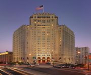
InterContinental Hotels MARK HOPKINS SAN FRANCISCO
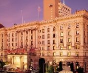
Fairmont San Francisco
Holiday Inn SAN FRANCISCO-FISHERMANS WHARF
Stanford Court
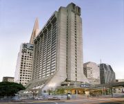
Hilton San Francisco Financial District
Sheraton Fisherman's Wharf Hotel
Hyatt Centric Fishermans Wharf
Hotel Zephyr San Francisco
San Francisco Marriott Fisherman's Wharf
Courtyard San Francisco Fisherman's Wharf
Videos from this area
These are videos related to the place based on their proximity to this place.
San Francisco Cable Car - Entire Trip from Fisherman's Wharf to Market Street
San Francisco Cable Car - Entire Trip. Fisherman's Wharf to Market Street Turnaround. I shot this myself, edited on my Mac, adding street names at every stop. I held the camera at the front...
Sea Lions Pier 39 Fisherman's Wharf San Francisco California
Sea lions at Pier 39 in the Fisherman's Wharf neighborhood of San Francisco.
Bush Man - Fisherman's Wharf, San Francisco, CA
SUBSCRIBE! http://tinyurl.com/p2fveuj California travel expert Veronica Hill of http://www.CaliforniaTravelExpert.com shares this quick clip of the Bush Man in Fisherman's Wharf, San Francisco,...
Fisherman's Wharf - San Francisco, CA
Just a brief video of Fisherman's Wharf, located in San Francisco - the once the home of California Gold Rush-era fishermen. Today it stands as one of the most popular tourist attractions on...
San Francisco Street Car Ride - Market Street to Fisherman's Wharf
San Francisco Vintage Street Car Ride Along - Market Street to Fisherman's Wharf. I shot this on a recent vacation and edited it on my Mac, putting the names of every stop on screen for the...
San Francisco Carousel Pier 39 Fisherman's Wharf San Francisco California
San Francisco Carousel at Pier 39 in the Fisherman's Wharf neighborhood of San Francisco.
Hidden Camera - Scary man - Fisherman's Wharf, San Francisco, California
The simplest way to scare people which help others to laugh.
RocketBoat Pier 39 Fisherman's Wharf San Francisco California
RocketBoat on San Francisco Bay as seen from Pier 39 in the Fisherman's Wharf neighborhood of San Francisco.
Oski Ferry Blue & Gold Fleet Pier 39 Fisherman's Wharf San Francisco California
Oski Ferry of the Blue and Gold Fleet returns from San Francisco Bay to Pier 39 in the Fisherman's Wharf neighborhood of San Francisco.
San Francisco, Fisherman's wharf, Christmas fishing boat lights
Fishing boat Christmas lights reflected in the marina water at Fisherman's Wharf, San Francisco.
Videos provided by Youtube are under the copyright of their owners.
Attractions and noteworthy things
Distances are based on the centre of the city/town and sightseeing location. This list contains brief abstracts about monuments, holiday activities, national parcs, museums, organisations and more from the area as well as interesting facts about the region itself. Where available, you'll find the corresponding homepage. Otherwise the related wikipedia article.
North Beach, San Francisco
North Beach is a neighborhood in the northeast of San Francisco adjacent to Chinatown, Fisherman's Wharf and Russian Hill. The neighborhood is San Francisco's Little Italy, and has historically been home to a large Italian American population. It is still home to many Italian restaurants today, though many other ethnic groups currently live in the neighborhood. It was also the historic center of the beatnik subculture.
City Lights Bookstore
City Lights is an independent bookstore-publisher combination in San Francisco, California that specializes in world literature, the arts, and progressive politics. It also houses the nonprofit City Lights Foundation, which publishes selected titles related to San Francisco culture. It was founded in 1953 by poet Lawrence Ferlinghetti and Peter D. Martin (who left two years later).
San Francisco Art Institute
San Francisco Art Institute (SFAI) is a school of higher education in contemporary art with the main campus in the Russian Hill district of San Francisco, California. Its graduate center is in the Dogpatch neighborhood. The private, non-profit institution is accredited by WASC and is a member of the Association of Independent Colleges of Art and Design. SFAI was founded in 1871, and is one of the oldest art schools in the United States and the oldest west of the Mississippi River
The Real World: San Francisco
The Real World: San Francisco is the third season of MTV's reality television series The Real World, which focuses on a group of diverse strangers living together for several months in a different city each season, as cameras follow their lives and interpersonal relationships. It was the second season of The Real World to be filmed in California after The Real World: Los Angeles in 1993.
San Francisco Cable Car Museum
The Cable Car Museum is a free museum in the Nob Hill neighborhood of San Francisco, California. Located at 1201 Mason Street, It contains historical and explanatory exhibits on the San Francisco cable car system, which can itself be regarded as a working museum. The museum contains several examples of old cable cars, together with smaller exhibits and a shop.
Washington Square (San Francisco)
Washington Square is a park in the North Beach district of San Francisco, California. The popular destination, for both locals and tourists, is surrounded by eating establishments and the Sts. Peter and Paul Church Director Don Siegel features the church and the square in scenes from the 1971 movie, Dirty Harry. The church, and nearby Dante Building, are the setting of sniper attacks by the "Scorpio Killer". The park and surrounding area is also featured in the 2000 film, Bedazzled.
KREV (FM)
KREV (92.7 FM, "92.7 Rev FM") is a Top 40 (CHR) music formatted radio station that serves the greater San Francisco Bay Area. Its city of license is Alameda, California, and it is owned by Royce International.
Barbary Coast, San Francisco
The Barbary Coast was a red-light district in old San Francisco, California. Geographically it constituted nine blocks bounded by Montgomery Street, Washington Street, Stockton Street, and Broadway. Particularly notorious was Pacific Avenue, one of the earliest streets to be cut through the hills, which led directly from the wharf to the center of town, near Portsmouth Square. The neighborhood quickly took on its seedy character during the California Gold Rush (1848–1858).
Telegraph Hill, San Francisco
Telegraph Hill (elev. 275 ft) is a neighborhood in San Francisco, California. It is one of San Francisco's 44 hills, and one of its original "Seven Hills."
Macondray Lane
Macondray Lane is a small pedestrian lane on the south-eastern side of Russian Hill in San Francisco, California. A wooded enclave in the heart of the city, it was recast by Armistead Maupin as Barbary Lane for his Tales of the City. Macondray Lane extends two blocks east-west between Leavenworth and Taylor streets, paralleling Union and Green streets. At the Taylor Street end, a set of steps descend from the lane to Taylor Street.
Saints Peter and Paul Church, San Francisco
Saints Peter and Paul Church is a Roman Catholic Church in San Francisco's North Beach neighborhood. Located (somewhat ironically) at 666 Filbert Street, it is directly across from Washington Square, San Francisco and is administered by the Salesians of Don Bosco. It is known as "La cattedrale d'Italia ovest," or "The Italian Cathedral of the West," and has served as the home church and cultural center for San Francisco's Italian-American community since its consecration.
Caffe Trieste
Caffé Trieste is a chain of six Italian-themed coffeehouse plus one retail store in the San Francisco Bay Area, California. The Caffe Trieste was opened in 1956 by Giovanni Giotta (aka "Papa Gianni"), who in 1950 had emigrated to San Francisco, California, from the small fishing town of Rovigno, Italy (now part of Croatia). Missing the espresso houses of Trieste, Italy, Giotta opened his own cafe. Caffe Trieste is said to be the first espresso house on the West Coast.
The Summit (San Francisco)
The Summit is a highrise condominium tower developed by Joseph Eichler, located at the top of the upscale Russian Hill in San Francisco, California, at 999 Green Street. The tower was designed by Niell Smith and Associates. Above ground, it has 4 floors of parking and 25 floors of residential condominiums. The tower, completed in 1965, has some of San Francisco's most expensive and scenic condos.
Condor Club
The Condor Night Club is a striptease bar or topless bar in the North Beach section of San Francisco, in California, USA. The club opened in 1964. The club is located at the corner of Broadway and Columbus. The large lit sign in front of the club featured a picture of Carol Doda. The sign had red lights on the image of her breasts. She was the first topless entertainer there and the most famous. Her première topless dance occurred on the evening of June 19, 1964. The club went bottomless (i.e.
Vesuvio Cafe
Vesuvio Cafe is a historic bar in North Beach, San Francisco, California where 'beat' poetry was invented. It is located at 255 Columbus Avenue across an alley from City Lights Bookstore. It is open every day of the year 6 a.m. to 2 a.m. The bar was founded in 1948 by Henri Lenoir, and was frequented by a number of Beat Generation celebrities, including Jack Kerouac, Dylan Thomas, and Neal Cassady.
Jack Kerouac Alley
Jack Kerouac Alley (formerly Adler Alley or Adler Place) is a one-way alleyway in Chinatown, San Francisco, California, that connects Grant Avenue and Columbus Avenue. The alley is named after Jack Kerouac, a Beat Generation writer who used to frequent the pub and bookstore adjacent to the alley. The alley was a common place for garbage dumping and a shortcut for trucks.
Broadway Tunnel (San Francisco)
The Broadway Tunnel (officially the Robert C. Levy Tunnel) is a roadway tunnel in San Francisco, California. The tunnel opened in 1952, and serves as a high-capacity conduit for traffic between Chinatown and North Beach to the east and Russian Hill and Van Ness to the west. In a proposal of the city's 1948 Transportation Plan, the tunnel was to serve as a link between the Embarcadero Freeway and the Central Freeway. The east portal is located just past the Mason Street overpass.
Washington Square Bar and Grill
The Washington Square Bar and Grill is a landmark restaurant adjoining Washington Square in San Francisco, California's North Beach neighborhood (Powell at Union streets). Known widely as the Washbag, so named by columnist Herb Caen as a play on words, it was a favorite gathering place for a generation of writers, politicians, musicians, and social elite. The restaurant was opened in 1973 by local Ed Moose, a former dispatcher and reporter for the St.
Columbus Avenue (San Francisco)
Columbus Avenue is a street that runs diagonally through the North Beach and Chinatown areas of San Francisco, California, from Washington and Montgomery Streets by the Transamerica Pyramid to Beach Street near Fisherman's Wharf. This street is home to several notable venues, such as Jack Kerouac Alley, named for poet Jack Kerouac, City Lights Bookstore, and Bimbo's 365 Club. The street's original name was Montgomery Avenue.
Grant Avenue
Grant Avenue in San Francisco, California is one of the oldest streets in the city's Chinatown district. It runs in a north-south direction starting at Market Street in the heart of downtown and dead-ending past Francisco Street in the North Beach district. It resumes at North Point Street and stretches one block to The Embarcadero and the foot of Pier 39. Grant Avenue is a one-way street; automobile traffic can only travel northbound.
North Beach Malt House
The North Beach Malt House is an historical landmark building, located at 445 Francisco Street in San Francisco, California. It originally served as a malting factory and brewery for 40 years. It was nearly destroyed in the 1906 San Francisco earthquake. The owner at the time, George W. Bauer, rebuilt the Malt House using concrete and steel girders. His company, Bauer & Schweitzer, continued to supply malt to Bay Area breweries, including the Anchor Brewing Company, into the 1960s.
Barbary Coast Trail
The Barbary Coast Trail is a walking tour connecting 20 historic sites and local history museums in San Francisco, California. Approximately 180 bronze medallions and arrows embedded in the sidewalk mark the 3.8-mile (6.1 km) trail. The historic sites of the Barbary Coast Trail relate primarily to the period from the California Gold Rush of 1849 to the Earthquake and Fire of 1906, a period when San Francisco grew from a small village to the busiest port on the West Coast.
Club Fugazi
The Club Fugazi is a small theater and nightclub located in the North Beach, San Francisco, California district of San Francisco, California. The address is 678 Green Street although the portion of Green in front of the club has been renamed Beach Blanket Babylon Boulevard in honor of the long-running musical revue which has played at the Club Fugazi for some two decades. The theater is on the ground floor in a building which is formally known as Casa Coloniale Italiana John F.
Pioneer Park (San Francisco)
Pioneer Park is a 4.89-acre park crowning the top of Telegraph Hill in San Francisco. It was established in 1876 in celebration of the United States Centennial. Prior to establishment of the park, it was the site of the Marine Telegraph Station. The main feature of the park, Coit Tower, was completed in 1933 using a $100,000 bequest left to the city by Lillie Hitchcock Coit in 1924.
Bimbo's 365 Club
Bimbo's 365 Club, also known as Bimbo's 365, is an entertainment club located at 1025 Columbus Avenue in San Francisco. It specializes in live rock and jazz shows. The location is one of San Francisco's oldest nightclub sites, and has operated under two names with a series of owners. The building started as Bal Tabarin in 1931, the same year that the 365 Club started at 365 Market Street.


