Safety Score: 2,7 of 5.0 based on data from 9 authorites. Meaning we advice caution when travelling to United States.
Travel warnings are updated daily. Source: Travel Warning United States. Last Update: 2024-08-13 08:21:03
Delve into Glen Park
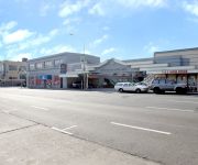
The district Glen Park of San Francisco in San Francisco County (California) is a subburb in United States about 2,436 mi west of Washington DC, the country's capital town.
If you need a hotel, we compiled a list of available hotels close to the map centre further down the page.
While being here, you might want to pay a visit to some of the following locations: Oakland, San Rafael, Redwood City, Martinez and Napa. To further explore this place, just scroll down and browse the available info.
Local weather forecast
Todays Local Weather Conditions & Forecast: 12°C / 54 °F
| Morning Temperature | 10°C / 51 °F |
| Evening Temperature | 11°C / 52 °F |
| Night Temperature | 10°C / 50 °F |
| Chance of rainfall | 0% |
| Air Humidity | 50% |
| Air Pressure | 1022 hPa |
| Wind Speed | Fresh Breeze with 14 km/h (9 mph) from South-East |
| Cloud Conditions | Clear sky, covering 6% of sky |
| General Conditions | Sky is clear |
Tuesday, 19th of November 2024
11°C (52 °F)
12°C (54 °F)
Overcast clouds, gentle breeze.
Wednesday, 20th of November 2024
14°C (57 °F)
14°C (57 °F)
Light rain, fresh breeze, overcast clouds.
Thursday, 21st of November 2024
14°C (56 °F)
14°C (57 °F)
Light rain, moderate breeze, overcast clouds.
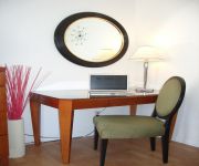
Hotels and Places to Stay
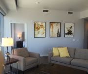
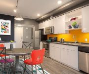
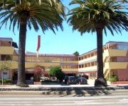
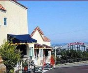
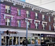
Aboda at 100 Van Ness
OAKWOOD AT AVA 55 NINTH
THE ALPINE INN
SAN FRANCISCO
CIVIC CENTER MOTOR INN
Beck's Motor Lodge
Alpine Inn And Suites
Ram's Hotel
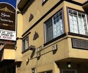
San Francisco Inn
Casa Loma Hotel
Videos from this area
These are videos related to the place based on their proximity to this place.
San Francisco Apartment for Rent | 625 Guerrero St #6
Don't miss this large Mission District 1 bedroom apartment with amazing walk-in closet and big eat-in kitchen! Available now in this amazing location!!! Guerrero St between 18th & 19th. Walking...
San Francisco Mortgage Agent
Ed Craine, San Francisco Mortgage Smith-Craine Real Estate Financing 5214F Diamond Heights Blvd, Ste 629 CA DRE #00781230 NMLS#288854 San Francisco, CA 94131...
San Francisco Firefighters Funeral Procession @ south 280 PART1
SFFD ANTHONY & VINCENT FUNERAL PART1 San Francisco Firefighters Funeral Procession @ 280 south.
Summer Camp 2014 Session 1 Musical Showcase - Beatrice Stewart Journey to the Past
The Young Actors' Theatre Camp (YATC) is a multiple award-winning overnight theatre camp where kids of all ages and experience levels from across the country and around the world have the ...
California road trip 2009
A two-week driving tour of California taking in San Francisco, Napa Valley, Sacramento, Lake Tahoe, Mammoth Mountain, Yosemite, Monterey and the Pacific Coast Highway. This is a montage...
Yvette Travel Host
Yvette and her dog host a fun travel show. They travel the world--talking with people and animals! :) See a preview.
Ride Along: The Steep Streets of San Francisco
Ride along as we travel some of the steepest streets in San Francisco.
Summer 2014 Session 2 MS/ES Musical Showcase - Eleanor Koski Little Girls -Annie
The Young Actors' Theatre Camp (YATC) is a multiple award-winning overnight theatre camp where kids of all ages and experience levels from across the country and around the world have the ...
Videos provided by Youtube are under the copyright of their owners.
Attractions and noteworthy things
Distances are based on the centre of the city/town and sightseeing location. This list contains brief abstracts about monuments, holiday activities, national parcs, museums, organisations and more from the area as well as interesting facts about the region itself. Where available, you'll find the corresponding homepage. Otherwise the related wikipedia article.
Bernal Heights, San Francisco
Bernal Heights is a neighborhood in San Francisco, California.
Excelsior District, San Francisco
The Excelsior District is a neighborhood in San Francisco, California.
Glen Canyon Park
Glen Canyon Park is a city park in San Francisco, California. It occupies about 70 acres along a deep canyon adjacent to the Glen Park, Diamond Heights, and Miraloma Park neighborhoods. O’Shaughnessy Hollow is a rugged, undeveloped 3.6 acres tract of parkland that lies immediately to the west, and may be considered as an extension of Glen Canyon Park.
Balboa Park, San Francisco
Balboa Park is a neighborhood and public park in San Francisco, California. It was created in 1909 and parts of it were built over time. The neighborhood is located between Mission Street and Interstate 280 north of Geneva Avenue and the park is located on San Jose Avenue, north of Ocean Avenue. Inside of the park there is a public swimming pool, a children's playground, a stadium, baseball diamonds, tennis courts and the Ingleside police station.
Glen Park Station
40px Glen Park {{#invoke:InfoboxImage|InfoboxImage|image=Glen Park Station platform. jpg|size=225|sizedefault=300px|alt=}}View of station platformStation statisticsAddress 2901 Diamond StreetSan Francisco, CA 94131Lines BART Pittsburg/Bay Point–SFO/Millbrae Dublin/Pleasanton–Daly City Richmond–Daly City/Millbrae Fremont–Daly City Connections MUNI and MUNI Metro J Church The San Jose and Bosworth Station is midway across a pedestrian bridge on the median of nearby San Jose Avenue.
Diamond Heights, San Francisco
Diamond Heights is a neighborhood in central San Francisco, California, roughly bordered by Diamond Heights Boulevard and Noe Valley to the north and east and Glen Canyon Park to the south and west.
22nd Street (San Francisco)
22nd Street in San Francisco, California is one of the steepest streets in the world. In the block from Vicksburg to Church Streets in the Noe Valley neighborhood it descends 79 feet along the south side (78-1/2 feet along the north side) for an average grade of just over 31%, about the same as the steepest block of Filbert Street in San Francisco.
Balboa High School (California)
Balboa High School, colloquially known as Bal, is an American public high school located near the Excelsior District in the Mission Terrace neighborhood of San Francisco, California. Balboa serves grades nine through twelve as part of the San Francisco Unified School District (SFUSD). Balboa is a comprehensive school located in an urban working class district. It educates a greater proportion of the city's disadvantaged and minority students relative to other city high schools.
Boxer Stadium
Boxer Stadium (also known as Matthew J. Boxer Stadium) is a soccer stadium in San Francisco, California. It is owned and operated by the San Francisco Recreation and Parks Department and is the only soccer-specific public stadium in San Francisco. Located within the confines of Balboa Park, the stadium has a capacity of 3,500. Boxer Stadium is the primary home of the century-year old San Francisco Soccer Football League.
Immaculate Conception Academy (San Francisco, California)
Immaculate Conception Academy is a private, all-girls Roman Catholic high school in San Francisco, California. It is located in the Roman Catholic Archdiocese of San Francisco.
St. Paul's Catholic Church (San Francisco)
St. Paul's Catholic Church, or Parroquia De San Pablo is a parish of the Roman Catholic Archdiocese of San Francisco. The parish is located in the city of San Francisco, California, at Church and Valley Street in the city's Noe Valley neighborhood.
Bernal Heights Summit
Bernal Heights Summit or Bernal Heights Hill is a hill in San Francisco, California the neighborhood of Bernal Heights. Upper elevations are part of Bernal Hill Park, a component of San Francisco Recreation and Parks; a property at the highest elevation is privately owned and houses an equipment building and telecommunications tower, known among the local community as "Sutrito Tower. " The park and summit are largely surrounded by Bernal Heights Boulevard.
Church and 22nd Street
Church and 22nd Street is a station on the San Francisco Municipal Railway light rail network's J Church line. It is located in the Mission District neighborhood.
Church and 24th Street
Church and 24th Street is a station on the San Francisco Municipal Railway light rail network's J Church line. It is located in the Noe Valley neighborhood.
Church and Clipper
Church and Clipper is a station on the San Francisco Municipal Railway light rail network's J Church line. It is located in the Mission District neighborhood.
Church and 27th Street
Church and 27th Street is a station on the San Francisco Municipal Railway light rail network's J Church line. It is located in the Mission District neighborhood.
Church and 29th Street
Church and 29th Street is a station on the San Francisco Municipal Railway light rail network's J Church line. It is located in the Mission District neighborhood.
Church and 30th Street
Church and 30th Street is a station on the San Francisco Municipal Railway light rail network's J Church line in the city of San Francisco, California. It is located in the Upper Noe Valley neighborhood.
30th Street and Dolores
30th Street and Dolores is a station on the San Francisco Municipal Railway light rail network's J Church line. It is located in the Bernal Heights neighborhood.
San Jose and Randall
San Jose and Randall is a station on the San Francisco Municipal Railway light rail network's J Church line. It is located in the Bernal Heights neighborhood.
San Jose and Bosworth
San Jose and Bosworth is a station on the San Francisco Municipal Railway light rail network's J Church line. It is located in the Glen Park neighborhood. The Glen Park Station of the Bay Area Rapid Transit subway is located directly across the street from the stop.
San Jose and Santa Rosa
San Jose and Santa Rosa is a station on the San Francisco Municipal Railway light rail network's J Church line. It is located in the Mission Terrace neighborhood.
San Jose and Ocean
San Jose and Ocean is a station on the San Francisco Municipal Railway light rail network's J Church line. It is located in the Mission Terrace neighborhood. It is located along the edge of Balboa Park.
San Jose and Santa Ynez
San Jose and Santa Yenz is a station on the San Francisco Municipal Railway light rail network's J Church line. It is located in the Mission Terrace neighborhood. It is located along the edge of Balboa Park.
Rancho Rincon de las Salinas y Potrero Viejo
Rancho Rincon de las Salinas y Potrero Viejo was a 4,446-acre Mexican land grant, largely in present day San Francisco County, California and extending to San Mateo County, California, given in 1839 by Governor Protem Manual Jimeno to José Cornelio Bernal. The grant consisted of two grants - Rincon de las Salinas ("corner of a salty marsh" - around Islais Creek) and Potrero Viejo ("old pasture" - part of Mission Dolores).


