Safety Score: 2,7 of 5.0 based on data from 9 authorites. Meaning we advice caution when travelling to United States.
Travel warnings are updated daily. Source: Travel Warning United States. Last Update: 2024-08-13 08:21:03
Discover Duboce Triangle
The district Duboce Triangle of San Francisco in San Francisco County (California) is a district in United States about 2,436 mi west of Washington DC, the country's capital city.
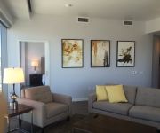
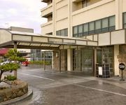
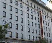
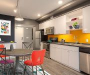
Looking for a place to stay? we compiled a list of available hotels close to the map centre further down the page.
When in this area, you might want to pay a visit to some of the following locations: Oakland, San Rafael, Redwood City, Martinez and Napa. To further explore this place, just scroll down and browse the available info.
Local weather forecast
Todays Local Weather Conditions & Forecast: 12°C / 54 °F
| Morning Temperature | 10°C / 51 °F |
| Evening Temperature | 11°C / 52 °F |
| Night Temperature | 10°C / 50 °F |
| Chance of rainfall | 0% |
| Air Humidity | 50% |
| Air Pressure | 1022 hPa |
| Wind Speed | Fresh Breeze with 14 km/h (9 mph) from South-East |
| Cloud Conditions | Clear sky, covering 6% of sky |
| General Conditions | Sky is clear |
Tuesday, 19th of November 2024
11°C (52 °F)
12°C (54 °F)
Overcast clouds, gentle breeze.
Wednesday, 20th of November 2024
14°C (57 °F)
14°C (57 °F)
Light rain, fresh breeze, overcast clouds.
Thursday, 21st of November 2024
14°C (56 °F)
14°C (57 °F)
Light rain, moderate breeze, overcast clouds.
Hotels and Places to Stay
Aboda at 100 Van Ness
Hotel Kabuki
EMBASSY HOTEL
Hotel Kabuki - a Joie de Vivre Boutique Hotel
Whitcomb
OAKWOOD AT AVA 55 NINTH
Beck's Motor Lodge
The Red Coach Motor Lodge
Kimpton Buchanan Hotel
EDWARDIAN SAN FRANCISCO HOTEL
Videos from this area
These are videos related to the place based on their proximity to this place.
STOCK SHOT CLIP NAT SOUND SANY0009 449 Buena Vista Avenue East Haight-Ashbury - San Francisco
Buena Vista Park - Haight-Ashbury - San Francisco STOCK SHOT CLIP NAT SOUND feb 2010 449 Buena Vista Avenue East Haight-Ashbury - San Francisco.
Lower Haight |1 Bed | Furnished | 1 Bath | Loft | Office | $3.5-4.2K
This spacious and modern 1 bedroom, 1 bathroom loft in the Haight Ashbury is available for a short-stay rental. Sleek in design and a comfortable home. This unit features stainless steel appliances...
Beautiful Sunny Day for A Brief Tour of Haight Street, San Francisco
A Brief tour down Haight Street on board a tour bus.
The Castro Neighborhood Guide
The Castro is one of San Francisco's most recognizable neighborhoods. At the heart sits a rainbow flag, known by many names. It acts as a symbol of acceptance, which is how the Castro is defined....
Car ride over the Golden Gate Bridge; Car Trip 2011
Car ride over the Golden Gate Bridge; San Francisco, California.
Golden Gate Model RR San Francisco Bart and Great Northern Empire Builder HO Scale
Layout : Golden Gate Model Railroad Scale : HO Trains : BART (Bay Area Rapid Transit 'San Francisco') (Walthers) A-B-B-A units (both the A units are powered) ...
San Francisco, California - Alamo Square - Painted Ladies HD (2014)
Alamo Square is a residential neighborhood and park in San Francisco, California, in the Western Addition. Its boundaries are not well-defined, but are generally considered to be Webster Street...
San Francisco MUNI Trains ( light rail) & Buses
http://www.discovering-sanfrancisco.com/san_francisco_muni.html Founded in 1912, San Francisco MUNI is one of Americas oldest public transit agencies and today carries over 200 million riders...
The Western Circle deel 1: Intro + San Francisco
Een camperreis door het zuidwesten van de Verenigde Staten, deel 1.
Videos provided by Youtube are under the copyright of their owners.
Attractions and noteworthy things
Distances are based on the centre of the city/town and sightseeing location. This list contains brief abstracts about monuments, holiday activities, national parcs, museums, organisations and more from the area as well as interesting facts about the region itself. Where available, you'll find the corresponding homepage. Otherwise the related wikipedia article.
Castro Theatre
The Castro Theatre is a popular San Francisco movie palace which became San Francisco Historic Landmark #100 in September 1976. Located at 429 Castro Street, in the Castro district, it was built in 1922 with a Spanish Colonial Baroque façade that pays homage—in its great arched central window surmounted by a scrolling pediment framing a niche—to the recently rebuilt basilica of Mission Dolores nearby. Its designer, Timothy L.
San Francisco LGBT Community Center
The San Francisco LGBT Community Center is a nonprofit organization serving the lesbian, gay, bisexual and transgender population of San Francisco, California and nearby communities, located at 1800 Market Street in San Francisco. Incorporated in 1996, the Center opened its solar-powered, 35,000-square-foot facility in 2002.
Painted ladies
"Painted ladies" is a term used for Victorian and Edwardian houses and buildings painted in three or more colors that embellish or enhance their architectural details. The term was first used for San Francisco Victorian houses by writers Elizabeth Pomada and Michael Larsen in their 1978 book Painted Ladies - San Francisco's Resplendent Victorians.
San Francisco Zen Center
San Francisco Zen Center (SFZC), is a network of affiliated Sōtō Zen practice and retreat centers in the San Francisco Bay area, comprising the City Center or Beginner's Mind Temple, the Tassajara Zen Mountain Center, and the Green Gulch Farm Zen Center. The sangha was incorporated by Shunryu Suzuki-roshi and a group of his American students in 1962. Today SFZC is the largest Sōtō organization in the West.
Church Street Station (San Francisco)
Church Street Station is a Muni Metro station at the intersection of Market Street, Church Street and 14th Street in San Francisco, California. The J Church, which enters and exits the Market Street tunnel in a portal near the station, has an aboveground stop on Church and Market Streets. The N Judah also exits the tunnel before reaching the station and stops one block away at Church and Duboce Avenue.
Castro Street Station
Castro Street Station is a Muni Metro station at the intersection of Market Street, Castro Street, and 17th Street in The Castro district of San Francisco, California. The station consists of two side platforms next to the tracks on the second level down with the concourse mezzanine level overlooking it. At both Castro Street Station and Church Street Station, there is only one stairway on each side of Market Street leading into the station.
Sunset Tunnel
The Sunset Tunnel is a 4,232 ft -long light rail/streetcar tunnel in San Francisco, California. The tunnel runs under the steep hill that Buena Vista Park is located on and is used by the N Judah Muni Metro line. The tunnel opened on 21 October 1928 in a ceremony presided over by Mayor James Rolph.
Twin Peaks Tunnel
The Twin Peaks Tunnel is a 2.27-mile -long light rail/streetcar tunnel in San Francisco, California. The tunnel runs under the Twin Peaks and is used by the K Ingleside, L Taraval, M Ocean View, and T Third Street Muni Metro lines. The S Castro Shuttle also use the tunnel for AT&T Park game day runs.
Lower Haight, San Francisco
The Lower Haight is a neighborhood, sometimes referred to as Haight-Fillmore, in San Francisco, California.
Mission High School (San Francisco, California)
Mission High School is a public high school in the San Francisco Unified School District (SFUSD) San Francisco, California. Serving grades 9-12, Mission is the oldest high school on its original site in San Francisco; it has been on 18th Street, between Dolores and Church, since 1896. The original campus burned in 1922, and the replacement was completed in two stages, the west wing in 1925 and the main building was dedicated by San Francisco mayor James Rolph on June 12, 1927.
Eureka Station
The Eureka Valley Station was an underground streetcar station in San Francisco, California, in use from 1918 until 1972. It was located inside the Twin Peaks Tunnel, very close to its eastern end, in the Eureka Valley neighborhood. Its location was chosen with the intent that it could serve as a transfer station to the Sunset Tunnel, whose east portal in early plans was to be located at the corner of Market and Eureka streets.
Duboce Park
Duboce Park is a small urban park located between the Duboce Triangle and Lower Haight neighborhoods of San Francisco, California. The park is less than one block wide from north to south, and two blocks wide from west to east. Its western boundary is Scott Street and its eastern boundary is Steiner Street. The N Judah Muni Metro streetcar line runs along Duboce Avenue, which forms the southern boundary of the park.
Eureka Valley, San Francisco
Eureka Valley is a neighborhood in San Francisco, primarily a quiet residential neighborhood but boasts one of the most visited sub-neighborhoods - The Castro.
Randall Museum
The Randall Museum is a museum in San Francisco, California and is owned and operated by the City's Recreation and Parks Department. It focuses on the arts, crafts, sciences, and natural history. On view are a number of live native and domestic animals and interactive displays. The Museum is located in Corona Heights Park on a large hill between the Castro and Haight districts of San Francisco, and boasts stunning views of the city, downtown financial district and the bay.
The Wiggle
The Wiggle is a one-mile, zig-zagging bicycle route from Market Street to Golden Gate Park in San Francisco, California, that minimizes hilly inclines for bicycle riders. Rising 120 feet, The Wiggle inclines average 3% and never exceed 6%. The path generally follows the historical route of the long since paved-over Sans Souci Valley watercourse, winding through the Lower Haight neighborhood toward the Panhandle section of Golden Gate Park.
Nightingale House
The Nightingale House is a Queen Anne Style, Stick and Eastlake styles Victorian era home built in 1882 at 201 Buchanan Street in San Francisco, California. The structure was designated as a San Francisco landmark in October 1972. Notably the last resident of this home was San Francisco Arts Commissioner and San Francisco artist Jo Hanson who died March 13, 2007.
Southern Exposure (art space)
Hartford Street Zen Center
The Hartford Street Zen Center, temple name Issan-ji (literally 'One Mountain Temple'), is a Soto Zen practice-center located in the Castro district of San Francisco.
Castro Camera
Castro Camera was a camera store in the Castro District of San Francisco, California, operated by Harvey Milk from 1972 until his assassination in 1978. During the 1970s the store became the center of the neighborhood's growing gay community, as well as campaign headquarters for Milk's various campaigns for elected office.
Duboce and Church
Duboce and Church is a station on the San Francisco Municipal Railway light rail network's J Church and N Judah lines and 22 Fillmore bus line. It is the first stop for the routes outside of the Market Street Subway, which these lines leave earlier and through a separate portal from other services. The stop is located in the Duboce Triangle neighborhood.
Church and 14th Street
Church and 14th Street is a station on the San Francisco Municipal Railway light rail network's J Church line. It is located in the Duboce Triangle neighborhood. The F Market & Wharves streetcar line intersects with the Metro system at this stop.
Church and 16th Street
Church and 16th Street is a station on the San Francisco Municipal Railway light rail network's J Church line. It is located in the Castro neighborhood.
Church and 18th Street
Church and 18th Street is a station on the San Francisco Municipal Railway light rail network's J Church line. It is located in the Castro neighborhood.
Duboce and Noe Street
Duboce and Noe is a station on the San Francisco Municipal Railway light rail network's N Judah line. It is located in the Duboce Triangle neighborhood. It is the first stop east of the Sunset Tunnel under Buena Vista Park and is adjacent to Duboce Park.
Rancho San Miguel (Noe)
Rancho San Miguel was a 4,443-acre Mexican land grant in present day San Francisco County, California given in 1845 by Governor Pío Pico to José de Jesús Noé. The grant included what is now known as Eureka Valley and extended past Mount Davidson almost to present day Daly City. The grant encompassed the present-day San Francisco neighborhoods of Noe Valley, the Castro, Glen Park, Diamond Heights, and St. Francis Wood.


