Safety Score: 2,7 of 5.0 based on data from 9 authorites. Meaning we advice caution when travelling to United States.
Travel warnings are updated daily. Source: Travel Warning United States. Last Update: 2024-08-13 08:21:03
Delve into China Basin
The district China Basin of San Francisco in San Francisco County (California) is a subburb in United States about 2,434 mi west of Washington DC, the country's capital town.
If you need a hotel, we compiled a list of available hotels close to the map centre further down the page.
While being here, you might want to pay a visit to some of the following locations: Oakland, San Rafael, Redwood City, Martinez and Napa. To further explore this place, just scroll down and browse the available info.
Local weather forecast
Todays Local Weather Conditions & Forecast: 12°C / 54 °F
| Morning Temperature | 10°C / 51 °F |
| Evening Temperature | 11°C / 52 °F |
| Night Temperature | 10°C / 50 °F |
| Chance of rainfall | 0% |
| Air Humidity | 50% |
| Air Pressure | 1022 hPa |
| Wind Speed | Fresh Breeze with 14 km/h (9 mph) from South-East |
| Cloud Conditions | Clear sky, covering 6% of sky |
| General Conditions | Sky is clear |
Tuesday, 19th of November 2024
11°C (52 °F)
12°C (54 °F)
Overcast clouds, gentle breeze.
Wednesday, 20th of November 2024
14°C (57 °F)
14°C (57 °F)
Light rain, fresh breeze, overcast clouds.
Thursday, 21st of November 2024
14°C (56 °F)
14°C (57 °F)
Light rain, moderate breeze, overcast clouds.
Hotels and Places to Stay
Four Seasons San Francisco
W San Francisco
San Francisco a Luxury Collection Hotel Palace Hotel
InterContinental Hotels SAN FRANCISCO
The St. Regis San Francisco
The Park Central San Francisco
San Francisco Marriott Marquis
Hotel Vitale
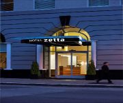
Hotel Zetta San Francisco
Hotel Zelos San Francisco
Videos from this area
These are videos related to the place based on their proximity to this place.
New San Francisco Apartments - Jasper - Get On The List
New San Francisco high-rise apartments in Rincon Hill. For Jasper, we obsessed over every detail. Every other San Francisco apartment building was practice for this. Leasing begins in May,...
Sunrise from China Basin/AT&T Park in San Francisco
Watch the sunrise from China Basin/AT&T Park w/ the Bay Bridge! Sorry for the video quality, was playing with a new app. I promise I'll reshoot from here. Time lapsed with iPhone 6. Got...
4th St Draw Bridge Mission Bay San Francisco
http://goo.gl/maps/6ksws http://sfhotlist.com/ The 4th Street Draw Bridge - at the crossroads of the SF Giants Baseball Stadium, Mission Creek Park, the Mission Bay condos & neighborhood,...
Bike SF: 4th St through Mission Bay
Bike Commute from 7th St and Townsend St to Dogpatch, via Townsend St, 4th St, 16th St, Illinois St, & 20th St.
Saiga Conservation Alliance · Elena Bykova and Olga Espiova · Expo 2014
Mother-daughter conservation team Elena Bykova and Olga Espiova talk about their work saving the endangered saiga antelope. Recorded at the Wildlife Conservation Network Expo at Mission Bay...
Ewaso Lions · Shivani Bhalla · Expo 2014
Shivani Bhalla started Ewaso Lions seven years ago to save lion in Kenya's northern lands. She works closely with Samburu Warriors—young men from the area—to create a culture of conservation...
Videos provided by Youtube are under the copyright of their owners.
Attractions and noteworthy things
Distances are based on the centre of the city/town and sightseeing location. This list contains brief abstracts about monuments, holiday activities, national parcs, museums, organisations and more from the area as well as interesting facts about the region itself. Where available, you'll find the corresponding homepage. Otherwise the related wikipedia article.
Wired (magazine)
Wired (stylized as WIRED) is a full-color monthly American magazine and online periodical, published since January 1993, that reports on how new and developing technology affects culture, the economy, and politics. Owned by Condé Nast, it is headquartered in San Francisco, California. The magazine spawned several spin-offs: Wired UK, Wired Italia, Wired Japan and Wired Germany. In its earliest colophons, Wired credited Canadian media theorist Marshall McLuhan as its "patron saint.
AT&T Park
AT&T Park is a ballpark used for Major League Baseball. It is located in the South of Market (SoMa) neighborhood of San Francisco, California, at 24 Willie Mays Plaza, at the corner of Third and King Streets. It has served as the home of the San Francisco Giants of Major League Baseball since 2000.
Yerba Buena Gardens
Yerba Buena Gardens is the name for two blocks of public parks located between Third and Fourth, Mission and Folsom Streets in downtown San Francisco, California. The first block bordered by Mission and Howard Streets was opened in 1993. The second block, between Howard and Folsom Streets was opened in 1998. A pedestrian bridge over Howard Street connects the two blocks, sitting on top of part of the Moscone Center convention center.
McCovey Cove
McCovey Cove is the unofficial name of a section of San Francisco Bay beyond the right field wall of AT&T Park, home of the San Francisco Giants, named after famed Giants first baseman Willie McCovey. The proper name for the cove is China Basin, which is the mouth of Mission Creek as it meets the bay. The cove is bounded along the north by AT&T Park, with a ferry landing and a breakwater at the northeast end. The southern shore is lined by China Basin Park and McCovey Point.
Zeum
Children's Creativity Museum is a hands-on, multimedia arts and technology museum for kids of all ages located at the Yerba Buena Gardens in San Francisco, California. It aims to nurture the "3Cs of 21st-century literacy - Creativity, Collaboration, and Communication - in all youth and families" http://zeum. org/about/index. html.
South Park, San Francisco
South Park is a small neighborhood South of Market in San Francisco, California. It centers on the small, oval-shaped park of the same name, and South Park Street, which encircles the park. The area is bounded by Second, Third, Bryant, and Brannan streets. The two halves of the South Park Street re-join at both ends of the park, and continue for short, straight stretches before terminating at Second Street on one end and Third Street on the other.
Moscone Center
Moscone Center /mɒsˈkoʊni/ is the largest convention and exhibition complex in San Francisco, California. It comprises three main halls: Two underground halls underneath Yerba Buena Gardens, known as Moscone North and Moscone South, and a three-level Moscone West exhibition hall across 4th Street.
The EndUp
The EndUp was founded in November 1973 and is a dance club in San Francisco, California. It is located on the corner of 6th and Harrison, in the SoMa (South of Market) district. The EndUp has two bars, a lounge with fireplace, a dance floor with mirrored columns, and a large open-air deck with plants and seating. The club is renowned for its powerful high-end sound system, and for usually being the only club open throughout the night and well into the next day.
Rincon Hill, San Francisco
Rincon Hill is a neighborhood in San Francisco, California. It is one of San Francisco's 44 hills, and one of its original "Seven Hills. " Originally a prestigious residential neighborhood, Rincon Hill is registered as a California Historical Landmark.
Room 641A
Room 641A is a telecommunication interception facility operated by AT&T for the U.S. National Security Agency, beginning in 2003, and exposed in 2006.
InterContinental San Francisco
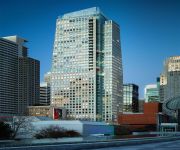
The InterContinental San Francisco is a high-rise hotel at 888 Howard Street in the financial district of San Francisco, California. The 103.63 m 32-story hotel has 550 hotel rooms, and is operated by the InterContinental Hotels Group. The hotel is next to the Moscone West Center, completed in 2003. The hotel opened on February 28, 2008. There is a two-level underground garage and a six-floor podium housing hotel amenities.
W San Francisco
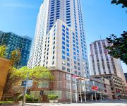
W San Francisco is a 31 floor, 96 m highrise luxury boutique hotel in San Francisco, California located next to the San Francisco Museum of Modern Art and across from Moscone Center. The tower was constructed by Webcor Builders and opened in 1999. The building was the tallest concrete-framed structure in San Francisco until The Paramount was completed three years later.
King Street Garage
The King Street Garage was a nightclub located at 174 King Street in San Francisco, California near the present location of AT&T Park. It was directly adjacent to, and physically connected with, the Club Townsend, another famous club on the other side of the block at 177 Townsend Street. The King Street Garage hosted many clubs, notably the monthly New Wave City dance club which celebrated the best post-punk, synthpop, and new wave music of the 1970s and 1980s.
San Francisco 4th and King Street Station
San Francisco 4th and King Street or 4th and King station (previously known as 4th & Townsend) or Caltrain Depot is the northern terminus of the Caltrain commuter rail line that serves the San Francisco Peninsula and Santa Clara Valley, and is a major regional transit hub. It is also served by the adjacent Muni Metro light rail stations with direct connections to downtown San Francisco and Bay Area Rapid Transit.
Maritime Hall
The Maritime Hall is a historic 3,000 capacity concert hall in San Francisco's South of Market neighborhood that operated from 1995 through 2001 as a popular music venue and nightclub. It was located at 450 Harrison Street (at First Street) at the Sailors Union of the Pacific building.
Consulate General of Mexico, San Francisco
The Consulate-General of Mexico in San Francisco is located on: 532 Folsom Street San Francisco CA. , 94105 USA
Brannan and The Embarcadero Station
Brannan and The Embarcadero Station or simply Brannan is an island platform light rail station of the San Francisco Municipal Railway's Muni Metro system located in the median of The Embarcadero at Brannan Street in South Beach, San Francisco, California.
2nd and King Station
2nd and King Station is an island platform light rail station of the San Francisco Municipal Railway's Muni Metro system located in the median of The Embarcadero at Second Street in Mission Bay, San Francisco, California adjacent to AT&T Park.
Mission Rock Station
The Mission Rock Street Station is an island platform light rail station of the San Francisco Municipal Railway's Muni Metro system located in the median of Third Street at Mission Rock Street in Mission Bay, San Francisco, California.
UCSF Mission Bay Station
The UCSF Mission Bay Station also known as the Gene Friend Way station is a light rail station of the San Francisco Municipal Railway's Muni Metro system located in the median of Third Street at South Street in Mission Bay, San Francisco, California. This station serves the hub of biotech in this district of the city.
Wikimedia Foundation
Wikimedia Foundation, Inc. is an American non-profit charitable organization headquartered in San Francisco, California, United States of America. It is organized under the laws of the state of Florida, where it was initially based. It operates several online collaborative wiki projects including Wikipedia, Wiktionary, Wikiquote, Wikibooks, Wikisource, Wikimedia Commons, Wikispecies, Wikinews, Wikiversity, Wikidata, Wikivoyage, Wikimedia Incubator, and Meta-Wiki.
The Montgomery (San Francisco)
The Montgomery is a residential highrise located at 74 New Montgomery Street in San Francisco, California. The building was designed by the Reid Brothers architects in 1914 and served as headquarters and the offices of newspaper, The San Francisco Call after its building The Call Building was damaged in the great fire. The site was selected for its central location, which quickly became a regional media hub during that time period.
Hosfelt Gallery
Hosfelt Gallery in San Francisco, California was founded in 1996 by Todd Hosfelt to exhibit contemporary international artists working in all media.
Gamesauce
Gamesauce is a full-color trade magazine and on-line portal for the game industry founded in Fall 2009 by Jessica Tams, managing director of the Casual Games Association focusing on the international video game industry. The magazine currently has an international distribution of over 23,000.
Lefty O'Doul Bridge
The Lefty O'Doul Bridge (also known as the Third Street Bridge or China Basin Bridge) is a drawbridge which connects the China Basin and Mission Bay neighborhoods of San Francisco, carrying Third Street across McCovey Cove. It opened in 1933, and was renamed in 1969 in honor of the famous baseball player Lefty O'Doul. The bridge carries five lanes of traffic.


