Safety Score: 2,7 of 5.0 based on data from 9 authorites. Meaning we advice caution when travelling to United States.
Travel warnings are updated daily. Source: Travel Warning United States. Last Update: 2024-08-13 08:21:03
Explore Anza Vista
The district Anza Vista of San Francisco in San Francisco County (California) is located in United States about 2,436 mi west of Washington DC, the country's capital.
If you need a place to sleep, we compiled a list of available hotels close to the map centre further down the page.
Depending on your travel schedule, you might want to pay a visit to some of the following locations: Oakland, San Rafael, Redwood City, Martinez and Napa. To further explore this place, just scroll down and browse the available info.
Local weather forecast
Todays Local Weather Conditions & Forecast: 12°C / 54 °F
| Morning Temperature | 10°C / 51 °F |
| Evening Temperature | 11°C / 52 °F |
| Night Temperature | 10°C / 50 °F |
| Chance of rainfall | 0% |
| Air Humidity | 50% |
| Air Pressure | 1022 hPa |
| Wind Speed | Fresh Breeze with 14 km/h (9 mph) from South-East |
| Cloud Conditions | Clear sky, covering 6% of sky |
| General Conditions | Sky is clear |
Tuesday, 19th of November 2024
11°C (52 °F)
12°C (54 °F)
Overcast clouds, gentle breeze.
Wednesday, 20th of November 2024
14°C (57 °F)
14°C (57 °F)
Light rain, fresh breeze, overcast clouds.
Thursday, 21st of November 2024
14°C (56 °F)
14°C (57 °F)
Light rain, moderate breeze, overcast clouds.
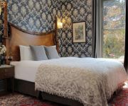
Hotels and Places to Stay
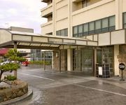
Hotel Kabuki - a Joie de Vivre Boutique Hotel
Hotel Drisco
Hotel Kabuki
Monte Cristo Inn
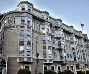
THE HOTEL MAJESTIC
Laurel Inn
JACKSON COURT
QUEEN ANNE HOTEL
PRESIDIO INN
AMERICAS BEST VALUE INN
Videos from this area
These are videos related to the place based on their proximity to this place.
California Motorcycle Ride: San Francisco
Ride with us through San Francisco, California. Starting in Oakland, we head west over the Bay Bridge and arrive at Pier 39, part of Fisherman's Wharf, in San Francisco. Here we take a boat...
The Real Home Tour of 738 Lyon Street San Francisco, CA
738 Lyon is the perfect home for the urban sophisticate. Located behind a beautifully restored Victorian facade is a striking contemporary townhouse, constructed in 2009. A gallery hallway...
LEASED - 1150 Masonic Avenue $14,000
Two large upper levels of newly remodeled space. New Kitchen, 5.5 New Baths, Spacious Living Room, New Hardwood Floors, In Unit Laundry, 11 Real Bedrooms, 3300 Estimated Square feet. Haight.
Lower Haight |1 Bed | Furnished | 1 Bath | Loft | Office | $3.5-4.2K
This spacious and modern 1 bedroom, 1 bathroom loft in the Haight Ashbury is available for a short-stay rental. Sleek in design and a comfortable home. This unit features stainless steel appliances...
Beautiful Sunny Day for A Brief Tour of Haight Street, San Francisco
A Brief tour down Haight Street on board a tour bus.
Golden Gate National Recreation Area - Panasonic Lumix DMC-G2 720p HD Video
Video taken at the Golden Gate National Recreation Area San Francisco, CA August 2011 While waiting for my group to finish, I thought I'd do a quick recording. Not too bad at all with...
San Francisco, California - Alamo Square - Painted Ladies HD (2014)
Alamo Square is a residential neighborhood and park in San Francisco, California, in the Western Addition. Its boundaries are not well-defined, but are generally considered to be Webster Street...
Bike SF: Commute via the Wiggle & Golden Gate Park
Morning commute from Dogpatch to SOMA via Minnesota St, Mariposa St, Mississippi St, 16th St, 15th St, Market St to the Wiggle to Fell St, Golden Gate Park Panhandle and Golden Gate Park out...
Videos provided by Youtube are under the copyright of their owners.
Attractions and noteworthy things
Distances are based on the centre of the city/town and sightseeing location. This list contains brief abstracts about monuments, holiday activities, national parcs, museums, organisations and more from the area as well as interesting facts about the region itself. Where available, you'll find the corresponding homepage. Otherwise the related wikipedia article.
Haight-Ashbury
Haight-Ashbury is a district of San Francisco, California, named for the intersection of Haight and Ashbury streets. It is also called The Haight and The Upper Haight.
The Fillmore
The Fillmore Auditorium is a historic music venue in San Francisco, California, made famous by Bill Graham. Named for its original location at the intersection of Fillmore Street and Geary Boulevard, it is situated in the historical center of the Western Addition neighborhood, on the edge of the Fillmore District and Upper Fillmore (lately known as Lower Pacific Heights).
Painted ladies
"Painted ladies" is a term used for Victorian and Edwardian houses and buildings painted in three or more colors that embellish or enhance their architectural details. The term was first used for San Francisco Victorian houses by writers Elizabeth Pomada and Michael Larsen in their 1978 book Painted Ladies - San Francisco's Resplendent Victorians.
Winterland Ballroom
The Winterland Ballroom, often referred to as Winterland Arena or simply Winterland, was an ice skating rink and 5,400-seat music venue in San Francisco, California. Located at the corner of Post Street and Steiner Street, it was converted to exclusive use as a music venue in 1971 by rock promoter Bill Graham and became a common performance site for many of the most famous rock music artists.
Panhandle (San Francisco)
The Panhandle is a park in San Francisco, California that forms a panhandle with Golden Gate Park. It is long and narrow, being three-quarters of a mile long and one block wide. Fell Street borders it to the north, Oak Street to the south, and Baker Street to the east. Only two streets run through it, Stanyan Street at the western end between it and Golden Gate Park, and Masonic Avenue through the middle.
Haight Street
Haight Street, in San Francisco, is perhaps best known as the principal street in San Francisco's Haight-Ashbury district, also known as Upper Haight. It stretches from Market Street to Stanyan Street, at Golden Gate Park. It is named after California pioneer and exchange banker Henry Haight (1820–1869).
Fillmore West
The Fillmore West was a historic music venue in San Francisco, California made famous by concert promoter Bill Graham. Named after Graham's original "Fillmore" location at the intersection of Fillmore Street and Geary Boulevard, it stood at Market Street and South Van Ness Avenue and was formerly known as both The Carousel Ballroom and El Patio.
The Urban School of San Francisco
The Urban School of San Francisco is a private high school located adjacent to Golden Gate Park in San Francisco, California.
San Francisco University High School
San Francisco University High School (familiarly known as UHS, Uni or simply "University") is an academically focused, college preparatory, private high school located in the Pacific Heights neighborhood of San Francisco, California. The school was established in 1973.
Town School for Boys
Town School for Boys, located in San Francisco, California, is an independent school for boys in the kindergarten through the eighth grade. Started in 1939 by parents from the recently closed privately owned Damon School, the school is currently a preeminent institution for boy's education in San Francisco. Headmaster Brewster Ely frequently addresses his peers and is well respected nationally. The community of approximately 400 boys is divided into 18 classes, two classes in each grade.
University of San Francisco School of Law
The University of San Francisco School of Law (USF Law) is the American Bar Association (ABA) approved law school of the private University of San Francisco, California. Established in 1912, the law school has approximately 700 students. It received ABA approval in 1935. It joined the Association of American Law Schools (AALS) in 1937.
St. Dominic Church in San Francisco
St. Dominic's Church in San Francisco, California, is a Roman Catholic parish situated in the Western Addition neighborhood, located at 2390 Bush St. (at Steiner St.). The parish was established by the Dominican order in 1873, and the current church, built in the Gothic style, was finished in 1928. In addition to a large parish membership, St. Dominic's Church has one of the most active Catholic Young Adults Groups in the Archdiocese of San Francisco.
Negoesco Stadium
Negoesco Stadium is a 3,000 seat soccer stadium located in San Francisco, California, on the campus of University of San Francisco. Named for legendary USF Soccer Coach Steve Negoesco. It is the home field for the men's and women's soccer teams. Negoesco is also the primary home field for the San Francisco Seals of the USL Premier Development League. The stadium is also used by USF students and staff for recreational activities.
Alta Plaza
Alta Plaza is a park in San Francisco, California, USA and caps the top of the western edge of Pacific Heights. It falls under the jurisdiction of the City's Supervisorial District 2. The park is served by several San Francisco Municipal Railway bus lines. Alta Plaza consists of four square blocks at the top of Pacific Heights and overlooks much of San Francisco's Marina and Cow Hollow Districts, the Presidio, Fort Mason and Alcatraz.
University of San Francisco School of Nursing
The University of San Francisco School of Nursing is a private nursing school located in San Francisco, California. First established in 1954, the school has approximately 800 students.
Lone Mountain, San Francisco
Lone Mountain is a hill and neighborhood in San Francisco, California, United States. It is the area immediately surrounding the University of San Francisco (USF) campus, to the south of Laurel Heights. It is bordered by Geary Boulevard to the north, Arguello Boulevard to the west, Masonic Avenue to the east, and Fulton Street to the south. Lone Mountain is one of San Francisco's historic hills.
Harding Theater
The Harding Theater is a historic movie theater located at 616 Divisadero Street in San Francisco, California.
Peoples Temple in San Francisco
The Peoples Temple, the organization at the center of the Jonestown incident, was headquartered in San Francisco, California, from the early to mid-1970s until the Temple's move to Guyana. While the Temple originated in Indiana in the 1950s, after leader Jim Jones predicted an apocalypse that would create a socialist Eden on earth, it moved to Redwood Valley, California in the late 1960s.
Fromm Institute for Lifelong Learning
The Fromm Institute for Lifelong Learning at the University of San Francisco (USF) offers noncredit courses with no assignments or grades for adults age 50 and over with no other objective than the love of learning. Organized in 1976 with support from Hanna and Alfred Fromm, the Institute’s program served as a model for the Osher Lifelong Learning Institutes that have been established at over 120 universities and colleges in the United States.
Rancho San Miguel (Noe)
Rancho San Miguel was a 4,443-acre Mexican land grant in present day San Francisco County, California given in 1845 by Governor Pío Pico to José de Jesús Noé. The grant included what is now known as Eureka Valley and extended past Mount Davidson almost to present day Daly City. The grant encompassed the present-day San Francisco neighborhoods of Noe Valley, the Castro, Glen Park, Diamond Heights, and St. Francis Wood.
War Memorial Gymnasium
The War Memorial Gymnasium in San Francisco, California is an athletic venue on the University of San Francisco campus. It currently serves as home for the USF men's and women's basketball teams as well as the women's volleyball team. It also houses athletic department offices and training facilities for the university's other athletic teams. It is currently the oldest basketball venue in the West Coast Conference.
University of San Francisco
The University of San Francisco (USF) is a Jesuit Catholic university located in San Francisco, California, United States. Founded in 1855, USF was established as the first university in San Francisco. It is the second oldest institution for higher learning in California, the tenth-oldest university of the Association of Jesuit Colleges and Universities, and the eighth largest Jesuit university in the United States.
Santa Maria de Ovila
Santa María de Óvila is a former Cistercian monastery built in Spain beginning in 1181 on the Tagus River near Trillo, Guadalajara, about 90 miles northeast of Madrid. During prosperous times over the next four centuries, construction projects expanded and improved the small monastery. Its fortunes declined significantly in the 1700s, and in 1835 it was confiscated by the Spanish government and sold to private owners who used its buildings to shelter farm animals.
Dante Benedetti Diamond at Max Ulrich Field
Dante Benedetti Diamond at Max Ulrich Field is a baseball venue in San Francisco, California, United States. It is home to the San Francisco Dons baseball team of the NCAA Division I West Coast Conference. Built in 1953, the facility has a capacity of 2,000 spectators. The venue was originally called simply Max Ulrich Field. After its 1953 construction, it was named after Max Ulrich, a San Francisco resident who donated in his will $358,000 to the university.
Huckleberry House
Huckleberry House is a shelter for runaway and homeless teens located in San Francisco, California. It was founded in June 1967 by several churches and the San Francisco Foundation.


