Safety Score: 2,7 of 5.0 based on data from 9 authorites. Meaning we advice caution when travelling to United States.
Travel warnings are updated daily. Source: Travel Warning United States. Last Update: 2024-08-13 08:21:03
Touring Ingleside Heights
Ingleside Heights in San Francisco County (California) is a town located in United States about 2,439 mi (or 3,925 km) west of Washington DC, the country's capital place.
Time in Ingleside Heights is now 02:40 AM (Monday). The local timezone is named America / Los Angeles with an UTC offset of -8 hours. We know of 8 airports nearby Ingleside Heights, of which 4 are larger airports. The closest airport in United States is San Francisco International Airport in a distance of 8 mi (or 13 km), South-East. Besides the airports, there are other travel options available (check left side).
Also, if you like the game of golf, there are several options within driving distance. We collected 10 points of interest near this location. Need some hints on where to stay? We compiled a list of available hotels close to the map centre further down the page.
Being here already, you might want to pay a visit to some of the following locations: San Francisco, Oakland, San Rafael, Redwood City and Martinez. To further explore this place, just scroll down and browse the available info.
Local weather forecast
Todays Local Weather Conditions & Forecast: 12°C / 53 °F
| Morning Temperature | 10°C / 50 °F |
| Evening Temperature | 11°C / 52 °F |
| Night Temperature | 10°C / 50 °F |
| Chance of rainfall | 0% |
| Air Humidity | 56% |
| Air Pressure | 1023 hPa |
| Wind Speed | Fresh Breeze with 16 km/h (10 mph) from South-East |
| Cloud Conditions | Clear sky, covering 8% of sky |
| General Conditions | Sky is clear |
Monday, 18th of November 2024
11°C (53 °F)
12°C (53 °F)
Overcast clouds, moderate breeze.
Tuesday, 19th of November 2024
13°C (56 °F)
14°C (56 °F)
Light rain, strong breeze, overcast clouds.
Wednesday, 20th of November 2024
14°C (57 °F)
14°C (57 °F)
Light rain, fresh breeze, overcast clouds.
Hotels and Places to Stay
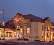
Hampton Inn San Francisco - Daly City CA
THE ALPINE INN
Laurel Inn
Monte Cristo Inn
Beach Motel
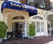
EDWARDIAN SAN FRANCISCO HOTEL
Casa Loma Hotel
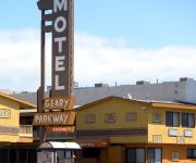
GEARY PARKWAY MOTEL
El Capitan Hotel
Rodeway Inn & Suites San Francisco
Videos from this area
These are videos related to the place based on their proximity to this place.
88 Hillside Apartments - Daly City - Elite - 2 Bedroom
Located in Daly City, CA, 88 Hillside apartments is perfectly positioned as the gateway between nature and the non-stop action of the Bay Area. At 88 Hillside, we have combined the excitement...
88 Hillside Apartments - Daly City - Posh - 2 Bedroom
Located in Daly City, CA, 88 Hillside apartments is perfectly positioned as the gateway between nature and the non-stop action of the Bay Area. At 88 Hillside, we have combined the excitement...
Taco Bell Doritos Locos Tacos Nacho Cheese & Cool Ranch @ Daly City California
Nacho Cheese and Cool Ranch Doritos Locos Tacos at Taco Bell on Mission Street in Daly City, California.
Lion Dancers @ Banana Island Westlake Shopping Center Daly City California
Lion dancers at Banana Island restaurant at Westlake Shopping Center in Daly City, California.
Daly City Chiropractic - Short | Daly City, CA
Call us today at (650) 757-7777. At Daly City Chiropractic Center we specialize in dalycitychiropractic.com - Chiropractic, Physical Therapy, Reflexology, and Massage Therapy. In addition our...
Jollibee Chickenjoy Fried Chicken Corn Rice Gravy @ Daly City California
Jollibee Chickenjoy fried chicken with corn, rice, and gravy on Mission Street in Daly City, California.
Westlake Shopping Center, Daly City, CA in 2000
Westlake Shopping Center before it was renovated. Shot with DV camcorder. Used DVDate to extract timecode and Textsub filter in Virtualdub to display timecode and SimpleSlugUpscale to upscale...
DJI Phantom 2 at Daly City, CA
Flying my DJI this morning at BART Station in Daly City. After I updated RC Firmware it took me a while to make it functional. Finally it's back to work again since last night. So I just test...
BART Daly City to Balboa Park
Another video from Daly City to Balboa Park on BART. This time there's more lighting to see the surroundings.
Videos provided by Youtube are under the copyright of their owners.
Attractions and noteworthy things
Distances are based on the centre of the city/town and sightseeing location. This list contains brief abstracts about monuments, holiday activities, national parcs, museums, organisations and more from the area as well as interesting facts about the region itself. Where available, you'll find the corresponding homepage. Otherwise the related wikipedia article.
Daly City (BART station)
Daly City Station is a Bay Area Rapid Transit station located in extreme northern San Mateo County, California, in suburban Daly City, less than one block outside the San Francisco city and county limits. Interstate 280 and California Route 1 run along the immediate west side of the station.
Krouzian-Zekarian-Vasbouragan Armenian School
Krouzian-Zakarian-Vasbouragan Armenian School is a bi-lingual Elementary school in San Francisco, California. The school is the only Armenian school in Northern California.
San Francisco State University Station
San Francisco State University Station is a major Muni Metro aboveground station located on the median of 19th Avenue at Holloway Avenue, near the station's namesake university. It is served by the M Ocean View line, which runs between Embarcadero Station and Balboa Park Station. Several Muni and SF State Shuttle bus lines also have stops near the station. The next station is Stonestown Galleria Station.
Ocean and Victoria
Ocean and Victoria is a station on the San Francisco Municipal Railway light rail network's K Ingleside line. It is located in the Mount Davidson neighborhood.
19th Avenue and Junipero Serra
19th Avenue and Junipero Serra is a station on the San Francisco Municipal Railway light rail network's M Ocean View line. It is located in the Merced Heights neighborhood.
Randolph and 19th Avenue
Randolph and 19th Avenue is a station on the San Francisco Municipal Railway light rail network's M Ocean View line. It is located in the Merced Heights neighborhood.
Randolph and Arch
Randolph and Arch is a station on the San Francisco Municipal Railway light rail network's M Ocean View line. It is located in the Merced Heights neighborhood.
Randolph and Bright
Randolph and Bright is a station on the San Francisco Municipal Railway light rail network's M Ocean View line. It is located in the Ingleside neighborhood.
Broad and Orizaba
Broad and Orizaba is a station on the San Francisco Municipal Railway light rail network's M Ocean View line. It is located in the Ingleside neighborhood.
Broad and Capitol
Broad and Capitol is a station on the San Francisco Municipal Railway light rail network's M Ocean View line. It is located in the Ingleside neighborhood.
Broad and Plymouth
Broad and Plymouth is a station on the San Francisco Municipal Railway light rail network's M Ocean View line. It is located in the Ingleside neighborhood.
Ingleside Terraces, San Francisco
Ingleside Terraces is an affluent neighborhood of approximately 750 homes built at the former location of the Ingleside Racetrack in the southwestern part of San Francisco. It is adjacent to the Ingleside neighborhood, and is bordered by Ocean Avenue to the north, Ashton Avenue to the east, Holloway Avenue to the south and Junipero Serra Boulevard to the west.


