Safety Score: 2,7 of 5.0 based on data from 9 authorites. Meaning we advice caution when travelling to United States.
Travel warnings are updated daily. Source: Travel Warning United States. Last Update: 2024-08-13 08:21:03
Touring Yaldora
Yaldora in San Diego County (California) is a town located in United States about 2,269 mi (or 3,651 km) west of Washington DC, the country's capital place.
Time in Yaldora is now 06:09 AM (Thursday). The local timezone is named America / Los Angeles with an UTC offset of -8 hours. We know of 9 airports nearby Yaldora, of which 5 are larger airports. The closest airport in United States is San Diego International Airport in a distance of 36 mi (or 59 km), South. Besides the airports, there are other travel options available (check left side).
Also, if you like the game of golf, there are several options within driving distance. We collected 2 points of interest near this location. Need some hints on where to stay? We compiled a list of available hotels close to the map centre further down the page.
Being here already, you might want to pay a visit to some of the following locations: San Diego, Santa Ana, Orange, Riverside and San Bernardino. To further explore this place, just scroll down and browse the available info.
Local weather forecast
Todays Local Weather Conditions & Forecast: 18°C / 64 °F
| Morning Temperature | 14°C / 57 °F |
| Evening Temperature | 15°C / 58 °F |
| Night Temperature | 14°C / 56 °F |
| Chance of rainfall | 0% |
| Air Humidity | 42% |
| Air Pressure | 1020 hPa |
| Wind Speed | Gentle Breeze with 9 km/h (5 mph) from South-East |
| Cloud Conditions | Clear sky, covering 0% of sky |
| General Conditions | Sky is clear |
Thursday, 21st of November 2024
17°C (62 °F)
14°C (57 °F)
Sky is clear, gentle breeze, clear sky.
Friday, 22nd of November 2024
16°C (62 °F)
16°C (61 °F)
Sky is clear, gentle breeze, clear sky.
Saturday, 23rd of November 2024
17°C (62 °F)
16°C (60 °F)
Light rain, light breeze, scattered clouds.
Hotels and Places to Stay
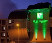
Holiday Inn OCEANSIDE CAMP PENDLETON AREA
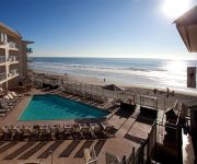
BEACH TERRACE INN
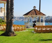
OCEANSIDE MARINA SUITES
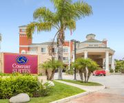
Comfort Suites Oceanside Marina
BEST WESTERN OCEANSIDE INN
SUPER 8 OCEANSIDE MARTY'S VALL
SpringHill Suites San Diego Oceanside/Downtown
WYNDHAM OCEANSIDE PIER RESORT
La Quinta Inn San Diego Oceanside
Motel 6 Oceanside Marina
Videos from this area
These are videos related to the place based on their proximity to this place.
Holiday Inn Oceanside Shake
Holiday Inn Oceanside Marina staff Celebrate Service with a Harlem Shake.
Meg & Jayme's Wedding at Del Mar Beach Resort Camp Pendleton, CA
www.belladivaphoto.com Photography: BellaDiva Photography Venue: Del Mar Beach Resort - Camp Pendleton, CA.
Biking on Interstate 5 North at night
Entrance at Harbor Dr. in Oceanside, part of the return trip of a 210 mile Anaheim to Downtown San Diego and back ride. Daytime Southbound shot here: http://www.youtube.com/watch?v=B56kuzl7ib8.
4th Of July AH-1W Super Cobra Flyover and Fireworks at MCB Camp Pendleton.
Shown is a flight of four AH-1W Super Cobra's from HMLA-367 returning home to Camp Pendleton after doing flyovers for several Orange County Communities. Following is a shortened version of...
Santa Fe #3751 Steams Through San Diego County 9-21-08
On September 21, 2008 a vintage steam locomotive pulled privately owned rail carriages from LA to San Diego. We captured portions of the journey through Dan Diego County. 15 fps.
marine core platoon 3210
my best friends older brother when he was in boot camp. 1st Class Matt Cusolito top row second to last.
Videos provided by Youtube are under the copyright of their owners.
Attractions and noteworthy things
Distances are based on the centre of the city/town and sightseeing location. This list contains brief abstracts about monuments, holiday activities, national parcs, museums, organisations and more from the area as well as interesting facts about the region itself. Where available, you'll find the corresponding homepage. Otherwise the related wikipedia article.
Camp Pendleton South, California
Camp Pendleton South is a census-designated place (CDP) in San Diego County, California, located at the southwest corner of the Marine Corps Base Camp Pendleton. The population was 10,616 at the 2010 census, up from 8,854 at the 2000 census.
Oceanside High School
Oceanside High School (California) is an American public secondary school located in Oceanside, California. It is part of the Oceanside Unified School District.
Mount Ecclesia
Mount Ecclesia is the location of the international headquarters of the fraternal and service organization The Rosicrucian Fellowship (TRF), located on grounds in Oceanside, California. It is also the location of its spiritual temple, called "The Ecclesia", situated upon the promontory of a high mesa overlooking the San Luis Rey River Valley and the Franciscan Mission San Luis Rey de Francia founded in 1798.
Oceanside Transit Center
The Oceanside Transit Center, usually referred to as simply Oceanside, is a major railway interchange in Oceanside, California, serving both intercity and suburban/commuter services. The station is used by Amtrak on the route of its Pacific Surfliner service between San Diego and San Luis Obispo.
Oceanside Pier
The Oceanside Pier, located in Oceanside, in northern San Diego County, California, is a wooden pier on the western United States coastline at 1,954 feet .
Oceanside Municipal Airport
Oceanside Municipal Airport is a public airport located two miles (3 km) northeast of the central business district of Oceanside, a city in San Diego County, California. The airport covers 43 acres and has one runway. It is mostly used for general aviation. The airport is operated and managed by Airport Property Ventures. Although most U.S. airports use the same three-letter location identifier for the FAA and IATA, Oceanside Municipal Airport is assigned OKB by the FAA and OCN by the IATA.
WWII/Korea LVT Museum
The WWII/Korea LVT Museum is located in a Quonset hut style building at Camp Del Mar, Marine Corps Base Camp Pendleton, California near the Assault Amphibian School Battalion Training Command. It houses exhibits on landing vehicles tracked (LVT)s from World War II and the Korean War including six vintage models used by the U. S. Marine Corps. The museum highlights the service of the "Alligator" Marines during the amphibious assaults of World War II and the Korean War.
Crouch Street (NCTD station)
Crouch Street is a station in Oceanside, California that is served by North County Transit District's Sprinter light rail line. The station is located at 609 Crouch Street.


