Safety Score: 2,7 of 5.0 based on data from 9 authorites. Meaning we advice caution when travelling to United States.
Travel warnings are updated daily. Source: Travel Warning United States. Last Update: 2024-08-13 08:21:03
Touring University Heights
University Heights in San Diego County (California) is a town located in United States about 2,268 mi (or 3,649 km) west of Washington DC, the country's capital place.
Time in University Heights is now 02:31 AM (Thursday). The local timezone is named America / Los Angeles with an UTC offset of -8 hours. We know of 9 airports nearby University Heights, of which 5 are larger airports. The closest airport in United States is San Diego International Airport in a distance of 3 mi (or 5 km), South-West. Besides the airports, there are other travel options available (check left side).
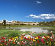
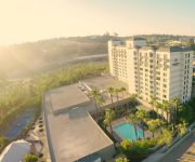
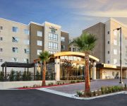
Also, if you like the game of golf, there are several options within driving distance. We collected 4 points of interest near this location. Need some hints on where to stay? We compiled a list of available hotels close to the map centre further down the page.
Being here already, you might want to pay a visit to some of the following locations: San Diego, Ensenada, Riverside, Santa Ana and Orange. To further explore this place, just scroll down and browse the available info.
Local weather forecast
Todays Local Weather Conditions & Forecast: 19°C / 66 °F
| Morning Temperature | 15°C / 59 °F |
| Evening Temperature | 18°C / 64 °F |
| Night Temperature | 16°C / 60 °F |
| Chance of rainfall | 0% |
| Air Humidity | 38% |
| Air Pressure | 1020 hPa |
| Wind Speed | Gentle Breeze with 8 km/h (5 mph) from South-East |
| Cloud Conditions | Clear sky, covering 0% of sky |
| General Conditions | Sky is clear |
Thursday, 21st of November 2024
18°C (64 °F)
16°C (60 °F)
Sky is clear, gentle breeze, clear sky.
Friday, 22nd of November 2024
18°C (64 °F)
17°C (63 °F)
Sky is clear, gentle breeze, clear sky.
Saturday, 23rd of November 2024
18°C (64 °F)
17°C (63 °F)
Light rain, gentle breeze, broken clouds.
Hotels and Places to Stay
Town and Country San Diego
GLOBETROT CORPORATE HOUSING
Hilton San Diego Mission Valley
DoubleTree by Hilton Hotel San Diego - Mission Valley
San Diego Marriott Mission Valley
Homewood Suites by Hilton San Diego Mission Valley-Zoo
Courtyard San Diego Mission Valley/Hotel Circle
INN AT THE PARK
Sunshine Suites at Hillcrest
The Lafayette Hotel Swim Club & Bungalows
Videos from this area
These are videos related to the place based on their proximity to this place.
2014-12-09 HBIA Board of Directors Meeting
+ Original agenda located at this link, http://hillcrestbia.org/wp-content/uploads/2011/10/Binder118.pdf - text of this agenda follows below + Time stamps from the video are presented in =00:00=...
New York Buffalo Wings 2940 El Cajon Blvd, San Diego, CA 92104 619-501-8674
For the BEST New York Buffalo Wings, Ribs, Salads, Chicken Strips, Chipotle Fries, Bread Sticks, Onion Rings, Macaroni Salad, Jalepeno Poppers, Strawberry Cheese Cake. Located in North Park...
A Path to College in City Heights
City Heights is one of the most diverse communities in San Diego, and many young people in this community do not make it to college. One organization in City Heights is making a difference...
Urban XC Balboa Park 2009 Racers and Chasers_0001.wmv
12-19-2009 My first Mountain Bike Race - a Cross Country Race in Balboa Park - San Diego, CA. Hosted by Racers and Chasers (www.racersandchasers.com) Track was 5 miles/lap.
Slip 'n Slide at the 2010 CIF-San Diego Section Cross Country Championships
All day rain and all day running will make for a muddy track at Balboa Park's Morley Field and by the time the CIF-SDS cross country boys' division I race began yesterday around 1 pm the track...
San Diego's Hidden Treasures Presents: North Park
Take a glimpse at one of San Diego's best neighborhoods! Whether you're looking for culture, restaurants, parks, bars, cafe's or just a great place to live, North Park has it all! Brought...
North Park EcoDistrict 2013/2014
The North Park EcoDistrict Project has made a huge impact throughout 2013 within the North Park Community. This initiative is the first EcoDistrict community in all of San Diego, and many highlight...
Travelblog: A Walk Through North Park, San Diego CA
Walking east on Upas Street and North on 30th Streeet.
3950 Ohio Street Condo - La Boheme - North Park
A truly unique home in hip, trendy North Park. Nearly New living area upstairs and a little something 'extra' on the ground floor, perfect for a home office or an entertainment space. Two parking...
Videos provided by Youtube are under the copyright of their owners.
Attractions and noteworthy things
Distances are based on the centre of the city/town and sightseeing location. This list contains brief abstracts about monuments, holiday activities, national parcs, museums, organisations and more from the area as well as interesting facts about the region itself. Where available, you'll find the corresponding homepage. Otherwise the related wikipedia article.
The Academy of Our Lady of Peace
Academy of Our Lady of Peace (locally called "OLP"), is a Catholic high school for young women in San Diego, started by the Sisters of St. Joseph of Carondelet (CSJ). Located in the Roman Catholic Diocese of San Diego, OLP's mission statement is as follows: "to assist and enable parents to fulfill their role as the primary educators, and to inspire its students to grow as committed Christians who are building Christ’s kingdom of justice, love and peace.
North Park, San Diego
North Park is a neighborhood in San Diego, California, USA. It is situated to the northeast of Balboa Park, bounded on the north by the canyons overlooking Mission Valley, on the south by Switzer Canyon and the South Park neighborhood, on the east by Interstate 805 and City Heights, and on the west by Florida Canyon, University Heights and Hillcrest. The pre-Interstate 805 boundary of North Park was widely considered to be 35th Street, which is now part of City Heights.
Dryden Historic District (San Diego)
The North Park Dryden Historic District is a historic district in North Park, San Diego, 92104, along both 28th and Pershing Streets (bordered to the south by Upas Street and to the north by Landis Street) that features a high concentration of homes designed and built by the renowned Arts and Crafts era architect/builder David Owen Dryden.
Lafayette Hotel & Suites in San Diego
The Lafayette Hotel and Suites is a hotel in San Diego, California that opened 01946-07-01July 1, 1946. It was listed on the National Register of Historic Places 02012-07-31July 31, 2012. The Lafayette's original name was Imig Manor, owned by local entrepreneur Larry Imig. The LaFayette was originally built at a cost of $2 million on El Cajon Boulevard. When Imig Manor opened in 1946, its first guest was Bob Hope; other celebrities followed.
Marjorie Cook Education Center
Marjorie Cook Education Center is a school based in San Diego, California. It is affiliated with the Institute for Effective Education.
El Cajon Boulevard
El Cajon Boulevard is a major east–west thoroughfare through San Diego, La Mesa and El Cajon, California. Before the creation of Interstate 8 it was the principal automobile route from San Diego to El Cajon, the Imperial Valley, and points east.
Mission Valley Center (San Diego Trolley station)
Mission Valley Center is a station on San Diego Trolley's Green Line and Special Event Service Line. The street-level station has side platforms. It is located near Camino De La Reina between Mission Center Road and Camino Del Este. The station is located next to the Westfield Mission Valley mall and serves a massive commercial corridor in the Mission Valley East neighborhood.
The Linkery
The Linkery is a farm-to-table restaurant in North Park, San Diego, California that specializes in natural meat, local food, fine wines, craft beer, and cask ale. The restaurant's name refers to their daily-changing offerings of house-made sausages. The Linkery was founded in 2005 by Jay Porter, a former engineer and consultant for consumer electronics companies with no prior restaurant experience.
Hazard Memorial Bridge
The Adams Avenue Bridge or Roscoe E. Hazard Memorial Bridge in the Normal Heights area of San Diego, California, is an arch bridge that carries Adams Avenue over Interstate 805. Under Senate Concurrent Resolution 67, it was named after the rancher who was involved in construction of several roads and highways in Southern California, especially in San Diego. The bridge was built in 1970, around the same time that the freeway below was constructed.
Mickie Finn's
For the variety television series, see Mickie Finn's (TV series). Mickie Finn's (also known as Mickey Finn's) was the creation of piano player Fred E. Finn, who developed the concept in several different forms: a 1960s nightclub in San Diego, a television show on NBC in 1966, a series of compilation record albums issued from 1966 on, and a stageshow continuing on into the 21st century.
Ray Street Arts District
The Ray Street Arts District is an arts district in the North Park neighborhood of San Diego, California.
Shirley Ann Place
The Shirley Ann Place Historic District is located in the University Heights neighborhood of San Diego, California. The block between Madison Ave. and Monroe Ave. was designated a historic district by the City of San Diego for its 1920s Spanish Colonial Revival bungalows.


