Safety Score: 2,7 of 5.0 based on data from 9 authorites. Meaning we advice caution when travelling to United States.
Travel warnings are updated daily. Source: Travel Warning United States. Last Update: 2024-08-13 08:21:03
Explore South Park
The district South Park of San Diego in San Diego County (California) is located in United States about 2,268 mi west of Washington DC, the country's capital.
If you need a place to sleep, we compiled a list of available hotels close to the map centre further down the page.
Depending on your travel schedule, you might want to pay a visit to some of the following locations: Ensenada, Riverside, Santa Ana, Orange and San Bernardino. To further explore this place, just scroll down and browse the available info.
Local weather forecast
Todays Local Weather Conditions & Forecast: 19°C / 66 °F
| Morning Temperature | 15°C / 59 °F |
| Evening Temperature | 18°C / 64 °F |
| Night Temperature | 16°C / 60 °F |
| Chance of rainfall | 0% |
| Air Humidity | 38% |
| Air Pressure | 1020 hPa |
| Wind Speed | Gentle Breeze with 8 km/h (5 mph) from South-East |
| Cloud Conditions | Clear sky, covering 0% of sky |
| General Conditions | Sky is clear |
Friday, 22nd of November 2024
18°C (64 °F)
16°C (60 °F)
Sky is clear, gentle breeze, clear sky.
Saturday, 23rd of November 2024
18°C (64 °F)
17°C (63 °F)
Sky is clear, gentle breeze, clear sky.
Sunday, 24th of November 2024
18°C (64 °F)
17°C (63 °F)
Light rain, gentle breeze, broken clouds.
Hotels and Places to Stay
Marriott Vacation Club Pulse San Diego
Andaz San Diego - a concept by Hyatt
TownePlace Suites San Diego Downtown
Courtyard San Diego Downtown
Carole's Bed & Breakfast
Tripbz San Diego
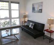
Stylish Suites in San Diego East Village
TRAVELODGE SAN DIEGO DOWNTOWN
10th Avenue Apartment by Stay Alfred
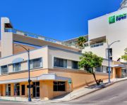
Holiday Inn Express SAN DIEGO DOWNTOWN
Videos from this area
These are videos related to the place based on their proximity to this place.
Giant Baby Panda 2012 It's a Boy! San Diego Zoo
What's black & white and fuzzy all over? A Giant Baby Panda! On Sunday, July 29 at a little after 11 am PST the giant panda team at the San Diego Zoo observed signs of labor in Bai Yun, a...
Free Salsa Dancing Lessons at Cafe Sevilla Restaurant in Gaslamp, San Diego
Hi my name is Lolly and I started LOLwithLolly, an inspirational show. http://wwwlolwithlolly.com Tonight I am going to show you, the free Salsa dancing lessons Cafe Sevilla has on Thursday...
Explore the Art Museums of San Diego's Balboa Park
Join SanDiego.org as we explore San Diego's historic Balboa Park, the largest urban park with cultural institutions in the United States. Spend the day or two exploring the 1200 acre park...
Rock 'n' Roll Marathon San Diego CA 2013
Rock 'n' Roll Marathon and 1/2 Marathon San Diego CA June 2, 2013 http://runrocknroll.competitor.com/san-diego Location: mile 1 and mile 25 Bernard Koech (bib 202) 58min41sec half marathon...
Young Scientists - Preschool Science Program
We had fun at the Reuben H. Fleet Science Center, with week one of our Winter Wonderland session for Young Scientists. We made some snow globes, snow men, snow angels and all sorts of other...
House Flipping with The Painted Lady
Here's our 2011 restoration of a 1909 Victorian Gingerbread we call "The Painted Lady " Green Button Homes, San Diego's best renovation company, specializing in historic restorations. This...
Wine Bearer the Premium in Bottle Protection for Travel Darrell L. Grant
Protection for your wine & all bottle goods while traveling.
A Trip Around The San Diego Rose Garden in Balboa Park
A scenic cruise around the San Diego Rose Garden in Balboa Park.
The Old Cactus Garden in Balboa Park, ,San diego CA
there are 2 cactus gardens, this one, and over the bridge to Park Blvd.
San Diego E19 & Rural/Metro M12 Responding
San Diego Fire-Rescue Department Engine 19 and Rural/Metro Medic 12 responding to a medical aid. 12-01-2014 San Diego, California. Additional Information: Both the engine and the ambulance...
Videos provided by Youtube are under the copyright of their owners.
Attractions and noteworthy things
Distances are based on the centre of the city/town and sightseeing location. This list contains brief abstracts about monuments, holiday activities, national parcs, museums, organisations and more from the area as well as interesting facts about the region itself. Where available, you'll find the corresponding homepage. Otherwise the related wikipedia article.
Balboa Stadium
Balboa Stadium is a football and soccer stadium located at 1405 Park Boulevard in San Diego, California, just east of San Diego High School. The original stadium was built in 1914 as part of the 1915 Panama-California Exposition, also in Balboa Park, with a capacity of 19,000. It was designed by the Quayle Brothers architectural firm and originally called City Stadium. It was expanded to 34,000 capacity and served as the home stadium for the San Diego Chargers from 1961-66.
St. Augustine High School (San Diego)
St. Augustine High School is a private Catholic high school for young men under the direction of the Order of Saint Augustine located in the North Park district of San Diego, California and founded in 1922. It is located in the Roman Catholic Diocese of San Diego. Named after Saint Augustine of Hippo, an early Christian theologian, St. Augustine teaches young men within the framework of the Catholic faith and in the Augustinian tradition.
North Park, San Diego
North Park is a neighborhood in San Diego, California, USA. It is situated to the northeast of Balboa Park, bounded on the north by the canyons overlooking Mission Valley, on the south by Switzer Canyon and the South Park neighborhood, on the east by Interstate 805 and City Heights, and on the west by Florida Canyon, University Heights and Hillcrest. The pre-Interstate 805 boundary of North Park was widely considered to be 35th Street, which is now part of City Heights.
Reuben H. Fleet Science Center
The Reuben H. Fleet Science Center is a science museum and planetarium in Balboa Park in San Diego, California. Established in 1973, it was the first science museum to combine interactive science exhibits with a planetarium and an IMAX Dome (OMNIMAX) theater, setting the standard that most major science museums follow today.
Zoro Garden Nudist Colony
Zoro Gardens Nudist Colony was an attraction at the 1935-36 Pacific International Exposition in Balboa Park in San Diego, California. It was located in Zoro Garden, a sunken garden originally created for the 1915-16 Panama-California Exposition. Billed as a nudist colony, it was populated by hired performers rather than actual practicing nudists. The women wore only G-strings; the men wore loincloths or trunks.
Balboa Park Gardens
Balboa Park Gardens are cultivated areas of Balboa Park in San Diego, California.
Golden Hill, San Diego
Golden Hill is a neighborhood of San Diego, California. It is located south of Balboa Park, north of Sherman Heights/Highway 94 (M. L. King, Jr. Freeway), and east of Downtown. Golden Hill is one of San Diego's most historic and architecturally eclectic zones, with many pre-1900 homes and apartments.
South Park, San Diego
South Park is a neighborhood in San Diego, California located east of Balboa Park, and borne out of its southern neighbor Golden Hill. "South Park" is also north of Grant Hill and south of North Park, the boundary being Juniper Street.
San Diego Model Railroad Museum
The San Diego Model Railroad Museum is a model railroad exhibit in San Diego, California. At 27,000 sq. ft. , it is the largest indoor such exhibit in North America, and one of the largest in the world. The museum is on the lower level of the Casa de Balboa on the Prado in Balboa Park. Nearly 3 million people have passed through the center since it opened in 1982.
San Diego Natural History Museum
The San Diego Natural History Museum is a museum located in Balboa Park in San Diego, California. It was founded in 1874 as the San Diego Society of Natural History. It is the third oldest scientific institution west of the Mississippi and the oldest in Southern California. The present location of the museum was dedicated on January 14, 1933. A major addition to the museum was dedicated in April 2001, doubling exhibit space.
Gateway, San Diego
Gateway is a neighborhood of the Mid-City region of San Diego, California.
Albert Einstein Academy Charter School
Albert Einstein Academy Charter School is an IB Primary Years Programme-certified charter school within the San Diego Unified School District. Established in 2002, it is the only school in the district authorized as an IB-PYP school. The school serves grades kindergarten through 8th grade. It is actually chartered as two schools: an elementary school (K-5) of about 300 students and a middle school (6-8) of about 250 students. It is accredited by the Western Association of Schools and Colleges.
Naval Medical Center San Diego
Naval Medical Center San Diego (NMCSD), also known as Bob Wilson Naval Hospital and informally referred to as "Balboa Hospital", is a technologically advanced Navy medical treatment facility. Located within the grounds of Balboa Park in San Diego, the hospital has played a role in the history of San Diego for more than 80 years. The goal has remained constant, to provide the finest medical care in a family-centered care environment to operational forces, their families, and veterans.
Mount Hope Cemetery (San Diego, California)
Mount Hope Cemetery is a municipal cemetery located at 3751 Market Street, San Diego, California, and gives its name to the neighborhood of Mount Hope. The cemetery is adjacent to Greenwood Memorial Park. Founded in 1869, on what was then the outskirts of New Town, Mount Hope now covers approximately 115 acres . The design of the cemetery is an example of a Rural cemetery, with architecture, art, and landscaping.
Pacific Fleet (San Diego Trolley station)
Pacific Fleet is a station of the Blue Line on the San Diego Trolley. It is located at the edge of Naval Base San Diego, an important US Naval station. The primary purpose of the stop is to provide civilian workers with transportation to the facility and military personnel with access to downtown.
25th & Commercial (San Diego Trolley station)
25th & Commercial is a station of the Orange Line on the San Diego Trolley. It is located in the Grant Hill section of the city, a working class, Hispanic neighborhood. The stop has been dedicated to Hispanic civil rights leader Cesar Chavez. This station was closed from May 16 until August 2012 as part of the Trolley Renewal Project, during which a temporary stop was erected west of 24th Street to serve the area.
32nd & Commercial (San Diego Trolley station)
32nd & Commercial is a station of the Orange Line on the San Diego Trolley. It is located in the Stockton neighborhood of the city, a working class, Hispanic neighborhood. The stop is located in an area where the light rail temporarily breaks from its street-level tracks and runs on a separate grade around the Mt. Hope and Greenwood Cemeteries. This station is currently undergoing renovation as part of the Trolley Renewal Project.
Burlingame, San Diego
Burlingame is a neighborhood in San Diego, California bordered by North Park to the North and East, and by South Park to the South, although over the last decade Burlingame has increasingly been considered a sub-neighborhood of South Park. 30th Street forms the Western boundary.
Grant Hill, San Diego
Grant Hill is a neighborhood in San Diego, California bordered by Golden Hill to the North, Stockton to the East, Sherman Heights to the West, and Logan Heights to the South. 30th Street connects Grant Hill to the neighborhood of Golden Hill.
Sherman Heights, San Diego
Sherman Heights is a neighborhood in San Diego bordered by Golden Hill to the north, Grant Hill to the east, East Village to the west, and Logan Heights to the south. The Sherman Heights neighborhood has the following roadways as boundaries: Highway 94 to the north, 25th Street to the east, Imperial Avenue to the south, and Interstate 5 to the west.
Stockton, San Diego
Stockton is a neighborhood in San Diego, California bordered by Golden Hill to the North, Mountain View and Mt. Hope to the East, Grant Hill to the West, and Logan Heights to the South. I-15 forms the Eastern boundary.
Veterans Museum and Memorial Center
The Veterans Museum and Memorial Center is a museum located in historic Balboa Park of San Diego, California. Founded in 1989, it is dedicated to create, maintain, and operate an institution to honor and perpetuate the memories of all men and women who have served in the Armed Forces of the United States of America. The museum currently resides in the former Chapel of the Old Balboa Naval Hospital.
Switzer Canyon
Switzer Canyon is a canyon in San Diego, California. It is situated to the east of Balboa Park and serves as the boundary between the neighborhoods of North Park and South Park in Central San Diego. Switzer Canyon remains an oasis of natural vegetation between some of the city's most urban neighborhoods and is a prime example of San Diego county's unique canyon-laced topography.
Balboa Park (San Diego)
Balboa Park is a 1,200-acre urban cultural park in San Diego, California. In addition to open space areas, natural vegetation green belts, gardens and walking paths, it contains museums, several theaters, and the world-famous San Diego Zoo. There are also many recreational facilities and several gift shops and restaurants. Placed in reserve in 1835, the park's site is one of the oldest in the United States dedicated to public recreational use.
Zoro Garden
Zoro Garden is a 6-acre sunken garden within Balboa Park in San Diego, California. It is located between the Reuben H. Fleet Science Center and the Casa de Balboa. The name refers to the Persian mystic Zoroaster. The stone garden was originally built for the 1915-16 Panama-California Exposition. During the 1935-36 California Pacific International Exposition it was the site of the Zoro Garden Nudist Colony, which featured mostly-nude performers rather than practicing nudists.


