Safety Score: 2,7 of 5.0 based on data from 9 authorites. Meaning we advice caution when travelling to United States.
Travel warnings are updated daily. Source: Travel Warning United States. Last Update: 2024-08-13 08:21:03
Delve into Logan Heights
The district Logan Heights of San Diego in San Diego County (California) is a subburb in United States about 2,269 mi west of Washington DC, the country's capital town.
If you need a hotel, we compiled a list of available hotels close to the map centre further down the page.
While being here, you might want to pay a visit to some of the following locations: Ensenada, Santa Ana, Riverside, Orange and San Bernardino. To further explore this place, just scroll down and browse the available info.
Local weather forecast
Todays Local Weather Conditions & Forecast: 18°C / 64 °F
| Morning Temperature | 14°C / 57 °F |
| Evening Temperature | 17°C / 62 °F |
| Night Temperature | 16°C / 60 °F |
| Chance of rainfall | 0% |
| Air Humidity | 63% |
| Air Pressure | 1020 hPa |
| Wind Speed | Light breeze with 5 km/h (3 mph) from North-East |
| Cloud Conditions | Broken clouds, covering 82% of sky |
| General Conditions | Broken clouds |
Wednesday, 4th of December 2024
18°C (64 °F)
16°C (61 °F)
Sky is clear, light breeze, clear sky.
Thursday, 5th of December 2024
19°C (66 °F)
16°C (61 °F)
Sky is clear, gentle breeze, clear sky.
Friday, 6th of December 2024
19°C (66 °F)
18°C (64 °F)
Sky is clear, gentle breeze, clear sky.
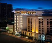
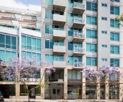
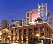
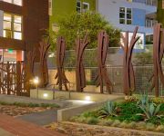
Hotels and Places to Stay
Hilton San Diego Bayfront
Pendry San Diego LVX
San Diego Marriott Gaslamp Quarter
Hotel Indigo SAN DIEGO-GASLAMP QUARTER
Residence Inn San Diego Downtown/Gaslamp Quarter
Courtyard San Diego Gaslamp/Convention Center
10th Avenue Apartment by Stay Alfred
Hard Rock Hotel San Diego
Stylish Suites in San Diego East Village
Residence Inn San Diego Downtown/Bayfront
Videos from this area
These are videos related to the place based on their proximity to this place.
Free Salsa Dancing Lessons at Cafe Sevilla Restaurant in Gaslamp, San Diego
Hi my name is Lolly and I started LOLwithLolly, an inspirational show. http://wwwlolwithlolly.com Tonight I am going to show you, the free Salsa dancing lessons Cafe Sevilla has on Thursday...
House Flipping with The Painted Lady
Here's our 2011 restoration of a 1909 Victorian Gingerbread we call "The Painted Lady " Green Button Homes, San Diego's best renovation company, specializing in historic restorations. This...
San Diego E19 & Rural/Metro M12 Responding
San Diego Fire-Rescue Department Engine 19 and Rural/Metro Medic 12 responding to a medical aid. 12-01-2014 San Diego, California. Additional Information: Both the engine and the ambulance...
30 Foot Print on 54 inch Roland VP-540 Printer
Sign for Sunglass & Optical Banner print Large format print back lit sign. We used a Roland VP 540 with Eco-Sol Max ink.
Resident Testimonial | Bralin Roberts on Pacific Beacon
Bralin Roberts shares his enthusiasm for living at Pacific Beacon.
1996 XJ Cherokee Basic Mods
My 1996 Cherokee some basic mods VHT Nightshades spray tint $7 thru O'reillys or Autozone OEM Taillights $75 thru DEPO Black HID Headlights $175 thru Dash Z Racing AFE Intake $350 thru Off...
How I make my Luminous Views
This is a short video explaining my process. Please check out my Luminous-Views. http://www.luminous-views.com/log/?p=146.
San Diego Trolley Passes at Harbor Dr. x Schley St.
January 16, 2013 12:18pm Filmed by Ray Roman in San Diego, CA. Waiting for the Trolley to pass at the corner of Harbor Drive and Schley Street in Barrio Logan Subscribe to Ray Roman Raw on...
Artistic Wrought Iron - Intro Video
http://www.artisticwroughtiron.net (619) 851-9786 Artistic Wrought Iron specializes in creating beautifully forged iron gates, railings, driveway gates, wine racks, fireplace screens, chandeliers...
Solar powered heliostat brings sunlight anywhere. Get yours at YourSolarLink.com
Get yours at http://www.yoursolarlink.com/solar-products/sunflower-heliostat The Sunflower Home Heliostat is an affordable day-lighting option that can bring natural light into your home and...
Videos provided by Youtube are under the copyright of their owners.
Attractions and noteworthy things
Distances are based on the centre of the city/town and sightseeing location. This list contains brief abstracts about monuments, holiday activities, national parcs, museums, organisations and more from the area as well as interesting facts about the region itself. Where available, you'll find the corresponding homepage. Otherwise the related wikipedia article.
Naval Base San Diego
Naval Base San Diego is the largest base of the United States Navy on the west coast of the United States, in San Diego, California. Naval Base San Diego is the principal homeport of the Pacific Fleet, consisting of 54 ships and over 120 tenant commands. The base is composed of 13 piers stretched over 977 acres of land and 326 acres of water. The total on base population is 20,000 military personnel and 6,000 civilians.
National Steel and Shipbuilding Company
National Steel and Shipbuilding Company, commonly referred to as NASSCO, is an American shipbuilding company with two shipyards located in San Diego, California and Norfolk, Virginia. It is a division of General Dynamics. The San Diego shipyard specializes in constructing commercial cargo ships and auxiliary vessels for the US Navy and Military Sealift Command; it is the largest new-construction shipyard on the West Coast of the United States.
Chicano Park
Chicano Park is a 32,000 square meter park located beneath the San Diego-Coronado Bridge in Barrio Logan, a predominantly Mexican American and Mexican-immigrant community in central San Diego, California. The park is home to the country's largest collection of outdoor murals (72), as well as various sculptures, earthworks, and an architectural piece dedicated to the cultural heritage of the community.
Barrio Logan, San Diego
Barrio Logan is a neighborhood in San Diego, California bordered by East Village and Logan Heights to the North, Shelltown and Southcrest to the East, San Diego Bay to the West, and National City to the South. I-5 forms the Northeastern boundary.
KBNT-CD
KBNT-CD is the low-powered Univision-affiliated television station in San Diego, California. It broadcasts a high definition digital signal on UHF channel 25 from a transmitter in La Jolla. Its signal is relayed on low-powered KTCD-LP in San Diego and KHAX-LP in Vista. Operated by Entravision Communications Corporation, it is sister to MyNetworkTV affiliate XHDTV-TV, Telefutura affiliate KDTF-LD and Telemundo affiliate XHAS-TV.
Golden Hill, San Diego
Golden Hill is a neighborhood of San Diego, California. It is located south of Balboa Park, north of Sherman Heights/Highway 94 (M. L. King, Jr. Freeway), and east of Downtown. Golden Hill is one of San Diego's most historic and architecturally eclectic zones, with many pre-1900 homes and apartments.
South Park, San Diego
South Park is a neighborhood in San Diego, California located east of Balboa Park, and borne out of its southern neighbor Golden Hill. "South Park" is also north of Grant Hill and south of North Park, the boundary being Juniper Street.
Lane Field (baseball)
Lane Field is a former baseball stadium located in San Diego, California. The ballpark was home to the San Diego Padres of the Pacific Coast League from 1936 through 1957. The ballpark was located in downtown San Diego, at the end of West Broadway near the waterfront. Broadway bounded the park to the south (first base). Its other two close bounding streets were Harbor Drive (third base) and Pacific Highway (right field).
New Chargers Stadium
The New Chargers Stadium is the working name of a proposed NFL football stadium that would house the San Diego Chargers football team, replacing Qualcomm Stadium as the franchise's home venue.
Balboa Elementary School
Balboa Elementary School is an elementary school that serves students in Kindergarten through sixth grade in the Shelltown neighborhood of San Diego, California, United States, as part of the San Diego City Schools.
Albert Einstein Academy Charter School
Albert Einstein Academy Charter School is an IB Primary Years Programme-certified charter school within the San Diego Unified School District. Established in 2002, it is the only school in the district authorized as an IB-PYP school. The school serves grades kindergarten through 8th grade. It is actually chartered as two schools: an elementary school (K-5) of about 300 students and a middle school (6-8) of about 250 students. It is accredited by the Western Association of Schools and Colleges.
Mount Hope Cemetery (San Diego, California)
Mount Hope Cemetery is a municipal cemetery located at 3751 Market Street, San Diego, California, and gives its name to the neighborhood of Mount Hope. The cemetery is adjacent to Greenwood Memorial Park. Founded in 1869, on what was then the outskirts of New Town, Mount Hope now covers approximately 115 acres . The design of the cemetery is an example of a Rural cemetery, with architecture, art, and landscaping.
Barrio Logan (San Diego Trolley station)
Barrio Logan is a station of the Blue Line on the San Diego Trolley. It is located in the Logan Heights section of the city and serves the corresponding Hispanic neighborhood. The stop is located near Chicano Park, famous for its artwork and legacy of protests for minority rights.
Harborside (San Diego Trolley station)
Harborside is a station of the Blue Line on the San Diego Trolley. It is located in the Logan Heights section of the city and serves the corresponding Hispanic neighborhood and a nearby industrial area.
25th & Commercial (San Diego Trolley station)
25th & Commercial is a station of the Orange Line on the San Diego Trolley. It is located in the Grant Hill section of the city, a working class, Hispanic neighborhood. The stop has been dedicated to Hispanic civil rights leader Cesar Chavez. This station was closed from May 16 until August 2012 as part of the Trolley Renewal Project, during which a temporary stop was erected west of 24th Street to serve the area.
32nd & Commercial (San Diego Trolley station)
32nd & Commercial is a station of the Orange Line on the San Diego Trolley. It is located in the Stockton neighborhood of the city, a working class, Hispanic neighborhood. The stop is located in an area where the light rail temporarily breaks from its street-level tracks and runs on a separate grade around the Mt. Hope and Greenwood Cemeteries. This station is currently undergoing renovation as part of the Trolley Renewal Project.
Grant Hill, San Diego
Grant Hill is a neighborhood in San Diego, California bordered by Golden Hill to the North, Stockton to the East, Sherman Heights to the West, and Logan Heights to the South. 30th Street connects Grant Hill to the neighborhood of Golden Hill.
Sherman Heights, San Diego
Sherman Heights is a neighborhood in San Diego bordered by Golden Hill to the north, Grant Hill to the east, East Village to the west, and Logan Heights to the south. The Sherman Heights neighborhood has the following roadways as boundaries: Highway 94 to the north, 25th Street to the east, Imperial Avenue to the south, and Interstate 5 to the west.
Stockton, San Diego
Stockton is a neighborhood in San Diego, California bordered by Golden Hill to the North, Mountain View and Mt. Hope to the East, Grant Hill to the West, and Logan Heights to the South. I-15 forms the Eastern boundary.
Voz Alta Project
The Voz Alta Project (originally named Voz Alta) is a multi-disciplinary art space in San Diego, California. It is located at 1754 National Avenue in the Barrio Logan neighborhood of San Diego Voz Alta was originally founded in 2002 by the Taco Shop Poets. The Taco Shop Poets aimed to create a venue that would help in cultivating the next wave of Latino, Mexican, Chicana/o and border region artists. The space has hosted such guest as Lila Down, Harry Gamboa, and Howard Zinn.
Shelltown, San Diego
Shelltown is a neighborhood located within Southeast San Diego, approximately 5 minutes from downtown San Diego by car and 25 minutes by bicycle. It is bordered by National City on the south, Interstate 5 on the west, Highland Avenue on the east, and Gamma Court and the neighborhood of Southcrest on the north. The neighborhood is called Shelltown because it used to border San Diego Bay. Land around the bay was added shortly after World War I to support the addition of the navy base.
KNSN
KNSN (1240 AM, "ESNE Radio") is a radio station licensed to serve San Diego, California, USA. The station is owned by Multi Cultural Broadcasting Inc. It broadcasts a Spanish Music format.
Mountain View, San Diego
Mountain View is a community in the southeastern section of the city of San Diego. It is bordered by Mount Hope and Greenwood Memorial Park on the north, Interstate 15 and the neighborhoods of Stockton and Logan Heights on the west, Interstate 805 and Lincoln Park on the east, and Southcrest and National City on the south. Major thoroughfares include Imperial Avenue and Ocean View Boulevard.
Southcrest, San Diego
Southcrest is a community in the southeastern section of the city of San Diego. It is bordered by Mountain View on the north and east, Interstate 5 and the neighborhoods of Barrio Logan and Logan Heights on the west, and Shelltown on the south. Major thoroughfares include National Avenue and 40th Street.
Mt. Hope, San Diego
Mt. Hope (Mount Hope) is a small community in the southeastern section of the city of San Diego. It is bordered on the north by the California State Route 94 freeway, on the east by the California State Route 15 freeway, on the west by the Interstate 805 freeway, and on the south by Mount Hope Cemetery and Greenwood Memorial Park cemetery.


