Safety Score: 2,7 of 5.0 based on data from 9 authorites. Meaning we advice caution when travelling to United States.
Travel warnings are updated daily. Source: Travel Warning United States. Last Update: 2024-08-13 08:21:03
Touring Chollas Creek
The district Chollas Creek of San Diego in San Diego County (California) is a subburb located in United States about 2,266 mi west of Washington DC, the country's capital place.
Need some hints on where to stay? We compiled a list of available hotels close to the map centre further down the page.
Being here already, you might want to pay a visit to some of the following locations: Ensenada, Riverside, Santa Ana, Orange and San Bernardino. To further explore this place, just scroll down and browse the available info.
Local weather forecast
Todays Local Weather Conditions & Forecast: 20°C / 68 °F
| Morning Temperature | 16°C / 60 °F |
| Evening Temperature | 19°C / 67 °F |
| Night Temperature | 16°C / 61 °F |
| Chance of rainfall | 0% |
| Air Humidity | 28% |
| Air Pressure | 1020 hPa |
| Wind Speed | Gentle Breeze with 6 km/h (4 mph) from South-East |
| Cloud Conditions | Clear sky, covering 0% of sky |
| General Conditions | Sky is clear |
Friday, 22nd of November 2024
19°C (66 °F)
16°C (62 °F)
Sky is clear, gentle breeze, clear sky.
Saturday, 23rd of November 2024
18°C (65 °F)
17°C (63 °F)
Sky is clear, gentle breeze, clear sky.
Sunday, 24th of November 2024
19°C (65 °F)
18°C (64 °F)
Broken clouds, light breeze.
Hotels and Places to Stay
Tripbz San Diego
Holiday Inn Express SAN DIEGO SOUTH-NATIONAL CITY
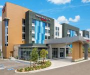
SpringHill Suites San Diego Mission Valley
Parc Suites
The Lafayette Hotel Swim Club & Bungalows
Carole's Bed & Breakfast
BEST WESTERN LAMPLIGHTER SDSU
RAMADA SAN DIEGO MISSIONVALLEY
Ace Budget Motel
HOWARD JOHNSON EXPRESS INN NAT
Videos from this area
These are videos related to the place based on their proximity to this place.
Lemon Ladies Orchard
FruitGuys' buyer Rebecca North visited Lemon Ladies Orchard in Emerald Hills, CA, for a tour of Karen Morss' Meyer lemon orchard. Learn more at fruitguys.com/lemonladies.
Chollas Creek 47th Street - Removal of non-native plants
This is the removal of invasive non-native plants mainly Arundo Donax. This was done on October 25th 2008, This is done as Friends of Chollas Creek http://www.chollascreek.org San Diego...
Creek-to-Bay Chollas Creek Cleanup @ the Jackie Robinson YMCA
April 28, 2012 Groundwork San Diego, GD NASSCO's Clean-up & Restoration Committee, San Diego Canyonlands, and volunteers from the Jackie Robinson Y's service area gathered and spent the ...
The Space Within at Jackie Robinson Family YMCA
Local non-profit Groundwork San Diego-Chollas Creek just received a $45889 planning grant from the TKF Foundation. "The Space Within" planning grant will enable Groundwork to assemble a ...
Radio Canyon Day Jan 2013
Radio Canyon Day officially marked the first event of the year! Local community volunteers joined us as we planted thousands of cactus and native plants together with NASSCO, AECOM, the ...
Planting Day at Radio Canyon
We Love Our Radio Canyon! Planting Day event on Jan. 28, 2012 Big Thanks to ... GWSD Green Team Millennial Tech Middle YALLA Soccer Lincoln High School Black Contractors Association Morse...
Trex700 in Chollas RC park by SAM
a sunny day at Chollas RC park in San Diego where Sam flies his TRex 700 , magnificent tricks.
Diamond Educational Excellence Partnership (DEEP)
Teacher from Chollas-Mead Elementary School shares about the impact the training provided through the California Reading and Literature Project had on her work and her students. The training...
San Diego Fire Hydrant Break in College Grove
Water was gushing at as high as the three story buildings at the condos across from the College Grove Shopping Center today (8/2/2013). Notice the water spilling down the stairs like white...
3568 Highland Ave Emerald Hills CA 94062
http://homesite.obeo.com/596285?refURL=youtube Contact: Vicky Costantini Sequoia Realty Services Group 650-430-8425 v_costantini@msn.com http://vickycostantini.com/ for more information...
Videos provided by Youtube are under the copyright of their owners.
Attractions and noteworthy things
Distances are based on the centre of the city/town and sightseeing location. This list contains brief abstracts about monuments, holiday activities, national parcs, museums, organisations and more from the area as well as interesting facts about the region itself. Where available, you'll find the corresponding homepage. Otherwise the related wikipedia article.
Mount Hope, San Diego
Mount Hope is an ethnically diverse hilly neighborhood of the City of San Diego, California. Located in the southeastern portion of the city, Mount Hope is named for the large municipal Mount Hope Cemetery, which encompasses approximately 115 acres of the community. State Route 94 (Martin Luther King Jr. Freeway) is the northern boundary, Interstate 805 is the eastern boundary, Interstate 15 is the western boundary, and Imperial Avenue is the southern boundary.
City Heights, San Diego
City Heights is a large community in the eastern part of San Diego, California, known for its ethnic diversity. Along the main streets (which include University Avenue, El Cajon Boulevard and Fairmount Avenue) one can find Hispanic, Northeast African, Near Eastern, South Asian and Southeast Asian immigrant businesses. The area was previously a separate city known as East San Diego.
KOGO (AM)
KOGO ("Newsradio 600 KOGO") is a talk radio station in San Diego, California. One of seven San Diego owned and operated Clear Channel Communications radio stations, KOGO's main focus is local and syndicated talk shows. At 5,000 watts day and night, the AM signal is one of the strongest in the region. The signal pattern generally follows the coast from the transmitter site in San Diego, with reception good to Santa Barbara and beyond.
KHTS-FM
KHTS-FM, also known as "Channel 933" or simply "nine-three-three", is a Top 40 (CHR) station in San Diego, California, broadcasting in analog and digital HD Radio. It is licensed in El Cajon, California and is owned by Clear Channel Communications.
KSON
KSON is a radio station licensed to serve San Diego, California, USA. The station, founded in 1964, is owned by Lincoln Financial Media and the broadcast license is held by Lincoln Financial Media Company of California. KSON broadcasts a country music format. KSON simulcasts their FM programming at 92.1 FM in Escondido, California. The station was most recently assigned the KSON call letters by the Federal Communications Commission on March 1, 2009.
KLNV
KLNV (106.5 FM, "La Nueva 106.5") is a Spanish language radio station. It is owned, by Univision Radio License Corporation. Its antenna is located at the same site of KSON and KOGO.
California's 53rd congressional district
California's 53rd congressional district is a congressional district in the U.S. state of California based in San Diego County. The district includes central and eastern portions of the city of San Diego, as well as eastern suburbs such as El Cajon, La Mesa, Spring Valley and Lemon Grove. The district is currently represented by Democrat Susan A. Davis. From 2003 through 2013 the district was primarily coastal; it included western San Diego as well as Coronado and Imperial Beach.
Hoover High School (San Diego, California)
Herbert Hoover High School is a comprehensive public secondary school located in the Talmadge neighborhood of San Diego, California. It is part of the San Diego Unified School District. It is best known for being the high school from which baseball legend Ted Williams graduated. The school was established in 1930 and named in honor of then U.S. President Herbert Hoover.
Encanto, San Diego
Encanto is a hilly neighborhood located in the southeastern part of San Diego, California. The neighborhood of Encanto is split into two sections, North Encanto (which lies north of Broadway), and South Encanto (which lies south of Broadway).
El Cerrito, San Diego
El Cerrito, Spanish for "the little hill," is a neighborhood of the Mid-City region of San Diego, California. El Cerrito is a residential neighborhood, consisting mostly of suburban homes, with some commercial activity along the streets that define its borders.
Oak Park, San Diego
Oak Park is a neighborhood of the Mid-City region of San Diego, California.
Webster, San Diego
Webster is a neighborhood of the Mid-City region of San Diego, California.
Gateway, San Diego
Gateway is a neighborhood of the Mid-City region of San Diego, California.
Mount Hope Cemetery (San Diego, California)
Mount Hope Cemetery is a municipal cemetery located at 3751 Market Street, San Diego, California, and gives its name to the neighborhood of Mount Hope. The cemetery is adjacent to Greenwood Memorial Park. Founded in 1869, on what was then the outskirts of New Town, Mount Hope now covers approximately 115 acres . The design of the cemetery is an example of a Rural cemetery, with architecture, art, and landscaping.
Will C. Crawford High School
Will C. Crawford High School (also known as the Crawford Educational Complex) is a high school located in the El Cerrito neighborhood of San Diego, California. It is part of the San Diego Unified School District. Erected in 1957 and dedicated in 1958, it is a comprehensive school serving 1,500 students in grades 9–12.
Waldorf School of San Diego
Waldorf School of San Diego (WSSD) is an independent Waldorf school located in the Oak Park neighborhood of San Diego, California. It offers preschool/kindergarten through 12th grades with an enrollment of 284 in 2011. Founded in 1981, it is one of approximately more than 250 independent North American and 1,000 world-wide Waldorf schools. The school is an accredited member school of the Association of Waldorf Schools of North America.
Crawford Educational Complex
Crawford Educational Complex, formerly Will C. Crawford High School and still known as Crawford High School, is a high school located in the El Cerrito neighborhood of San Diego, California. It is part of the San Diego Unified School District. Erected in 1957 and dedicated in 1958, it is a comprehensive school serving 1,500 students in grades 9–12.
Azalea Park, San Diego
The Azalea Park neighborhood is a community within City Heights in the greater San Diego, California area. Located on top of a plateau 3 miles east of San Diego Bay, with an elevation of around 300 feet. Bordered to the North by Manzanita Canyon (Lexington Street, officially, paper street at bottom of canyon, Fairmount Avenue to the East, Interstate 805 to the West and Hollywood Park to the South.
47th Street (San Diego Trolley station)
47th Street is a station of the Orange Line on the San Diego Trolley. It is located in the Chollas View neighborhood of the city and serves this mixed-income area of single family homes. A park and ride lot is also included on site. This station underwent renovations in 2012 in conjunction with the Trolley Renewal Project, although the station remained open.
Euclid Avenue (San Diego Trolley station)
Euclid Avenue is a station of the Orange Line on the San Diego Trolley. It is located in the Emerald Hills neighborhood of the city and serves both nearby residences and as a park and ride facility. This station underwent renovations in 2012 in conjunction with the Trolley Renewal Project, although the station remained open.
Chollas View, San Diego
Chollas View is a community in the southeastern section of the city of San Diego. It is bordered by Webster and California State Route 94 on the north, Mount Hope and Interstate 805 on the west, Emerald Hills and Euclid Avenue on the east, and Lincoln Park and the San Diego Trolley on the south. Major thoroughfares include Market Street and 47th Street.
Greenwood Memorial Park (San Diego)
Greenwood Memorial Park is a cemetery located on county-owned land at 4300 Imperial Avenue in San Diego County, California. The cemetery is adjacent to Mount Hope Cemetery. Opened in 1908, Greenwood covers approximately 125 acres five miles east of Downtown San Diego. The cemetery is an example of a Rural cemetery, incorporating architecture, art, and landscaping into its design.
Holy Cross Cemetery (San Diego)
Holy Cross Cemetery is a cemetery located in the Chollas View neighborhood of San Diego, California. Holy Cross was dedicated in 1919 for the exclusive use of Roman Catholics, with expansions in 1945 and 1956. The mausoleum, with its distinctive blue roof visible from California State Route 94, is a landmark of San Diego.
Emerald Hills, San Diego
Emerald Hills is a community in the southeastern section of the city of San Diego. It is bordered by Oak Park and California State Route 94 on the north, Chollas View and Euclid Avenue on the west, Encanto on the east, and Valencia Park and Market Street on the south. Major thoroughfares include Kelton Road and Roswell Street.
Mt. Hope, San Diego
Mt. Hope (Mount Hope) is a small community in the southeastern section of the city of San Diego. It is bordered on the north by the California State Route 94 freeway, on the east by the California State Route 15 freeway, on the west by the Interstate 805 freeway, and on the south by Mount Hope Cemetery and Greenwood Memorial Park cemetery.


