Safety Score: 2,7 of 5.0 based on data from 9 authorites. Meaning we advice caution when travelling to United States.
Travel warnings are updated daily. Source: Travel Warning United States. Last Update: 2024-08-13 08:21:03
Delve into East San Diego
East San Diego in San Diego County (California) is a city located in United States about 2,266 mi (or 3,647 km) west of Washington DC, the country's capital town.
Current time in East San Diego is now 08:50 AM (Tuesday). The local timezone is named America / Los Angeles with an UTC offset of -8 hours. We know of 8 airports closer to East San Diego, of which 4 are larger airports. The closest airport in United States is San Diego International Airport in a distance of 5 mi (or 8 km), West. Besides the airports, there are other travel options available (check left side).
Also, if you like playing golf, there are some options within driving distance. We saw 4 points of interest near this location. In need of a room? We compiled a list of available hotels close to the map centre further down the page.
Since you are here already, you might want to pay a visit to some of the following locations: San Diego, Ensenada, Riverside, Santa Ana and Orange. To further explore this place, just scroll down and browse the available info.
Local weather forecast
Todays Local Weather Conditions & Forecast: 18°C / 64 °F
| Morning Temperature | 14°C / 57 °F |
| Evening Temperature | 17°C / 62 °F |
| Night Temperature | 16°C / 60 °F |
| Chance of rainfall | 0% |
| Air Humidity | 63% |
| Air Pressure | 1020 hPa |
| Wind Speed | Light breeze with 5 km/h (3 mph) from North-East |
| Cloud Conditions | Broken clouds, covering 82% of sky |
| General Conditions | Broken clouds |
Tuesday, 3rd of December 2024
18°C (64 °F)
16°C (61 °F)
Sky is clear, light breeze, clear sky.
Wednesday, 4th of December 2024
19°C (66 °F)
16°C (61 °F)
Sky is clear, gentle breeze, clear sky.
Thursday, 5th of December 2024
19°C (66 °F)
18°C (64 °F)
Sky is clear, gentle breeze, clear sky.
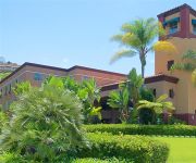
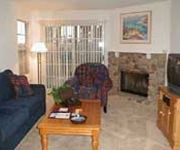
Hotels and Places to Stay
San Diego Marriott Mission Valley
Hilton San Diego Mission Valley
Carole's Bed & Breakfast
ExecuStay at Promenade Rio Vis
Quality Suites San Diego SeaWorld Area
INN AT THE PARK
La Quinta Inn and Suites San Diego SeaWorld/Zoo Area
Oakwood Mission Valley
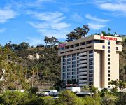
Sheraton Mission Valley San Diego Hotel
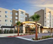
Homewood Suites by Hilton San Diego Mission Valley-Zoo
Videos from this area
These are videos related to the place based on their proximity to this place.
New York Buffalo Wings 2940 El Cajon Blvd, San Diego, CA 92104 619-501-8674
For the BEST New York Buffalo Wings, Ribs, Salads, Chicken Strips, Chipotle Fries, Bread Sticks, Onion Rings, Macaroni Salad, Jalepeno Poppers, Strawberry Cheese Cake. Located in North Park...
3568 Highland Ave Emerald Hills CA 94062
http://homesite.obeo.com/596285?refURL=youtube Contact: Vicky Costantini Sequoia Realty Services Group 650-430-8425 v_costantini@msn.com http://vickycostantini.com/ for more information...
Wine Bearer the Premium in Bottle Protection for Travel Darrell L. Grant
Protection for your wine & all bottle goods while traveling.
A Path to College in City Heights
City Heights is one of the most diverse communities in San Diego, and many young people in this community do not make it to college. One organization in City Heights is making a difference...
Cruisin' Interstate 805 in San Diego, Chula Vista and National City, California on November 28, 2011
Starting down near the international border of the United States of America and Mexico, right before coming to Camino De La Plaza over pass, heading northbound on I-805 to Balboa Ave. Twitter:...
4349 Hilldale Rd San Diego, CA 92116 (Kensington) | MLS # 130039055
More info, photos, & floorplan at: http://bit.ly/4349hilldale Gorgeous Cape Cod style 3 bed (plus bonus/game room), 3 bath home in Kensington, San Diego with panoramic canyon views! Entire...
Saldo de operativos de sobriedad en el condado de San Diego
univisionsandiego.com San Diego. Las autoridades estuvieron tras la pista de conductores ebrios este fin de semana por todos el condado fueron detenidas personas por manejar con copas de...
Large Home in North Park
Client Video Tour of a large home for sale in North Park San Diego. Search for North Park San Diego Real Estate here - http://www.teamaguilar.com/north-park-real-estate.html You can also...
Videos provided by Youtube are under the copyright of their owners.
Attractions and noteworthy things
Distances are based on the centre of the city/town and sightseeing location. This list contains brief abstracts about monuments, holiday activities, national parcs, museums, organisations and more from the area as well as interesting facts about the region itself. Where available, you'll find the corresponding homepage. Otherwise the related wikipedia article.
PSA Flight 182
Pacific Southwest Airlines (PSA) Flight 182, registration N533PS, was a Boeing 727-214 commercial airliner that collided with a private Cessna 172 over San Diego, California on September 25, 1978. It was Pacific Southwest Airlines' first accident involving fatalities. The death toll of 144 makes it the deadliest aircraft disaster in California history.
City Heights, San Diego
City Heights is a large community in the eastern part of San Diego, California, known for its ethnic diversity. Along the main streets (which include University Avenue, El Cajon Boulevard and Fairmount Avenue) one can find Hispanic, Northeast African, Near Eastern, South Asian and Southeast Asian immigrant businesses. The area was previously a separate city known as East San Diego.
Normal Heights, San Diego
Normal Heights is a neighborhood of the mid-city region of San Diego, California. It is known for its affordable pubs, restaurants, coffee houses, antique shops, book shops, and burgeoning arts community.
Hoover High School (San Diego, California)
Herbert Hoover High School is a comprehensive public secondary school located in the Talmadge neighborhood of San Diego, California. It is part of the San Diego Unified School District. It is best known for being the high school from which baseball legend Ted Williams graduated. The school was established in 1930 and named in honor of then U.S. President Herbert Hoover.
Kensington Terrace
Kensington Terrace is a proposed 56,000-square-foot mixed-use development project in the Kensington neighborhood of San Diego, California. The project is controversial. The controversy stems partly because of its size compared to the existing neighborhood buildings, and partly from factors such as one of the houses that would be replaced by the project.
The Linkery
The Linkery is a farm-to-table restaurant in North Park, San Diego, California that specializes in natural meat, local food, fine wines, craft beer, and cask ale. The restaurant's name refers to their daily-changing offerings of house-made sausages. The Linkery was founded in 2005 by Jay Porter, a former engineer and consultant for consumer electronics companies with no prior restaurant experience.
Azalea Park, San Diego
The Azalea Park neighborhood is a community within City Heights in the greater San Diego, California area. Located on top of a plateau 3 miles east of San Diego Bay, with an elevation of around 300 feet. Bordered to the North by Manzanita Canyon (Lexington Street, officially, paper street at bottom of canyon, Fairmount Avenue to the East, Interstate 805 to the West and Hollywood Park to the South.
Ray Street Arts District
The Ray Street Arts District is an arts district in the North Park neighborhood of San Diego, California.


