Safety Score: 2,7 of 5.0 based on data from 9 authorites. Meaning we advice caution when travelling to United States.
Travel warnings are updated daily. Source: Travel Warning United States. Last Update: 2024-08-13 08:21:03
Explore Southridge Village
Southridge Village in San Bernardino County (California) is a city in United States about 2,254 mi (or 3,627 km) west of Washington DC, the country's capital.
Local time in Southridge Village is now 05:36 AM (Tuesday). The local timezone is named America / Los Angeles with an UTC offset of -8 hours. We know of 8 airports in the vicinity of Southridge Village, of which 3 are larger airports. The closest airport in United States is Ontario International Airport in a distance of 6 mi (or 10 km), West. Besides the airports, there are other travel options available (check left side).
Also, if you like golfing, there are multiple options in driving distance. We found 2 points of interest in the vicinity of this place. If you need a place to sleep, we compiled a list of available hotels close to the map centre further down the page.
Depending on your travel schedule, you might want to pay a visit to some of the following locations: Riverside, San Bernardino, Orange, Santa Ana and Los Angeles. To further explore this place, just scroll down and browse the available info.
Local weather forecast
Todays Local Weather Conditions & Forecast: 22°C / 71 °F
| Morning Temperature | 16°C / 61 °F |
| Evening Temperature | 20°C / 69 °F |
| Night Temperature | 17°C / 63 °F |
| Chance of rainfall | 0% |
| Air Humidity | 14% |
| Air Pressure | 1014 hPa |
| Wind Speed | Gentle Breeze with 7 km/h (4 mph) from East |
| Cloud Conditions | Broken clouds, covering 58% of sky |
| General Conditions | Broken clouds |
Tuesday, 5th of November 2024
20°C (67 °F)
16°C (61 °F)
Few clouds, strong breeze.
Wednesday, 6th of November 2024
19°C (67 °F)
16°C (62 °F)
Sky is clear, fresh breeze, clear sky.
Thursday, 7th of November 2024
20°C (67 °F)
18°C (64 °F)
Sky is clear, gentle breeze, clear sky.
Hotels and Places to Stay
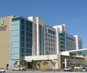
Embassy Suites by Hilton Ontario Airport
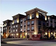
Four Points by Sheraton Ontario-Rancho Cucamonga
Hilton Garden Inn Fontana
Hilton Garden Inn Ontario-Rancho Cucamonga
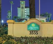
La Quinta Inn and Suites Ontario Airport
EXECUSTAY AT AMLI AT EMPIRE LK
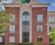
Holiday Inn Express & Suites ONTARIO AIRPORT-MILLS MALL
TownePlace Suites Ontario Airport
Fairfield Inn & Suites Ontario Rancho Cucamonga
Homewood Suites by HiltonOntario-Rancho Cucamonga
Videos from this area
These are videos related to the place based on their proximity to this place.
The Girl City and Colour Cover by Charlie Velasco. PLEASE WATCH, LISTEN, LIKE, COMMENT,& SHARE! :)
via YouTube Capture.
2012 Fontana City Nationals in da Rain.wmv
just having a great time this weekend @ City National in Fontana , CA with da Boyz gettin Drunk on sat and race hungover on Sunday might post the what the tr...
The Southern Ridge
The epic journey of two 2012 survivors living out their days in the hills of Southridge. They have turned to guns and explosives to protect what resources they have left. However, in this scenario,...
Fontana Nationals 2014 Race Run Beginner
Fontana Nationals 2014 Race Run Beginner 35-39? 6th yes, some of it was super slow... SDBC MT bike. Emerald Textiles.
Kenda Golden State series Race 1 2013 Fontana SRC
My race run for Race # 1 of the Kenda Golden state series in Fontana. Had a pretty solid run and pulled off a second place.
Fontana Nationals 2013 DH race run
Fontana DH Race Run Crash on the easiest parts of the course. I think I hit the rut I have been training in.
Videos provided by Youtube are under the copyright of their owners.
Attractions and noteworthy things
Distances are based on the centre of the city/town and sightseeing location. This list contains brief abstracts about monuments, holiday activities, national parcs, museums, organisations and more from the area as well as interesting facts about the region itself. Where available, you'll find the corresponding homepage. Otherwise the related wikipedia article.
Glen Avon, California
Glen Avon was a census-designated place (CDP) in Riverside County, California, United States. The population was 20,199 at the 2010 census, up from 14,853 at the 2000 census. On July 1, 2011, the CDP became part of the newly incorporated City of Jurupa Valley.
Jurupa Valley High School
Jurupa Valley Valley High School is a public high school in Jurupa Valley, California. The school was established in 1989, as part of the Jurupa Unified School District, and the first class graduated in 1992. Located at the junction of the Ontario (I-15) and Pomona (State Route 60) freeways, it is one of four high schools in the district, the others being Rubidoux High School, Patriot High School, and Nueva Vista High School, a continuation school.
Patriot High School
Patriot High School is a high school in Jurupa Valley, California and is part of the Jurupa Unified School District. It accommodates students of the 9th to 12th grades. It is one of four high schools in the Jurupa Unified School District along with Jurupa Valley High School, Rubidoux High School and Nueva Vista.
Jurupa Unified School District
Jurupa Unified School District is grade K-12 school district in Riverside County, California. It has an enrollment of approximately 20,500 students. The geographic location of the Jurupa area is the upper western corner of Riverside County, California, north and west of the Santa Ana River and south of the San Bernardino-Riverside County line. The Superintendent is Elliott Duchon.
Stringfellow Acid Pits
The Stringfellow Acid Pits are a toxic waste dump, and a Superfund site, located in Riverside County, California, United States, just north of the neighborhood of Glen Avon, California. The site became the center of national news coverage in the early 1980s, in part because it was considered one of the most polluted sites in California, and because it became linked with mismanagement and scandal in the U.S. Environmental Protection Agency.


