Safety Score: 2,7 of 5.0 based on data from 9 authorites. Meaning we advice caution when travelling to United States.
Travel warnings are updated daily. Source: Travel Warning United States. Last Update: 2024-08-13 08:21:03
Explore Arrowhead Farms
The district Arrowhead Farms of Serrano Village in San Bernardino County (California) is located in United States about 2,241 mi west of Washington DC, the country's capital.
If you need a place to sleep, we compiled a list of available hotels close to the map centre further down the page.
Depending on your travel schedule, you might want to pay a visit to some of the following locations: San Bernardino, Riverside, Orange, Santa Ana and Los Angeles. To further explore this place, just scroll down and browse the available info.
Local weather forecast
Todays Local Weather Conditions & Forecast: 14°C / 57 °F
| Morning Temperature | 13°C / 55 °F |
| Evening Temperature | 13°C / 56 °F |
| Night Temperature | 11°C / 51 °F |
| Chance of rainfall | 0% |
| Air Humidity | 69% |
| Air Pressure | 1018 hPa |
| Wind Speed | Light breeze with 4 km/h (2 mph) from East |
| Cloud Conditions | Overcast clouds, covering 87% of sky |
| General Conditions | Light rain |
Monday, 25th of November 2024
17°C (63 °F)
14°C (57 °F)
Overcast clouds, light breeze.
Tuesday, 26th of November 2024
14°C (58 °F)
14°C (56 °F)
Light rain, light breeze, overcast clouds.
Wednesday, 27th of November 2024
14°C (58 °F)
13°C (56 °F)
Light rain, light breeze, overcast clouds.
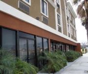
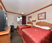
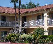
Hotels and Places to Stay
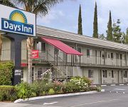
DAYS SAN BERNARDINO HIGHLAND
HILLS GARDEN HOTEL
Economy Inn
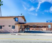
Rodeway Inn San Bernardino
Sleepy Hollow Cabins and Hotel of Crestline/Lake Gregory
Sunpark Inn & Suites
ALL STAR LODGE SAN BERNARDINO
MOTEL 6 SAN BERNARDINO NORTH
COUNTRY INN SAN BER
GOLDEN STAR INN
Videos from this area
These are videos related to the place based on their proximity to this place.
Hang Gliding Crestline
Flying Marshall Peak .. On a Wills Wing Falcon 3 - 195. Andy Jackson Airpark / Crestline is located about 60 miles east of Los Angeles, California, in the San Bernardino Mountains.
Motorcycle cruser ride Hwy 18,Rim of the World,Big Bear City,Hwy 38 pt. 2
Complete fall Big Bear motorcycle ride.
Wing Lifted and Flipped - 2015/03/14 Marshall Peak
The hang glider down on the lower launch at Marshal Peak, farthest from the camera, got flipped around and over by a nasty bit of air that hit me a little bit later. Could have been a dust...
Motorcycle cruser ride Hwy 18,Rim of the World,Big Bear City,Hwy 38 pt. 1
Complete fall Big Bear motorcycle ride.
Trip #2 on little mountain 91 Suburban 4x4 2500
Wanted to explore a bit more of little mountain's fire/service roads. just a short video of that. 4 Hi in the 1991 Suburban. Definitely held up better than a friends 2004 Dodge Durango 4x4...
Alec's First Feelings in U.S. @ Delta Airplane Part. 2
http://www.VanityBackstage.com Alec travel with Sarkku by Delta Air Lines plane to Los Angeles, CA LAX :]
Light Maps [Liquidemotions.com] Gloves Light Show @ Illuminate 09
Me giving a light show to four of my friends. So tired by the time I gave this show. If only people knew how to arrange themselves. Go to Liquidemotions.com for the best lights and gloves...
Ministracion profetica 2010 www.iglesiacelebracion.us 6 de enero 2010
Ministracion y Alabanza Ministracion profetica 2010 www.iglesiacelebracion.us.
Videos provided by Youtube are under the copyright of their owners.
Attractions and noteworthy things
Distances are based on the centre of the city/town and sightseeing location. This list contains brief abstracts about monuments, holiday activities, national parcs, museums, organisations and more from the area as well as interesting facts about the region itself. Where available, you'll find the corresponding homepage. Otherwise the related wikipedia article.
Crestline, California
Crestline is a census-designated place in the San Bernardino Mountains of San Bernardino County, California, USA. The population was 10,770 at the 2010 census, up from 10,218 at the 2000 census.
Muscoy, California
Muscoy is a census-designated place (CDP) in San Bernardino County, California, United States. The population was 10,644 at the 2010 census, up from 8,919 at the 2000 census. Muscoy shares zip code 92407 with northwest San Bernardino, California's Verdemont neighborhood, Devore Heights, and Arrowhead Farms. Residents enjoy a semi-rural setting with large lots where they can raise horses and other livestock, nursery plants, and fruit trees.
San Bernardino, California
San Bernardino is a city located in the Riverside-San Bernardino metropolitan area (sometimes called the "Inland Empire"). It serves as the county seat of San Bernardino County, California, United States. As one of the Inland Empire's anchor cities, San Bernardino spans 81 square miles on the floor of the San Bernardino Valley, and has a population of 209,924 as of the 2010 census. San Bernardino is the 17th largest city in California, and the 99th largest city in the United States.
Arrowhead Springs, San Bernardino, California
Arrowhead Springs is a highly mountainous neighborhood in the 81-square-mile municipality of San Bernardino, California, officially annexed to the city on November 19, 2009. The neighborhood lies below the Arrowhead geological monument, which is California Historical Landmark #977. The natural geographic formation of light quartz on the side of the mountains presides over San Bernardino and the rest of the San Bernardino Valley.
Richard and Maurice McDonald
Richard James "Dick" McDonald (February 16, 1909 – July 14, 1998) and his brother, Maurice James "Mac" McDonald (November 26, 1902 – December 11, 1971) were early American fast food pioneers, who established the first McDonald's restaurant at 1938 North E Street and West 14th Street in San Bernardino, California in 1940. They introduced the "Speedee Service System" in 1948. The McDonald Brothers were of Irish origin and have a proven Irish genealogy back to their great-grandparents.
San Manuel Stadium
San Manuel Stadium is a stadium in San Bernardino, California, United States. Located adjacent to Downtown San Bernardino. San Manuel Stadium has been the home ballpark to the Inland Empire 66ers of San Bernardino minor league baseball team since when it was originally built in 1996. It was called the Ranch as the baseball team name at that time was the San Bernardino Stampede. The stadium seats 5,000 people, with additional capacity provided by lawn seating.
McDonald's
McDonald's Corporation is the world's largest chain of hamburger fast food restaurants, serving around 68 million customers daily in 119 countries. Headquartered in the United States, the company began in 1940 as a barbecue restaurant operated by Richard and Maurice McDonald; in 1948 they reorganized their business as a hamburger stand using production line principles. Businessman Ray Kroc joined the company as a franchise agent in 1955.
KFRG
KFRGCity of license San Bernardino, CaliforniaBroadcast area Riverside-San Bernardino, CaliforniaBranding K-FrogSlogan "California Country"First air date August 1974 (as KQLH)Format CountryERP 50,000 wattsHAAT 149 metersClass BFacility ID 1241Callsign meaning K FRoGFormer callsigns KQLH (1974-1989)Owner CBS RadioSister stations KRAK, KVFG, KXFGpart of CBS Corp. cluster with Los Angeles-based TV stations KCBS & KCALWebcast Listen LiveWebsite kfrog.
Coussoulis Arena
Formally known as the James & Aerianthi Coussoulis Arena, the "Coussoulis Arena" is a 5,000-seat multi-purpose arena in San Bernardino, California, USA. It is home to the California State University, San Bernardino Coyotes basketball team. It opened in 1995.
KCAL-FM
KCAL-FM (96.7 FM, "96-7 K-CAL Rocks") is a commercial rock radio station. Licensed to Redlands, California, USA, it serves the Riverside-San Bernardino radio market.
KTDD
KTDD is a commercial radio station in San Bernardino, California, broadcasting to the Riverside-San Bernardino, California, area on 1350 AM. KTDD airs a classic country music format branded as "The Toad".
KKDD
KKDD is a radio station broadcasting a Contemporary Christian Music format. Licensed to San Bernardino, California, USA, the station is currently owned by Clear Channel Communications and operated by ERC Media LLC in a local marketing agreement (LMA).
San Bernardino train disaster
The San Bernardino Train Disaster, sometimes known as the Duffy Street Incident, is a combination of two separate but related incidents which occurred in San Bernardino, California: A runaway train derailment on May 12, 1989, and the subsequent failure on May 25, 1989, of a petroleum pipeline adjacent to the tracks which was damaged by earth-moving equipment during the crash cleanup.
Fiscalini Field
Fiscalini Field is a stadium in San Bernardino, California, USA. Over the years, the stadium was the spring training homes of the Pittsburgh Pirates and St. Louis Browns and was the home field for the San Bernardino Stars and the San Bernardino Pioneers. Today, Fiscalini Field is used for NCAA Division II college baseball games hosted by California State University, San Bernardino.
Santa Fe Depot (San Bernardino, California)
The Santa Fe Depot is a Mission Revival Style passenger rail terminal in San Bernardino, California, United States. It currently serves one Amtrak and two Metrolink lines. The depot is a historical landmark listed on the National Register of Historic Places as Atchison, Topeka and Santa Fe Railway Passenger and Freight Depot.
KSGN
KSGN is a non-commercial radio station located in Riverside, California, broadcasting to the Riverside-San Bernardino area on 89.7 FM. KSGN airs a christian contemporary music format. First launched in 1970 on AM dial 850, KSGN grew into one of the Inland Empire's well-known radio stations. The station's business office was briefly in Moreno Valley, California, in the late 1980s and 1990s, but had returned to Riverside in the early 2000s.
American Sports University
American Sports University is a private, non-profit sports business university in San Bernardino, California, has remained unaccredited since its inception in 2006; it is still currently seeking accreditation. It has been granted approval to operate from the Bureau for Private Postsecondary and Vocational Education of the State of California.
Aquinas High School (San Bernardino, California)
Aquinas High School is a private, Roman Catholic high school in San Bernardino, California, USA. It is located in the Roman Catholic Diocese of San Bernardino.
KJVA-LP
KJVA-LP is a radio station broadcasting a Contemporary Christian format. Licensed to San Bernardino, California, USA, it serves the Riverside-San Bernardino area. The station is currently owned by Vida Abundante.
Cajon High School
Cajon High School is located in the University District of San Bernardino, California, and is part of the San Bernardino City Unified School District.
Rancho San Bernardino
Rancho San Bernardino was a 35,509-acre Mexican land grant in present day San Bernardino County, California given in 1842 by Governor Juan B. Alvarado to José del Carmen Lugo, José María Lugo, Vicente Lugo, and Diego Sepulveda. The grant included a large part of the San Bernardino valley, and encompassed present day San Bernardino, Fontana, Rialto, Redlands and Colton.
Pacific High School (San Bernardino, California)
Pacific High School is a high school in the San Bernardino City Unified School District located in San Bernardino, California, at the corner of Pacific Street and Perris Hill Street.
Rancho Muscupiabe
Rancho Muscupiabe was a 30,145-acre Mexican land grant in present day San Bernardino County, California given to Michael C. White April 29, 1843 by Governor Manuel Micheltorena. The name comes from a Serrano word Muscupiabit, meaning "Place of little pines. " The rancho was adjacent to the Cajon Pass.
Community Hospital of San Bernardino
Community Hospital of San Bernardino (CHSB) is a 343-bed non-profit hospital in San Bernardino, California, USA. It is currently affiliated with Dignity Health, but remains a non-denominational community hospital. The hospital is one of the region's largest employers, with more than 1,350 employees, and primarily serves the areas of San Bernardino, Rialto, Colton, Highland and Fontana.
Our Lady of the Rosary Cathedral (San Bernardino, California)
Our Lady of the Rosary Cathedral is a Roman Catholic cathedral located in San Bernardino, California, United States. It is the seat of the Diocese of San Bernardino.







!['Light Maps [Liquidemotions.com] Gloves Light Show @ Illuminate 09' preview picture of video 'Light Maps [Liquidemotions.com] Gloves Light Show @ Illuminate 09'](https://img.youtube.com/vi/2MNq4_Sb6QU/mqdefault.jpg)

