Safety Score: 2,7 of 5.0 based on data from 9 authorites. Meaning we advice caution when travelling to United States.
Travel warnings are updated daily. Source: Travel Warning United States. Last Update: 2024-08-13 08:21:03
Explore Valley Gardens
The district Valley Gardens of San Bernardino in San Bernardino County (California) is located in United States about 2,242 mi west of Washington DC, the country's capital.
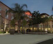
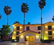
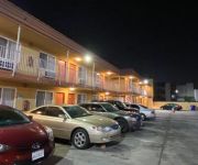
If you need a place to sleep, we compiled a list of available hotels close to the map centre further down the page.
Depending on your travel schedule, you might want to pay a visit to some of the following locations: Riverside, Orange, Santa Ana, Los Angeles and San Diego. To further explore this place, just scroll down and browse the available info.
Local weather forecast
Todays Local Weather Conditions & Forecast: 15°C / 59 °F
| Morning Temperature | 8°C / 47 °F |
| Evening Temperature | 14°C / 56 °F |
| Night Temperature | 11°C / 51 °F |
| Chance of rainfall | 0% |
| Air Humidity | 33% |
| Air Pressure | 1015 hPa |
| Wind Speed | Light breeze with 3 km/h (2 mph) from North-West |
| Cloud Conditions | Clear sky, covering 0% of sky |
| General Conditions | Sky is clear |
Tuesday, 19th of November 2024
17°C (62 °F)
13°C (55 °F)
Broken clouds, light breeze.
Wednesday, 20th of November 2024
19°C (67 °F)
14°C (57 °F)
Scattered clouds, light breeze.
Thursday, 21st of November 2024
21°C (71 °F)
16°C (61 °F)
Broken clouds, calm.
Hotels and Places to Stay
DoubleTree by Hilton San Bernardino
Residence Inn San Bernardino
Hilton Garden Inn San Bernardino
Comfort Inn & Suites Colton
TownePlace Suites San Bernardino Loma Linda
Fairfield Inn & Suites San Bernardino
La Quinta Inn San Bernardino
Homewood Suites by Hilton San Bernardino
Hampton Inn - Suites San Bernardino
Economy Inn
Videos from this area
These are videos related to the place based on their proximity to this place.
Cocky vs CB | rap battle | AHAT | Stockton vs San Bernardino
AHAT Cali presents Cocky vs CB. Cocky is from Stockton California and has battled on URLtv and has battled MC's like Heartless, NuBorn, and Daylyt. C.B. who is from San Bernardino California...
San Bernardino Patio Furniture
Click here to see patio furniture in San Bernardino http://www.outdoorfurniturenow.com/patio-furniture-san-bernardino-outdoor-furniture ' Patio Furniture in the San Bernardino Valley is Easier...
[HD] Freight Trains at Cajon Pass, San Bernardino, CA
WATCH IN HD!*** (and your volume low since it's like 10 minutes of wind noise) BNSF and UP freight Trains at Cajon Pass, San Bernardino, CA September 25, 2015.
San Bernardino Defense Lawyers
San Bernardino Defense Lawyers - http://www.riverside-san-bernardino-attorneys-lawyers-dui-directory.us/ Find San Bernardino defense lawyers listed by their main legal practice areas. San...
Bobcat hunting in San Bernardino NF 8 Nov 2012. Lynx rufus, predator, Cat.
Bobcat hunting 8 Nov 2012 in San Bernardino NF. Predator, cat. http://en.wikipedia.org/wiki/Bobcat.
GO ON A BIKE RIDE w/ San Bernardino Generation Now
San Bernardino Generation Now's first bike ride in the 5th Ward on January 28, 2014. Join us Feb 1st and 2nd.
San Bernardino County Personal Injury Attorney - (909) 784-2112 Free Consultation
Call (909) 784-2112 to speak with an experienced San Bernardino County Personal Injury Attorney. 30 plus years experience. No fees unless we win your case.
San Bernardino labor attorney; San Bernardino employment attorney
http://californialaborlawattorney.org. Looking for a San Bernardino attorney or a San Bernardino employment lawyer? I'm one of the leading labor law attorneys in California. I specialize...
Transumanza delle Vacche - San Bernardino
Transumanza delle vacche al Villaggio San Bernardino, il 15 agosto 2012. Scendendo dal Pizzo Uccello le Vacche da latte, addobbate e decorate con fiori e campanacci, attraversano la via principale.
San Bernardino Attorneys
San Bernardino Attorneys - http://www.riverside-san-bernardino-attorneys-lawyers-dui-directory.us/ Find San Bernardino attorneys listed by their main legal practice areas. San Franciscoo Attorneys...
Videos provided by Youtube are under the copyright of their owners.
Attractions and noteworthy things
Distances are based on the centre of the city/town and sightseeing location. This list contains brief abstracts about monuments, holiday activities, national parcs, museums, organisations and more from the area as well as interesting facts about the region itself. Where available, you'll find the corresponding homepage. Otherwise the related wikipedia article.
Colton, California
Colton is a city in San Bernardino County, California, United States. The city is located in the Inland Empire region of the state and is approximately 57 miles east of Los Angeles. The population of Colton is 52,154 according to the 2010 census, up from 47,662 at the 2000 census. Colton is the site of Colton Crossing, one of the busiest at-grade railroad crossings in the United States.
San Bernardino, California
San Bernardino is a city located in the Riverside-San Bernardino metropolitan area (sometimes called the "Inland Empire"). It serves as the county seat of San Bernardino County, California, United States. As one of the Inland Empire's anchor cities, San Bernardino spans 81 square miles on the floor of the San Bernardino Valley, and has a population of 209,924 as of the 2010 census. San Bernardino is the 17th largest city in California, and the 99th largest city in the United States.
Loma Linda University
Loma Linda University (LLU) is a Seventh-day Adventist coeducational health sciences university located in Loma Linda, California, United States. The University comprises eight schools and the Faculty of Graduate Studies. More than 100 certificate and degree programs are offered by the schools of allied health professions, dentistry, medicine, nursing, pharmacy, public health, religion, and science and technology.
Richard and Maurice McDonald
Richard James "Dick" McDonald (February 16, 1909 – July 14, 1998) and his brother, Maurice James "Mac" McDonald (November 26, 1902 – December 11, 1971) were early American fast food pioneers, who established the first McDonald's restaurant at 1938 North E Street and West 14th Street in San Bernardino, California in 1940. They introduced the "Speedee Service System" in 1948. The McDonald Brothers were of Irish origin and have a proven Irish genealogy back to their great-grandparents.
San Manuel Stadium
San Manuel Stadium is a stadium in San Bernardino, California, United States. Located adjacent to Downtown San Bernardino. San Manuel Stadium has been the home ballpark to the Inland Empire 66ers of San Bernardino minor league baseball team since when it was originally built in 1996. It was called the Ranch as the baseball team name at that time was the San Bernardino Stampede. The stadium seats 5,000 people, with additional capacity provided by lawn seating.
McDonald's
McDonald's Corporation is the world's largest chain of hamburger fast food restaurants, serving around 68 million customers daily in 119 countries. Headquartered in the United States, the company began in 1940 as a barbecue restaurant operated by Richard and Maurice McDonald; in 1948 they reorganized their business as a hamburger stand using production line principles. Businessman Ray Kroc joined the company as a franchise agent in 1955.
San Bernardino Valley
The San Bernardino Valley is a valley in Southern California. It lies at the south base of the Transverse Ranges. It is bordered on the north by the eastern San Gabriel Mountains and San Bernardino Mountains, on the east by the San Jacinto Mountains, and on the south and west by the Santa Ana Mountains and Pomona Valley. Elevation varies from 180 metres on valley floors near Chino, where it gradually increases to about 420 metres near San Bernardino and Redlands.
Lytle Creek (California)
Lytle Creek, California, is an approximately 18-mile-long stream in southwestern San Bernardino County near the city of San Bernardino. It is a tributary of the Santa Ana River. The river flows through the eastern San Gabriel Mountains and has three forks, the North, Middle and South forks. The North Fork and Middle Fork meet just west of the town of Lytle Creek, California and the South Fork joins them soon after.
KTDD
KTDD is a commercial radio station in San Bernardino, California, broadcasting to the Riverside-San Bernardino, California, area on 1350 AM. KTDD airs a classic country music format branded as "The Toad".
KTIE
KTIE (590 AM, "AM 590 The Answer") is a conservative talk radio station located in San Bernardino, California, broadcasting to the Riverside-San Bernardino, California area. During night hours, its radio signals can travel across Los Angeles County, California and Orange County, California (another targeted area for KTIE with its conservative programming) into the Coachella Valley.
KKDD
KKDD is a radio station broadcasting a Contemporary Christian Music format. Licensed to San Bernardino, California, USA, the station is currently owned by Clear Channel Communications and operated by ERC Media LLC in a local marketing agreement (LMA).
KEZY
For the Los Angeles area stations that previously used the KEZY calls, see KGBN and KFSH-FM.
Loma Linda Academy
Loma Linda Academy (LLA) is a Seventh-day Adventist K-12 college preparatory WASC-accredited school in Loma Linda, California, United States. Loma Linda Academy comprises three separate, semi-autonomous schools: Loma Linda Elementary (LLE), an elementary school; Loma Linda Academy Junior High, a junior high school; and Loma Linda Academy, a high school. Each school has its own principal in addition to the head principal.
Inland Center
Inland Center is a regional shopping mall owned and operated by Macerich, located in San Bernardino, California along the southwest border adjacent to Interstate 215 and the city of Colton. Within one mile of three bordering cities on the southern end of San Bernardino, Inland Center is a single level mall anchored by Macy's, Sears, and Forever 21, plus 130 specialty shops and services.
Santa Fe Depot (San Bernardino, California)
The Santa Fe Depot is a Mission Revival Style passenger rail terminal in San Bernardino, California, United States. It currently serves one Amtrak and two Metrolink lines. The depot is a historical landmark listed on the National Register of Historic Places as Atchison, Topeka and Santa Fe Railway Passenger and Freight Depot.
Orange Pavilion
The Orange Pavilion is a multi-purpose arena, on the grounds of the NOS Events Center, in San Bernardino, California. It seats 5,000 spectators and is best known for hosting the National Orange Show. It is home to the San Bernardino Bucking Bulls, of the NIFL. The arena played host to the Tattoo the Earth Tour on August 12, 2000. The show featured performances by Slipknot, Slayer, Sevendust, Sepultura, Hed PE, Mudvayne, downset. , Hatebreed, Full Devil Jacket, Famous, Amen, U.P.O.
American Sports University
American Sports University is a private, non-profit sports business university in San Bernardino, California, has remained unaccredited since its inception in 2006; it is still currently seeking accreditation. It has been granted approval to operate from the Bureau for Private Postsecondary and Vocational Education of the State of California.
Rancho San Bernardino
Rancho San Bernardino was a 35,509-acre Mexican land grant in present day San Bernardino County, California given in 1842 by Governor Juan B. Alvarado to José del Carmen Lugo, José María Lugo, Vicente Lugo, and Diego Sepulveda. The grant included a large part of the San Bernardino valley, and encompassed present day San Bernardino, Fontana, Rialto, Redlands and Colton.
Loma Linda University Church of Seventh-day Adventists
The Loma Linda University Church of Seventh-day Adventists is a Seventh-day Adventist church in Loma Linda, California. It is home to one of the largest Adventist congregations in the world, with about 7,000 members. The church, which is on the campus of Loma Linda University, hosts two weekly worship services, Sabbath School, and vespers programs on Saturday, which are broadcasted live on the Loma Linda Broadcasting Network, as well as weekly programs for the University.
Loma Linda University Medical Center
Loma Linda University Medical Center (LLUMC) is a teaching hospital on the campus of Loma Linda University in Loma Linda, California, United States. The medical center serves as a level I trauma center for San Bernardino County and the rest of the Inland Empire. The hospital has two helipads for use by an air ambulance or other helicopter medical transport. However, personal use of the helipad by employees of the hospital or any of the other LLUAHSC entities is not allowed.
Loma Linda University School of Allied Health Professions
The School of Allied Health Professions is the largest school at Loma Linda University with more than a thousand full-time students enrolled (Fall 2010) and offers more than fifty degrees in various health care related professions.
Loma Linda University School of Public Health
The Loma Linda University School of Public Health offers degrees in earth and biological sciences; environmental health and geoinformatics sciences; epidemiology, biostatistics, and population medicine; global health; health policy and management; health promotion and education; and nutrition.
Hospitality Lane District, San Bernardino, California
The Hospitality Lane District is a business district in San Bernardino, California, located 2–3 miles southeast of the city's downtown area along the street of the same name. It is adjacent to an exit on Interstate 10, and is only a few miles away from San Bernardino International Airport.
San Jacinto Valley
The San Jacinto Valley is a valley located in south western Riverside County, in Southern California. The valley is located at the base of the San Jacinto Mountains in the east and Santa Rosa Hills to the south with the San Gorgonio Pass to the north. The elevation on average is 1500 feet, with the highest points in the foot hills south of Hemet and the foot hills of the San Jacinto Mountains. It is home to two cities; Hemet and San Jacinto.
Loma Linda University Occupational Medicine Center
The Loma Linda University Occupational Medicine Center (LLUOMC) is a patient-centered clinic that handles the occupational medicine needs of its parent organization, and those of local businesses in the Inland Empire of Southern California. It is staffed by board certified physicians who specialize in the care and health maintenance of workers in every occupation.


!['[HD] Freight Trains at Cajon Pass, San Bernardino, CA' preview picture of video '[HD] Freight Trains at Cajon Pass, San Bernardino, CA'](https://img.youtube.com/vi/Yl9Sb1llJeE/mqdefault.jpg)


