Safety Score: 2,7 of 5.0 based on data from 9 authorites. Meaning we advice caution when travelling to United States.
Travel warnings are updated daily. Source: Travel Warning United States. Last Update: 2024-08-13 08:21:03
Delve into East Colton Heights
East Colton Heights in San Bernardino County (California) is located in United States about 2,243 mi (or 3,611 km) west of Washington DC, the country's capital town.
Current time in East Colton Heights is now 10:06 AM (Tuesday). The local timezone is named America / Los Angeles with an UTC offset of -8 hours. We know of 8 airports close to East Colton Heights, of which 3 are larger airports. The closest airport in United States is Ontario International Airport in a distance of 17 mi (or 28 km), West. Besides the airports, there are other travel options available (check left side).
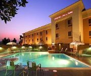
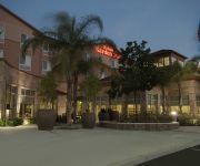
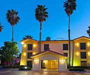
Also, if you like playing golf, there are some options within driving distance. We encountered 2 points of interest near this location. If you need a hotel, we compiled a list of available hotels close to the map centre further down the page.
While being here, you might want to pay a visit to some of the following locations: San Bernardino, Riverside, Orange, Santa Ana and Los Angeles. To further explore this place, just scroll down and browse the available info.
Local weather forecast
Todays Local Weather Conditions & Forecast: 20°C / 69 °F
| Morning Temperature | 15°C / 58 °F |
| Evening Temperature | 18°C / 64 °F |
| Night Temperature | 14°C / 58 °F |
| Chance of rainfall | 0% |
| Air Humidity | 15% |
| Air Pressure | 1019 hPa |
| Wind Speed | Calm with 2 km/h (2 mph) from East |
| Cloud Conditions | Overcast clouds, covering 100% of sky |
| General Conditions | Overcast clouds |
Tuesday, 3rd of December 2024
21°C (69 °F)
15°C (59 °F)
Sky is clear, light breeze, clear sky.
Wednesday, 4th of December 2024
22°C (71 °F)
16°C (60 °F)
Sky is clear, light breeze, clear sky.
Thursday, 5th of December 2024
21°C (70 °F)
16°C (61 °F)
Sky is clear, gentle breeze, clear sky.
Hotels and Places to Stay
DoubleTree by Hilton San Bernardino
BEST WESTERN PLUS ARROWHEAD
Hampton Inn - Suites San Bernardino
Homewood Suites by Hilton San Bernardino
Fairfield Inn & Suites San Bernardino
TownePlace Suites San Bernardino Loma Linda
Hilton Garden Inn San Bernardino
Residence Inn San Bernardino
La Quinta Inn San Bernardino
Comfort Inn & Suites Colton
Videos from this area
These are videos related to the place based on their proximity to this place.
TS 2014 - EMD SD40-2 - Colton and Northern - By JMCV 2014
RailWorks, later simply Train Simulator, is a train simulation game developed by Ltd. It is the official successor to Rail Simulator, and was released online on 12 June 2009 and in stores...
Union Pacific Big Boy #4014 Enters Colton, CA January 2014
I've got one more Big Boy video for you all! In this, we see the first epic journey of UP 4014's return to steam draw to a close as the locomotives, and support train are gently lead into the...
Season Pass Event in Colton, CA at Fiesta Village Family Fun Park
Fiesta Village Family Fun Park - We are having yet another Season Pass Holder Appreciation Day for the holidays! All season pass holders get to bring a friend for a whole day of FREE fun....
SP TOFC TRAIN on WEST COLTON
SP TOFC train rolls through West Colton. Various locations of the route shown. These recent videos are of the new "SP WEST COLTON" route from 3DTrainstuff. Sorry for the jittery action..my...
Colton's Birthday Firework celebration 2013
The city of Colton California celebrating with a great firework display, 7-13-13...
Colton High School
This is video of Colton high school in southern California. The fences are permanently up... 2010.
ASG Paintball 3/22/14, Colton CA, Etek 4, Planet Eclipse
Me and my son playing rec ball with Mountain View Paintball at Action Sports Games in Colton on the dirt hills map, not sure what the name of it is.
My Gastric Sleeve Surgery Journey- Month 7 Update
This is my Surgery update for 2013. I talk about my status on my Gastric Sleeve Surgery. It has been almost seven months since my surgery. My how time does fly fast. Happy Holidays everybody...
NASCAR Joey Logano Test Drives Fiesta Village Race Cars
NASCAR Racer Joey Logano #22 Test Drives Fiesta Village's Brand New Race Cars! Each car travels about 2.5 miles per race, about 18 miles in an hour and about 200 miles per day. Joey and his...
Videos provided by Youtube are under the copyright of their owners.
Attractions and noteworthy things
Distances are based on the centre of the city/town and sightseeing location. This list contains brief abstracts about monuments, holiday activities, national parcs, museums, organisations and more from the area as well as interesting facts about the region itself. Where available, you'll find the corresponding homepage. Otherwise the related wikipedia article.
Colton, California
Colton is a city in San Bernardino County, California, United States. The city is located in the Inland Empire region of the state and is approximately 57 miles east of Los Angeles. The population of Colton is 52,154 according to the 2010 census, up from 47,662 at the 2000 census. Colton is the site of Colton Crossing, one of the busiest at-grade railroad crossings in the United States.
Grand Terrace, California
Grand Terrace is a city in San Bernardino County, California, United States. The population was 12,040 at the 2010 census, up from 11,626 at the 2000 census. Grand Terrace is located between the cities of Riverside and San Bernardino along the I-215 and Aqua Mansa Industrial corridors. The city is situated between two mountain ridges, Blue Mountain to the east, and La Loma Hills to the west.
San Bernardino Valley
The San Bernardino Valley is a valley in Southern California. It lies at the south base of the Transverse Ranges. It is bordered on the north by the eastern San Gabriel Mountains and San Bernardino Mountains, on the east by the San Jacinto Mountains, and on the south and west by the Santa Ana Mountains and Pomona Valley. Elevation varies from 180 metres on valley floors near Chino, where it gradually increases to about 420 metres near San Bernardino and Redlands.
Lytle Creek (California)
Lytle Creek, California, is an approximately 18-mile-long stream in southwestern San Bernardino County near the city of San Bernardino. It is a tributary of the Santa Ana River. The river flows through the eastern San Gabriel Mountains and has three forks, the North, Middle and South forks. The North Fork and Middle Fork meet just west of the town of Lytle Creek, California and the South Fork joins them soon after.
KTIE
KTIE (590 AM, "AM 590 The Answer") is a conservative talk radio station located in San Bernardino, California, broadcasting to the Riverside-San Bernardino, California area. During night hours, its radio signals can travel across Los Angeles County, California and Orange County, California (another targeted area for KTIE with its conservative programming) into the Coachella Valley.
Loma Linda University Church of Seventh-day Adventists
The Loma Linda University Church of Seventh-day Adventists is a Seventh-day Adventist church in Loma Linda, California. It is home to one of the largest Adventist congregations in the world, with about 7,000 members. The church, which is on the campus of Loma Linda University, hosts two weekly worship services, Sabbath School, and vespers programs on Saturday, which are broadcasted live on the Loma Linda Broadcasting Network, as well as weekly programs for the University.
Hospitality Lane District, San Bernardino, California
The Hospitality Lane District is a business district in San Bernardino, California, located 2–3 miles southeast of the city's downtown area along the street of the same name. It is adjacent to an exit on Interstate 10, and is only a few miles away from San Bernardino International Airport.
San Jacinto Valley
The San Jacinto Valley is a valley located in south western Riverside County, in Southern California. The valley is located at the base of the San Jacinto Mountains in the east and Santa Rosa Hills to the south with the San Gorgonio Pass to the north. The elevation on average is 1500 feet, with the highest points in the foot hills south of Hemet and the foot hills of the San Jacinto Mountains. It is home to two cities; Hemet and San Jacinto.


