Safety Score: 2,7 of 5.0 based on data from 9 authorites. Meaning we advice caution when travelling to United States.
Travel warnings are updated daily. Source: Travel Warning United States. Last Update: 2024-08-13 08:21:03
Delve into Walsh Station
Walsh Station in Sacramento County (California) is a city located in United States about 2,364 mi (or 3,805 km) west of Washington DC, the country's capital town.
Current time in Walsh Station is now 07:51 AM (Friday). The local timezone is named America / Los Angeles with an UTC offset of -8 hours. We know of 8 airports closer to Walsh Station, of which 4 are larger airports. The closest airport in United States is Sacramento International Airport in a distance of 18 mi (or 29 km), North-West. Besides the airports, there are other travel options available (check left side).
Also, if you like playing golf, there are some options within driving distance. We saw 4 points of interest near this location. In need of a room? We compiled a list of available hotels close to the map centre further down the page.
Since you are here already, you might want to pay a visit to some of the following locations: Sacramento, Auburn, Woodland, Placerville and Stockton. To further explore this place, just scroll down and browse the available info.
Local weather forecast
Todays Local Weather Conditions & Forecast: 13°C / 56 °F
| Morning Temperature | 15°C / 60 °F |
| Evening Temperature | 13°C / 55 °F |
| Night Temperature | 14°C / 56 °F |
| Chance of rainfall | 42% |
| Air Humidity | 86% |
| Air Pressure | 1015 hPa |
| Wind Speed | Moderate breeze with 11 km/h (7 mph) from North-West |
| Cloud Conditions | Overcast clouds, covering 100% of sky |
| General Conditions | Heavy intensity rain |
Friday, 22nd of November 2024
15°C (58 °F)
10°C (50 °F)
Moderate rain, gentle breeze, broken clouds.
Saturday, 23rd of November 2024
10°C (50 °F)
11°C (51 °F)
Moderate rain, gentle breeze, overcast clouds.
Sunday, 24th of November 2024
12°C (53 °F)
11°C (52 °F)
Light rain, gentle breeze, overcast clouds.
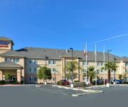
Hotels and Places to Stay
Sacramento Marriott Rancho Cordova
Fairfield Inn & Suites Sacramento Elk Grove
La Quinta Inn and Suites Rancho Cordova Sacramento
LARKSPUR LANDING SACRAMENTO
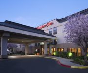
Hampton Inn Rancho Cordova
Residence Inn Sacramento Rancho Cordova
Residence Inn Sacramento Cal Expo
Fairfield Inn & Suites Rancho Cordova
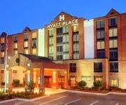
Hyatt Place Rancho Cordova
Holiday Inn SACRAMENTO RANCHO CORDOVA
Videos from this area
These are videos related to the place based on their proximity to this place.
Amtrak California San Joaquins at Florin, CA
A quick video of some grab shots at Florin (Sacramento) while waiting for the Siemens Amtrak electric locos to depart the factory.
Fresno Trip The Movie2of Day*1* (2010)....3400TV
Brah Brah, Shane O Mac, & Lil Lv take a roadtrip to Fresno, CA for AD's 22st b-day and party the whole weekend AGAIN IN 2010...
SCUSD Middle School Track and Field Championships - Sara Blair
SCUSD Middle School Championships, Sacramento California, May 10th, 2014. Rosemont High School. 7th grade girls 4K shot-put. 32 ft. 7 in. 1st place for Pioneer Elementary.
Oz | Korean BBQ | Elk Grove | DinnerWire
This Oz Korean BBQ is located just off I-5 and Elk Grove Blvd in Elk Grove. Weekends and dinners are All-you-can-eat. Choose from a variety of meats to BBQ tableside. https://dinnerwire.com/ca/sac...
Race Place Motorsports - RPM
This is how you can have a race of 10 and still enjoy yourself!!! At the end of the race I had a time of 20.888 second place was at 21.734 that's a gap of 0.846!!! TRACK MONSTER FOREVER!!!...
Videos provided by Youtube are under the copyright of their owners.
Attractions and noteworthy things
Distances are based on the centre of the city/town and sightseeing location. This list contains brief abstracts about monuments, holiday activities, national parcs, museums, organisations and more from the area as well as interesting facts about the region itself. Where available, you'll find the corresponding homepage. Otherwise the related wikipedia article.
La Riviera, California
La Riviera is a census-designated place (CDP) in Sacramento County, California, United States. It is part of the Sacramento–Arden-Arcade–Roseville Metropolitan Statistical Area. The population was 10,802 at the 2010 census, up from 10,273 at the 2000 census. La Riviera is a primarily residential neighborhood located between the American River on the North side and Highway 50 on the southern border.
Rosemont, California
Rosemont is a census-designated place (CDP) in Sacramento County, California, United States. It is part of the Sacramento–Arden-Arcade–Roseville Metropolitan Statistical Area. The population was 22,681 at the 2010 census, down from 22,904 at the 2000 census.
Mather Air Force Base
For the civil use of this facility and airport information, see Sacramento Mather Airport Mather Air Force Base 50pxMather Army Airfield Part of Air Training Command (ATC) Sacramento County, California 300px2006 USGS airphoto Mather AFB is located in CaliforniaMather AFBMather AFB Type Air Force Base Coordinates coord}}{{#coordinates:38|33|14|N|121|17|51|W|type:airport_region:US name= }} Built 1918 In use 1918–1993 Controlled by United States Air Force Garrison 323d Flying Training Wing Map of all coordinates from GoogleMap of first 200 coordinates from Bing Export all coordinates as KML Export all coordinates as GeoRSS Map of all microformatted coordinates Place data as RDF Mather Air Force Base (Mather AFB) is a closed United States Air Force Base located 12 miles east of Sacramento near Rancho Cordova on the south side of U.S.
Butterfield (Sacramento RT)
Butterfield is a side platformed Sacramento RT light rail station in La Riviera, California, United States. The station was opened on September 5, 1987, and is operated by the Sacramento Regional Transit District. As part of the Gold Line, it has service to Downtown Sacramento, California State University, Sacramento, Rancho Cordova, Gold River and Folsom. The station is located at the intersection of Folsom Boulevard and Butterfield Way just northeast of Highway 50.
Tiber (Sacramento RT)
Tiber is a side platformed Sacramento RT light rail station in La Riviera, California, United States. The station was opened on September 5, 1987, and is operated by the Sacramento Regional Transit District. As part of the Gold Line, it has service to Downtown Sacramento, California State University, Sacramento, Rancho Cordova, Gold River and Folsom. The station is located just west of Tiber Drive on Folsom Boulevard, north of Highway 50.
Safetyville USA
Safetyville USA is a miniature town, complete with miniature scale California State Capitol building, miniature municipal building, business buildings, and small streets, in Sacramento, California. Safetyville USA is part of the non-profit Safety Center, Inc. 's Children's Safety Program which provides life-saving safety education. Safetyville USA was opened at the Safety Center in 1984.
Carrington College (US)
For the residential college in New Zealand, see Carrington College, Otago. For the affiliated school in California, see Carrington College California. Carrington College {{#invoke:InfoboxImage|InfoboxImage|image=|size=|sizedefault=frameless|alt=}}Established 1976Type Private, For-ProfitPresident Tamara Rozhon, Ed.D. Admin. staff Varies by locationStudents Varies by locationLocation Multiple; Western U.S. Campus Urban; SuburbanFormer names Apollo CollegeWebsite http://www. carrington.
Starfire (Sacramento RT)
Starfire is a side platformed Sacramento RT light rail station in Rosemont, California, United States. The station was opened on September 5, 1987, and is operated by the Sacramento Regional Transit District. As part of the Gold Line, it has service to Downtown Sacramento, California State University, Sacramento, Rancho Cordova, Gold River and Folsom. The station is located near the intersection of Starfire Drive on Folsom Boulevard, south of Highway 50.


