Safety Score: 2,7 of 5.0 based on data from 9 authorites. Meaning we advice caution when travelling to United States.
Travel warnings are updated daily. Source: Travel Warning United States. Last Update: 2024-08-13 08:21:03
Delve into Robla
Robla in Sacramento County (California) is located in United States about 2,368 mi (or 3,811 km) west of Washington DC, the country's capital town.
Current time in Robla is now 03:55 AM (Friday). The local timezone is named America / Los Angeles with an UTC offset of -8 hours. We know of 8 airports close to Robla, of which 4 are larger airports. The closest airport in United States is Sacramento International Airport in a distance of 8 mi (or 13 km), West. Besides the airports, there are other travel options available (check left side).
Also, if you like playing golf, there are some options within driving distance. We encountered 2 points of interest near this location. If you need a hotel, we compiled a list of available hotels close to the map centre further down the page.
While being here, you might want to pay a visit to some of the following locations: Sacramento, Woodland, Auburn, Marysville and Yuba City. To further explore this place, just scroll down and browse the available info.
Local weather forecast
Todays Local Weather Conditions & Forecast: 13°C / 56 °F
| Morning Temperature | 14°C / 58 °F |
| Evening Temperature | 13°C / 55 °F |
| Night Temperature | 14°C / 56 °F |
| Chance of rainfall | 42% |
| Air Humidity | 83% |
| Air Pressure | 1015 hPa |
| Wind Speed | Fresh Breeze with 13 km/h (8 mph) from North-West |
| Cloud Conditions | Overcast clouds, covering 100% of sky |
| General Conditions | Heavy intensity rain |
Friday, 22nd of November 2024
14°C (58 °F)
10°C (50 °F)
Light rain, gentle breeze, broken clouds.
Saturday, 23rd of November 2024
10°C (49 °F)
10°C (50 °F)
Moderate rain, light breeze, overcast clouds.
Sunday, 24th of November 2024
11°C (51 °F)
11°C (52 °F)
Light rain, gentle breeze, overcast clouds.
Hotels and Places to Stay
DoubleTree by Hilton Sacramento
Hilton Sacramento Arden West
Courtyard Sacramento Cal Expo
Red Lion Hotel Woodlake Conference Center Sacramento
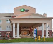
Holiday Inn Express & Suites SACRAMENTO NE CAL EXPO
Hampton Inn - Suites Sacramento-Cal Expo CA
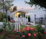
Arden Acres Executive Suites and Cottages
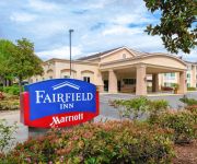
Fairfield Inn Sacramento Cal Expo
Residence Inn Sacramento Cal Expo
Staybridge Suites SACRAMENTO AIRPORT NATOMAS
Videos from this area
These are videos related to the place based on their proximity to this place.
Rio Linda, CA. Small Plane Crash 2-28-2009 near Sacramento, CA
A private plane ( 1960 Mooney craft) crashed shortly after takeoff from Rio Linda Airport. The pilot and passenger were both killed on impact. Preliminary reports suggests that the pilot...
Rio Linda Fly-In 2014
The Northern California Rio Linda (L36) Fly-In and Sonex Gathering was held Saturday, May 31, 2014. Twelve Sonex made the trip. Jeffry Larson - Sonex N321SX, James Hicke -Waiex N716WX, ...
Northern California Sonex Fly-In, Rio Linda CA June 1, 2013
Sonex fly-in held at Rio Linda, CA (L36) on Sat June 1, 2013. Photos by Doug Smith and video by Mike Kelley.
Sell Your House Fast in Rio Linda CA
Trying to sell you home in Rio Linda CA as quickly as possible? 800-BUY-KWIK gives cash offers on homes within 24 hours or less. We buy Rio Linda CA properti...
2014 River City ARCS Field Day
I logged a few final 40 meter CW contacts on Sunday morning using the Flex-1500 software defined radio and HF Packer amplifier running 40 watts to a 40 meter full wave Loop Skywire antenna....
June 2013 - ARRL Field Day at Dry Creek Ranch
Video clips from River City ARCS 2013 ARRL Field Day at Dry Creek Ranch at Dry Creek Ranch, Rio Linda, CA Field Day, the River City ARCS' premier annual operating event, is a live training...
Merry Christmas from Brashers Dec 18, 2012
From all of us to all of you, Merry Christmas. Enjoy the holiday with your family. Be safe. Thank you for making Brasher's Sacramento the "Right Choice!" in Northern California.
Field Day 2012 by N6TWW
I paid a vist to the River City ARCS field day location in Rio Linda, California just to see how they had set things up and to see how it was going.
Videos provided by Youtube are under the copyright of their owners.
Attractions and noteworthy things
Distances are based on the centre of the city/town and sightseeing location. This list contains brief abstracts about monuments, holiday activities, national parcs, museums, organisations and more from the area as well as interesting facts about the region itself. Where available, you'll find the corresponding homepage. Otherwise the related wikipedia article.
Rio Linda, California
Rio Linda is a census-designated place (CDP) in Sacramento County, California, United States. It is part of the Sacramento–Arden-Arcade–Roseville Metropolitan Statistical Area. As of the 2010 census, the CDP population was 15,106, up from 10,466 at the 2000 census.
KSEG (FM)
KSEG (96.9 FM, "The Eagle") is a classic rock station based in Sacramento, California. The Entercom outlet broadcasts at 96.9 MHz with an ERP of 50 kW.
Dry Creek (Sacramento River)
Dry Creek (formerly called Linda Creek) is a 15-mile long stream in Placer County and Sacramento County, California, USA, tributary to the Sacramento River. Its watershed lies within the Sacramento Valley. Because suburban development borders much of its length, the stream is noted for its capacity to cause local flooding and as a recreational attraction.
Robla, Sacramento, California
Robla is a neighborhood located within the city of Sacramento, California. The borders of Robla are generally considered to be city limits on the north adjacent to Rio Linda, McClellan Park on the east, the Beltline Freeway Interstate 80 on the south, and Northgate Boulevard on the west. Robla was part of the "Unincorporated place" of Del Paso Heights-Robla, which recorded a population of 11,495 in 1960.
Marconi Arcade
Marconi Arcade is a side platformed Sacramento RT light rail station in Sacramento, California, United States. The station was opened on March 12, 1987, and is operated by the Sacramento Regional Transit District as part of the Blue Line. The Arcade portion in the station name comes from the surrounding neighborhood of Arden-Arcade.
Rio Linda High School
Rio Linda High School is a high school located in Rio Linda, Sacramento, CA. It has an enrollment of 2,035 students. It is part of the Twin Rivers Unified School District, and was formerly part of the Grant Unified School District. Rio Linda High School opened in 1962 and has been the one of the primary high schools for students in the Rio Linda/Elverta and Natomas Communities. It offers a wide range of extracurricular activities and academic opportunities.
Rancho Del Paso
Rancho Del Paso was a 44,371-acre Mexican land grant in present day Sacramento County, California given in 1844 by Governor Manuel Micheltorena to Eliab Grimes. The grant extended along the north bank of the American River and was bounded roughly by today’s Northgate Boulevard, Manzanita Avenue, and Elkhorn Boulevard. The grant encompassed present day North Sacramento, Del Paso Heights, Rio Linda, Arden-Arcade, and a portion of Carmichael.
Grant Union High School (Sacramento, California)
Grant Union High School is a public high school in Sacramento, California, United States.


