Safety Score: 2,7 of 5.0 based on data from 9 authorites. Meaning we advice caution when travelling to United States.
Travel warnings are updated daily. Source: Travel Warning United States. Last Update: 2024-08-13 08:21:03
Delve into Riverside
Riverside in Sacramento County (California) is a town located in United States about 2,374 mi (or 3,821 km) west of Washington DC, the country's capital town.
Time in Riverside is now 12:29 PM (Friday). The local timezone is named America / Los Angeles with an UTC offset of -8 hours. We know of 8 airports closer to Riverside, of which 4 are larger airports. The closest airport in United States is Sacramento International Airport in a distance of 13 mi (or 21 km), North. Besides the airports, there are other travel options available (check left side).
Also, if you like the game of golf, there are some options within driving distance. We saw 2 points of interest near this location. In need of a room? We compiled a list of available hotels close to the map centre further down the page.
Since you are here already, you might want to pay a visit to some of the following locations: Sacramento, Woodland, Auburn, Fairfield and Stockton. To further explore this place, just scroll down and browse the available info.
Local weather forecast
Todays Local Weather Conditions & Forecast: 13°C / 55 °F
| Morning Temperature | 14°C / 58 °F |
| Evening Temperature | 13°C / 56 °F |
| Night Temperature | 13°C / 55 °F |
| Chance of rainfall | 45% |
| Air Humidity | 78% |
| Air Pressure | 1015 hPa |
| Wind Speed | Moderate breeze with 11 km/h (7 mph) from North-West |
| Cloud Conditions | Overcast clouds, covering 100% of sky |
| General Conditions | Heavy intensity rain |
Friday, 22nd of November 2024
15°C (59 °F)
9°C (48 °F)
Heavy intensity rain, moderate breeze, broken clouds.
Saturday, 23rd of November 2024
13°C (56 °F)
12°C (53 °F)
Broken clouds, gentle breeze.
Sunday, 24th of November 2024
12°C (54 °F)
12°C (54 °F)
Light rain, gentle breeze, overcast clouds.
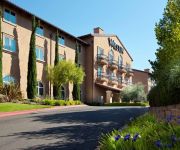
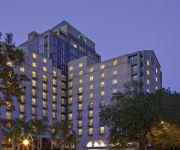
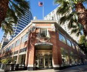
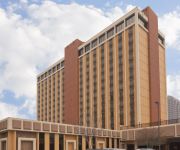
Hotels and Places to Stay
The Westin Sacramento
The Citizen Hotel Autograph Collection
Hyatt Regency Sacramento
Inn & Spa at Parkside
Sheraton Grand Sacramento Hotel
Embassy Suites by Hilton Sacramento Riverfront Promenade
Residence Inn Sacramento Downtown at Capitol Park
Holiday Inn Express WEST SACRAMENTO - CAPITOL AREA
Holiday Inn SACRAMENTO DOWNTOWN - ARENA
Sky Riders Motel
Videos from this area
These are videos related to the place based on their proximity to this place.
Building a Setback Levee in West Sacramento
Edward Stewart, a construction representative with the U.S. Army Corps of Engineers Sacramento District, explains the basics of a setback levee being constructed along South River Road in West...
5604 Norman Way | Michael Glascock | Lyon Real Estate
Built in 1957, 5604 Norman Way offers 3 bedrooms and two bathrooms with newly refinished hardwood floors in each bedroom. A short trip to Oto's Market, Bing Maloney Golf Course, Hollywood ...
Flying for no particular reason
Flying in the Sacramento valley. And FYI for pilots, the stall warning on this 172 comes on 14 knots faster than it should. It has since been fixed.
IFR Training ILS Rwy 2 KSAC
This was my first ILS approach of my IFR training. All ATC communications were recorded for your listening pleasure :) Thought I'd share. Enjoy! Flight originated at the Lodi airport 1O3,...
Timelapse Clouds in Sacramento
Shot with a Canon 5D MarkII using a cheap interval timer I bought off EBay.
Cole Farrow Highlight Film JV 2009
QB#15 Cole Farrow's 2009 JV Football Season Highlights Rio Linda Knights.
Andrew Koumelis: Catching Success at Sacramento City College
Meet Andrew Koumelis, a student-athlete at Sacramento City College who dreams of taking his ball game and education to the next level. Andrew says SCC, one of the four Los Rios colleges, is...
Sierra College Wolverines at Sac City College Panthers, 1st Half
CCCAA Men's Basketball, Big 8 Conference Game, January 27, 2015 at the Sacramento City College Gymnasium, Sacramento, CA.
Videos provided by Youtube are under the copyright of their owners.
Attractions and noteworthy things
Distances are based on the centre of the city/town and sightseeing location. This list contains brief abstracts about monuments, holiday activities, national parcs, museums, organisations and more from the area as well as interesting facts about the region itself. Where available, you'll find the corresponding homepage. Otherwise the related wikipedia article.
Sacramento City College
Sacramento City College (SCC) is a two-year community college located in Sacramento, California. SCC is part of the Los Rios Community College District and had an enrollment of 25,307 in 2009. Sacramento City College is officially accredited by the Western Association of Schools and Colleges (WASC), offering Associate in Science (A. S) and Associate in Art (A.A. ) degrees. It is located at the intersection of Freeport Boulevard and Sutterville Road in Sacramento, California.
Sacramento Zoo
The Sacramento Zoo is a zoo located in William Land Park in Sacramento, California. It opened on June 2, 1927 with 40 animals. At that time it occupied 4.2 acres, which remained the case until the early 1960s when the zoo expanded to its current 14.3 acres . As of December 2012 the zoo had just over 500 animals on site.
Charles C. Hughes Stadium
Charles C. Hughes Stadium, commonly referred to as Hughes Stadium, is a 20,311 seatstadium in Sacramento, California, located at Sacramento City College. The stadium first opened in 1928. In 1944, the stadium was named after Charles C. Hughes, the first superintendent of the Sacramento City Unified School District.
Sacramento Executive Airport
Sacramento Executive Airport, also known as simply Executive Airport, is a public airport located three miles (5 km) south of the central business district (CBD) of Sacramento, a city in Sacramento County, California, USA. The airport covers 540 acres and has three runways (2 lit) and a helipad.
C. K. McClatchy High School
C.K. McClatchy High School is a Sacramento City Unified School District High School. It is located in the Land Park area of Sacramento, California, USA . McClatchy High School is also the second-oldest high school in Sacramento, having been established in 1937. It is currently the oldest high school in Sacramento since the closure of Sacramento High School. McClatchy High School is home to over fifty clubs, as well as over 50,000 alumnae.
City College (Sacramento RT)
City College is a side platformed Sacramento RT light rail station on the Sacramento City College campus in Sacramento, California, United States. The station was opened on September 26, 2003, and is operated by the Sacramento Regional Transit District. As part of the Blue Line, it has service to Downtown Sacramento, North Sacramento, California State University, Sacramento, Rancho Cordova, Gold River and Folsom. The station is located northeast of Charles C. Hughes Stadium on campus.
Fruitridge (Sacramento RT)
Fruitridge is an island platformed Sacramento RT light rail station in Sacramento, California, United States. The station was opened on September 26, 2003, and is operated by the Sacramento Regional Transit District. As part of the Blue Line, it has service to Downtown Sacramento, North Sacramento, California State University, Sacramento, Rancho Cordova, Gold River and Folsom.
Riverview, Yolo County, California
Riverview (formerly, Glide Landing and Riverlands) is an unincorporated community in Yolo County, California. It lies on the west bank of the Sacramento River, on the Sacramento Northern and the Oakland, Antioch and Eastern Railroads 5 miles south-southwest of West Sacramento, at an elevation of 16 feet (5 m).


