Safety Score: 2,7 of 5.0 based on data from 9 authorites. Meaning we advice caution when travelling to United States.
Travel warnings are updated daily. Source: Travel Warning United States. Last Update: 2024-08-13 08:21:03
Discover Pollock
Pollock in Sacramento County (California) is a city in United States about 2,372 mi (or 3,817 km) west of Washington DC, the country's capital city.
Local time in Pollock is now 12:25 PM (Friday). The local timezone is named America / Los Angeles with an UTC offset of -8 hours. We know of 8 airports in the vicinity of Pollock, of which 4 are larger airports. The closest airport in United States is Sacramento International Airport in a distance of 16 mi (or 25 km), North-West. Besides the airports, there are other travel options available (check left side).
Also, if you like golfing, there are a few options in driving distance. We discovered 3 points of interest in the vicinity of this place. Looking for a place to stay? we compiled a list of available hotels close to the map centre further down the page.
When in this area, you might want to pay a visit to some of the following locations: Sacramento, Woodland, Stockton, Auburn and Fairfield. To further explore this place, just scroll down and browse the available info.
Local weather forecast
Todays Local Weather Conditions & Forecast: 13°C / 56 °F
| Morning Temperature | 15°C / 58 °F |
| Evening Temperature | 13°C / 56 °F |
| Night Temperature | 13°C / 56 °F |
| Chance of rainfall | 38% |
| Air Humidity | 71% |
| Air Pressure | 1014 hPa |
| Wind Speed | Moderate breeze with 11 km/h (7 mph) from North-West |
| Cloud Conditions | Overcast clouds, covering 100% of sky |
| General Conditions | Heavy intensity rain |
Friday, 22nd of November 2024
15°C (59 °F)
9°C (48 °F)
Heavy intensity rain, moderate breeze, overcast clouds.
Saturday, 23rd of November 2024
13°C (56 °F)
11°C (52 °F)
Overcast clouds, gentle breeze.
Sunday, 24th of November 2024
13°C (55 °F)
12°C (54 °F)
Light rain, gentle breeze, overcast clouds.
Hotels and Places to Stay
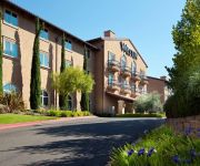
The Westin Sacramento
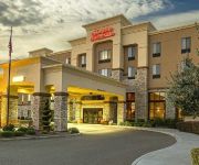
Hampton Inn - Suites Sacramento-Elk Grove Laguna I-5
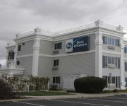
BEST WESTERN JOHN JAY INN
Courtyard Sacramento Midtown
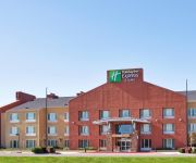
Holiday Inn Express ELK GROVE - SACRAMENTO AREA
Fairfield Inn & Suites Sacramento Elk Grove
Hampton Inn - Suites Sacramento at CSUS
Sky Riders Motel
Good Nite Inn Sacramento
VIZCAYA PAVILION AN
Videos from this area
These are videos related to the place based on their proximity to this place.
Shop Florin Road
Florin Road, Sacramento, Ca http://florinroad.com - Florin Road Partnership Florin Road is a Great Place to Shop. Video produced for the Florin Road Partnership to increase holiday shopping...
Yemaso BJJ Grand Opening - Sacramento Jiu-Jitsu Academy
http://www.yemasobjj.com A video documenting some of the highlights of the grand opening of the new space for Yemaso Brazilian Jiu-Jitsu in Sacramento, CA. We had promotions, we had a huge...
Brazilian Jiu-Jitsu Purple Belt Demonstration - Yemaso BJJ | Sacramento Jiu-Jitsu Academy
Sacramento, CA BJJ Academy has two students demonstrate some of their techniques in a 4 minute video after they were promoted from the blue belt rank to the purple belt rank. Saturday, June...
Google wallet card that I ordered came in the mail today. November 29 2013.
Google Wallet allows you to pay using your NFCenabled smartphone anywhere it's accepted, but there are several businesses that aren't equipped to take Google Wallet payments. Until now....
5604 Norman Way | Michael Glascock | Lyon Real Estate
Built in 1957, 5604 Norman Way offers 3 bedrooms and two bathrooms with newly refinished hardwood floors in each bedroom. A short trip to Oto's Market, Bing Maloney Golf Course, Hollywood ...
3509 Winning Way, Sacramento, CA 95823
http://3509winning.epropertysites.com?rs=youtube Here is your chance to own a 3 bedroom, 2 bath home! This home shows pride of ownership! Owners have taken v...
Las Posadas en Mi Rancho
Como cada año gracias a Mi Rancho por creer en D'Chaleco Magazine y juntos hacer una gran posada, donde se divierten grandes y chicos, música por el Grupo Musical Valle de Santiago, ...
Elk Grove Girls Softball
The Elk Grove Girls Softball coaches and players thanking the players of Florin Road Bingo for all of their support.
Videos provided by Youtube are under the copyright of their owners.
Attractions and noteworthy things
Distances are based on the centre of the city/town and sightseeing location. This list contains brief abstracts about monuments, holiday activities, national parcs, museums, organisations and more from the area as well as interesting facts about the region itself. Where available, you'll find the corresponding homepage. Otherwise the related wikipedia article.
Parkway–South Sacramento, California
Parkway–South Sacramento is a former census-designated place (CDP) in Sacramento County, California, United States. It was part of the Sacramento–Arden-Arcade–Roseville Metropolitan Statistical Area. The area shared three boundaries with the City of Sacramento. The population was 36,468 at the 2000 census. The CDP was abolished before the 2010 census.
Sacramento Executive Airport
Sacramento Executive Airport, also known as simply Executive Airport, is a public airport located three miles (5 km) south of the central business district (CBD) of Sacramento, a city in Sacramento County, California, USA. The airport covers 540 acres and has three runways (2 lit) and a helipad.
Fruitridge (Sacramento RT)
Fruitridge is an island platformed Sacramento RT light rail station in Sacramento, California, United States. The station was opened on September 26, 2003, and is operated by the Sacramento Regional Transit District. As part of the Blue Line, it has service to Downtown Sacramento, North Sacramento, California State University, Sacramento, Rancho Cordova, Gold River and Folsom.
47th Avenue (Sacramento RT)
47th Avenue is a side platformed Sacramento RT light rail station in Sacramento, California, United States. The station was opened on September 26, 2003, and is operated by the Sacramento Regional Transit District. As part of the Blue Line, it has service to Downtown Sacramento, North Sacramento, California State University, Sacramento, Rancho Cordova, Gold River and Folsom.
Meadowview (Sacramento RT)
Meadowview is a side platformed Sacramento RT light rail station in Sacramento, California, United States. The station was opened on September 26, 2003, and is operated by the Sacramento Regional Transit District. As part of the Blue Line, it has service to Downtown Sacramento, North Sacramento, California State University, Sacramento, Rancho Cordova, Gold River and Folsom. The station is located north of Meadowview Road at Tisdale Way, and is the present southern terminus of the Blue Line.
Florin (Sacramento RT)
Florin is a side platformed Sacramento RT light rail station in Sacramento, California, United States. The station was opened on September 26, 2003, and is operated by the Sacramento Regional Transit District. As part of the Blue Line, it has service to Downtown Sacramento, North Sacramento, California State University, Sacramento, Rancho Cordova, Gold River and Folsom.
Masjid Annur Islamic Center
Masjid Annur Islam Center in Sacramento, California is the largest mosque in the greater Sacramento area of Northern California.
Luther Burbank High School (California)
Luther Burbank High School (LBHS) is a high school in Sacramento, California. It is a part of the Sacramento City Unified School District. As of 2002 the school offers a Hmong language class for native speakers of Hmong. {{#invoke:Coordinates|coord}}{{#coordinates:38|29|41|N|121|27|57|W|type:edu_region:US-CA_source:GNIS |primary |name= }}


