Safety Score: 2,7 of 5.0 based on data from 9 authorites. Meaning we advice caution when travelling to United States.
Travel warnings are updated daily. Source: Travel Warning United States. Last Update: 2024-08-13 08:21:03
Delve into Fruitridge Pocket
Fruitridge Pocket in Sacramento County (California) with it's 5,800 habitants is located in United States about 2,370 mi (or 3,815 km) west of Washington DC, the country's capital town.
Current time in Fruitridge Pocket is now 08:10 AM (Friday). The local timezone is named America / Los Angeles with an UTC offset of -8 hours. We know of 8 airports close to Fruitridge Pocket, of which 4 are larger airports. The closest airport in United States is Sacramento International Airport in a distance of 13 mi (or 22 km), North-West. Besides the airports, there are other travel options available (check left side).
Also, if you like playing golf, there are some options within driving distance. We encountered 2 points of interest near this location. If you need a hotel, we compiled a list of available hotels close to the map centre further down the page.
While being here, you might want to pay a visit to some of the following locations: Sacramento, Woodland, Auburn, Stockton and Marysville. To further explore this place, just scroll down and browse the available info.
Local weather forecast
Todays Local Weather Conditions & Forecast: 13°C / 55 °F
| Morning Temperature | 14°C / 58 °F |
| Evening Temperature | 13°C / 55 °F |
| Night Temperature | 13°C / 56 °F |
| Chance of rainfall | 39% |
| Air Humidity | 89% |
| Air Pressure | 1015 hPa |
| Wind Speed | Moderate breeze with 12 km/h (8 mph) from North-West |
| Cloud Conditions | Overcast clouds, covering 100% of sky |
| General Conditions | Heavy intensity rain |
Friday, 22nd of November 2024
15°C (58 °F)
9°C (49 °F)
Moderate rain, gentle breeze, broken clouds.
Saturday, 23rd of November 2024
10°C (50 °F)
10°C (51 °F)
Moderate rain, gentle breeze, overcast clouds.
Sunday, 24th of November 2024
11°C (53 °F)
11°C (52 °F)
Light rain, gentle breeze, overcast clouds.
Hotels and Places to Stay
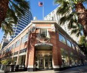
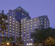
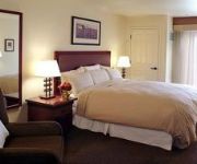
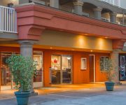
Inn & Spa at Parkside
Sheraton Grand Sacramento Hotel
Hyatt Regency Sacramento
Residence Inn Sacramento Downtown at Capitol Park
BW PLUS SUTTER HOUSE
LARKSPUR LANDING SACRAMENTO
Holiday Inn Express SACRAMENTO CONVENTION CENTER
Courtyard Sacramento Midtown
Hampton Inn - Suites Sacramento at CSUS
Quality Inn Sacramento Convention Center
Videos from this area
These are videos related to the place based on their proximity to this place.
Sacramento Mortgage Broker | Mortgage Lender- Kathleen Beck (916) 722-0395
Sacramento Mortgage Broker | Mortgage Lender- Kathleen Beck (916) 722-0395 Looking for a Mortgage Broker in Sacramento? http://www.beckhomeloanpro.com Look no more and call Kathleen ...
Google wallet card that I ordered came in the mail today. November 29 2013.
Google Wallet allows you to pay using your NFCenabled smartphone anywhere it's accepted, but there are several businesses that aren't equipped to take Google Wallet payments. Until now....
5604 Norman Way | Michael Glascock | Lyon Real Estate
Built in 1957, 5604 Norman Way offers 3 bedrooms and two bathrooms with newly refinished hardwood floors in each bedroom. A short trip to Oto's Market, Bing Maloney Golf Course, Hollywood ...
3509 Winning Way, Sacramento, CA 95823
http://3509winning.epropertysites.com?rs=youtube Here is your chance to own a 3 bedroom, 2 bath home! This home shows pride of ownership! Owners have taken v...
(916) 550-4386 Time Clock System Installation Sacramento
Time Clock System Installation in Sacramento - Mr Surveillance (916) 550-4386 Serving the Greater Sacramento California Area - (916) 550-4386 Mr Surveillance Sacramento's Best Security Camera...
Chihuahua Courtship, fascinating dogs Courting
Male and female chihuahua during they're Courtship. Playing, biting, wrestling, doggie flirting. 3.
28th Ave Fireworks Arrest
Video from the scene of several people being tased and arrested after officers attempted to disperse a block party and a person through fireworks at a CHP officer on 28th Ave near Anson Ct...
(916) 550-4386 Media Center Installation Sacramento
Media Center Installation Sacramento - (916) 550-4386 @mrsurveillance Call us for a free security consultation. Sacramento's Best Security Camera System inst...
Videos provided by Youtube are under the copyright of their owners.
Attractions and noteworthy things
Distances are based on the centre of the city/town and sightseeing location. This list contains brief abstracts about monuments, holiday activities, national parcs, museums, organisations and more from the area as well as interesting facts about the region itself. Where available, you'll find the corresponding homepage. Otherwise the related wikipedia article.
Parkway–South Sacramento, California
Parkway–South Sacramento is a former census-designated place (CDP) in Sacramento County, California, United States. It was part of the Sacramento–Arden-Arcade–Roseville Metropolitan Statistical Area. The area shared three boundaries with the City of Sacramento. The population was 36,468 at the 2000 census. The CDP was abolished before the 2010 census.
McGeorge School of Law
University of the Pacific, McGeorge School of Law is a private, American Bar Association (ABA) approved law school in the Oak Park neighborhood of the city of Sacramento, California. It is part of the University of the Pacific. Originally founded in 1924, the school merged with and became part of the University of the Pacific in 1966. The current dean of McGeorge School of Law is Francis J. Mootz III, formerly the William S.
UC Davis Medical Center
UC Davis Medical Center, formerly known as Sacramento Medical Center, is a major academic health center located in Sacramento, California. It is owned and operated by the University of California of Oakland, California as part of its University of California, Davis campus.
Elmhurst, Sacramento, California
Elmhurst is a historic residential neighborhood located in the eastern part of Sacramento, California. Elmhurst is known for its large elm, ash, and oak trees that provide shady canopy for the neighborhood.
West Campus High School
West Campus High School is a public college preparatory magnet high school in Sacramento, California. The school serves about 800 students in the Sacramento City Unified School District in grades 9-12. West Campus used to be a satellite school of nearby Hiram Johnson but became its own school for the 2002-2003 school year. The class of 2006 was the first class to graduate from West Campus having spent all four years at the school.
Tahoe Park, Sacramento, California
Tahoe Park is a neighborhood located within the city of Sacramento, California. The name "Tahoe Park" is generally used to refer to several official and unofficial neighborhoods that surround Tahoe Park proper, including Tahoe Park East, Tahoe Park South, Tahoe Terrace, and West Tahoe Park.
Christian Brothers High School (Sacramento, California)
Christian Brothers High School High School is a private, Roman Catholic, college-preparatory high school in Sacramento, California. It is located within the Roman Catholic Diocese of Sacramento.
California State Fairgrounds Race Track
California State Fairgrounds Race Track was a dirt oval racing track located in Sacramento, California. The track was built in 1906 for horse racing on the site of the California Exposition. It was active for auto racing in 1907, 1912, and from 1946 until 1970. A 2.1-mile (3.4-km) road course was laid out in the parking lots surrounding the oval, and used for sports car racing between 1955 and 1969.


