Safety Score: 2,7 of 5.0 based on data from 9 authorites. Meaning we advice caution when travelling to United States.
Travel warnings are updated daily. Source: Travel Warning United States. Last Update: 2024-08-13 08:21:03
Delve into Del Paso Heights
Del Paso Heights in Sacramento County (California) is located in United States about 2,367 mi (or 3,809 km) west of Washington DC, the country's capital town.
Current time in Del Paso Heights is now 04:14 AM (Friday). The local timezone is named America / Los Angeles with an UTC offset of -8 hours. We know of 8 airports close to Del Paso Heights, of which 4 are larger airports. The closest airport in United States is Sacramento International Airport in a distance of 10 mi (or 16 km), North-West. Besides the airports, there are other travel options available (check left side).
Also, if you like playing golf, there are some options within driving distance. We encountered 4 points of interest near this location. If you need a hotel, we compiled a list of available hotels close to the map centre further down the page.
While being here, you might want to pay a visit to some of the following locations: Sacramento, Woodland, Auburn, Marysville and Yuba City. To further explore this place, just scroll down and browse the available info.
Local weather forecast
Todays Local Weather Conditions & Forecast: 13°C / 56 °F
| Morning Temperature | 15°C / 59 °F |
| Evening Temperature | 13°C / 55 °F |
| Night Temperature | 14°C / 56 °F |
| Chance of rainfall | 42% |
| Air Humidity | 86% |
| Air Pressure | 1015 hPa |
| Wind Speed | Moderate breeze with 12 km/h (7 mph) from North-West |
| Cloud Conditions | Overcast clouds, covering 100% of sky |
| General Conditions | Heavy intensity rain |
Friday, 22nd of November 2024
14°C (58 °F)
10°C (50 °F)
Moderate rain, gentle breeze, broken clouds.
Saturday, 23rd of November 2024
10°C (50 °F)
11°C (51 °F)
Moderate rain, light breeze, overcast clouds.
Sunday, 24th of November 2024
12°C (53 °F)
11°C (52 °F)
Light rain, gentle breeze, overcast clouds.
Hotels and Places to Stay
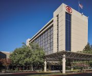
Hilton Sacramento Arden West
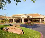
DoubleTree by Hilton Sacramento
Hampton Inn - Suites Sacramento-Cal Expo CA
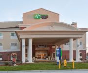
Holiday Inn Express & Suites SACRAMENTO NE CAL EXPO
Red Lion Hotel Woodlake Conference Center Sacramento
Fairfield Inn Sacramento Cal Expo
Courtyard Sacramento Cal Expo
TownePlace Suites Sacramento Cal Expo
Residence Inn Sacramento Cal Expo
Arden Acres Executive Suites and Cottages
Videos from this area
These are videos related to the place based on their proximity to this place.
Visions Optometry - Short | Sacramento, CA
http://visionseyecare.com/ - Call us today at (916) 925-2020. At Visions Optometry, we specialize in LASIK Eye Surgery, Eye Exams, and Pre- and Post-Operative Care. In addition our facility...
Camp Trip Half moon bay 2014 Kids at the beach playing Half Moon Bay State Beach Campground
Half moon bay 2014 Kids at the beach playing Half Moon Bay State Beach Campground Amazing beach and fun times.
Half moon bay State Beach 2014 Kids at the beach playing
Half moon bay 2014 Kids at the beach playing.
Jeffs Locksmiths Shop at 2377 Arden Way Sacramento CA
Jeff's Locksmiths Walk In Shop located at 2377 Arden Way, Sacramento, CA 95825. Complete Commercial, Residential, Automotive and Safe Locksmith Services Available.
2007 Honda Odyssey Ex-l Minivan Sacramento Roseville Elk Grove Folsom Stockton
2007 Honda Odyssey Ex-l Minivan Stock Number: 4136 Vin:5FNRL38767B431701. Give us a call at (916) 924-7255 or visit our website at http://www.mkauto.net for more information about this or...
Half moon bay 2014 Girls at the beach playing Half Moon Bay State Beach Campground
Half moon bay 2014 Kids at the beach playing Half Moon Bay State Beach Campground Fun!!!!!!!!!!!!!!!
UP 844 at Speed Near Sacramento 2012 UP 150th Anniversary Tour
Caught it again just West of Roseville at McClellan on a straight section where they could get it up to speed, it was flying there!
Posada En la Victoria Carniceria y Mercado.
Posada en la Victoria Carniceria y Mercado Del Paso Blvd, por D'Chaleco Magazine, animación del Grupo Musical Valle de Santiago de Baltazar Aguilar y el Rey Del kareoke Rúben Navarrete. En...
Rio Linda Blvd Shooting
Video of a shooting that occurred in the area of Rio Linda Blvd and Rivera Dr in the Del Paso Heights area.
Because God Cares Video 10 17 2009
Because God Cares Beautification Work day on 10-17-09, hosted by Shoulder to Shoulder. Over 250 people from the local area and numerous colleges from SoCAL worked on 4 Del Paso Heights, CA.
Videos provided by Youtube are under the copyright of their owners.
Attractions and noteworthy things
Distances are based on the centre of the city/town and sightseeing location. This list contains brief abstracts about monuments, holiday activities, national parcs, museums, organisations and more from the area as well as interesting facts about the region itself. Where available, you'll find the corresponding homepage. Otherwise the related wikipedia article.
KRVA (AM)
KRVA, branded as "Radio Saigon Dallas 1600", is a Vietnamese language radio station, broadcasting in the Dallas/Fort Worth Metroplex. This station is licensed in Cockrell Hill, Texas and it's under the ownership of Mortenson Broadcasting.
Ben Ali, Sacramento, California
Ben Ali is a neighborhood located within the city of Sacramento, California, United States. The Ben Ali community is defined as north of El Camino Avenue, east of Auburn Boulevard, and west of the Capital City Freeway. The Ben Ali community was named for James Ben Ali Haggin who owned much of the ranch later subdivided into these streets as well as adjacent neighborhoods. Ben Ali is represented by Steve Cohn on the Sacramento City Council.
Roseville Road
Roseville Road is an island platformed Sacramento RT light rail station in North Highlands, California, United States. The station was opened on March 12, 1987, and is operated by the Sacramento Regional Transit District as part of the Blue Line. There are 1,087 spaces in the park-and-ride lot at this station, which utilizes right-of-way from an abandoned freeway project.
Swanston (Sacramento RT)
Swanston is a side platformed Sacramento RT light rail station between Arden Way and El Camino Avenue, just west of the Capital City Freeway, in Sacramento, California, United States. The station was opened on March 12, 1987, and is operated by the Sacramento Regional Transit District as part of the Blue Line. The station is named for the Swanston Heights neighborhood of the city, which is served by the stop.
Marconi Arcade
Marconi Arcade is a side platformed Sacramento RT light rail station in Sacramento, California, United States. The station was opened on March 12, 1987, and is operated by the Sacramento Regional Transit District as part of the Blue Line. The Arcade portion in the station name comes from the surrounding neighborhood of Arden-Arcade.
Watt / I-80 West
The Watt/I-80 West is a side platformed Sacramento RT light rail station in North Highlands, California, United States. The station was opened on March 12, 1987, and is operated by the Sacramento Regional Transit District. As part of the Blue Line, it has service to Downtown Sacramento, South Sacramento, California State University, Sacramento, Rancho Cordova, Gold River and Folsom. The station is located in the median of Interstate 80 at Longview Drive.
Rancho Del Paso
Rancho Del Paso was a 44,371-acre Mexican land grant in present day Sacramento County, California given in 1844 by Governor Manuel Micheltorena to Eliab Grimes. The grant extended along the north bank of the American River and was bounded roughly by today’s Northgate Boulevard, Manzanita Avenue, and Elkhorn Boulevard. The grant encompassed present day North Sacramento, Del Paso Heights, Rio Linda, Arden-Arcade, and a portion of Carmichael.
Grant Union High School (Sacramento, California)
Grant Union High School is a public high school in Sacramento, California, United States.


