Safety Score: 2,7 of 5.0 based on data from 9 authorites. Meaning we advice caution when travelling to United States.
Travel warnings are updated daily. Source: Travel Warning United States. Last Update: 2024-08-13 08:21:03
Discover Bruceville
Bruceville in Sacramento County (California) is a place in United States about 2,372 mi (or 3,817 km) west of Washington DC, the country's capital city.
Current time in Bruceville is now 08:13 AM (Friday). The local timezone is named America / Los Angeles with an UTC offset of -8 hours. We know of 8 airports near Bruceville, of which 4 are larger airports. The closest airport in United States is Sacramento International Airport in a distance of 27 mi (or 43 km), North. Besides the airports, there are other travel options available (check left side).
Also, if you like playing golf, there are a few options in driving distance. We encountered 7 points of interest in the vicinity of this place. If you need a hotel, we compiled a list of available hotels close to the map centre further down the page.
While being here, you might want to pay a visit to some of the following locations: Sacramento, Stockton, Woodland, Fairfield and Jackson. To further explore this place, just scroll down and browse the available info.
Local weather forecast
Todays Local Weather Conditions & Forecast: 13°C / 55 °F
| Morning Temperature | 15°C / 59 °F |
| Evening Temperature | 13°C / 55 °F |
| Night Temperature | 13°C / 56 °F |
| Chance of rainfall | 39% |
| Air Humidity | 88% |
| Air Pressure | 1015 hPa |
| Wind Speed | Fresh Breeze with 13 km/h (8 mph) from North-West |
| Cloud Conditions | Overcast clouds, covering 100% of sky |
| General Conditions | Heavy intensity rain |
Friday, 22nd of November 2024
15°C (58 °F)
9°C (49 °F)
Moderate rain, gentle breeze, broken clouds.
Saturday, 23rd of November 2024
10°C (49 °F)
11°C (51 °F)
Moderate rain, moderate breeze, overcast clouds.
Sunday, 24th of November 2024
12°C (53 °F)
11°C (52 °F)
Light rain, gentle breeze, overcast clouds.
Hotels and Places to Stay
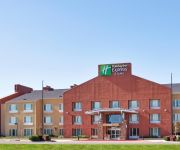
Holiday Inn Express ELK GROVE - SACRAMENTO AREA
Videos from this area
These are videos related to the place based on their proximity to this place.
Velocity Circus at the 19th Annual Elk Grove Giant Pumpkin Festival
Gregangelo and the Velocity Circus at the 19th Annual Elk Grove Giant Pumpkin Festival in Elk Grove, CA. Learn more - http://gregangelo.com See more videos ...
Elk Grove Charter School ALS Ice Bucket Challenge
On August 29th, after a one week donation drive, Elk Grove Charter School raised over $600 to help support ALS research and patient care efforts. Administrator Marc LaVine took an ice water...
Providence 62 - Elk Grove New Home Virtual Tour
Providence at Madeira 9948 Winkle Circle, Elk Grove, CA 95757 Fairhaven: 3655 Sq. Ft. 5 Bed, 4.5 Bath Virtual Tour By JMC Homes ...
2015 Jesuit at Elk Grove - 300 Hurdles, 200s, 4x400
This video is about 2015 Jesuit at Elk Grove - 300 Hurdles, 200s, 4x400.
2015 Jesuit at Elk Grove - hurdles, sprints
This video is about 2015 Jesuit at Elk Grove - hurdles, sprints.
2015 Jesuit at Elk Grove - hurdles, sprints
update of original upload - 2 minutes of junk footage cut.
Elk Grove Chiropractor For Back Pain 1-(916) 229-6268
Elk Grove Chiropractor For Back Pain 1-(916) 229-6268 ELk Grove, CA, 95758 Phone: 1-(916) 229-6268 http://youtu.be/LnQaK2i0n5o Elk Grove Chiropractor For Back Pain 1-(916) 229-6268 ...
2012 Chevrolet Silverado 1500 Folsom
We are proud to present this 2012 Chevrolet Silverado 1500 . Please visit our website at http://www.maitachevrolet.com and if you have any questions you can always call us at (877) 835-0729...
Videos provided by Youtube are under the copyright of their owners.
Attractions and noteworthy things
Distances are based on the centre of the city/town and sightseeing location. This list contains brief abstracts about monuments, holiday activities, national parcs, museums, organisations and more from the area as well as interesting facts about the region itself. Where available, you'll find the corresponding homepage. Otherwise the related wikipedia article.
Franklin Field (California)
Franklin Field, formerly Q53, is a public airport located four miles (6 km) southeast of the central business district (CBD) of Franklin in Sacramento County, California, USA. It is mostly used for general aviation. The airport was used for bomber training during World War II and in 1947 it was acquired by the County of Sacramento.


