Safety Score: 2,7 of 5.0 based on data from 9 authorites. Meaning we advice caution when travelling to United States.
Travel warnings are updated daily. Source: Travel Warning United States. Last Update: 2024-08-13 08:21:03
Delve into Pine Cove
Pine Cove in Riverside County (California) is a town located in United States about 2,220 mi (or 3,573 km) west of Washington DC, the country's capital town.
Time in Pine Cove is now 04:21 PM (Thursday). The local timezone is named America / Los Angeles with an UTC offset of -8 hours. We know of 8 airports closer to Pine Cove, of which 4 are larger airports. The closest airport in United States is Palm Springs International Airport in a distance of 14 mi (or 23 km), East. Besides the airports, there are other travel options available (check left side).
Also, if you like the game of golf, there are some options within driving distance. In need of a room? We compiled a list of available hotels close to the map centre further down the page.
Since you are here already, you might want to pay a visit to some of the following locations: San Bernardino, Riverside, Orange, San Diego and Santa Ana. To further explore this place, just scroll down and browse the available info.
Local weather forecast
Todays Local Weather Conditions & Forecast: 23°C / 73 °F
| Morning Temperature | 10°C / 49 °F |
| Evening Temperature | 14°C / 58 °F |
| Night Temperature | 10°C / 51 °F |
| Chance of rainfall | 0% |
| Air Humidity | 7% |
| Air Pressure | 1018 hPa |
| Wind Speed | Light breeze with 4 km/h (3 mph) from East |
| Cloud Conditions | Scattered clouds, covering 27% of sky |
| General Conditions | Scattered clouds |
Friday, 22nd of November 2024
19°C (66 °F)
14°C (57 °F)
Sky is clear, light breeze, clear sky.
Saturday, 23rd of November 2024
15°C (59 °F)
11°C (52 °F)
Light rain, light breeze, overcast clouds.
Sunday, 24th of November 2024
15°C (58 °F)
14°C (57 °F)
Moderate rain, light breeze, overcast clouds.
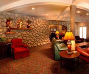
Hotels and Places to Stay
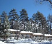
Quiet Creek Inn
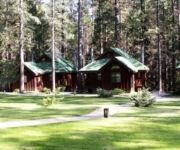
Pine Woods Resort
Always Inn Idyllwild Cottages
Creekstone Inn
Videos from this area
These are videos related to the place based on their proximity to this place.
Idyllwild California San Jacinto Mountain Campground and RV Resort
Nestled at an elevation of over 7000 feet, Thousand Trails Idyllwild is one of the few destinations in Southern California with all four seasons. With close to 300 sites spread over 200 acres,...
Hellrazor Downhill Run Idyllwild
Hellrazor downhill run with UnitedAdobo.com and DTMMA, mountain bike trail in Idyllwild. Check out http://www.xandei.com for more mountain biking videos, photos and trail infos. MTB SoCal...
Moonsville Collective Idyllwild Recording
We rented a cabin up in Idyllwild and worked on a bunch of new songs. We like to call it The Big Brown because of the cabin we stayed in. Many of the songs we recorded will be on our new record...
Idyllwild - Ice is NOT my Friend
2015 New Years Day - Riding with friends from So-Cal Dual Sport Group on Facebook. Super fun...but challenging riding in the snow/ice!
CA SR 243 to Idyllwild - Wilson Valley & Sage Roads
Great last minute ride to Idyllwild, 250 mi round, with 4 bikers.
CampgroundViews.com - Idyllwild Park Idyllwild California CA County Park Campground
http://www.CampgroundViews.com takes user submitted videos combined with professional editing to provide tent and RV campers with a first person view of a campground or RV park. Idyllwild Park...
Curvy Mtn Road from Pine Cove-Idyllwild
For those wondering why I rarely run from my home, but rather drive to the myriad nearby trail heads here in Idyllwild, this highway is the only way to leave my home, to leave the mountain...
Cali female riders doing what they do best up in Idyllwild
Sue-Nami was lucky enough to ride with Lady L, Shogun09r1, Kerryann and a few other riders on 1-19-14. This is my first attempt at editing a video so I apologize if it's not great. Please enjoy...
Idyllwild avec 12
Great ride to Idyllwild via Rt's 79 and 74 Best viewed HD 1080P, Large Player or Full Screen.
Videos provided by Youtube are under the copyright of their owners.
Attractions and noteworthy things
Distances are based on the centre of the city/town and sightseeing location. This list contains brief abstracts about monuments, holiday activities, national parcs, museums, organisations and more from the area as well as interesting facts about the region itself. Where available, you'll find the corresponding homepage. Otherwise the related wikipedia article.
Idyllwild-Pine Cove, California
Idyllwild, Pine Cove, and Fern Valley are three adjacent communities, of which Idyllwild is the largest, located in the San Jacinto Mountains in Riverside County, California, United States. "Mile-high Idyllwild" is a popular southern California mountain resort about one mile (1.6 km) in altitude. Idyllwild is flanked by two large rocks, Tahquitz Peak (with nearby Lily Rock) and Suicide Rock, which are famous in Southern California rock climbing circles.
Idyllwild Arts Foundation
Idyllwild Arts Foundation encompasses two institutions in Idyllwild, California for training in the arts: the Idyllwild Arts Academy (IAA) and the Idyllwild Arts Summer Program. The institution was formerly known as Idyllwild School of Music and the Arts (ISOMATA). Idyllwild Arts is in the mountains above Palm Springs, California in the San Bernardino National Forest, at an elevation of 5,300 feet, 2 hours from Los Angeles, 2 hours from San Diego and 1 hour from Palm Springs.
KATY-FM
KATY-FM, also known as 101.3 The Mix, is a commercial adult contemporary music radio station in Temecula, California, USA, broadcasting and super serving to the south-western portion of the Riverside-San Bernardino, California area. KATY- The Best Mix of the 80’s, 90’s and Today- is a heritage station in the Temecula Valley serving their clients and listeners for almost 20 years. KATY is a sister station to KCXX.
Suicide Rock
Suicide Rock (once Suicide Peak) is a well-known granite outcrop near Idyllwild-Pine Cove, California, which is popular with rock climbers. Over three hundred climbing routes have been described. It is located near the equally famous Tahquitz Peak.


!['[FULL HD] Visit Idyllwild CA in California' preview picture of video '[FULL HD] Visit Idyllwild CA in California'](https://img.youtube.com/vi/sdyKpRJlmlo/mqdefault.jpg)


