Safety Score: 2,7 of 5.0 based on data from 9 authorites. Meaning we advice caution when travelling to United States.
Travel warnings are updated daily. Source: Travel Warning United States. Last Update: 2024-08-13 08:21:03
Discover De Anza Village
De Anza Village in Riverside County (California) is a town in United States about 2,253 mi (or 3,626 km) west of Washington DC, the country's capital city.
Current time in De Anza Village is now 07:18 AM (Sunday). The local timezone is named America / Los Angeles with an UTC offset of -8 hours. We know of 9 airports near De Anza Village, of which 4 are larger airports. The closest airport in United States is Ontario International Airport in a distance of 10 mi (or 16 km), North-West. Besides the airports, there are other travel options available (check left side).
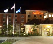
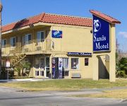
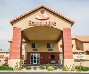
Also, if you like playing golf, there are a few options in driving distance. We discovered 2 points of interest in the vicinity of this place. Looking for a place to stay? we compiled a list of available hotels close to the map centre further down the page.
When in this area, you might want to pay a visit to some of the following locations: Riverside, San Bernardino, Orange, Santa Ana and Los Angeles. To further explore this place, just scroll down and browse the available info.
Local weather forecast
Todays Local Weather Conditions & Forecast: 17°C / 63 °F
| Morning Temperature | 14°C / 56 °F |
| Evening Temperature | 16°C / 61 °F |
| Night Temperature | 14°C / 57 °F |
| Chance of rainfall | 0% |
| Air Humidity | 53% |
| Air Pressure | 1018 hPa |
| Wind Speed | Gentle Breeze with 6 km/h (4 mph) from East |
| Cloud Conditions | Scattered clouds, covering 31% of sky |
| General Conditions | Light rain |
Sunday, 24th of November 2024
18°C (65 °F)
16°C (61 °F)
Overcast clouds, light breeze.
Monday, 25th of November 2024
17°C (63 °F)
15°C (59 °F)
Light rain, light breeze, overcast clouds.
Tuesday, 26th of November 2024
16°C (60 °F)
15°C (59 °F)
Light rain, calm, overcast clouds.
Hotels and Places to Stay
Marriott Riverside at the Convention Center
Hilton Garden Inn Fontana
Hampton Inn - Suites Riverside-Corona East
The Mission Inn Hotel and Spa
Sands Motel
Econo Lodge Fontana
Days Inn Fontana / Rialto
Rodeway Inn Riverside
Sierra Crossing Motel
SANTA CRUZ INN RIVERSIDE
Videos from this area
These are videos related to the place based on their proximity to this place.
Cruise Down Victoria Ave - Riverside Southern California - Dirt Bike Paradise!
This is a quick trip down Victoria Ave. in Riverside California. If you ride dirt bikes, you probably have been, or know about Riverside California. Palm trees are the norm here, and dirt bikes...
Licensed Landscape Contractor for Pedley, Grand Terrace, Perris, Gavillan Springs / Hills, CA areas
Please check out http://onetimeservices.biz/ or call 951-537-8125 or 909-809-7357.
5010 Pedley Rd., Riverside, ca 92509
http://5010pedleyrd.epropertysites.com?rs=youtube 3 acre lot! Perfect for someone needing alot of space for dream home! Great if you have lots of animals!...
No Home To Go: Short FIlm by Blaine Miyakawa
Delusional, homeless guy seeks a magical doll. Matchbox production's Short film by an RCC film student. Plz RATE!!
Install and Buy Walk in Tubs Jurupa Valley, California 855 877 1496 Walk in Bathtub
Call 24/7: (855) 877-1496 Visit: http://www.1callbathsolutions.com For more information about how to own your very own step in tub, give us a call and visit our site! walk in tubs Jurupa...
SOLITARIO DEL SOL Caballo Bailador
Transportes Medina Presenta su caballo bailador "Solitario Del Sol"
Velocity Off-Road... Made by one man...
An insight into what goes into every product we produce at Velocity Off-Road. This video shows a torsion key being machined from 4130 steel.
Graham and The Home Team Reviews (951)534-9296
http://www.GrahamAndTheHomeTeam.com (951)534-9296 Graham and The Home Team Review We recently hired Graham and the Home Team, and the work they put into selling our property was ...
Patriot High School AVID Campaign 2015
You have a 'Choice' that will impact the Patriot High School Community upon your VOTE.
Videos provided by Youtube are under the copyright of their owners.
Attractions and noteworthy things
Distances are based on the centre of the city/town and sightseeing location. This list contains brief abstracts about monuments, holiday activities, national parcs, museums, organisations and more from the area as well as interesting facts about the region itself. Where available, you'll find the corresponding homepage. Otherwise the related wikipedia article.
Rubidoux, California
Rubidoux was a census-designated place and an unincorporated community in Riverside County, California. As of the 2010 census, the population was 34,280, up from 29,180 at the 2000 census. Like much of the fast-growing Inland Empire Metropolitan Area, Rubidoux is rapidly changing from a rural area of quarries and dairy farms to an exurb of Riverside. As of the 2000 Census, Rubidoux was the largest unincorporated community in the Inland Empire and in Riverside County.
Riverside Municipal Airport
Riverside Municipal Airport, also known as Riverside Airport (and formerly as Riverside Arlington Airport), is a public airport located four miles (6 km) southwest of the central business district of Riverside, the county seat of Riverside County, California, United States. The airport is located in the Inland Empire, a region with a population of over four million people.
Rubidoux High School
Rubidoux High School is a four-year public high school in Riverside, California as part of the Jurupa Unified School District, opened in 1959. It is one of four high schools in the district, the others being Jurupa Valley High School, Patriot High School, and Nueva Vista High School, a continuation school. As of the 2007-08 school year, the school had an enrollment of 1,325 students and 53.5 classroom teachers (on an FTE basis), for a student-teacher ratio of 24.8.
Pedley (Metrolink station)
Pedley Station is located at 6001 Pedley Rd. in Pedley, a part of the city of Jurupa Valley. It is located just east of Van Buren Blvd. and just north of Limonite Ave. , and has 285 free parking spaces. The station is owned by the Riverside County Transportation Commission, and it serves the unincorporated communities of Pedley, Mira Loma, West Riverside and Glen Avon. Riverside Transit Agency buses #21 and #29 serve the station. There is no service, bus or rail, to the station on weekends.
Flabob Airport
Flabob Airport is a small public use airport located three nautical miles (6 km) northwest of the central business district of Riverside, in Riverside County, California, United States. The airport is located in the city of Jurupa Valley beside the Santa Ana River. Established in 1925 by Flavio Madariaga and Bob Bogan, the name of the airport was derived by combining the first three letters of their names.
Martha McLean – Anza Narrows
Martha McLean – Anza Narrows is a 40-acre regional park located along the Santa Ana River in Riverside, California, United States. The park is operated by the Riverside County Regional Park and Open-Space District (RivCo Parks). A plaque in the southwest corner of the park marks the point at which the Juan Bautista de Anza party, the first Europeans to traverse the Riverside area, crossed the river in 1774 and again in 1776.
Jurupa Unified School District
Jurupa Unified School District is grade K-12 school district in Riverside County, California. It has an enrollment of approximately 20,500 students. The geographic location of the Jurupa area is the upper western corner of Riverside County, California, north and west of the Santa Ana River and south of the San Bernardino-Riverside County line. The Superintendent is Elliott Duchon.
Stringfellow Acid Pits
The Stringfellow Acid Pits are a toxic waste dump, and a Superfund site, located in Riverside County, California, United States, just north of the neighborhood of Glen Avon, California. The site became the center of national news coverage in the early 1980s, in part because it was considered one of the most polluted sites in California, and because it became linked with mismanagement and scandal in the U.S. Environmental Protection Agency.


